So far, things are working out about as expected. We are watching two main areas for tornadic potential the next few hours.

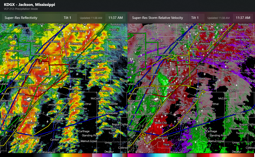
The first area is this area north and northeast of Jackson. This band of embedded supercells has been evolving the last few hours, and already produced a likely tornado near Grace in Issaquena County, MS. As it continues to shift east across the area in an area of increasingly favorable environment for significant tornadoes. SPC just issued a mesoscale discussion highlighting this area for potential intense tornadoes the next few hours.
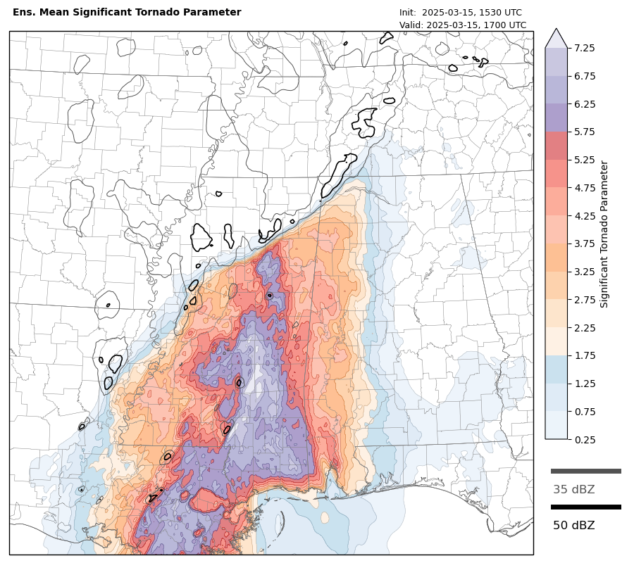
The other area of interest the next few hours are these supercells evolving in south central Mississippi and the Florida parishes of Louisiana. As the image below of significant tornado parameter for midday from the NSSL Warn-on-Forecast model shows, eastern Mississippi is becoming increasingly primed for significant tornadoes with time, values above 5 are very high. So these storms have real potential for long-tracked, intense tornadoes this afternoon.
.The rest of the forecast for Alabama and parts farther east and northeast still looks generally on track. Below is the just issued midday update from SPC.

I continue to host a free, live chat about the ongoing severe weather that can be found here.
Quick Update on Friday
SPC has now received more than 750 reports of wind damage, tornadoes and large hail from the storms on Friday and Friday night.
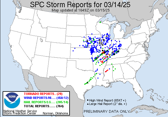
CNN is reporting that 16 people died as a result of Friday’s active weather, with 10 reported dead in Missouri from tornadoes that ripped through east central and southeast Missouri late in the evening and overnight. More than 100,000 customers are without power in Missouri as well.

Leave a comment