Monday, March 17, 2025
Sunday saw the weather system that has created days of havoc for days across the entire country finally push off the East Coast, but not before one more day of impacts. The focus on Sunday was in the Mid-Atlantic and Northeast where a line of severe thunderstorms produced widespread damaging winds, with over 300 reports from West Virginia to upstate New York.

A few more isolated severe storms caused some reports of large hail and damaging winds south of there into northern Florida; there were also swaths of 1.5” up to localized spots of 4” of rain which cause some instances of flash flooding.

With the departure of that system stage right, the focus now turns back west and to fire weather concerns in the Plains and parts of the Rockies, with increasing risks the next 36 to 48 hours that will peak with extreme fire danger across west Texas and eastern New Mexico Tuesday afternoon and evening.
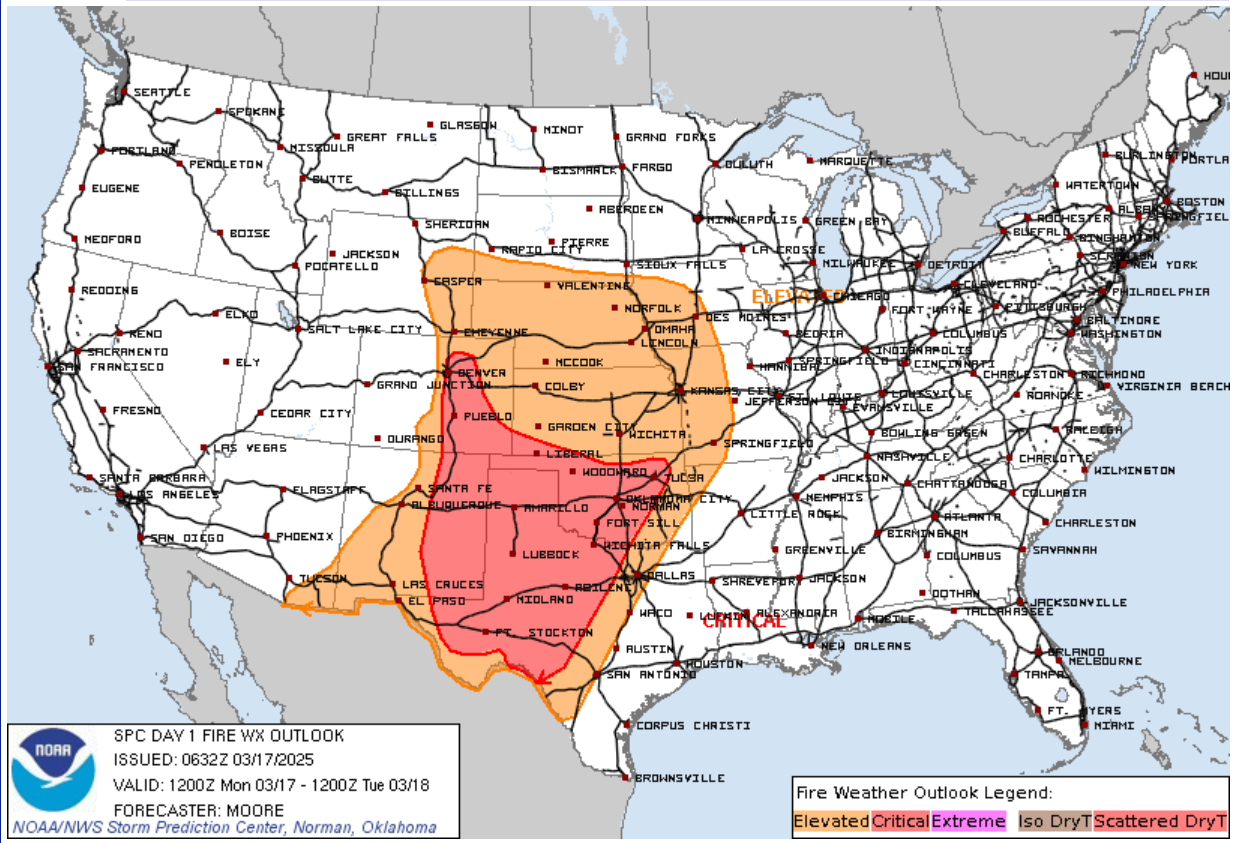

As another strong low pressure system develops and move through the central Rockies, very strong winds will once again affect these regions. When the low starts to pull east into Kansas Tuesday afternoon, a dry line will move east and behind it very strong winds and dry air will overspread the southern Plains especially west of the I-35 corridor. The overlap of strongest winds and lowest relative humidity (below 10%) will be in the extreme fire danger area where explosive fire growth and very rapid fire spread is possible. Widespread fire danger concerns will surround the peak area, and red flag warnings are expansive across the central third of the country the next couple of days.

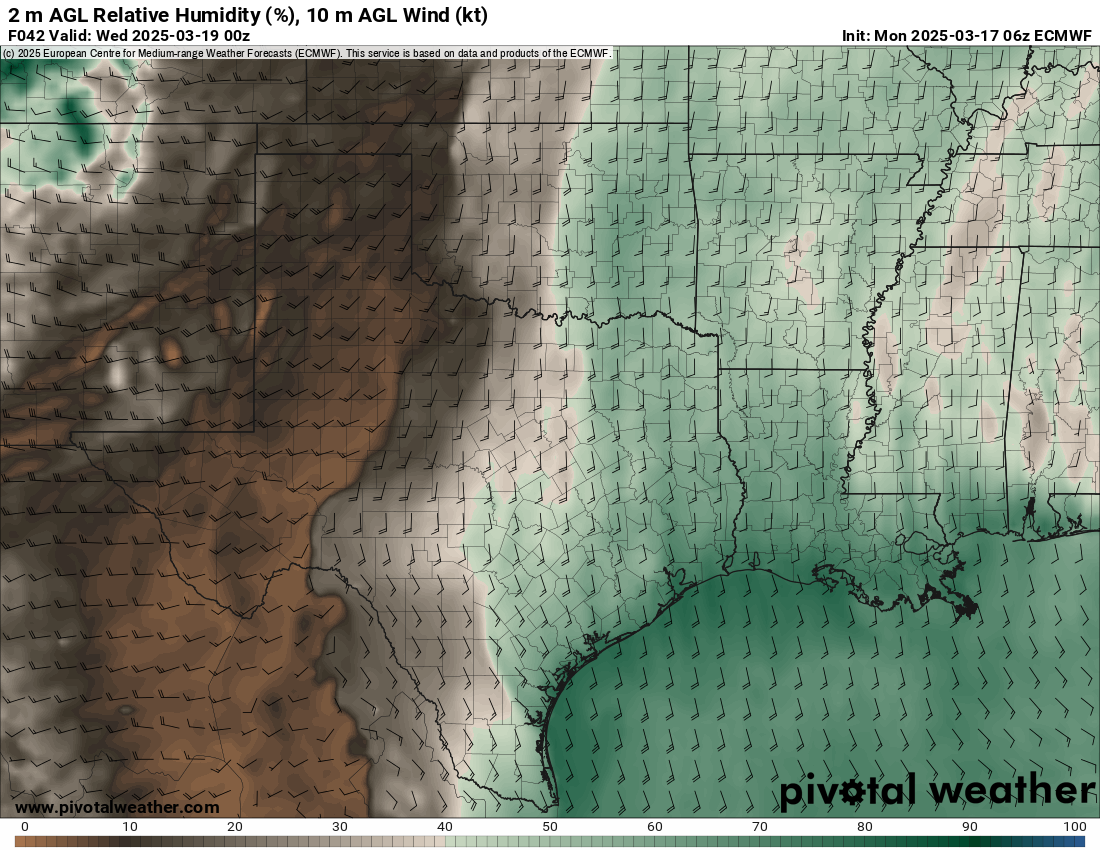

While conditions will be less critical Wednesday, strong northwest winds behind the low pressure system will be an issue over a large area of the Plains and Midwest. Additional critical fire danger periods are possible late in the week and weekend in the Plains.
Winter weather threats
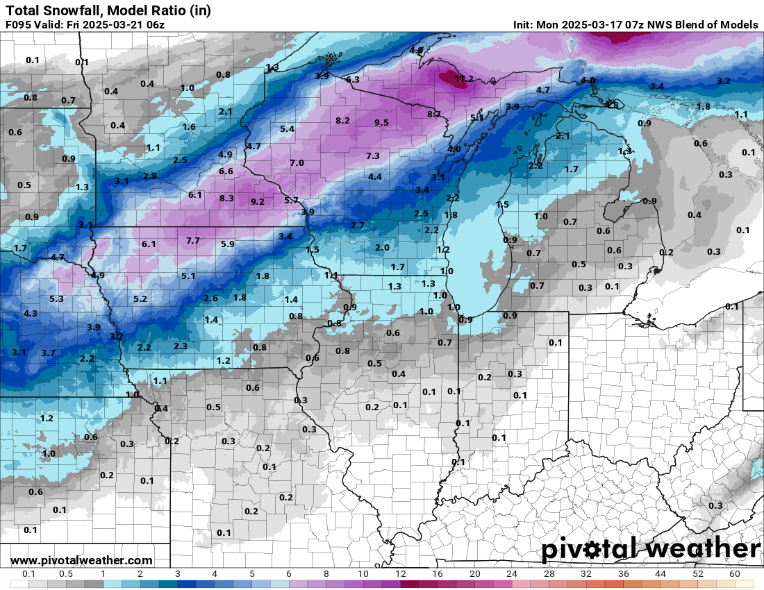
In addition to the fire weather threats, this strong low pressure system will also cause impacts from winter weather across the Midwest. A swath of heavy snow is anticipated from eastern Nebraska into the upper peninsula of Michigan Wednesday and Wednesday night.
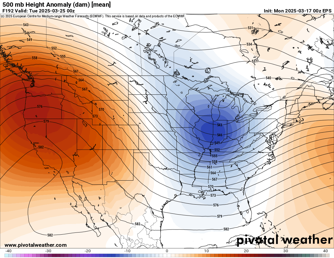
Beyond this system, while the fire weather concerns discussed above will continue, it does look the overall national weather pattern will transition toward one that will be a bit less active. By early next week, ensemble models suggest an evolution toward an unusually strong ridge of high pressure along the west coast and a trough over the east, which would lead to warmer and drier conditions in the west and cooler and wetter conditions in the east.
I am planning to put together a recap story on this intense system which caused tragic impacts across a large part of the country the last several days. Look for that later today.

Leave a comment