Discussing the bumpiness of a descent over the desert
I am writing today from Phoenix where I am visiting my son. When the flight attendant was making the announcements for our final descent when we flew out here Saturday evening, she warned that “things were going to be a little bumpy on the way down” so that everyone needed to be sure they were buckled up. I was sitting in a window seat but hadn’t been paying too much attention to the view outside because it had been fairly clear (and to be honest, because I was watching the Final Four on my cell phone.) After hearing the announcement about turbulence, I took a look out the window, and was immediately in meteorological heaven, as this was the site that greeted me.
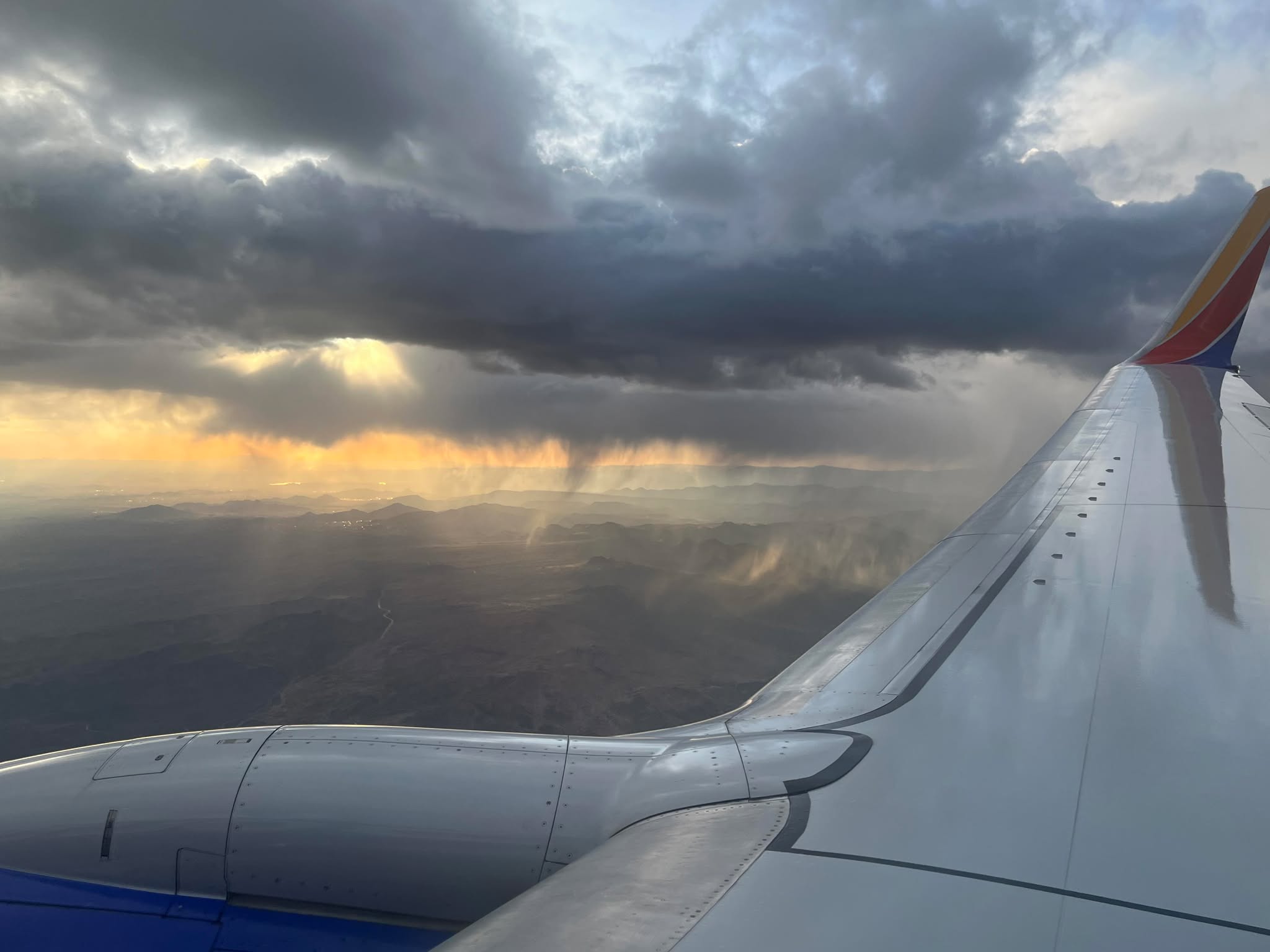
We were approaching Phoenix Sky Harbor Airport from the northeast, descending over the Superstition Mountains and the Tonto National Forest. What you can see in this picture is that we had just descended below the cloud layer, and that rain was falling from sections of the cloud deck. If you look closely, you can see that some of the rain curtains, especially on the left hand side of the picture, are clearly not reaching all the way to the ground. That is because the rain is falling from the cloud but evaporating in drier air below the cloud. Rain that evaporates before reaching the ground is called virga.

This is a radar image from the Phoenix WSR-88D from the time of that picture. Our plane was somewhere in between Fort McDowell and Tonto Basin; the weak echo you see around Fort McDowell and Fountain Hills, as well as the echo around Apache Junction, is likely false echo from ground clutter. The echoes to the west of Rio Verde and the small echo between Rio Verde and Tonto Basin are real.
So, this radar doesn’t look very impressive as there is not much precipitation showing up. But…this is a radar image from the lowest elevation the radar scans at and we are looking at an area very close to the radar, meaning the radar is scanning down low, and rain that is evaporating would not be detected. Another product that we can look at from the radar is composite reflectivity, which combines the radar echoes from all of the elevation angles the radar scans at. If we look at composite reflectivity for the same time, we see this:

Composite reflectivity is not as fine of resolution as the base reflectivity product we started with, so the echoes will appear larger just because of resolution differences. But still, you can see that overall the reflectivity echoes over the entire area are more widespread and intense in the composite reflectivity than in the lowest level base reflectivity image. This is because the composite reflectivity product is including data from higher elevations where the radar is detecting (heavier) precipitation.
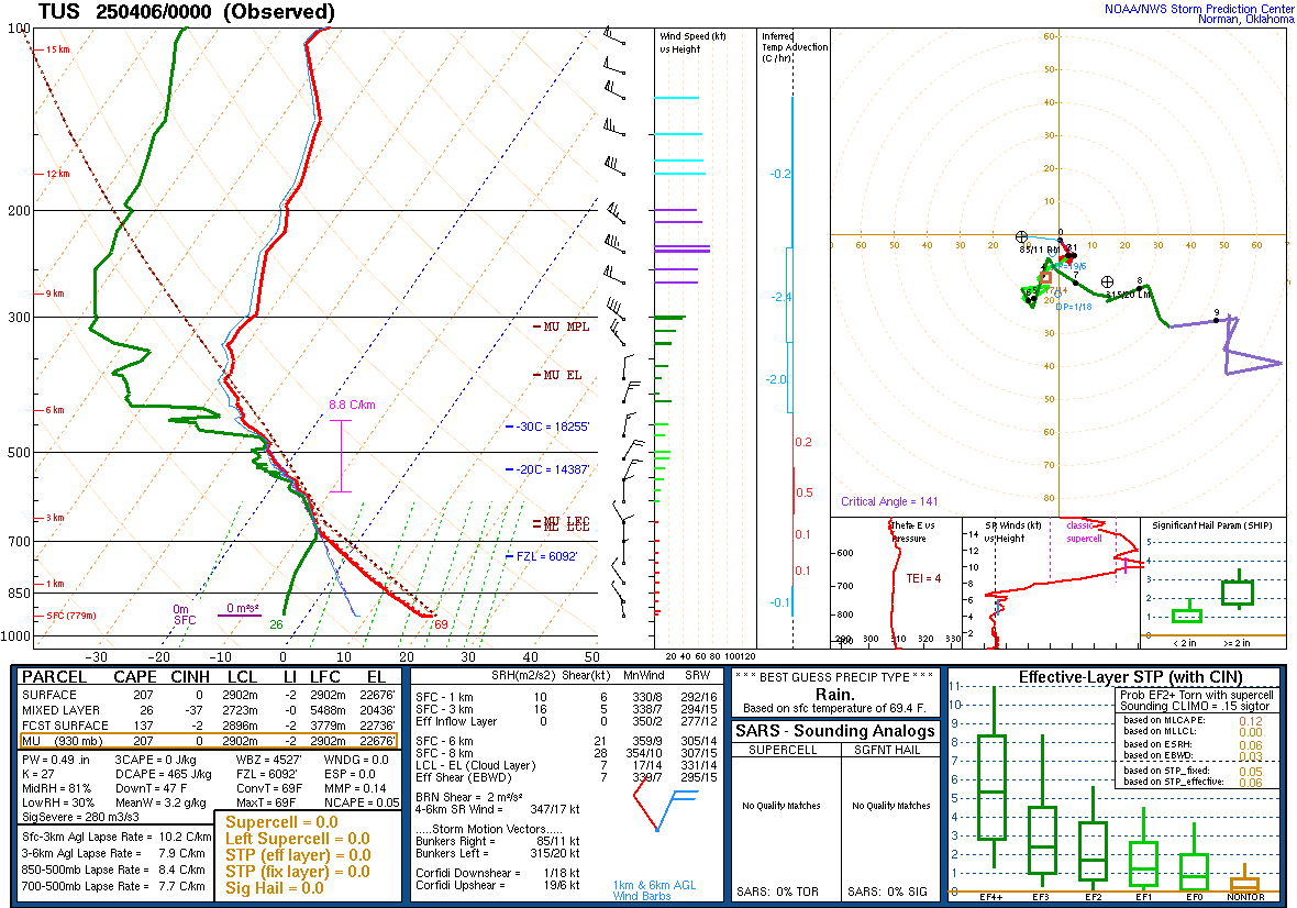
The closest upper air site to Phoenix is Tucson, and above is their sounding taken at 5 pm local time. The surface conditions at the balloon site were a temperature of 69F and dewpoint of 26F; the actual observed conditions at Phoenix Sky Harbor when we were on final approach were 77F temperature and 30F dewpoint, so slightly higher but similar enough to Tucson that we can assume relatively similar conditions.
This sounding is a fairly classic example of what meteorologists refer to as an “inverted-V” sounding. It is called that because of the dramatic appearance of the temperature trace (red) and dewpoint trace (green) which shows the atmosphere becoming increasingly dry in the lowest 8,000 feet of the atmosphere, forming what has an appearance of an upside down letter V.
Above that dry air, though, is a saturated layer up to about 20,000 feet, along with a bit of instability. In that layer of the atmosphere, there is enough instability, moisture and upward motion to support convective showers rather similar to what many areas see on summer days.
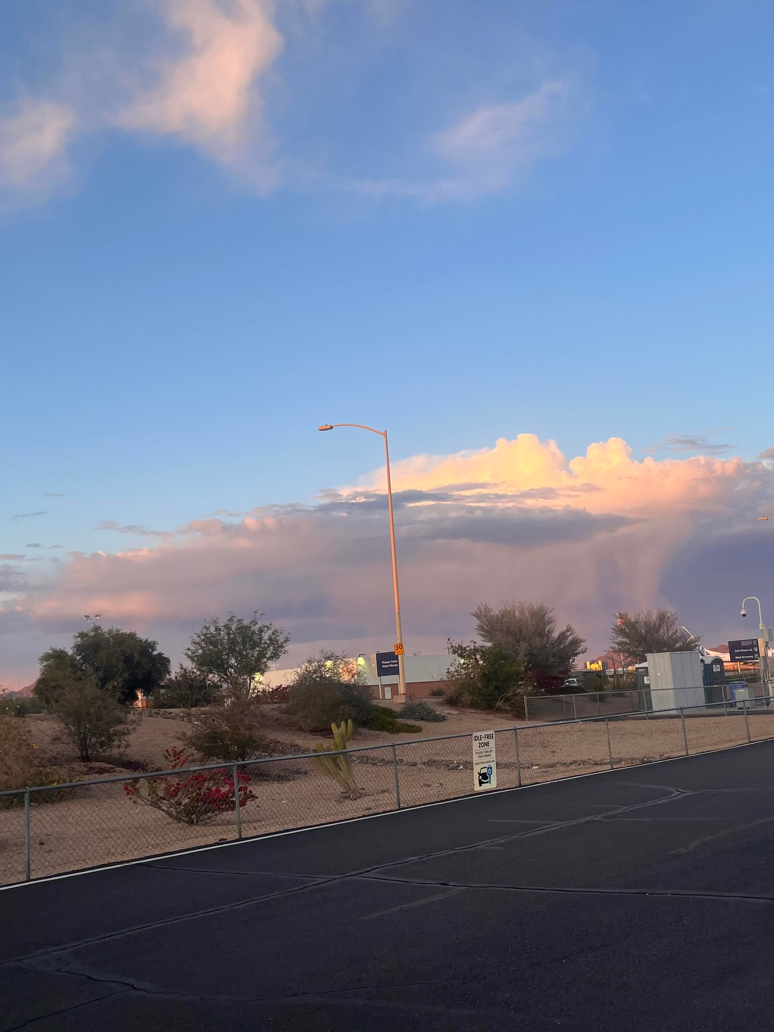
My son was actually impressed enough by the look of the clouds to his east while he was waiting in the cell phone lot at PHX that he took a picture. You can clearly see the cumuliform nature of the clouds, showing that they are convective. The difference here in this dry desert climate is that the showers are “based” around 8,000 feet, and the most of the rain falling out of them is evaporating before reaching the ground.
The evaporative process happening here also has the side effect of causing the turbulence that the flight attendant warned us about. As the rainfall evaporates, it causes the air to become “negatively buoyant,” in other words it is the opposite of the “positively buoyant” unstable air that rises on a warm day causing cumulus clouds and convective showers. The negatively buoyant parcels of air are essentially cooler and heavier than the surrounding air, meaning they sink and cause turbulence as they descend.
The showers in this situation were relatively weak as the instability was correspondingly weak. In more unstable environments, however, high based thunderstorms can develop in inverted-V environments such as this, and when that much more intense rain falls into a hot, dry environment of a typical western summer day, the downward rushing air becomes much more intense. This can result in dry microbursts which may cause severe to extreme turbulence and wind shear hazards to aircraft, but also severe winds that can cause significant impacts on the ground.
While renowned meteorologist Dr. Ted Fujita is primarily known to the public for his work on tornadoes and development of the tornado damage intensity scale named after him, much of his scientific work was actually focused on microbursts and trying to better understand and predict them. He was trying to reduce the impacts to aviation given that some of the deadliest aviation accidents in history were caused by microbursts. Dr. Fujita was the principal investigator on the 1982 JAWS microburst field project in Colorado which produced groundbreaking understanding of microbursts and the associated hazards. Because of Dr. Fujita and his colleagues’ work, the impacts of microbursts on aviation have been greatly reduced; in fact, there has not been a commercial aviation accident related to microbursts in the United States since 1994.
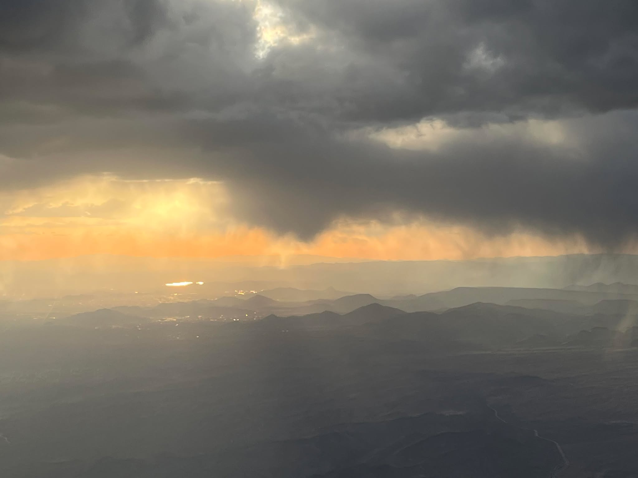
Finishing up this article with a photo of the sunset through the clouds and virga as we continued to descend; a cell phone pic cannot really due justice to how neat the sky looked, but hopefully it gives some idea. These sorts of science posts are something I plan to do as time and weather permit, so please feel free to add questions, comments, etc. to help me with future posts.

Leave a comment