And more springtime thunderstorms for many today
Yesterday, a wildfire broke out in southern New Jersey, forcing the evacuation of around 3,000 people and closure of the Garden State Parkway. The intense and large fire was visible on NWS weather radar.
While wildfires tend to be more associated with the western United States, there are many areas of the east that are also prone to wildfires and have seen large fires in recent years, such as the Gatlinburg and Smoky Mountain wildfires in 2016. My colleague Matt Lanza noted on Bluesky that this area of New Jersey is about as “classic of a wildland-urban interface as you get in the East.”
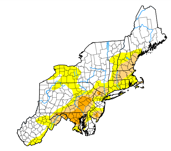
Much of the Northeast coastal region is in moderate to severe drought and has been dealing with fire danger concerns the last couple of months, and this is the second significant fire in the region in the last week.
While the evacuation orders have been lifted and the highways reopened per The Guardian, the fire is still visible on radar imagery this morning. Winds are expected to be much lighter the next few days across this region, and rain is in the forecast this weekend, all of which should help firefighting and the overall situation in the region.
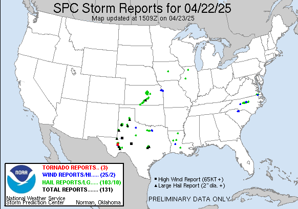
Severe thunderstorms impacted several areas on Tuesday, but the most impacted state was Texas were several severe storms produced a number of reports of very large hail and wind gusts greater than 75 mph.
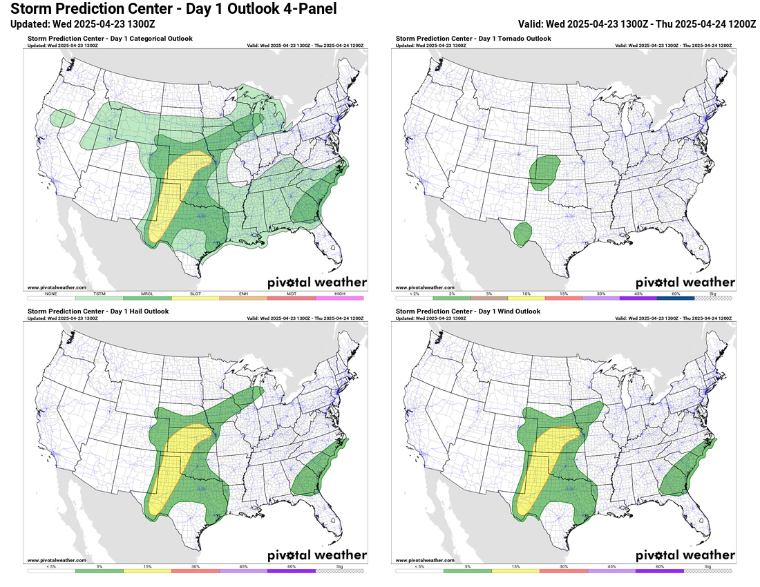
Overall today looks rather similar to yesterday, with clusters of severe storms capable of large hail and damaging winds across parts of the central United States, where the Storm Prediction Center has a large area outlooked in marginal to slight (level 1 to 2 of 5) risks of severe weather. A few severe storms also occurred on Tuesday in the Carolinas, and SPC also has a marginal risk in the Southeast for a similar scenario today.
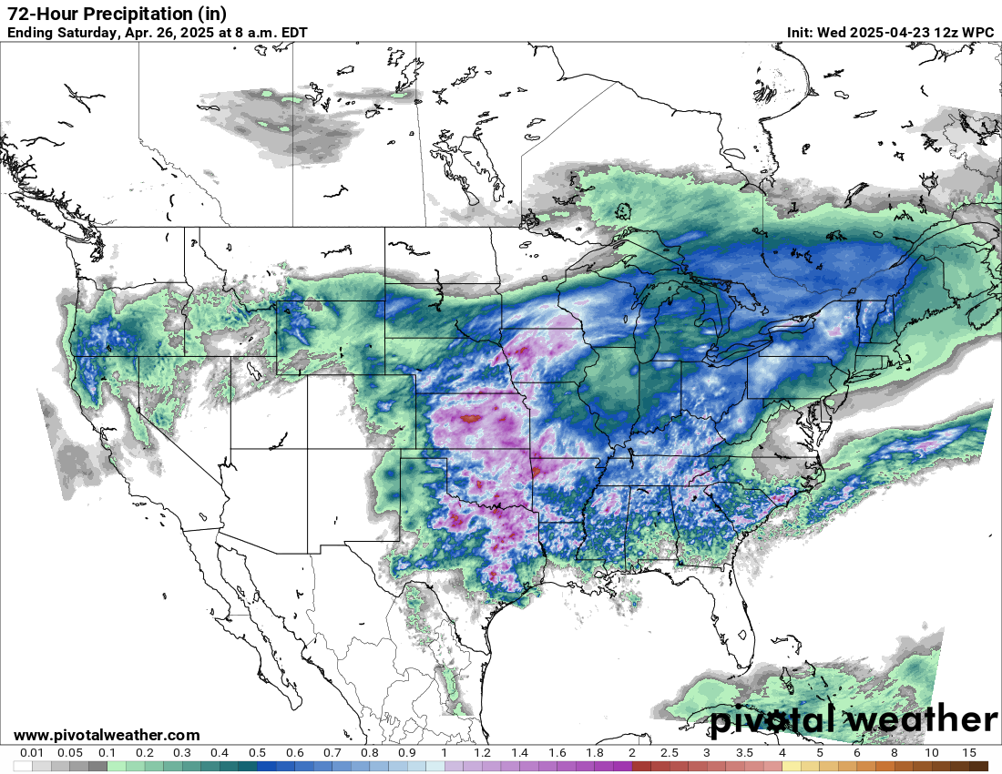
An overall similar weather pattern is expected to continue Thursday and Friday over the central and southern U.S., with clusters of strong to occasionally severe thunderstorms that could also produce some locally heavy rain. By Friday an upper level system moving southeast out of Canada will bring wet weather to the Northeast. Meanwhile, the intensifying upper level trough of low pressure off the west coast will begin to bring wet weather to Oregon and northern California later Thursday into Friday.
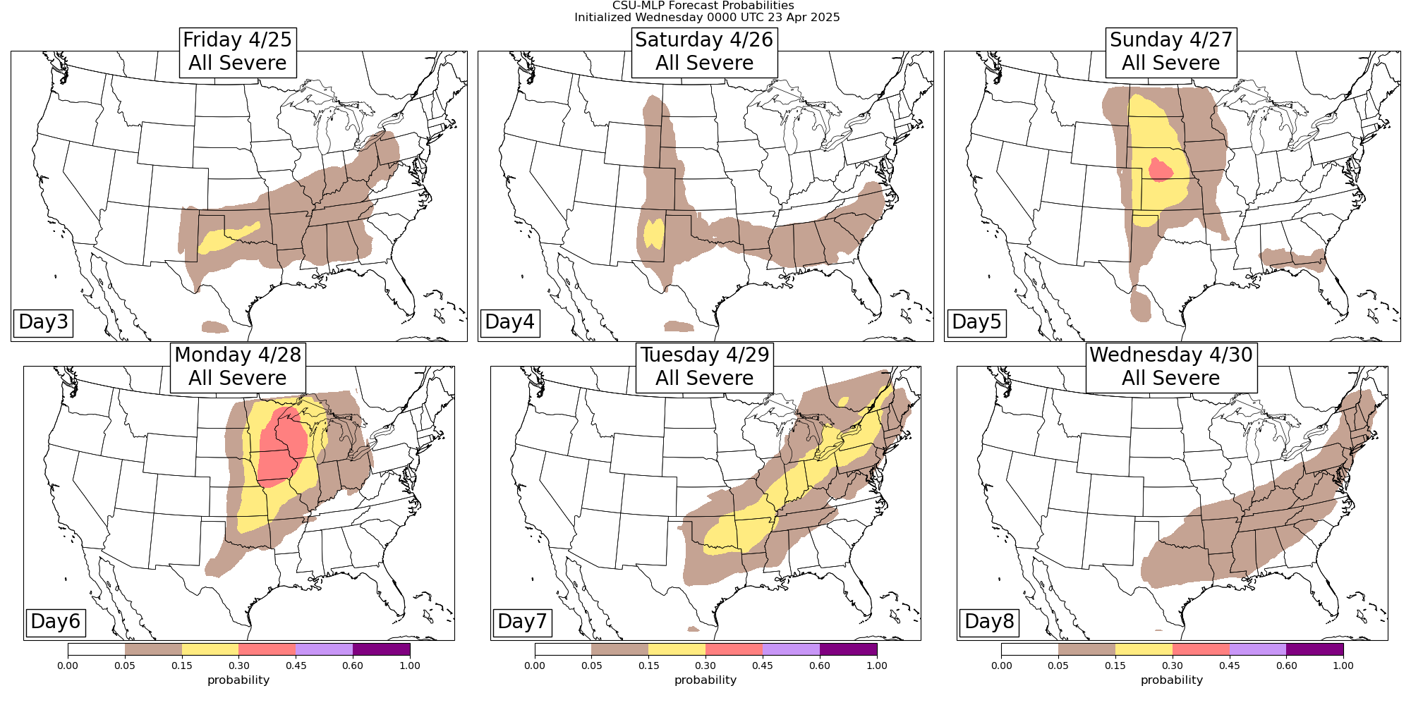
As that west coast system continues to move east into the Rockies, it is still expected to bring an increasingly active pattern for severe weather across the central part of the country early next week as shown in the CSU-MLP outlooks above. .

Leave a comment