And watch for increasing severe weather potential by early next week

Starting this morning by looking at the observed global temperature anomaly map, which shows a whole lot of red and not much blue, most notably a large area of extreme warmth (up to 10C above normal) covering much of Europe, western Asia and northern Africa. Record heat is affecting much of this region with many locations near or above record monthly warm temperatures. 45C (113F) was recorded in Egypt, and Hazeva in Israel reached 44.9C, just 0.1C from the monthly record for the country. Heat reached even to coastal areas with Tel Aviv hitting 40C (104F).

Record heat is expected to continue over much of this region the next few days, with model forecasts showing temperatures as much as 15C above normal from the Middle East into Central Asia.

Closer to home, temperatures will continue above normal for much of the country the next couple of days, but as far as record temperatures for the next several days, they will primarily be some scattered record high minimums in parts of the East.
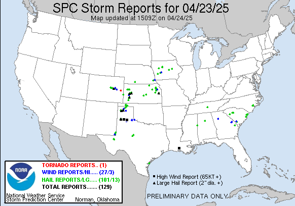
As far as severe weather, over 100 reports of severe wind and hail were received by the Storm Prediction Center (SPC) in the last 24 hours, primarily across the Plains and Midwest. Scattered to numerous thunderstorms over the Southeast also produced several incidences of severe hail and wind.

Today is anticipated to be a similar day, with severe weather primarily focused in the Plains. Large hail is anticipated to be the primary risk, with a focused area for potential very large hail across southwest Kansas, western Oklahoma and northwest Texas.
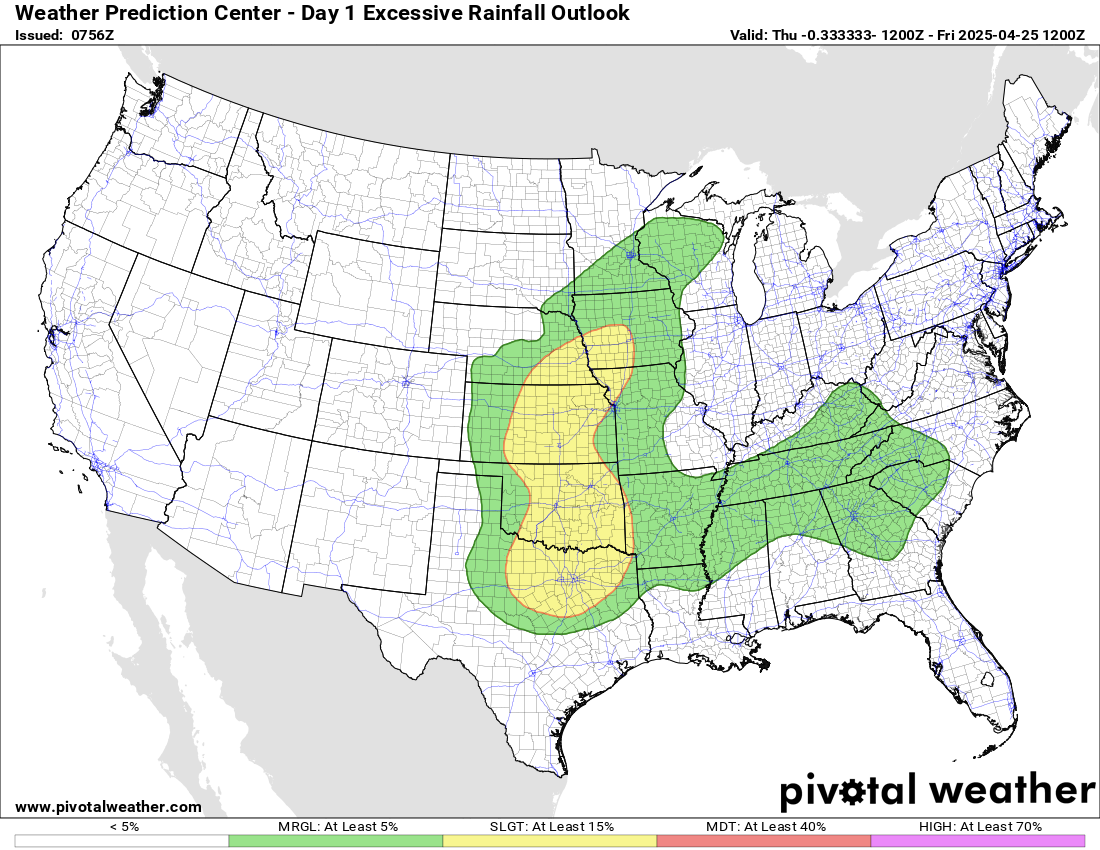
The thunderstorms across the Plains will be relatively slow moving, and as a result some storms could produce several inches of rainfall in a localized area, potentially producing some flash flooding. The Weather Prediction Center has outlooked a large slight (level 2 of 4) risk for flash flooding across this region for today and tonight.
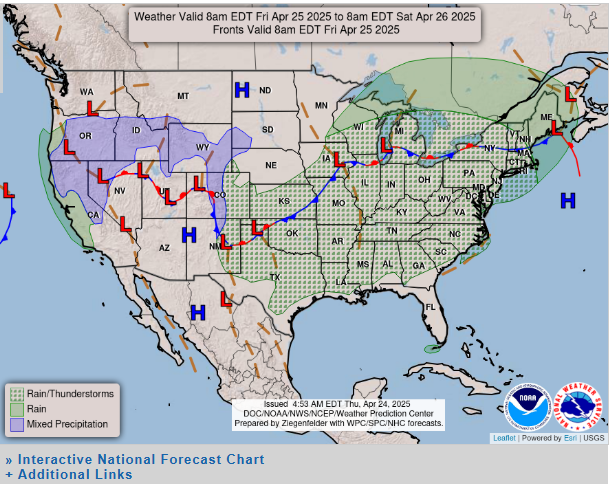

The weather pattern for much of the eastern two-thirds of the nation will remain relatively stagnant the next couple of days, with scattered to numerous showers and thunderstorms affecting much of the same areas. An upper level weather disturbance will drop southeast out of Canada and bring cooler air and rain and some higher elevation snow to the Northeast. In the west, the upper level weather system off the west coast we have been discussing will intensify and being to move inland, bringing a few low elevation showers and some mountain snows.
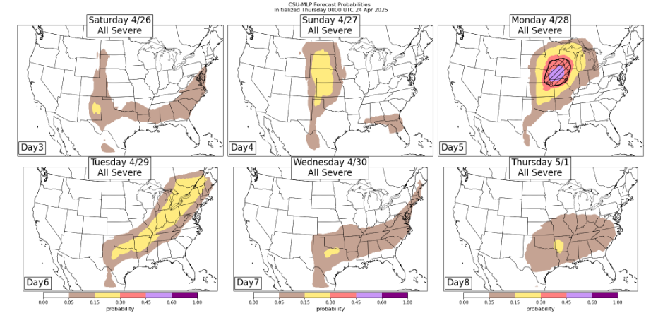
By Sunday, the western US system will begin to more directly impact the Plains and bring an increased risk of severe weather from Kansas north, and Monday is increasingly looking like a potentially significant severe weather day for parts of the upper Midwest as that system moves farther east. Wind shear is expected to become quite favorable, and unseasonably high levels of Gulf moisture look to surge well north into the region, resulting in a favorable environment for supercell severe thunderstorms. The Colorado State University machine learning system is showing unusually high probabilities at day 5 for severe storms (including significant severe weather) centered on Iowa, and SPC also has a 30% severe area (their highest at that time range) for the same area. This will be a scenario we will be keeping a close eye on the next couple of days.
After that system, it appears as though the focus for any severe storms will shift back more into the southern United States as the southern branch of the jet stream becomes more of the driver for active weather again. The CSU-MLP severe weather forecast shows a broad area of low probabilities across that region for now.

Leave a comment