Several tornado watches now in effect
Hi everyone, wanted to do a quick update on how the severe weather is evolving this afternoon before things get too hectic.
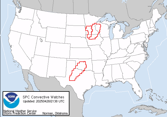
The Storm Prediction Center has issued three tornado watches this afternoon, two in southern Minnesota, northern Iowa and northwest Wisconsin and another from central Oklahoma across northwest Texas.

Severe thunderstorms have developed from north and northwest of the Twin Cities down into northwest Iowa, and several severe thunderstorm and tornado warnings are in effect across this area.
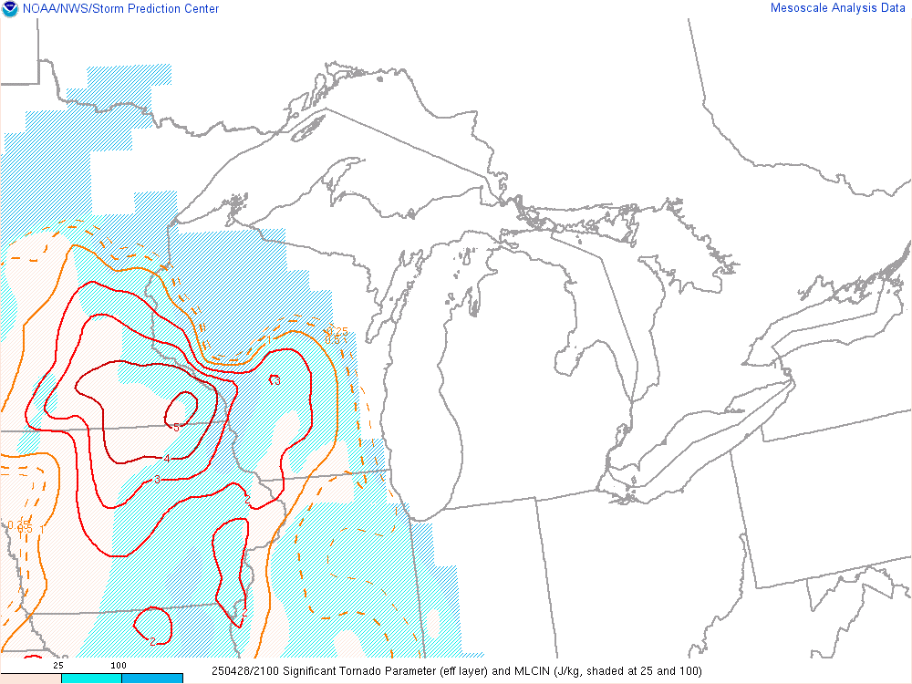
Conditions are becoming increasingly favorable for tornadoes in this region. The significant tornado parameter shown above, which is parameter that combines instability and low level wind shear into a single value, has been steadily increasing across the region, and now is showing values favorable for strong tornadoes.
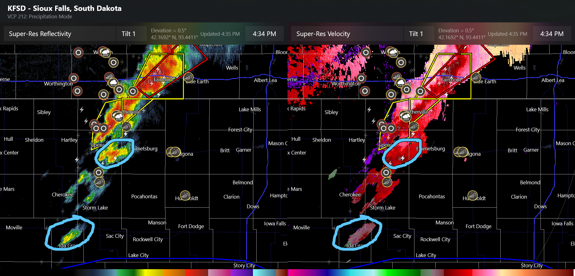
In addition to the main band of severe storms currently ongoing, radar and satellite is showing more robust isolated storms now developing to the south of this band, and these will also be of increasing concern for tornadoes and severe weather as they move east/northeast across northern Iowa the next several hours.

Farther southwest, the atmosphere has continued to destabilize, with convective potential energy values now in excess of 5000 J/kg over parts of Oklahoma, indicative of a very unstable atmosphere capable of explosive thunderstorm development. Thunderstorms have recently developed over central Kansas, and a tornado watch will likely be issued soon for parts of eastern Kansas into western Missouri. Additional severe thunderstorms should develop over southwest Oklahoma and northwest Texas the next few hours and move northeast.
I will continue to provide occasional updates via social media and Substack Notes. If you want to keep up with what is happening realtime, I have started a live Substack Chat for paid subscribers that can be found at this link. I will be providing frequent updates about all of the severe weather in the chat through the evening.
If you are in the severe weather threat areas this evening, keep up to date with the latest updates and warnings and stay safe! I have opened up the comments on this post to all subscribers, feel free to ask questions about your area here.

Leave a comment