And explaining record warmth in Florida
Good morning and welcome to the Memorial Day weekend and the unofficial start of summer. Appropriately, we start today’s newsletter talking about record warmth.
As graphically shown by my meteorological colleague Jeff Berardelli, Tampa set an all-time May monthly record for warmest minimum temperature yesterday with a low of 80F. If you look at the all-time warmest minimum temperatures in Tampa, you see a pretty clear trend:

Prior to 2000 (records in Tampa go back to 1890), a minimum of 79F or warmer had only been observed in May in Tampa three times. Since 2000, it has happened 13 times; since 2022 it’s happened 8 times, and it’s happened 3 times in the last 3 days.
As Jeff points out, it’s not a coincidence; as we have been talking about in recent newsletters, climate change is particularly affecting overnight low temperatures and making them warmer.

For Florida, a big reason why is persistent above normal sea surface temperatures (SSTs) in the Gulf and Caribbean. In the immediate coastal waters off the west coast of Florida, SSTs are current running 2-3C above normal. This results in higher low level moisture and warmer morning temperatures.
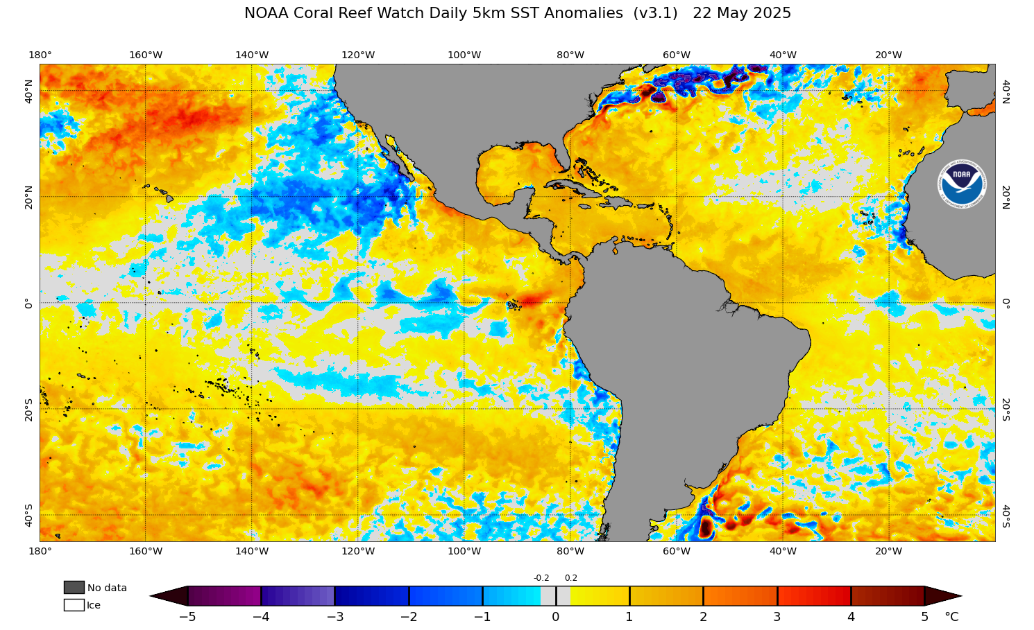
The discussion of SSTs provides a good segue into the Atlantic seasonal hurricane outlook that was released by NOAA yesterday. SSTs are running well above normal over much of the Atlantic, Gulf and Caribbean this year – but luckily are not as extreme as what was observed at this time of year in 2023 and 2024. Still, with above normal SSTs over much of the basin and the lack of an El Nino that typically disrupts tropical cyclone development, NOAA is anticipating a near to somewhat above normal season as far as activity.

I am planning to do a post dedicated to looking at the hurricane season – and what I am planning as far as tropical information on Balanced Weather – sometime before the season kicks off on June 1st.
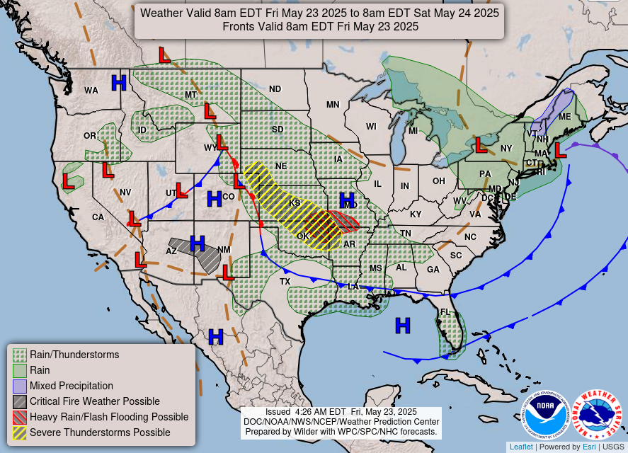
Let’s turn our attention to the weather for this upcoming long weekend. In the Northeast, a persistent area of low pressure along the coast will make for yet another unseasonably cold and damp day with again some high elevation wintry precipitation in northern New England. Meanwhile in the central part of the country, a slow moving warm front is expected to focus strong to severe thunderstorm development from western Nebraska to western Arkansas. Large hail and damaging winds will be the primary risks with these storms; a greater risk for very large hail 2” or greater will exist from northeast Colorado to northwest Oklahoma. Locally heavy rain could also cause some isolated flash flooding, with a somewhat greater risk from the Wichita and Tulsa areas east across the Ozarks, where a slight (level 2 of 4) risk of excessive rainfall is in place.
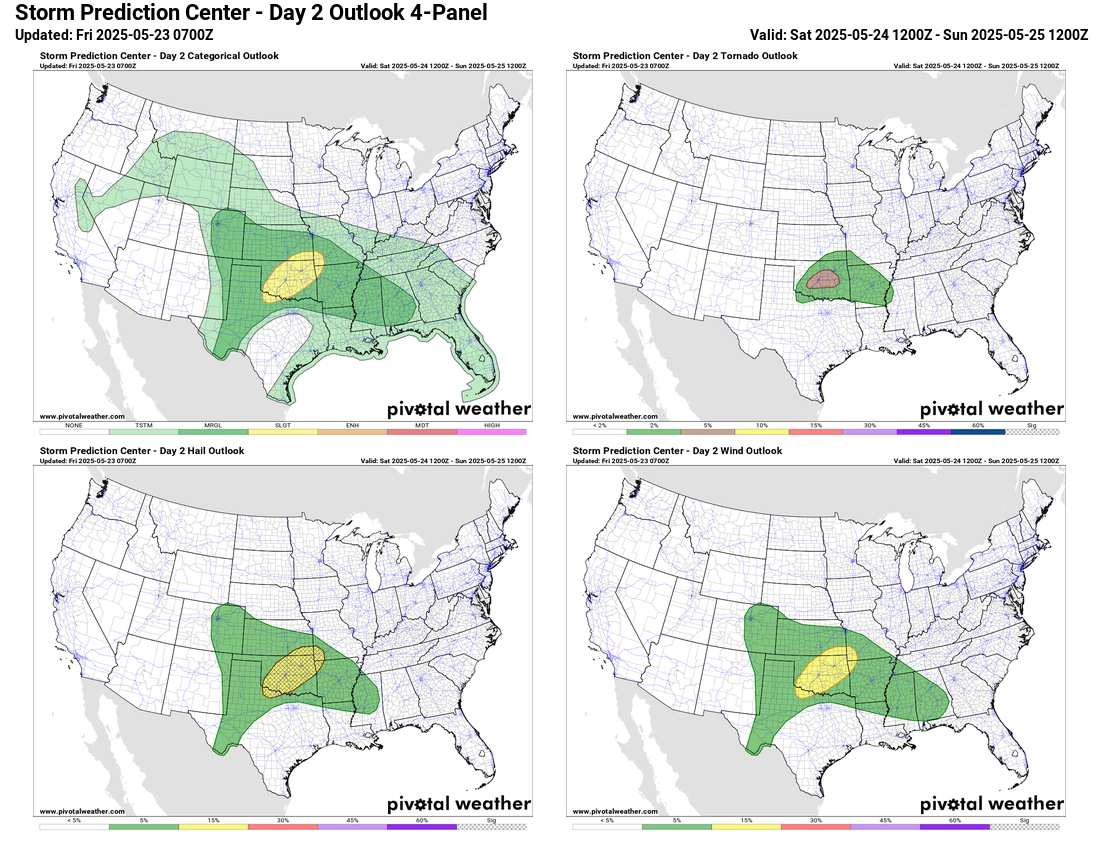

The forecast for Saturday looks rather murky in the central US as it will be primarily be driven by small scale influences and how thunderstorms evolve tonight. Overall conditions will be favorable for additional rounds of strong thunderstorms, some of which could be severe and produce heavy rainfall with risk areas shown above. Meanwhile, the Northeast will continue to be under the influence of cool and damp low pressure.

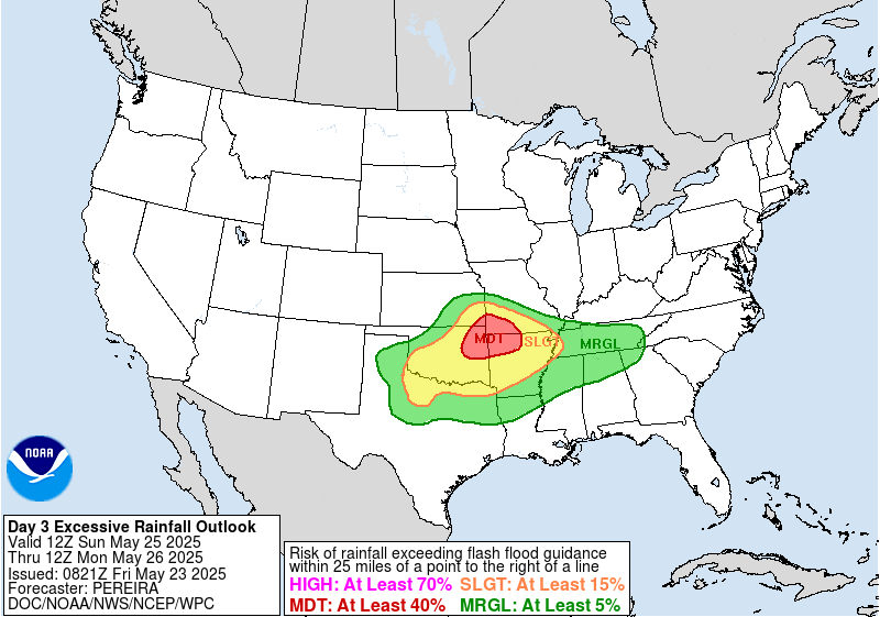
By Sunday, an area of low pressure aloft will begin to develop over the Southwest and begin to interact with the stationary front across the south central US, providing a bit more focus for thunderstorm activity across the region. The atmosphere will likely become quite unstable in areas where morning clouds and storms are not prevalent, so afternoon and evening thunderstorms across the slight risk area shown above could be quite intense with very large hail and possibly some tornadoes. Meanwhile, flash flooding will become an increasing risk from northeast Oklahoma to southwest Missouri where WPC has a moderate (level 3 of 4) risk of excessive rainfall in place.

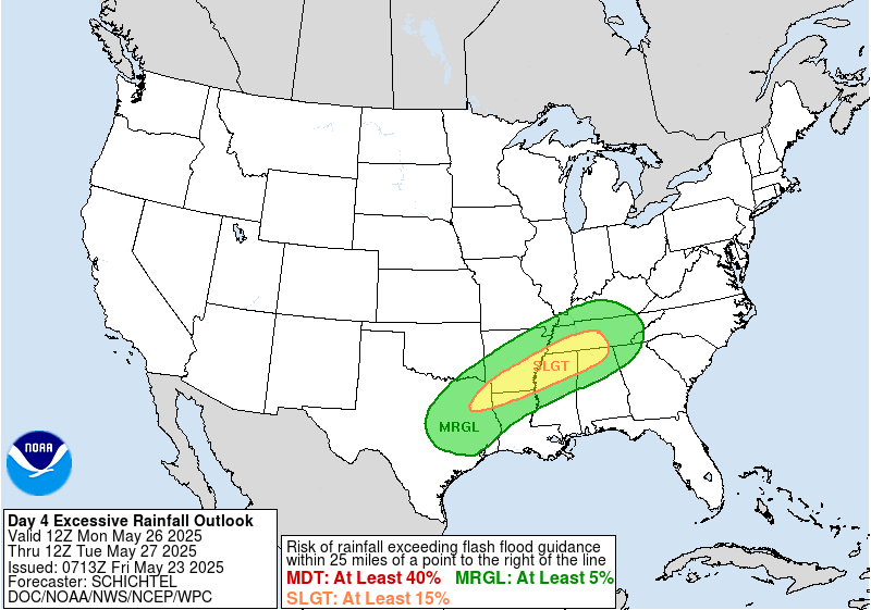
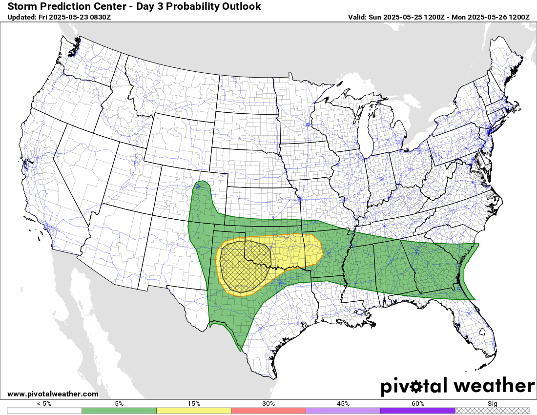
As the upper level low over the Southwest shifts east Monday, the front will begin to drift south, focusing thunderstorm activity and the corresponding risk of severe storms and flash flooding farther south.

North of the front, temperatures will be unseasonably cool across the center of the country with cooler than normal conditions continuing in the East as well. South and west of the front will continue to see unseasonable warmth, except along the West Coast where a weather system coming in off the Pacific will bring some cooler air.

Leave a comment