And a cool Memorial Day for much of the country
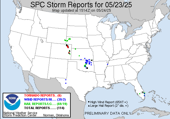
Friday ended up being a pretty active day across the center of the country, as several clusters of thunderstorms moved southeast along a stationary front across the region. A few different waves of severe storms moved across Oklahoma into Friday night, producing a number of reports of large hail and damaging winds. Additionally, supercell storms developed Friday afternoon in the upslope regions of eastern Colorado and produced several tornadoes along with a number of reports of very large hail up to 3” in diameter.
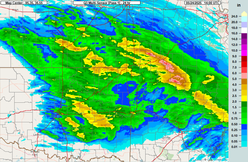
Farther northeast, rounds of thunderstorms moving over the same area produced a swath of heavy rain of 4-7” across southwest Missouri, which resulted in some significant flash flooding in the Springfield area this morning with water rescues and closed roads reported.
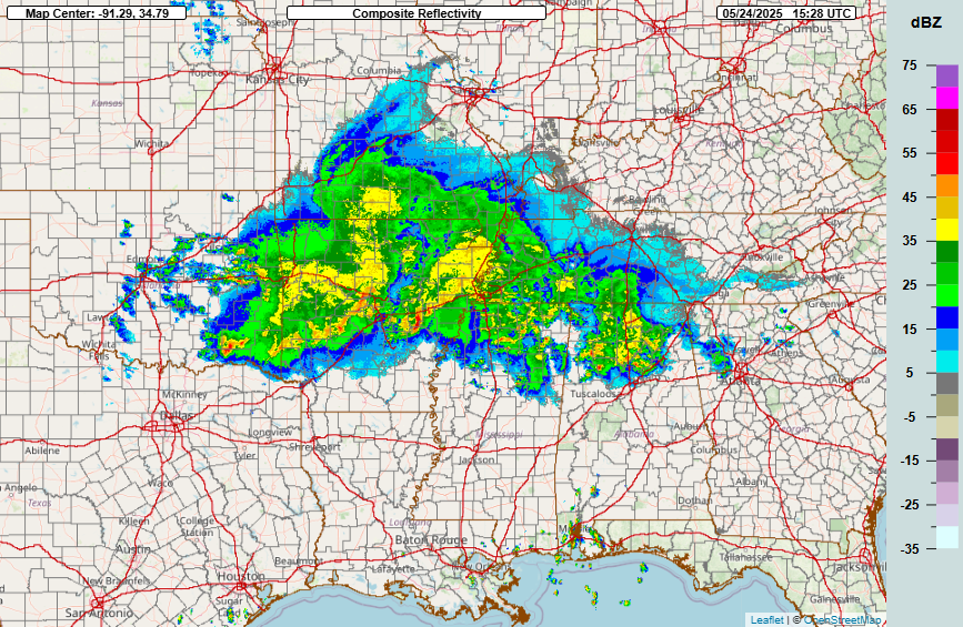
Late this morning the remnants of the overnight thunderstorm complexes were moving southeast through the Mid-South and Tennessee Valley regions.
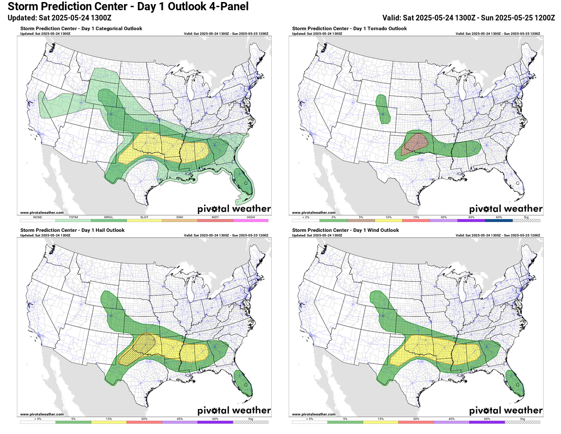
Daytime heating should destabilize the atmosphere ahead of these storms and allow some intensification, while in the wake of these storms strong heating acting on an already unstable atmosphere across the Southern Plains will result in a very unstable atmosphere this afternoon. While a broad slight (level 2 of 5) risk of severe storms is in place from northwest Texas east into Alabama, the region from northwest Texas across Oklahoma where the greatest instability is forecast is where the most intense activity is expected later today into tonight, with the potential for supercell storms producing very large hail and tornadoes.
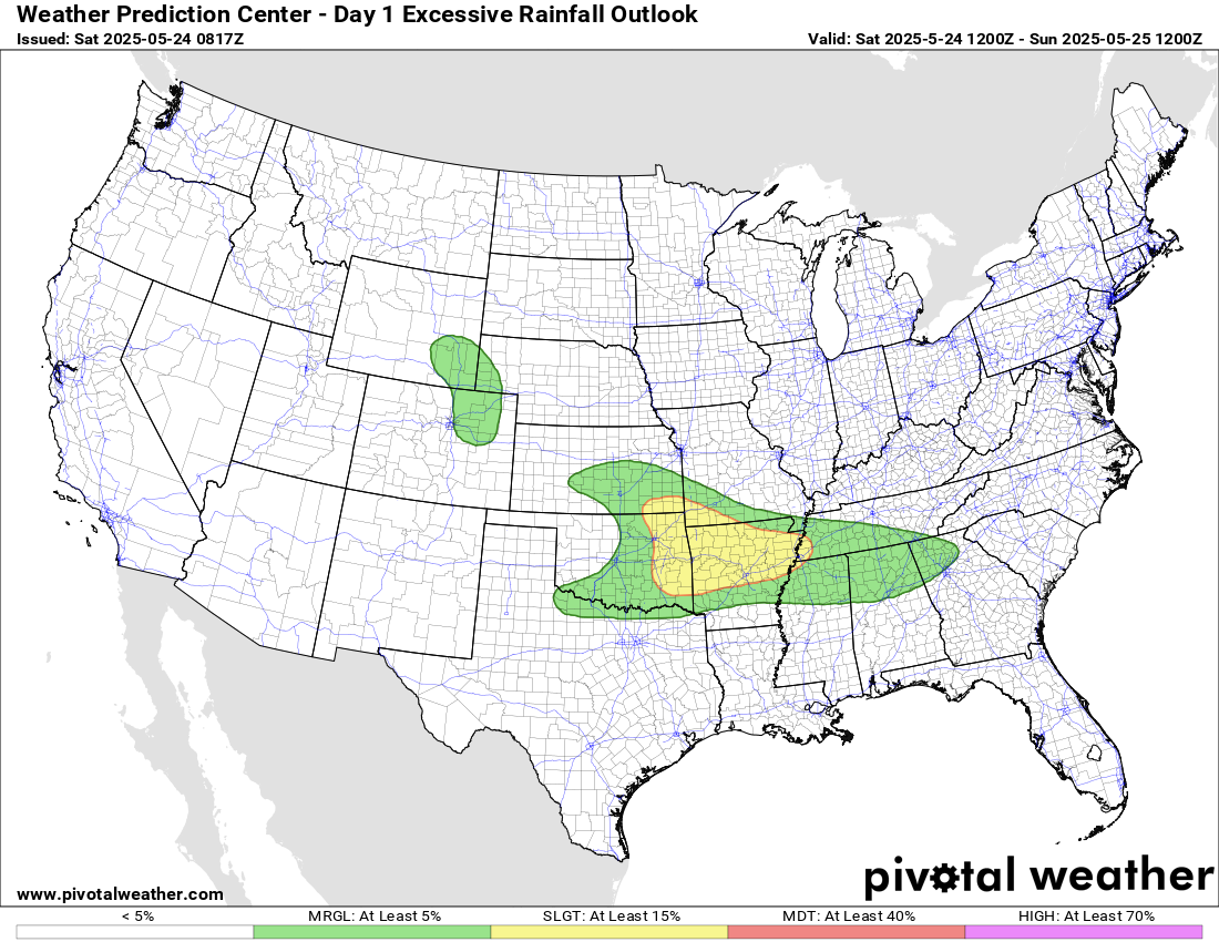
In addition to the risk of severe weather, heavy rainfall could produce additional flash flooding and a slight (level 2 of 4) risk is in place as shown above.

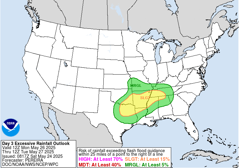
The risk of flash flooding looks as if it will increase on Sunday as a slow moving upper level area of low pressure to the west begins to focus more intense thunderstorm activity along the stationary front. The Weather Prediction Center has placed moderate (level 3 of 4) risk of excessive rainfall across northeast Oklahoma, northwest Arkansas and southwest Missouri while a large slight (level 2 of 4) risk surround this area.

Severe weather will continue to be a risk on Sunday over a very similar region as today.

By Monday the front will begin to slowly push south, with the risk of severe storms and flash flooding drifting south accordingly.

Areas north of the front across the central US will see a quite unseasonably cool Memorial Day. While not as below normal as areas farther west, the Northeast and Great Lakes region will see into Monday a continuation of the cool weather that has been in place the last few days.
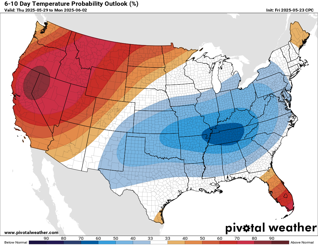
As we head into next week, the weather pattern will trend toward an upper level trough of low pressure in the eastern US and a building ridge of high pressure aloft along the west coast. This will lead to cooler than normal temperatures for much of the east – except Florida – while the west sees building early summer heat with some record warmth possible by late in the week.

Leave a comment