More smoke coming from Canada and a tropical summary

Happy Saturday! Friday worked out about as expected from a severe weather perspective, as multiple waves of severe storms moved east from the central and southern High Plains all the way east to the Mid-Atlantic states. Additionally, some severe storms impacted southern New England with wind damage and large hail reported. Several tornadoes were reported with supercell storms in the High Plains, and also with the complex of severe storms that moved east across eastern Oklahoma and western Arkansas Friday morning. One tornado near Van Buren, AR in the Fort Smith area damaged two dozen homes and injured two people per this story from ABC 40/29 news.


The biggest concern for severe weather today looks to come with a complex of strong thunderstorms currently moving across the Mid-South. This complex is expected to stay well organized and reintensify as it moves east and daytime heating destabilizes the atmosphere ahead of it. Widespread damaging winds are possible with these storms as they move east, and SPC has placed an enhanced (level 3 of 5) risk of severe weather across the region for this potential. Locally heavy rainfall may also cause some flash flooding.
Behind this complex of severe storms, less in the way of thunderstorm activity is expected, but some scattered strong to severe storms could redevelop if sufficient heating occurs in the wake of the storms. Additionally, widely scattered severe storms are expected again later today in the High Plains, but should be less intense and widespread as the previous few days.
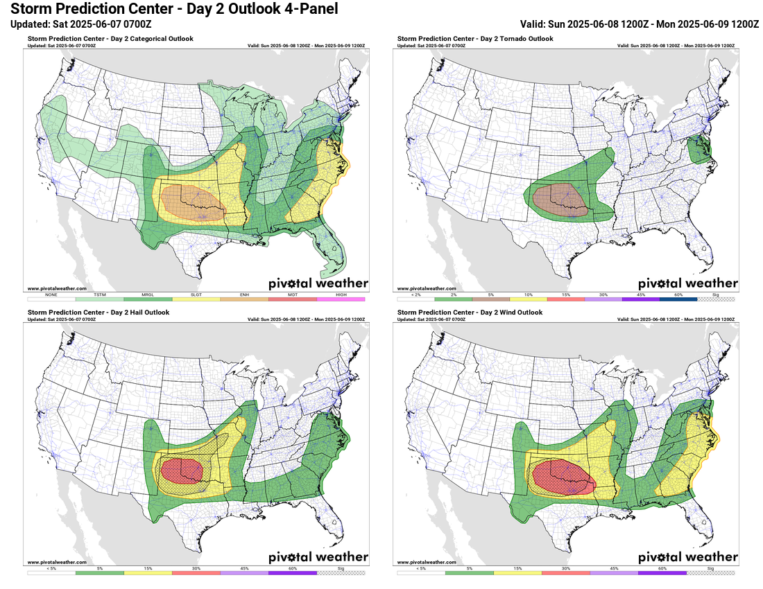
Sunday looks as if it will be a particularly active day for severe weather. In the Southern Plains, the atmosphere is expected to become quite supportive of severe storms with plenty of instability and wind shear ahead of a cold front dropping south through Kansas. Severe thunderstorms are expected to develop along and ahead of this boundary and move southeast through the afternoon and evening hours. The various high resolution models each have their own solution of the timing and location of the strongest activity, but where that activity occurs the atmosphere will be supportive of significant straight line wind damage, very large hail and tornadoes with the most intense storms. SPC has placed a large enhanced (level 3 of 5) risk across the region with a large area of 10% probabilities for very large hail and significant straight line winds.
Additionally, a developing low pressure system and associated cold front will focus a risk of severe storms from the Mid-Atlantic to the Southeast on Sunday. Storms capable of damaging winds and large hail are possible along with a few tornadoes. Some of the high resolution models suggest there could be a period of enhanced tornado risk across parts of eastern Virginia during the day Sunday, so that is something to be aware of.
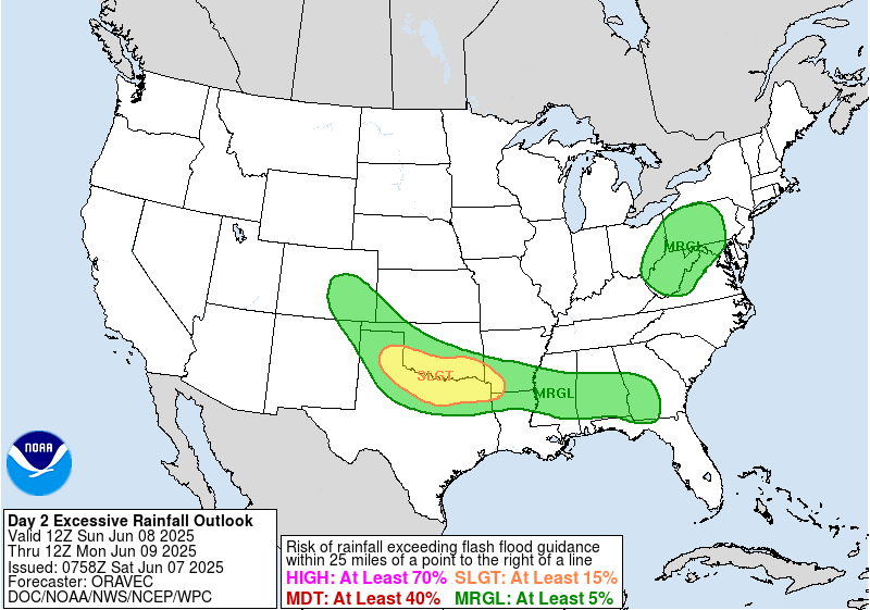
Locally heavy rain with these storms may also cause some additional pockets of flash flooding.

By Monday, an upper level trough will have become established across the eastern US, and on the south side of this trough stronger winds aloft and a reservoir of moisture and instability should support additional severe storms in the Southeast.
Meanwhile, out west another upper level ridge of high pressure will bring another round of record heat to the Pacific Northwest, with a number of record maximum and record high minimum temperatures expected on Monday.
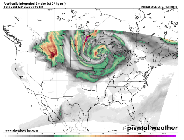
Between the upper level ridge in the West and downstream trough in the East, increasing northwesterly winds at all levels of the atmosphere will likely bring another wave of smoke from the still raging Canadian wildfires into the northern and central United States by early next week.
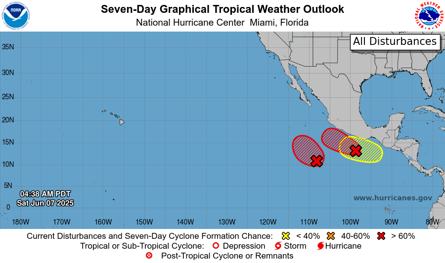
Taking a quick look at the tropics, the Atlantic is expected to remain quiet the next several days, but a couple of systems look likely to develop in the eastern Pacific. Both of these systems look as if they will remain offshore, but the system closer to the Mexican coast could cause locally heavy rainfall is southwestern Mexico.
By later in the upcoming week, conditions still look to become more favorable for tropical development overall in the area around central America. NHC has highlighted an area south of the Isthmus of Tehuantepec for potential development (the yellow area in the graphic above). The models continue to have some differences with this favorable period for tropical development with the European ensemble showing most of the potential activity on the Pacific side, while the American Global Ensemble Forecast System has some risk on the Caribbean/Gulf side. Again, for now we’re still looking at a period 5-10 days out and it’s just something to be keeping an eye on as the potential for a Gulf or Caribbean system is still relatively low.

Leave a comment