And a summary of the weekend weather
Happy Friday! I want to start off this morning by a highlighting a science announcement yesterday I found interesting – and exciting. Google posted a story about its new Weather Lab website, an interactive website featuring its artificial intelligence (AI) weather models. In particular, Google highlighted their new AI tropical cyclone model, an ensemble approach model that produces a 50-member 15-day forecast. Google is developing this model in partnership with a number of key entities in tropical cyclone forecasting and research, including NOAA’s National Hurricane Center and Colorado State University’s tropical cyclone research team, along with international partners such as the UK Met Office, the University of Tokyo, and Japan’s private sector meteorology company WeatherNews. I encourage you to read the full story at the link above, but these quotes from the story summarize the key results:
(O)ur initial evaluations of NHC’s observed hurricane data, on test years 2023 and 2024, in the North Atlantic and East Pacific basins, showed that our model’s 5-day cyclone track prediction is, on average, 140 km closer to the true cyclone location than ENS — the leading global physics-based ensemble model from ECMWF. This is comparable to the accuracy of ENS’s 3.5-day predictions — a 1.5-day improvement that has typically taken over a decade to achieve.
While previous AI weather models have struggled to calculate cyclone intensity, our experimental cyclone model outperformed the average intensity error of the National Oceanic and Atmospheric Administration (NOAA)’s Hurricane Analysis and Forecast System (HAFS), a leading regional, high-resolution physics-based model. Preliminary tests also show our model’s predictions of size and wind radii are comparable with physics-based baselines.
I really cannot overstate what an incredible result a 1.5 day improvement in track forecast over the track forecast from the European Center for Medium Range Forecast (ECMWF) ensemble, typically the best global model for tropical cyclone track forecasting. These are truly groundbreaking results that have the potential to significantly improve forecasts and society’s response to tropical cyclones. It is important to recognize that the Google model’s verification statistics are based on “hindcast” runs of forecasts of previous storms, but in my mind there is really not any reason to think that the performance should not be similar in real-time. I am excited to see how the model system performs for this season.
I know from being on social media that AI is currently facing a lot of negative publicity for a lot of deserved reasons (environmental concerns, power needs, intellectual property concerns, to name a few). Acknowledging those very valid concerns, the problems that meteorology present seem to be very amenable to AI approaches, and I have honestly been amazed at how rapidly AI is making significant advances in meteorological research and modeling. I plan to do a deeper dive into how AI is being used in meteorological R&D – and some of the broader issues surrounding AI – soon.
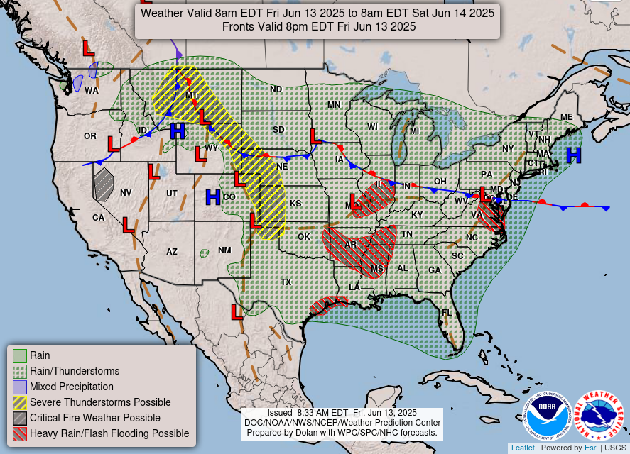
Turning to the weather, today will be a day with scattered to numerous showers and thunderstorms across much of the country from the Rockies east. Locally heavy rain will continue to be a concern, particularly in the Mid and Lower Mississippi Valley regions where the weakening upper level low pressure area that caused the flash flooding over Texas the last couple of days will focus thunderstorm activity. The risk of severe thunderstorms looks to be primarily in an axis of more unstable air that is expected to develop from the central Plains northwest into Montana; SPC has a slight (level 2 of 5) risk of severe storms in this area.
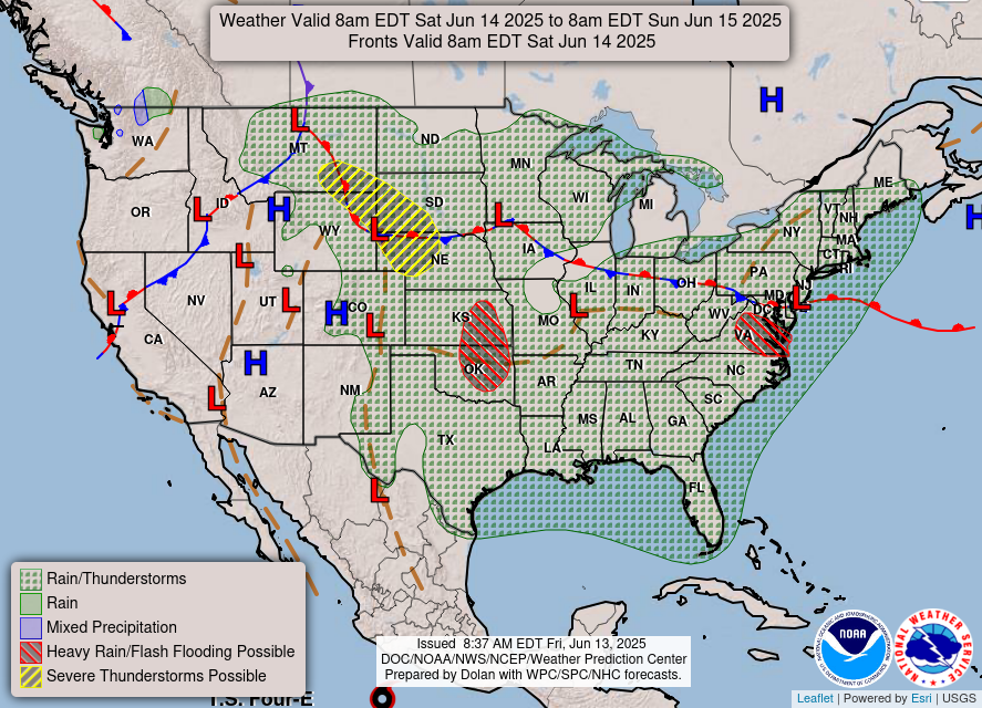
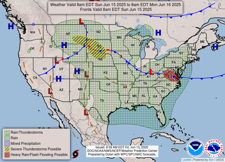
The weather pattern this weekend will be increasingly dominated by upper level high pressure areas developing over the Southwest and Florida, while the upper level low in the center of the country continues to weaken. This will continue to favor the continuation of scattered to numerous showers and storms over the eastern two-thirds of the country, with pockets of locally heavy rainfall. Severe weather risks will be focused in the northern Plains where disturbances will move through a stronger belt of mid and upper level winds on the north side of the building upper level high over the Southwest.
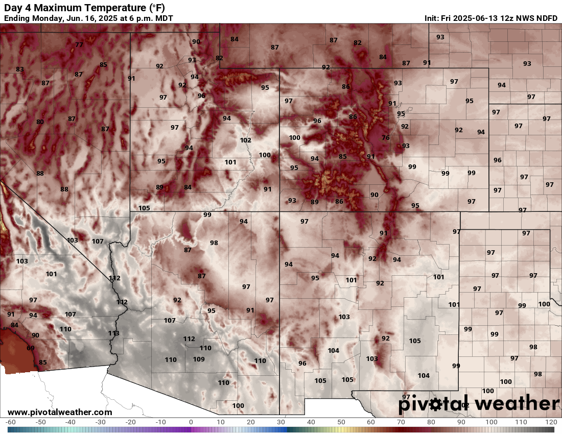
Heat will become an increasing concern under the Southwest upper level high, and by Sunday 110+F temperatures will become widespread in the deserts.
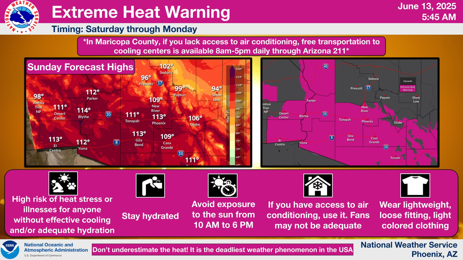
Extreme heat warnings are in effect for much of this region, including the Phoenix, Tucson and Yuma areas.
![[Key Messages]](https://balancedweather.com/wp-content/uploads/2025/06/59737-eff35096-1634-43cb-b1e2-8ba43caedde4_897x736.png)
In the tropics, NHC is issuing advisories on Tropical Depression 4-E in the eastern Pacific, which is expected to become a tropical storm over the next 24 hours as it moves northwest parallel to the Mexican coast. As of now, most of the models continue to show that the most favorable conditions for tropical cyclone development will stay in the eastern Pacific for next 7-10 days.

Leave a comment