In weather: more Phoenix heat records, and western fire danger concerns
Aug 08, 2025
In the context of my comments yesterday about the non-scientific approach being taken by the current administration with the National Climate Assessments, I want to share perspective about another governmental development from the last 24 hours. The White House yesterday afternoon announced a new executive order (EO) entitled “Improving Oversight of Federal Grantmaking,” focused on how federal agencies develop and award scientific grants.
As someone who was an actual federal grant officer for a NOAA science grant program, the VORTEX-USA tornado research program, I can tell you firsthand that there is definitely a need to improve the process and oversight of federal grant making. However, this executive order seems much less about actually improving the process and much more about putting in place additional layers of bureaucracy that will be led by political appointees rather than scientists.
You can read the full order at the link above, but some of the key points I take from it include:
- Directs agencies to develop a new process for the development of notices of federal funding opportunities (NOFOs, or grant programs) and the awarding of grants. These new processes require oversight and approval from political and other senior level appointees.
- Increased oversight by the Office of Management and Budget (OMB) over federal scientific grant programs
- Mandatory termination clauses in all grants that allow the federal government to terminate a grant for “convenience” at any time
- Agencies cannot issue new NOFOs until they have the new policies and procedures required by this EO in place
To me, a key paragraph of the EO that directly relates to what I discussed yesterday is this one:
Senior appointees and their designees shall not ministerially ratify or routinely defer to the recommendations of others in reviewing funding opportunity announcements or discretionary awards, but shall instead use their independent judgment.
To me, that is saying that political appointees should have the final say on all NOFO and grant approvals, and given that many senior level appointees do not have expert background in the science, they will be basing their final decisions on “other” criteria. In fact, the EO goes on to say that the first priority that should be considered by approving officials is if a program or grant “demonstrably advances the President’s priorities.”
All of this obviously is a major shift in how federal scientific grant programs are managed, and regardless of one’s view of the political or policy aspects, one thing that I can say with confidence as someone with experience in leading federal grant programs is that this will make an already slow, cumbersome process even slower and more cumbersome. In fact, this Ars Technica article makes the case that this EO is in direct response to Congressional pushback about science agency budget cuts, in that even if Congress keeps funding levels higher, the EO will greatly reduce agencies’ ability to actually spend the money through research grants. As with what the administration is doing with the National Climate Assessment, it will be very interesting to see how Congress responds to the administration’s latest move in this tug-of-war between the executive and legislative branches over federal science policy.
Back to weather: as expected, yesterday was a record breaking day in the Southwest, as Phoenix set a new all-time record high for the month of August with 118F, and Tucson tied its monthly record with 112F. Prior to 2011, Phoenix had only hit 115F or higher on a date after August 1st 6 times; it has now happened 33 times. Denver and Palm Springs both had daily record highs yesterday.
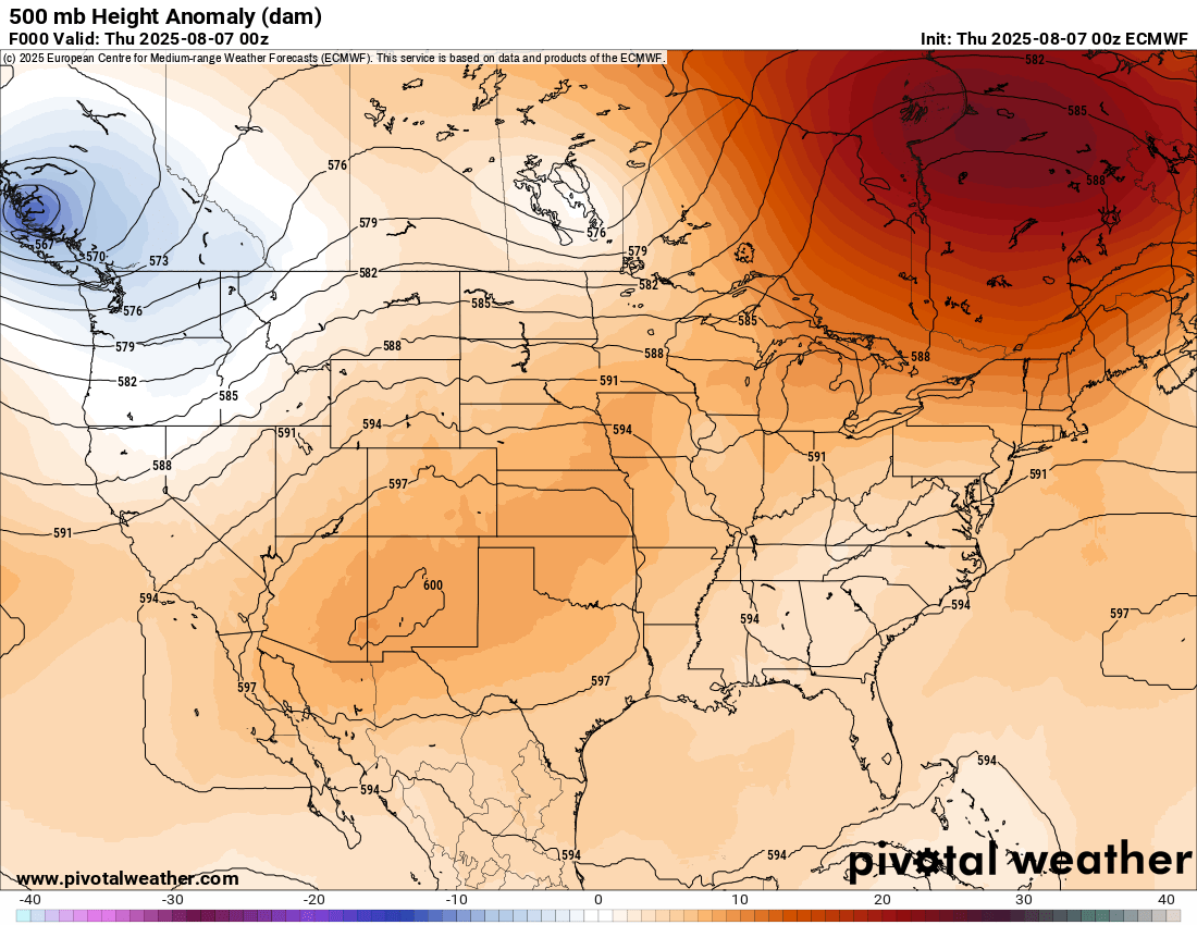
My also recently retired NWS colleague Victor Murphy pointed out to me in an email yesterday that with the record strong upper level high pressure at 500 millibars (mb, shown above), five NWS upper air stations recorded a geopotential height at 500 mb of 6000 meters. 6000 meters is a benchmark level for showing an extremely strong upper level high, and to have five stations at that level is pretty remarkable. Victor also pointed out that the likely reason that record heat was not even more widespread with this intense heat dome is that areas farther to the east in New Mexico and Texas have had above normal rainfall in recent weeks, and wetness generally leads to less effective heating of the surface even when upper level conditions are highly supportive.
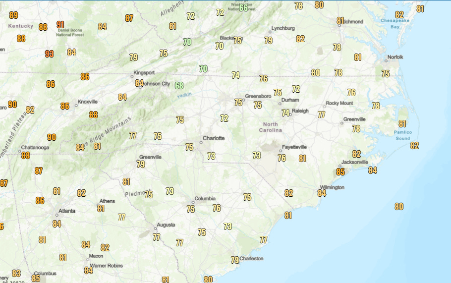
Downstream of that heat dome there has been a corresponding trough of upper level low pressure over the eastern United States, and while the trough itself is not record setting, it has set up a cloudy, cool wet weather pattern which has resulted in several days of well below normal high temperatures. The map above shows yesterday’s observed maximum temperatures, and most of the Carolinas did not make it out of the 70s as a cool “wedge” has setup east of the Appalachians. A few record low maximum temperatures have been set in this region this week, and the cool weather is a dramatic change from the intense heat of last week.

Today will see more generally cooler than normal and wet weather in the East north of the persistent stationary front along the Gulf Coast. After a very active afternoon and night of severe weather across the Dakotas and eastern Montana with more than 150 reports of damaging winds and large hail, today will see a slight (level 2 of 5) risk of severe storms across the upper Midwest. Flash flooding will also be possible, especially over northern Minnesota.
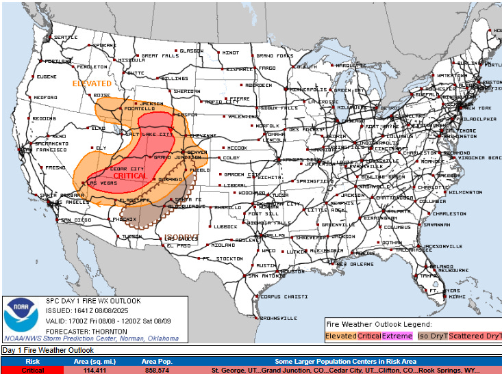
A large wildfire erupted yesterday in the northern parts of the Los Angeles region, forcing thousands of evacuations. Today will see another day of critical fire weather conditions across much of the West, with strong winds and hot and dry conditions ahead of an advancing cold front. That cold front will bring a bit of relief from the recent record heat, but overall hot and dry weather is expected in the West into next week.

In the tropics, NHC continues to monitor the system off the Carolinas and the system in the central Atlantic, but has lowered the probabilities of development for both systems. The latest European ensemble shows that the “orange” system in the central Atlantic will be unlikely to develop for at least the next couple of days, but could develop some as it is moving north to the east of Bermuda.
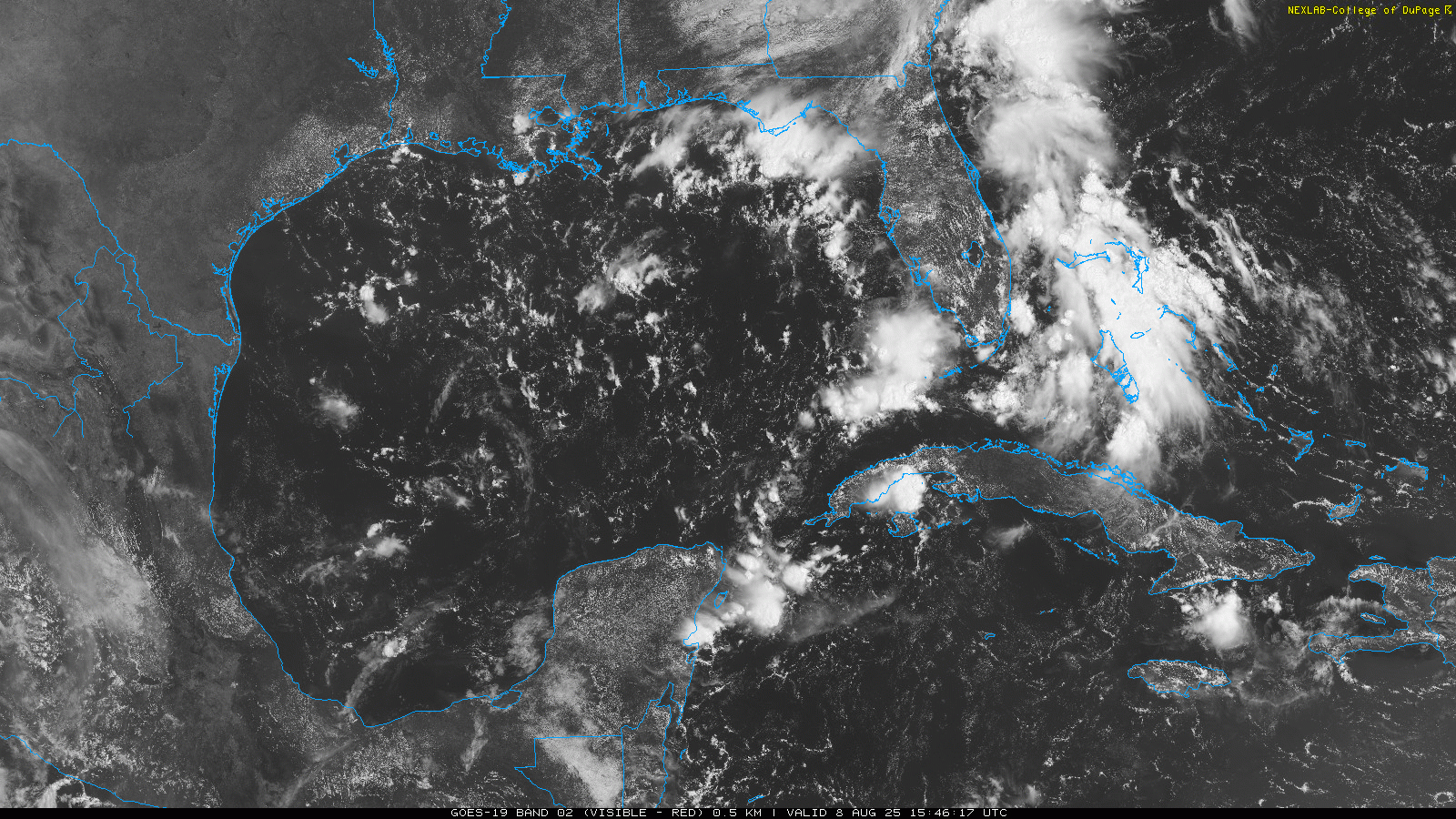
While not currently highlighted by NHC, this area of disturbed weather in the vicinity of Florida and Bahamas still has a couple of areas of weak rotation within it. A handful of members of the European ensemble and the Google Deepmind AI system still show a weak system developing out of this as it moves northwest through the eastern Gulf later this weekend and early next week. While an organized system seems unlikely at this point, it would not be surprising to see an area highlighted at some point in future NHC outlooks, and at a minimum this will enhance thunderstorms and rainfall across Florida through the weekend and in the Gulf Coast region early next week.
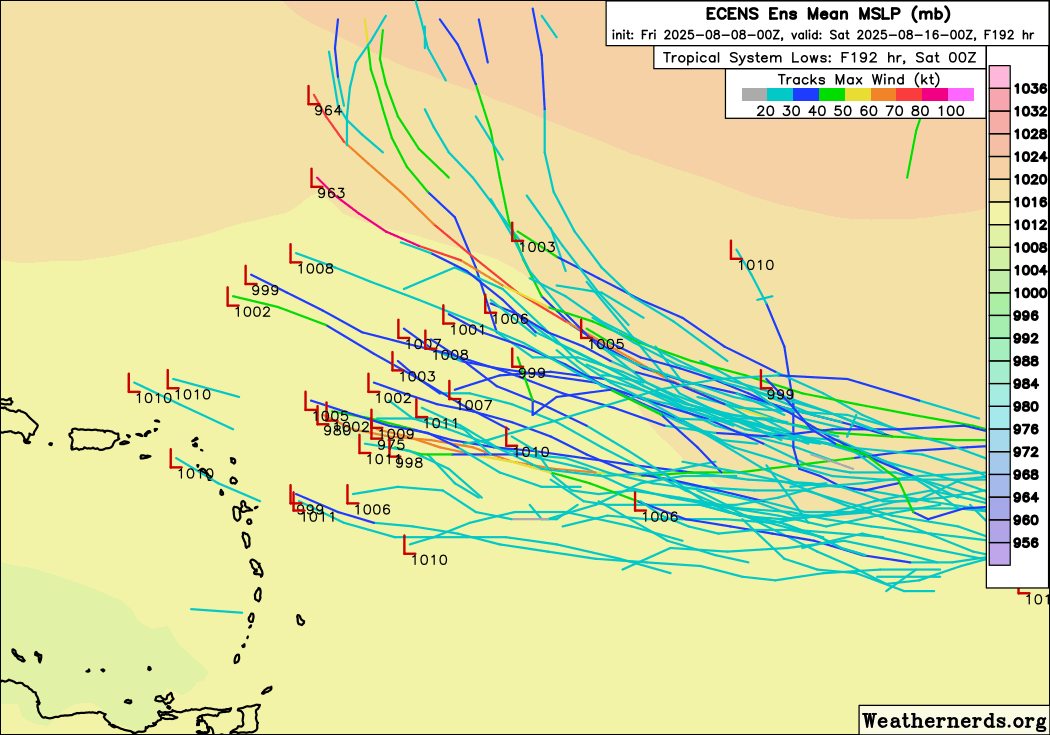
Finally, a tropical wave recently emerged off of western Africa, and current conditions and the forecast models suggest that this system will be in a more favorable environment for development than the one currently over the central Atlantic. A significant number of European ensemble members show this system developing by the time it is approaching the western Atlantic about a week from now, so this is a system we will be keeping an eye on.

Leave a comment