Weatherwise: flash flooding potential in the West and Midwest, record cool in the East
Aug 27, 2025
I have returned from my travel and am getting back into routine morning posts. Before I dive into the weather, I did want to follow-up on NOAA’s cancellation of the phased array radar (PAR) research instrument procurement I posted about last night. I have had questions both in Substack comments and on social media about what this means for the future of weather radar in the US, and I want to briefly share some perspective on that question.
I want to start by stressing that obviously this decision was just made, so NOAA almost certainly does not have any specific plans yet on how to proceed. Also, as I mentioned last night, Congress has not yet weighed in formally on any of the administration’s NOAA cuts, and the House specifically has in its budget bill directing NOAA to utilize the full $75M to procure the PAR research radar. If similar language actually makes it into the final FY26 budget signed into law, I would expect that the procurement would be revisited in FY2026.
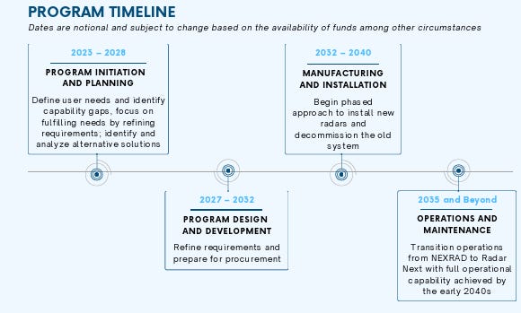
This is the notional timeline from the National Weather Service’s Radar Next planning document. Radar Next is the new NWS program to develop the next generation weather radar network for the country. As I have discussed in other posts, the current national Doppler weather radar network, the WSR-88D (or NEXRAD) network, was deployed in the 1990s. Even though there have been hardware and software upgrades over the years, the radars are aging and an analysis conducted by MITRE found that increasing component failures and difficulty obtaining spare parts would start resulting in increasing radar failures by the early to mid 2030s.
As the timeline above shows, the Radar Next program is currently developing the requirements from the weather community and broader society for a new weather radar network; once the requirements are determined and prioritized, the potential technology options to meet those requirements will be analyzed. As stated in the Radar Next document, “the Program, in partnership with OAR, will evaluate all modern technologies to enhance the NWS’ ability to observe and predict weather accurately and support our response to emergencies, ultimately mitigating the impacts of severe weather.” Given the time constraints the program is under, PAR research delays make it less likely that it will be able to be fully considered in the analysis of possible solutions.
Ironically, the American Meteorological Society’s biennial international radar meteorology conference where the latest research in weather radar is presented is happening this week in Toronto. I attended the previous one in Minneapolis in 2023, and there were many exciting talks about PAR research and ways in which it could improve operational meteorology, and I am sure that similar talks are happening this week. Unfortunately, this procurement cancellation jeopardizes the potential for this new science — developed through years of intense research by the National Severe Storms Lab, University of Oklahoma, and partners — to be included in a new radar network and increases the likelihood that the new network will be based around similar technology to what we have today, only with more modern parts and software.
One way in which any new weather radar network will differ from the current WSR-88D network is that it will likely be a heterogeneous network consisting of different types of radars that will be a mix of public and private sector radars. One aspect of the NOAA budget in which there seems to be bipartisan support is for NOAA to increase utilization of private sector observational data — the draft Congressional bills both have language directing NOAA to actively investigate the use of commercial radar sources to improve radar coverage in the lower levels of the atmosphere. Such a heterogenous approach would hopefully enable the eventual integration of PAR technology into the network, even if delayed.

Looking at the weather, the main focus continues to be on the unseasonable moisture that has overspread much of the western and central United States. Monsoonal moisture will result in scattered thunderstorms with locally heavy rainfall across the West, and a slight (level 2 of 4) risk of flash flooding exists across the northern Intermountain region. The Weather Prediction Center noted in their morning flash flood discussion that the precipitable water value at Boise this morning was 1.53”, fifth highest all time and smashing their daily record. Hence, the strongest storms that form in this region will be capable of intense rainfall rates and potentially significant flash flooding, especially in areas of vulnerable terrain.

Farther east, thunderstorm activity with extreme rainfall rates is anticipated to focus from the Colorado Front Range east-southeast into northern Arkansas. The Weather Prediction Center recently increased the excessive rainfall risk to moderate (level 3 of 4) across parts of eastern Kansas and southwest Missouri through tonight as they anticipate the potential for some significant flash flooding in this region.

On Thursday, monsoonal moisture will continue to support scattered thunderstorm activity across much of the west, while the central US flash flood risk will become focused on Arkansas and adjacent areas.
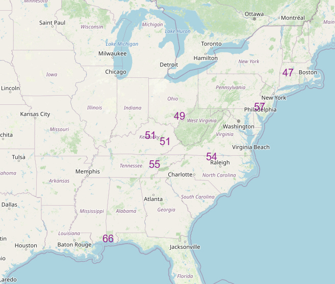
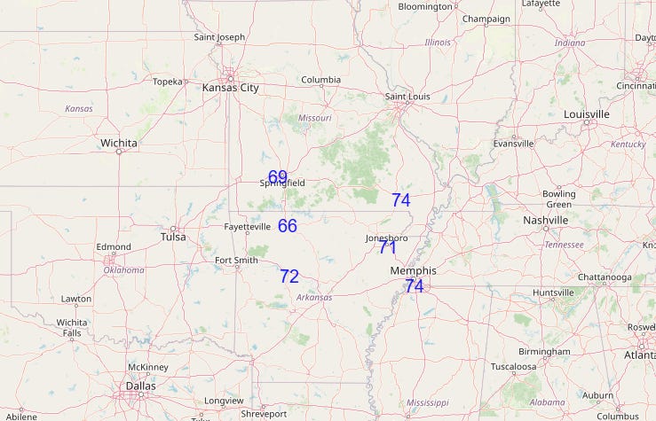
Downstream of the mild and wet pattern in the west, a large upper level trough of low pressure has brought a taste of fall to the East with unseasonably cool air in place. A number of record low temperatures were set this morning and several will likely be set again Thursday morning (top graphic). The widespread rainfall and below normal temperatures could lead to several record low max temperatures in the Mid-South region Thursday (bottom graphic), an area that was setting record high temperatures just a week ago.
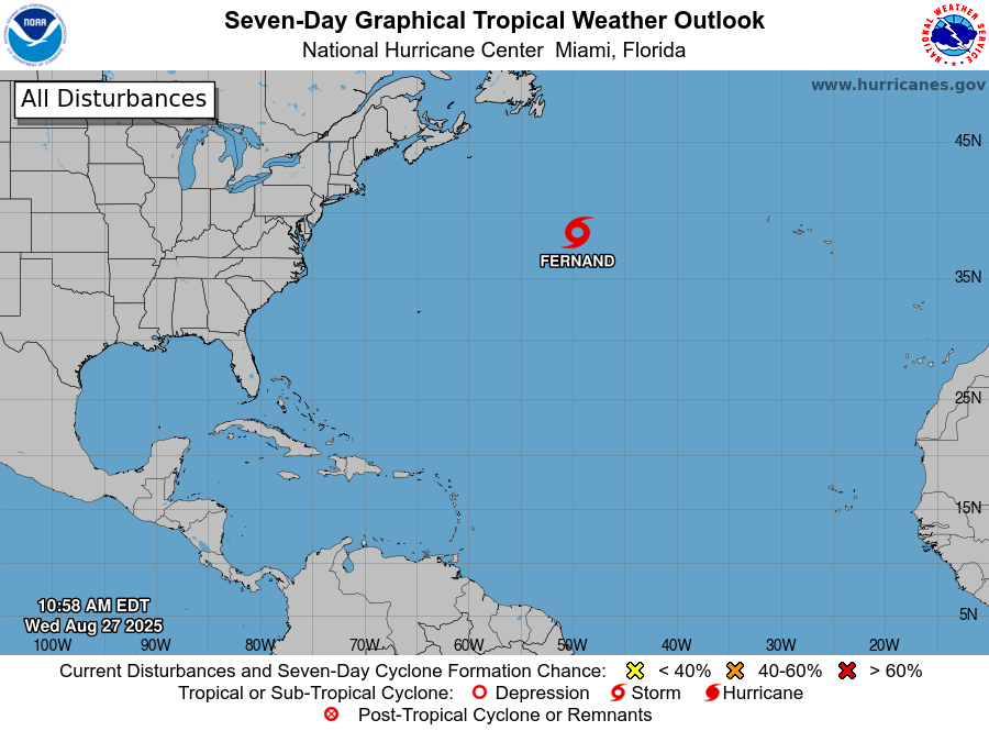
The Atlantic tropics are quiet with the exception of Fernand, which has went through another brief spate of intensification and now has 50 mph sustained winds again. The Atlantic looks to stay quiet for the next several days, but there are signs in the longer term models of increasing activity again.
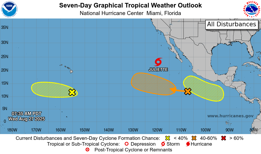
The Pacific has awoken from its quiet last couple of weeks, with Tropical Storm Juliette well west of Cabo San Lucas, and three other systems that NHC is monitoring for potential development. The models are relatively bullish on the two eastern systems, so we will keep a close eye on them in the next few days.

Leave a comment