Unseasonably cool for the East, but record heat for western Canada and the Pacific Northwest
Aug 30, 2025
Welcome to Labor Day Weekend, and the unofficial end of summer and beginning of autumn – which as a meteorological and climatological season will start on Monday. The atmosphere appears to have gotten the memo, as it has been stuck the last few days in a pattern with an upper level ridge of high pressure along the West Coast and unusual upper level trough of low pressure and cool air for much of the East. That pattern is only going to get stronger this upcoming week.
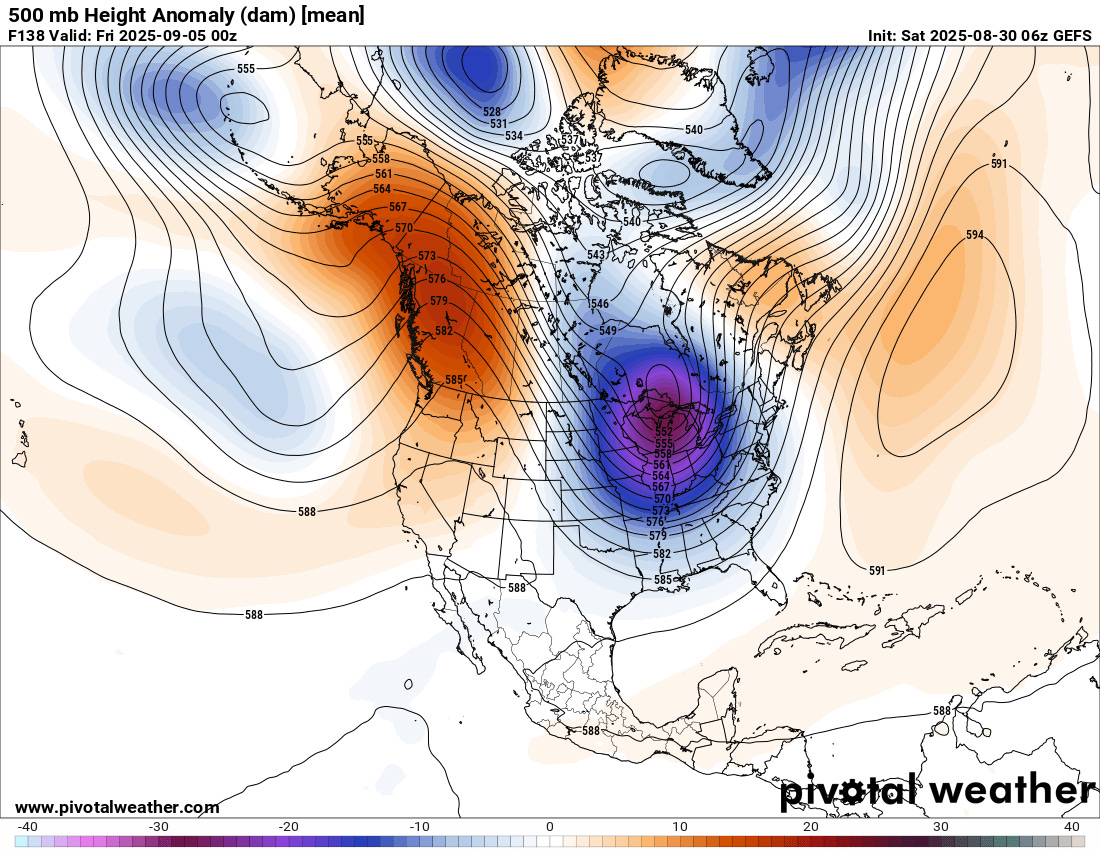
The weather chart is the forecast map for 500 millibars – about 18K ft AGL – for Thursday evening from the most recent run of the US Global Ensemble Forecast System. Along with the geopotential heights – similar to pressure on a surface weather map – the image shows the height anomaly, i.e., how much the values are above and below normal. You can see that the ridge of high pressure along the west coast of North America is unusually strong, and the downstream trough of low pressure centered of the Great Lakes is even more unusually strong. Meteorologists refer to this as a highly amplified upper level pattern, and it is a bit unusual to see such a strongly amplified flow setup in late August and early September. If this were winter, this would be a classic setup for a big arctic outbreak east of the Rockies.
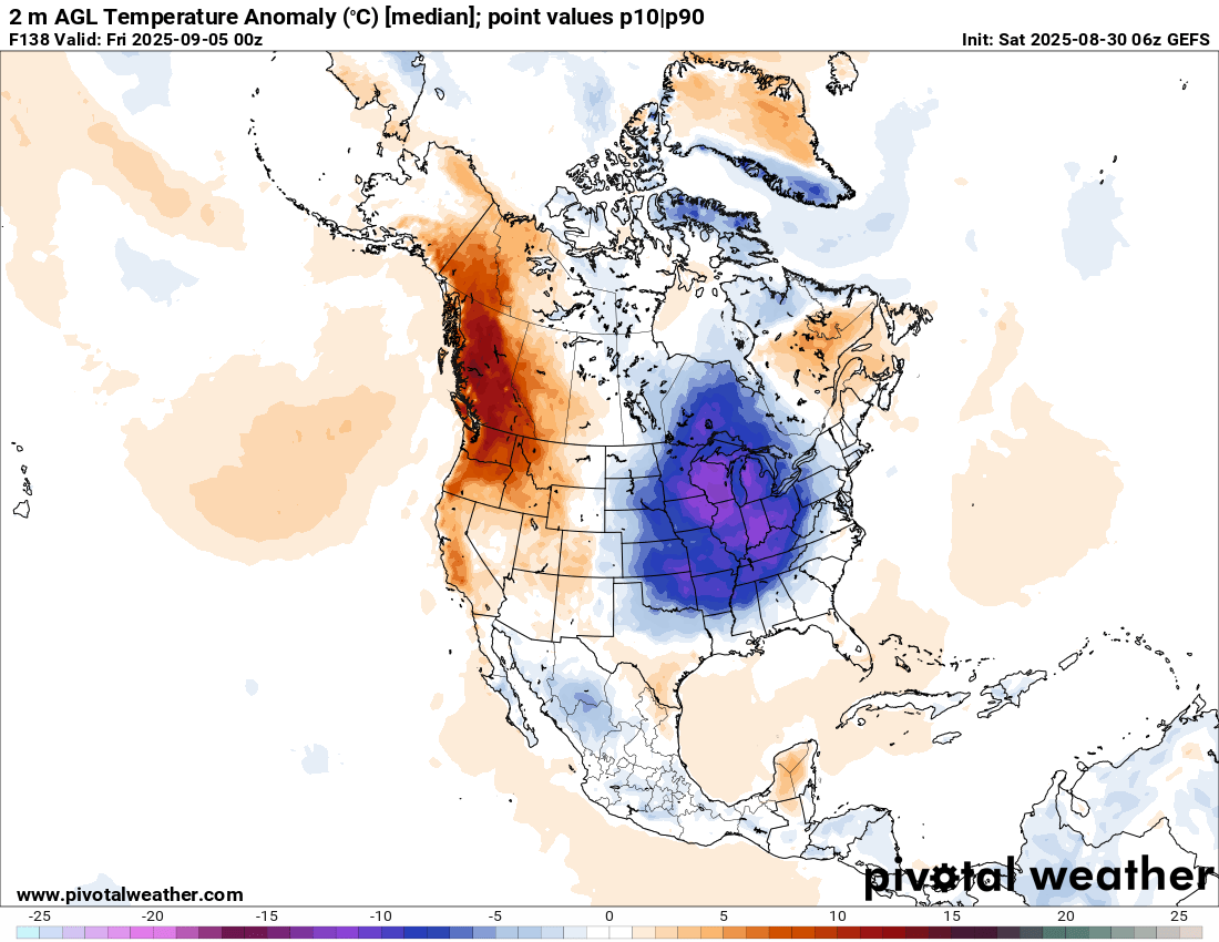
Luckily, it is not winter, but even at this time of year, this pattern will result in unusually cool weather continuing for much of the eastern US the next week.
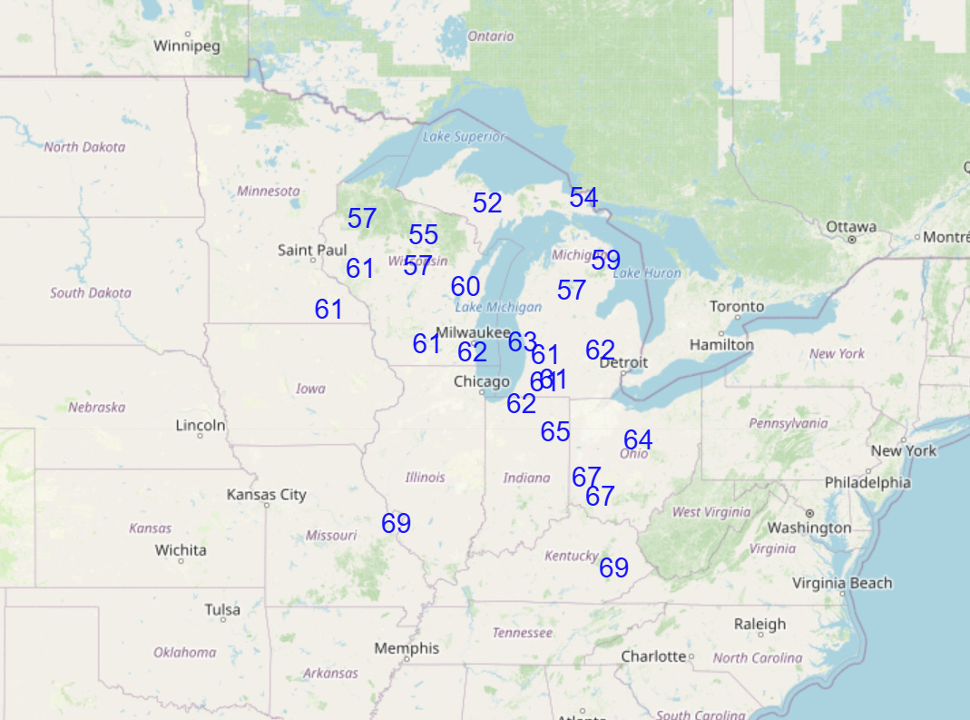
Some record cool temperatures are likely, particularly on Thursday when widespread clouds and the peak of the coolest air will result in high temperatures only making it to the 50s and 60s across much of the Great Lakes and Ohio Valley, which would be record low maximum temperatures for the date.
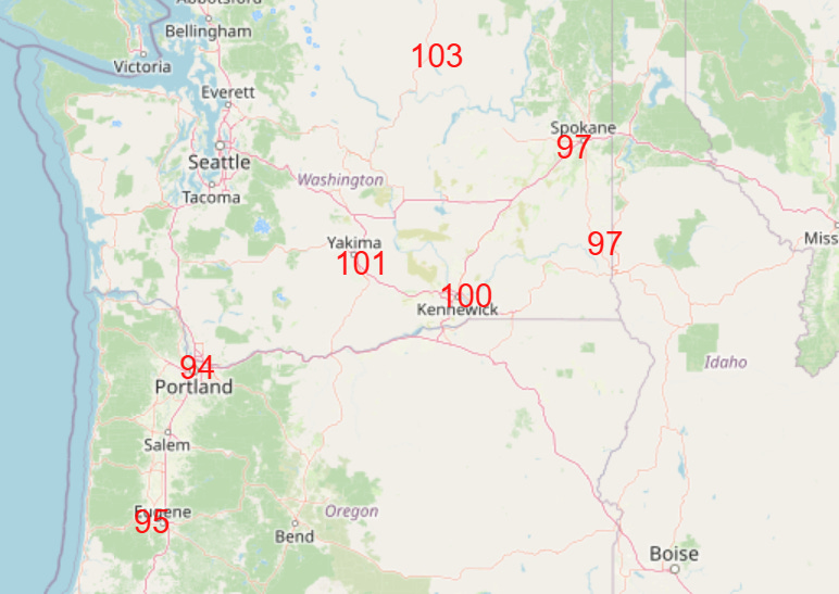
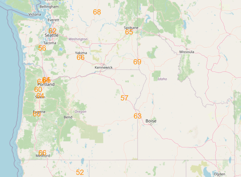
Meanwhile, the Pacific Northwest will be on the hot side of this weather pattern, with record warm temperatures, particularly on Wednesday (forecast record maxes top, record high minimums bottom). The peak of this heat wave though will be north of the border, particularly in British Columbia and the Northwest Territories which will see insanely warm conditions for that part of the world this upcoming week, with at least seasonal records likely to be set. The hot and mainly dry weather, along with some potential for lightning strikes from high based mainly dry thunderstorms, could significantly increase wildfire risk across western North America where a number of large wildfires are already in progress.


Turning back to the weekend weather, the persistent northwest mid and upper level flow combined with unusually high levels of moisture will continue to support a wet weather pattern across the central and south central US, with large areas of slight (level 2 of 4) risk of excessive rainfall and flash flooding.
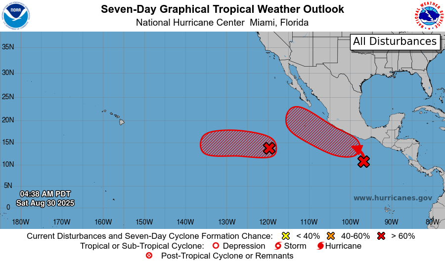
The tropics look as if they will become an increasing issue this upcoming week, definitely in the Pacific and potentially in the Atlantic. NHC is currently highlighting two areas in the eastern Pacific as having high risks of tropical cyclone. The westernmost – Invest 93E – has seen increasing thunderstorm activity and organization and has a 50% chance of development in the next couple of days and 80% over the next week. It looks as if it will be in a rather favorable environment and could become a hurricane as it moves west into the central Pacific, and we will need to at least keep an eye on it with respect to Hawaii. Meanwhile, the easternmost system is just developing, but has a high risk of tropical cyclone development later in the upcoming week and has potential to bring at least moisture to the Southwest US in the long term.
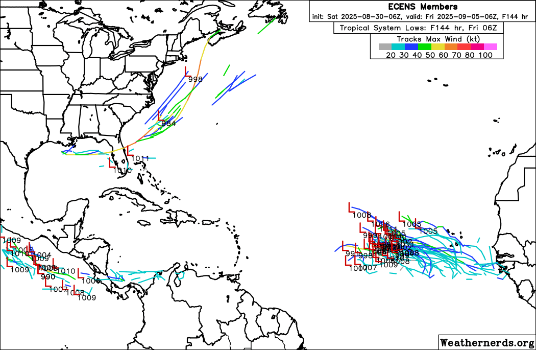
In the Atlantic, there will be two areas to watch in the upcoming week. The first will be in the eastern Atlantic, where NHC currently has a 30% probability of a tropical cyclone developing from a tropical wave emerging off the west coast of Africa. The models have become increasingly enthused about this wave with more favorable conditions forecast ahead of it, and it would not be surprising to see a tropical cyclone develop here this week.
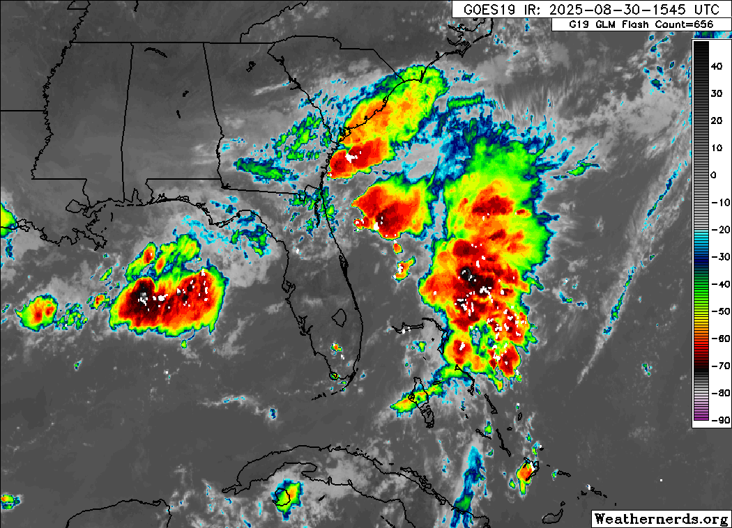
The other area is along a stationary front extending from the Gulf across northern Florida and into the Southwest Atlantic. Clusters of thunderstorms like we can see in this morning’s satellite image will be developing along this front the next several days. As we have seen a couple of times already this season, it is possible that one of these clusters could become persistent enough to slowly organize and try to become a tropical depression.
What is different about this particular setup is that with a strong upper level trough of low pressure across the eastern United States, there is at least a low chance that such a system could interact with jet stream energy from the upper level trough to become a stronger system that could move northeast on the east side of the trough. Of course, there is no way to know whether a system is more likely to form in the Gulf or east of Florida, when it might happen — and the strength and timing of upper systems moving through the trough and how they might interact with any tropical system is also impossible to predict. That is why in the European ensemble tracks above you can see a variety of tracks and intensities across the Gulf and into the western Atlantic. Right now, it is just an area to keep an eye on and be aware of the potential scenarios.

Leave a comment