Pacific provides a couple of systems to watch for U.S. this week; taking stock of big picture for Atlantic at start of September
Sep 01, 2025
Happy Labor Day, and welcome to the first day of climatological fall! (For a full explanation of meteorological/climatological seasons versus astronomical seasons, visit this helpful explainer from NOAA’s National Centers for Environmental Information.) It is a Monday, and the tropics are plenty busy, so today’s post will focus there, starting in the Pacific where most of the imminent action is.
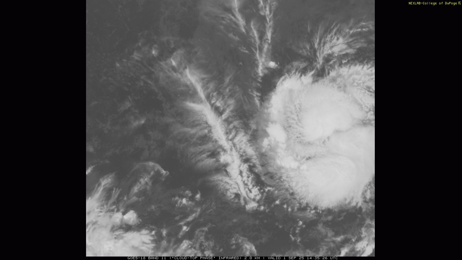
We start with Tropical Storm Kiko, which is centered about midway between the western coast of Mexico and the Hawaiian Islands. Kiko has been getting better organized over the last 24 hours and now has maximum sustained winds of 60 mph. Forecasters at the Central Pacific Hurricane Center (CPHC) in Honolulu discussed this morning that polar orbiting satellite microwave imagery — which we talked a lot about earlier this summer for its potential demise which luckily did not happen – showed a ring of convection around the center of Kiko. This is indicative of a developing eyewall and given an overall environment supportive of potential rapid intensification, CPHC calls for Kiko to intensify into a category 2 hurricane over the next 36 hours.

Kiko is expected to move west to west-southwest over the next few days, and then gradually turn more west-northwest. As you can see above, for the next 5 days it will be moving relatively slowly and it will still a long way away from Hawaii as we reach the weekend.
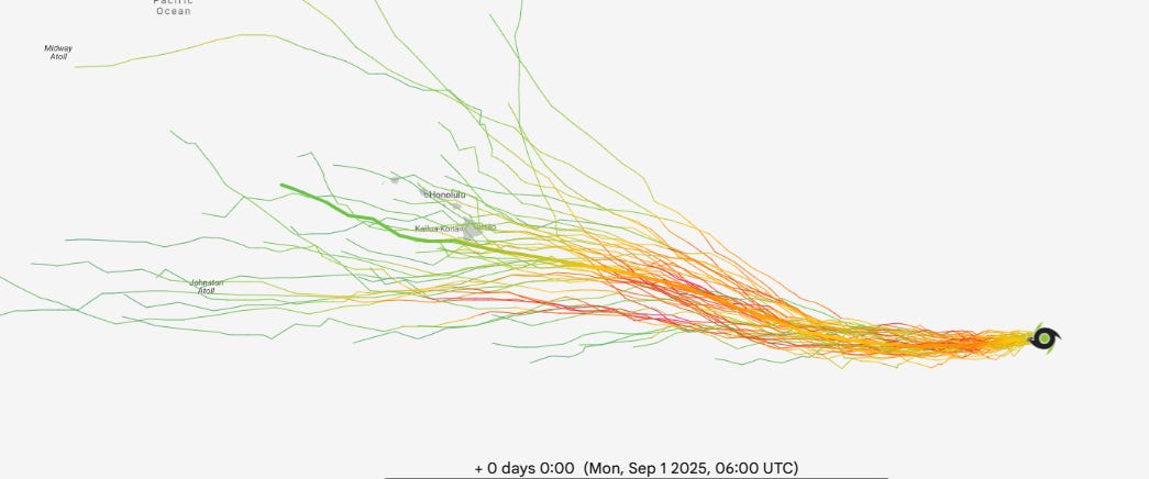
Overall, though, the models do support the potential for Kiko to at a minimum be a player in Hawaii’s weather in about 10 days. Above are ensemble forecast tracks from the Google AI DeepMind system; the mean forecast shows Kiko passing just south of the Big Island early next week as a weakening tropical storm.
The European ensemble is clustered farther south, with most of its members passing south of the Islands — but potentially close enough to bring at least some wind and rain.
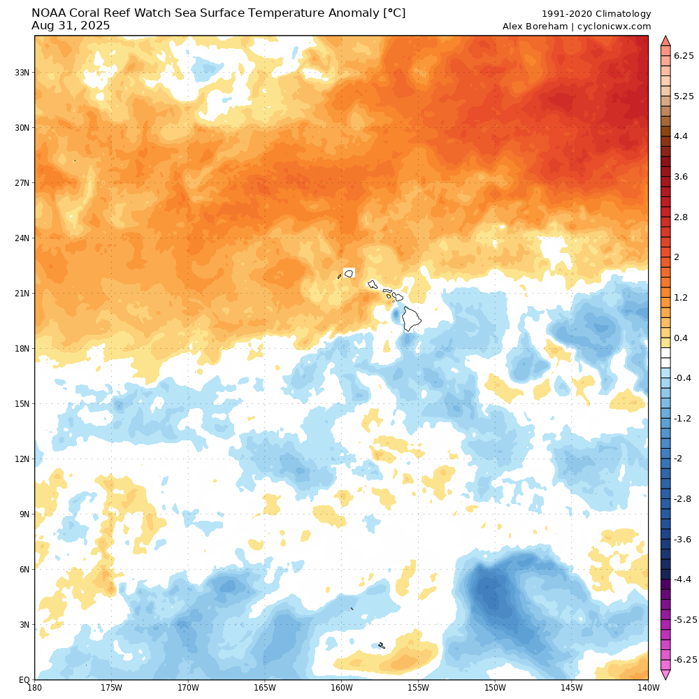
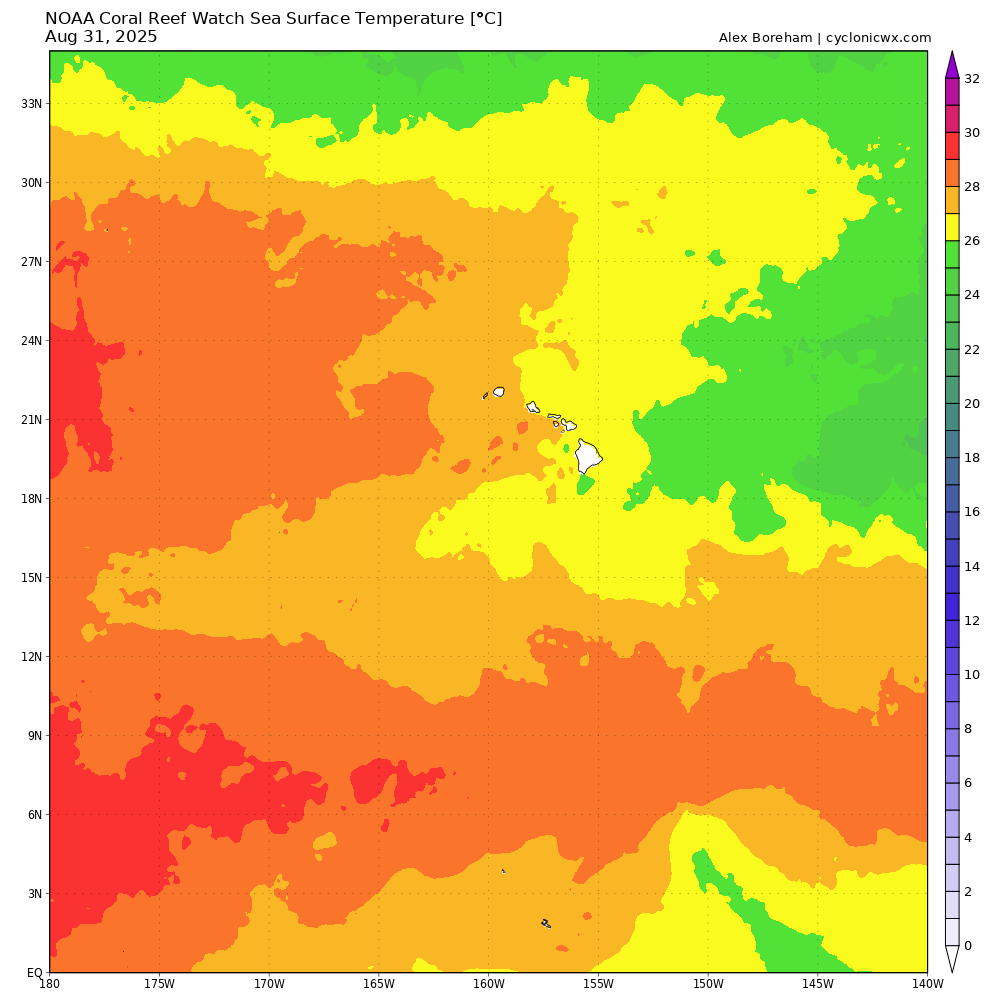
As I mentioned yesterday, luckily sea surface temperatures south of Hawaii are actually a tad below normal (top image) and just right at the minimum 26C value (bottom image) that can minimally support a tropical cyclone. Given that, and typically increasing wind shear closer to Hawaii, it seems unlikely that a system on Kiko’s forecast track would be anything other than a weakening system. Still, depending on the eventual track and how strong Kiko gets in the next several days, it could provide some impacts and will be worth keeping an eye on this week.
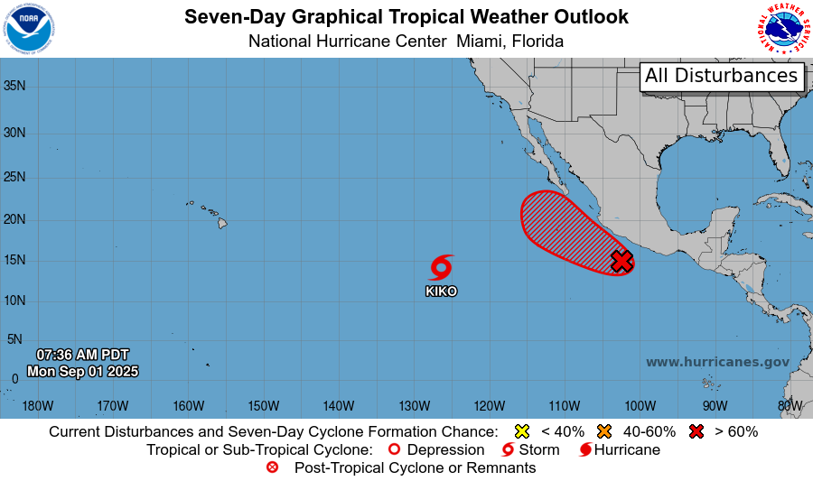
The other system of interest is in the eastern Pacific off the southwest coast of Mexico and has been designated Invest 94E by NHC. A large area of thunderstorms is gradually getting better organized, and NHC gives 94E a 60% probability of development over the next 2 days and 80% overall. While the models show a high likelihood of development to a cyclone, they are not overly bullish on intensification and generally show it becoming a strong tropical storm.
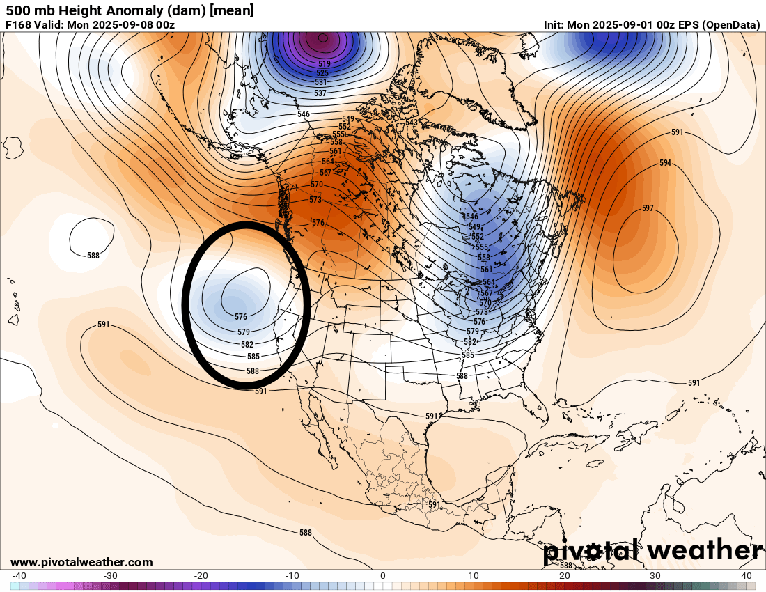
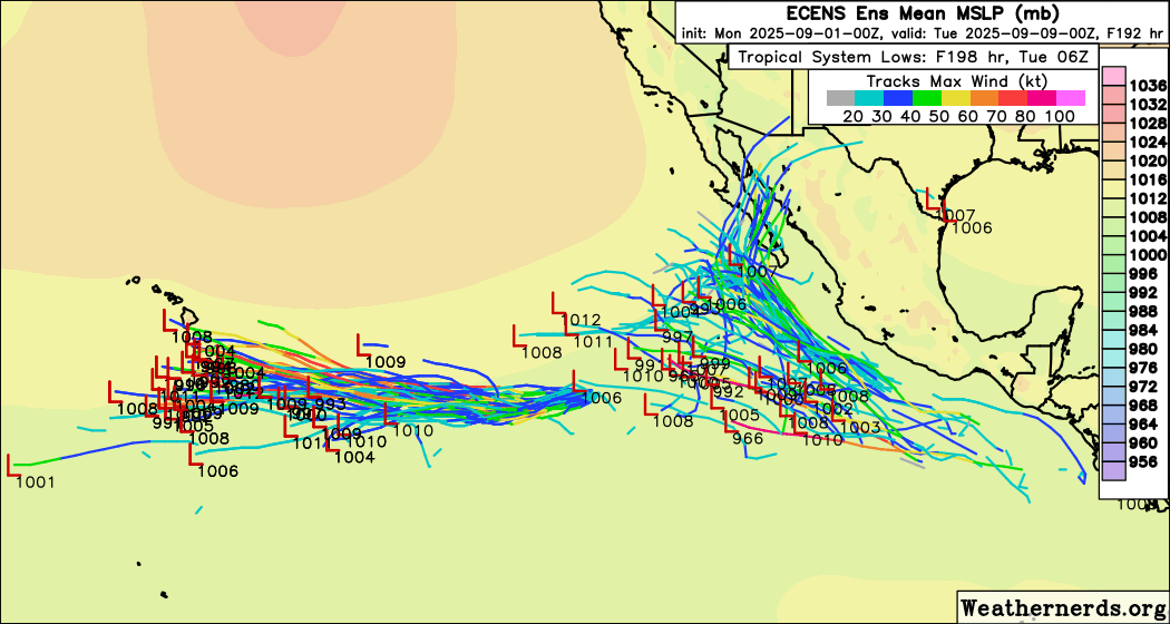
The biggest reason 94E is of some interest is the potential for it to bring moisture to the Southwest US. We are getting to the time of year when eastern Pacific tropical systems are more likely to interact with upper level troughs moving into the West and bring heavy rain to the Southwest and sometimes even the Southern Plains. In the European ensemble 500 millibar forecast for next Sunday, I have highlighted an upper level trough approaching California. Depending on the exact speed and depth of this trough, it could pull moisture into the Southwest. Right now the best signal for heavy rainfall in the model ensembles is in northwest Mexico, but as you can see in the European ensemble cyclone tracks a few maps up, several members do bring a more organized system farther northeast and there seems to be a lot of model uncertainty with the upper trough — so it is worth keeping an eye on.
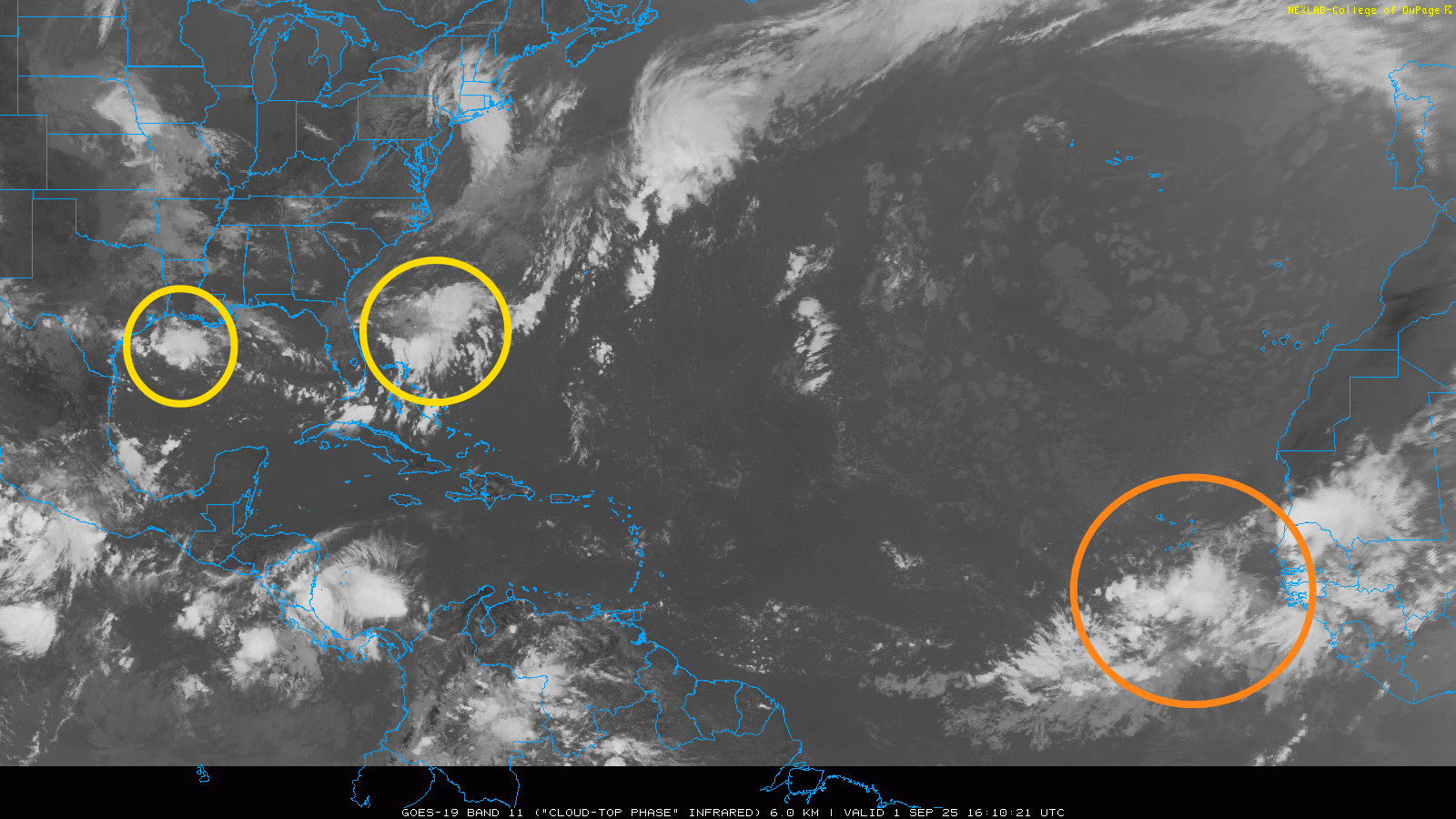
Moving over to the Atlantic, the morning satellite image shows a couple of areas of interest. Closer to home, the areas of thunderstorms I have highlighted in yellow are occurring along an old stationary front that runs from the Gulf across Florida and into the Southwest Atlantic. As we have seen a few times this year, this sort of setup can eventually result in a persistent enough area of thunderstorms to try to gain some organization, and within the individual model ensemble solutions you can occasionally see a weak system form within this area this week.
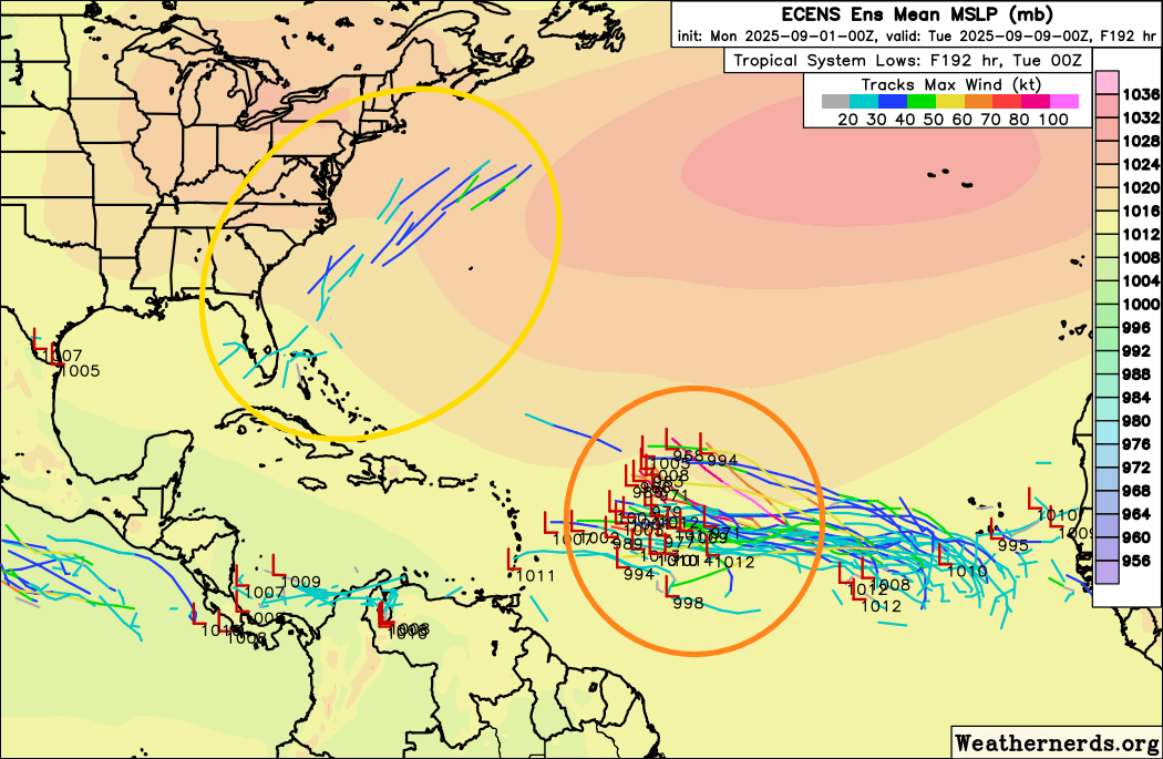
So while NHC does not currently have anything highlighted, it’s an area to keep a bit of an eye on this week, although any system that develops would likely remain weak or gradually become more extratropical as it gets pulled northeast by the large upper level trough of low pressure over the eastern United States (yellow area in ensemble track map above).
The other system of interest is in the far eastern Atlantic moving slowly west. The atmosphere ahead of this system looks at least somewhat conducive for development over the next week, and the models are rather bullish on it developing into a tropical cyclone as it moves west across the tropical Atlantic (orange circle above highlights forecasts from the European ensemble 8 days from now). Obviously, this system is a long, long way from the US, but we will need to keep an eye on it for the Caribbean. As is typical with systems in the Atlantic Main Development Region, the more quickly it develops into an organized system, the more likely it will be to move farther north — a slower developing system would likely stay more to the south and eventually approach the Caribbean.
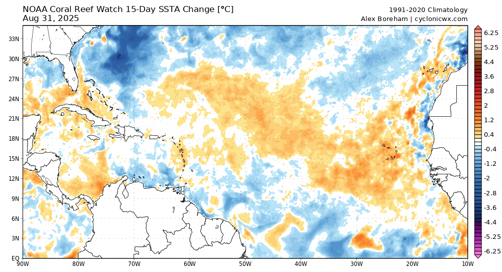
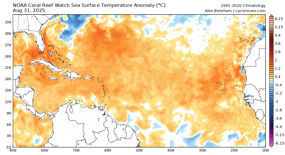
Taking a step back and looking at the big picture over the Atlantic tropics, SST anomalies have generally been increasing across the basin, although you can see the large area of cooling due to the passage of Erin through the western Atlantic (15 day change in SST anomalies top picture, anomalies bottom picture).
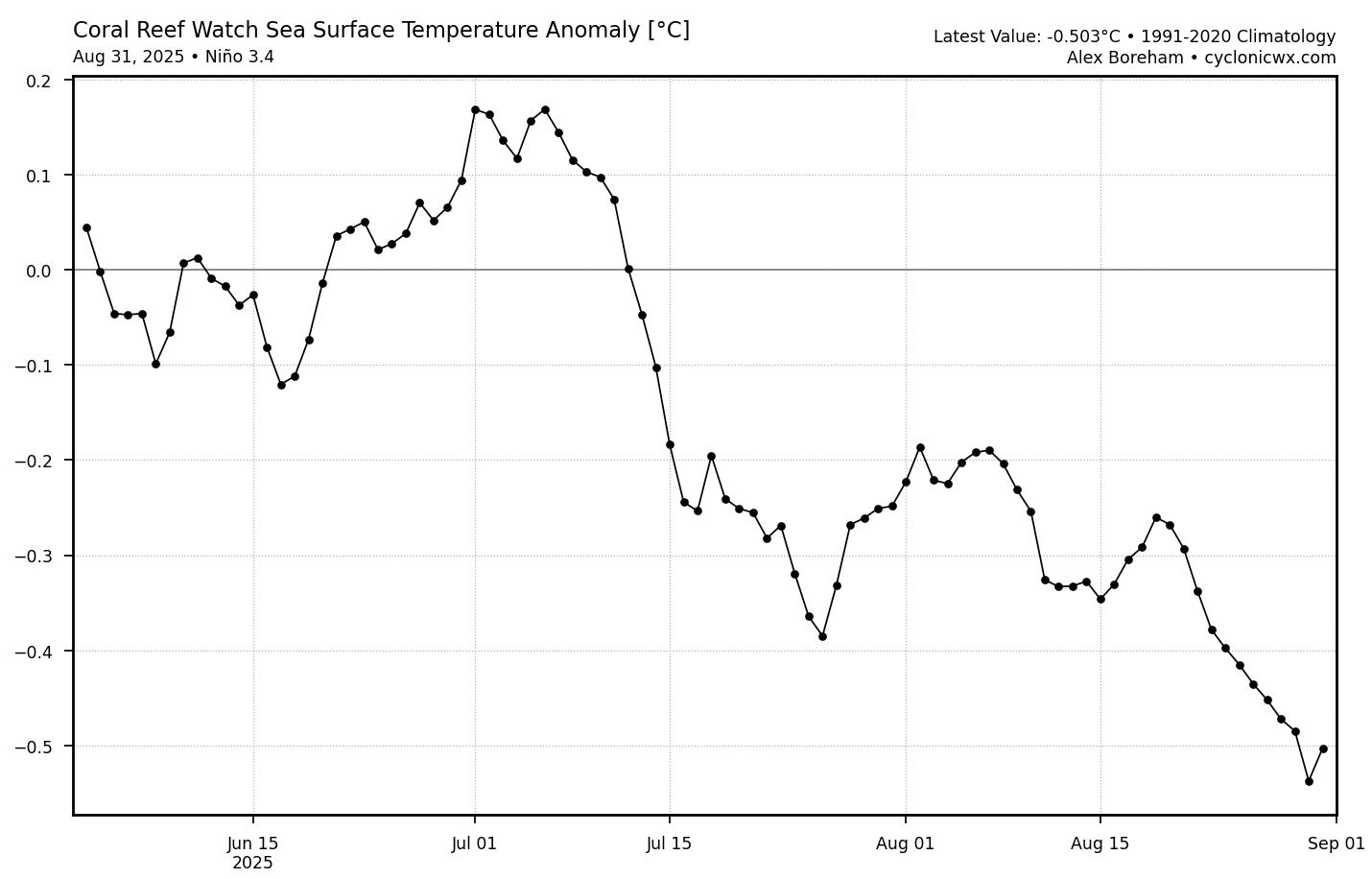
With regards to El Nino, SSTs have continued to cool in the equatorial eastern Pacific and are now actually near La Nina thresholds in the critical Nino 3.4 region. That cooling would have to persist for many more weeks to qualify as actual La Nina conditions — but regardless, we certainly do not have any signs of an El Nino emerging which could disrupt the peak and latter part of hurricane season. Overall, all of this suggests the seasonal outlooks for a somewhat above normal season continue on track (activity as measured by accumulated cyclone energy is exactly normal as of today in the Atlantic). The forecasting team at Colorado State University will release their next two week outlook on Wednesday, and I will share a summary of their outlook later in the week.

For this Labor Day, shower and thunderstorm activity will be scattered to numerous across the central and southern United States. Moderate heat risk will exist across the Southwest and California, as well as the interior Pacific Northwest. We will be watching record heat build across the Pacific Northwest and western Canada this week, with unseasonably cool weather downstream across the Great Lakes and Midwest.

Leave a comment