Kiko still poses some risk of impacts for Hawaii; Atlantic showing mixed & complex signs
Sep 05, 2025
As I mentioned yesterday, I am traveling today to the 50th National Weather Association meeting — but there’s quite a bit of weather happening, so wanted to at least post a quick update about it.

The strongly amplified weather pattern we have been seeing over the last week is providing a bit of a ramp up in severe thunderstorm risk for the country. After seeing some severe weather with very large hail and wind damage in parts of Kansas Wednesday night, yesterday saw a number of reports of thunderstorm wind damage in the central Appalachians. This afternoon will provide another risk for severe weather ahead of the cold front ushering in unseasonably cool weather to the eastern US — a number of record low maximum temperatures were observed in the wake of this front across the Great Lakes and upper Midwest on Thursday.
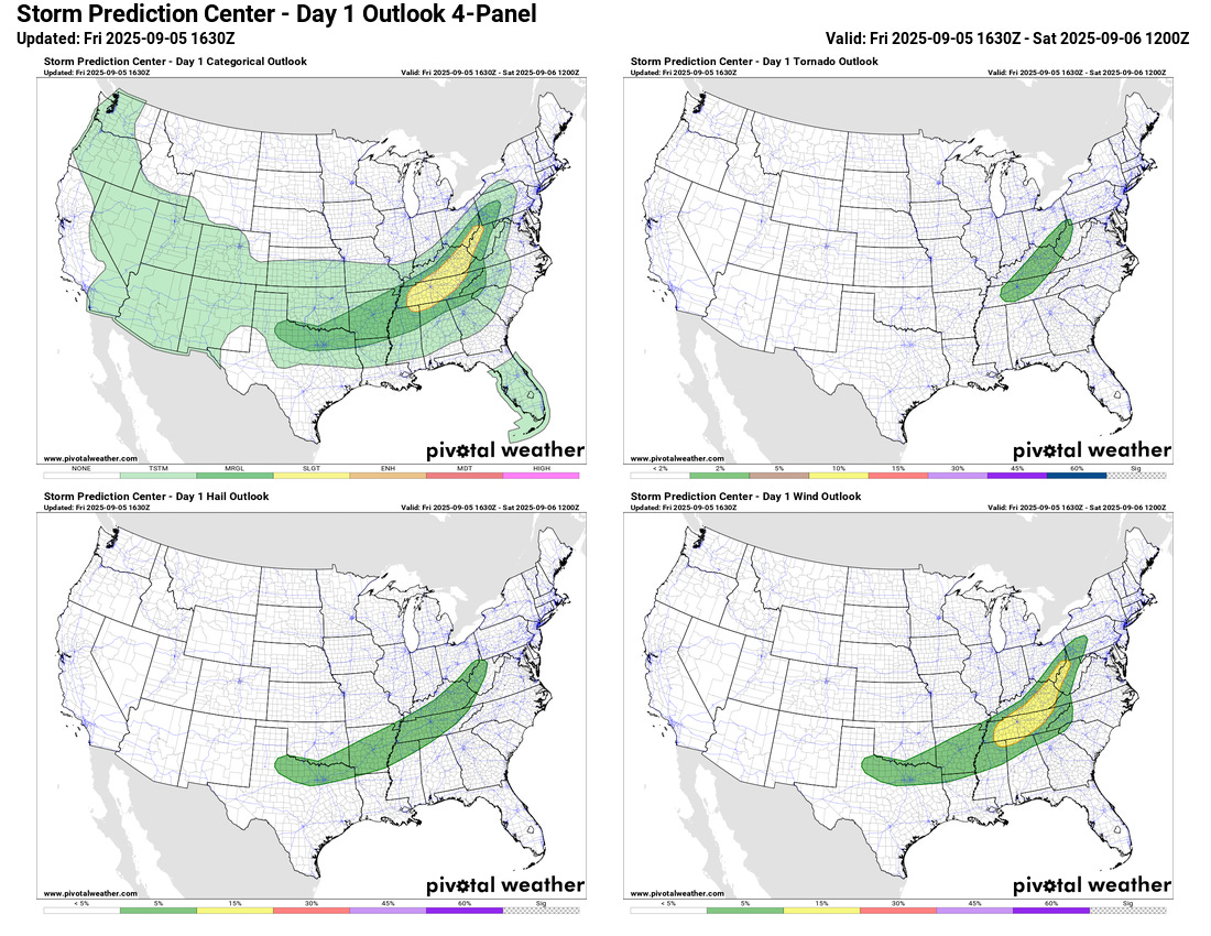
A slight (level 2 of 5) risk of severe weather is place for parts of the Tennessee and upper Ohio Valley regions today along and ahead of the front, with damaging straight line winds the primary risk with any severe storms.
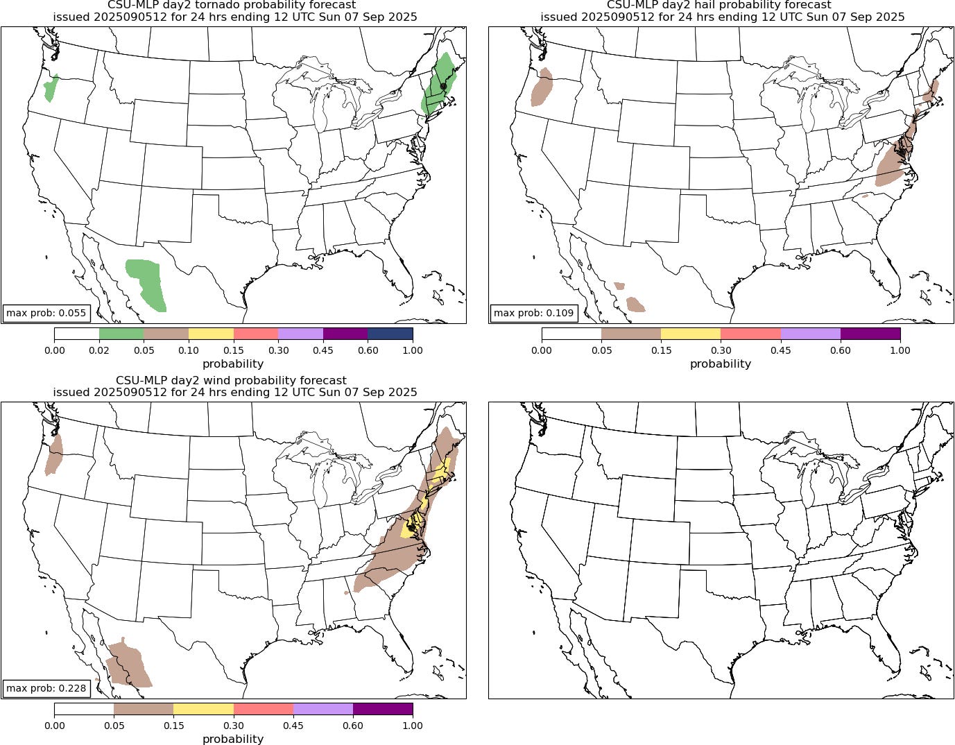
A risk of some severe storms will exist ahead of the front on Saturday as it moves off the East Coast as shown by the Colorado State University Machine Learning System forecast above. Again, damaging winds and perhaps a tornado or two will be the primary risk from parts of New England south across the Mid-Atlantic.
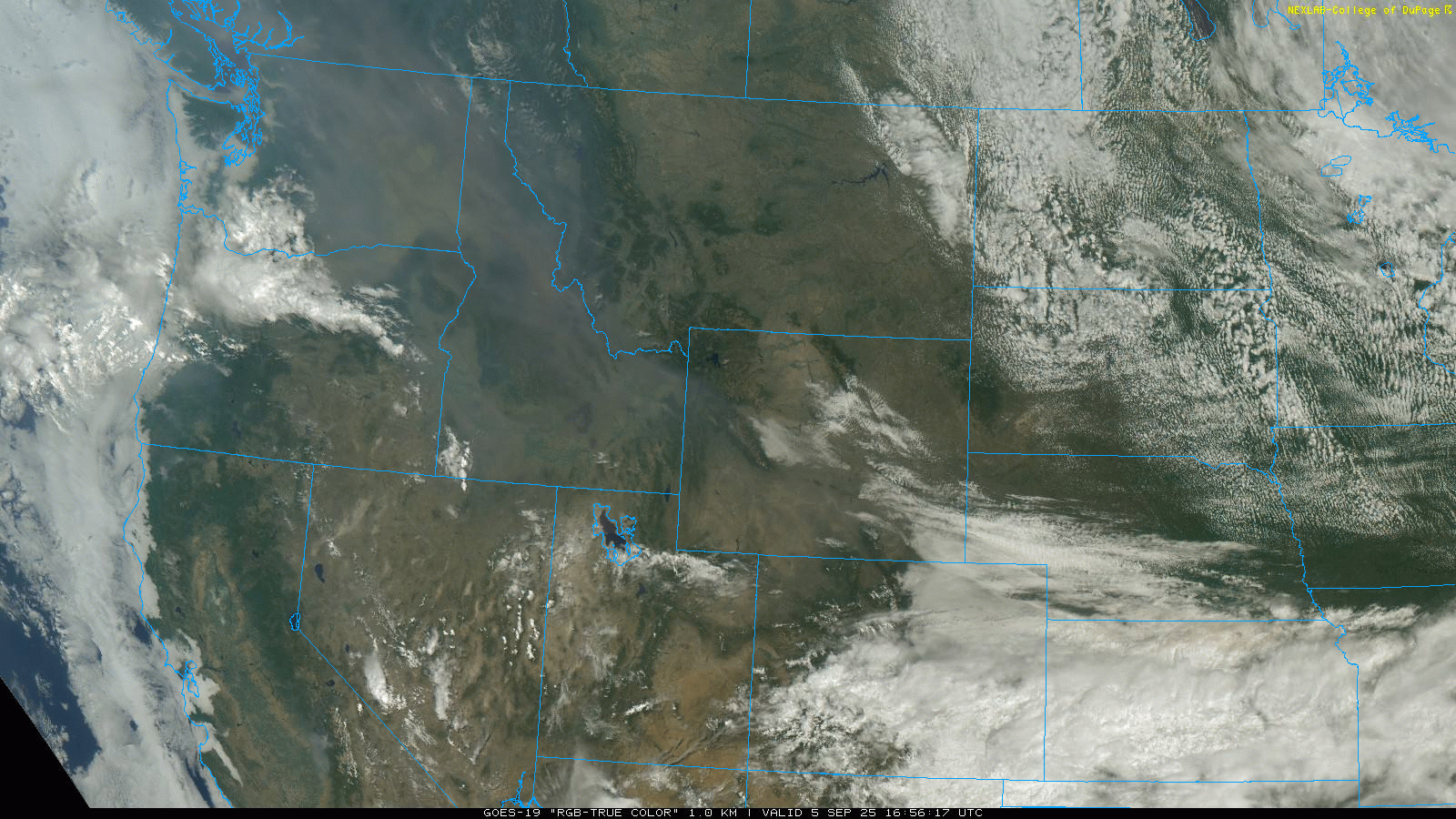
Upstream of this, unseasonably warm conditions continue over the Northwest. Isolated to scattered thunderstorms with limited rainfall are expected to continue to present a risk for additional wildfire starts the next couple of days given the warm and dry conditions. Ongoing wildfires are producing widespread smoke across the region as can be seen in visible satellite image above. While the thickest near surface smoke will be over the Northwest, areas of wildfire smoke at higher levels of the atmosphere will continue to be carried east and southeast across the country through the weekend.
In the tropics, Lorena has rapidly dissipated off of Baja California — though its moisture will continue to enhance monsoon thunderstorm activity in the Southwest. Kiko (infrared satellite loop above) weakened to a 115 mph low end category 3 hurricane overnight. However, in the last couple of hours it appears to finally be getting into the brief reintensification phase that has been expected, with the eye becoming more distinct in satellite images.

The overall expectation that we talked about with Kiko yesterday is still the same, with it looking to begin weakening over the weekend, and then weaken more rapidly into early next week as it deals with increased upper level wind shear as it passes north of the Hawaiian Islands. While specific impacts on Hawaii will depend upon the exact track and intensity which we should get a better handle on over the next few days, it does look as if it should at least pass close enough to enhance rainfall and wind for parts of the islands.
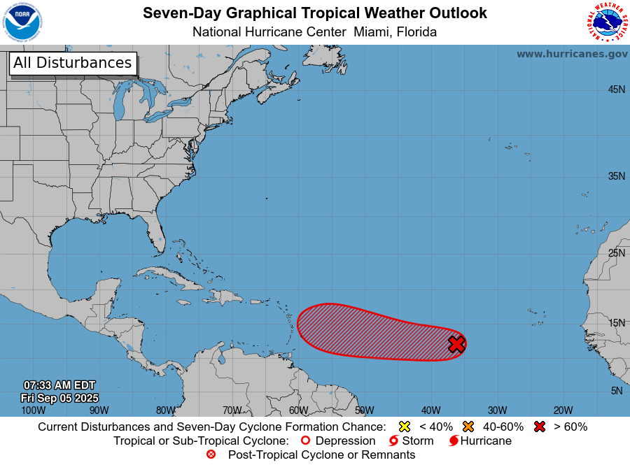
In the Atlantic, Invest 91L has become less organized since yesterday, with rather limited thunderstorm activity around it. NHC has it with a 90% probability of development over the next 7 days – but the model guidance seems to be responding to recent trends by being much less bullish on development. My bottom line right now is that any development is going to be slow to occur — but whether it is this wave or with a following wave that the models are also showing some potential development of, conditions should become more favorable over the next several days for a system to develop across the central or eastern Atlantic and move west. Right now, this is still very much of a just keeping our eye on things situation for the Caribbean and of course for the US.

Leave a comment