Severe storms in Northeast today, Kiko continues as a category 4 hurricane in central Pacific
Sep 06, 2025
Programming note: I am attending the 50th National Weather Association meeting this weekend, and as a result posts will be off schedule the next few days. I hope to have some conference related content at times on Sunday.
Good Saturday evening, everyone. I was busy much of today, but wanted to do a quick update on a few news and weather items.
First off, I wanted to share some Congressional news related to meteorology. Yesterday the House Science, Space and Technology Committee announced that they will be a holding a hearing on Wednesday to markup the Weather Act Reauthorization bill. This bill was introduced by Oklahoma Republican congressman Frank Lucas earlier this summer, and it is intended to reauthorize the 2017 Weather Research and Forecasting Innovation Act.
The initial 2017 Weather Act was passed by Congress and signed into law by President Trump. It provided Congress’ priorities for NOAA as far as weather forecasting and research. As an authorization bill, it did not specifically appropriate funding, but rather provided the multi-year policy and programmatic framework that Congress would then appropriate money for. The authorizations in the bill ran through 2023, so Congress began working on a reauthorization bill for the Weather Act, led by Congressman Lucas who at the time was chair of the House Science Committee. The reauthorization bill was passed by the full House in 2024, but was not passed by the Senate and as a result it expired when that Congress ended and had to be resubmitted by Congressman Lucas earlier this year.
While this act has a long way to becoming law, the markup hearing will offer another data point with regard to Congressional perspective on NOAA and see if they continue to pushback on the administration’s announced plans for the agency, including the elimination of the Office of Oceanic and Atmospheric Research (OAR) and significant changes and cuts to NOAA’s geostationary satellite program. I will obviously share more after the hearing on Wednesday.
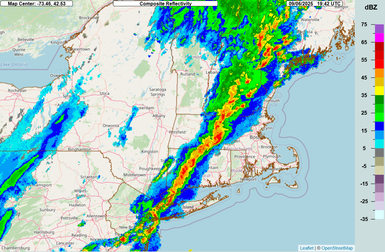
Turning to weather, earlier today a band of strong to severe storms moved across the Northeast, with over 100 reports of damaging wind in the region. The threat of severe storms has ended and a quieter period as far as strong thunderstorm activity is expected the next couple of days.
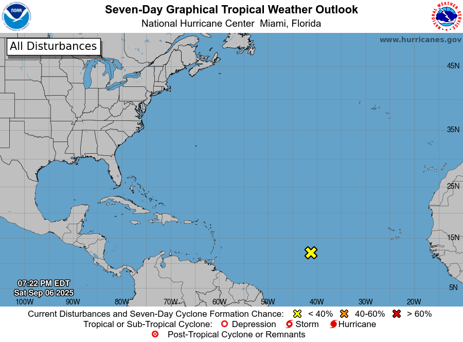
In the tropics, Invest 91L has continued to degenerate over the last 24 hours, and is now unlikely to develop in the next few days. Some of the model ensemble forecasts do show this system developing when it gets farther west toward the Caribbean later next week, along with the potential for another system farther east. Conditions in the Atlantic look to become more favorable overall for development by later next week. The most recent Colorado State University seasonal forecast team’s two week forecast from Thursday calls for near normal activity being likely — and as we are approaching the peak of the season, this should mean some additional systems during this time period.
![[Key Messages]](https://substackcdn.com/image/fetch/$s_!mFzA!,f_auto,q_auto:good,fl_progressive:steep/https%3A%2F%2Fsubstack-post-media.s3.amazonaws.com%2Fpublic%2Fimages%2F8252437a-a1c3-4bcc-9091-9dbf4a2a1668_897x736.png "[Key Messages]")
Kiko remains a category 4 hurricane as it moves northwest across the central Pacific. The forecast track has continued to shift a bit farther north, but the overall idea of Kiko beginning to weaken later this weekend and then pass north of the Hawaiian Islands next week as it weakens more rapidly still looks reasonable. Large swells are anticipated to impact the islands the next several days, resulting in life-threatening surf and rip currents, especially for east facing beaches. Any rain or wind impacts will come as the system makes its closest approach toward the middle of the week.

Leave a comment