Coastal low causing impacts today in the Mid-Atlantic; moisture from Mario likely to cause some issues in the Southwest later this week
Sep 16, 2025
Apologies but running a little behind today as I got my COVID and flu vaccines yesterday and was feeling a bit sluggish when I woke up this morning. Feeling better now and there is a lot to talk about in the weather world today, so let’s get to it.
Much of the focus today will be on the tropics, and I wanted to start off by sharing some very cool work released today by NOAA’s National Centers for Environmental Information (NCEI) about Hurricane Helene. We are approaching the one year anniversary of the landfall of the category 4 hurricane in the Florida Big Bend on September 26 2024. Along with the coastal impacts, Helene of course caused tremendous flooding impacts inland in the southern Appalachians. NCEI’s main headquarters facility is in Asheville, NC — ground zero for the flooding impacts —and was seriously impacted by the flooding.
NCEI has put together a tremendous storymap providing excellent information and context about the meteorology, hydrology and impacts of Helene. If you are a Balanced Weather subscriber, I think you will find this storymap well worth your time. The lead NCEI scientist responsible for this work was my colleague Jared Rennie, who when he shared the storymap on BlueSky this morning correctly pointed out that last year saw a very similar quiet period in the Atlantic tropics in the first half of September before Helene and Milton caused catastrophic impacts in the United States. While obviously that doesn’t mean we will see similar events this year, it does show that the tropics can ramp up (and down) very quickly.
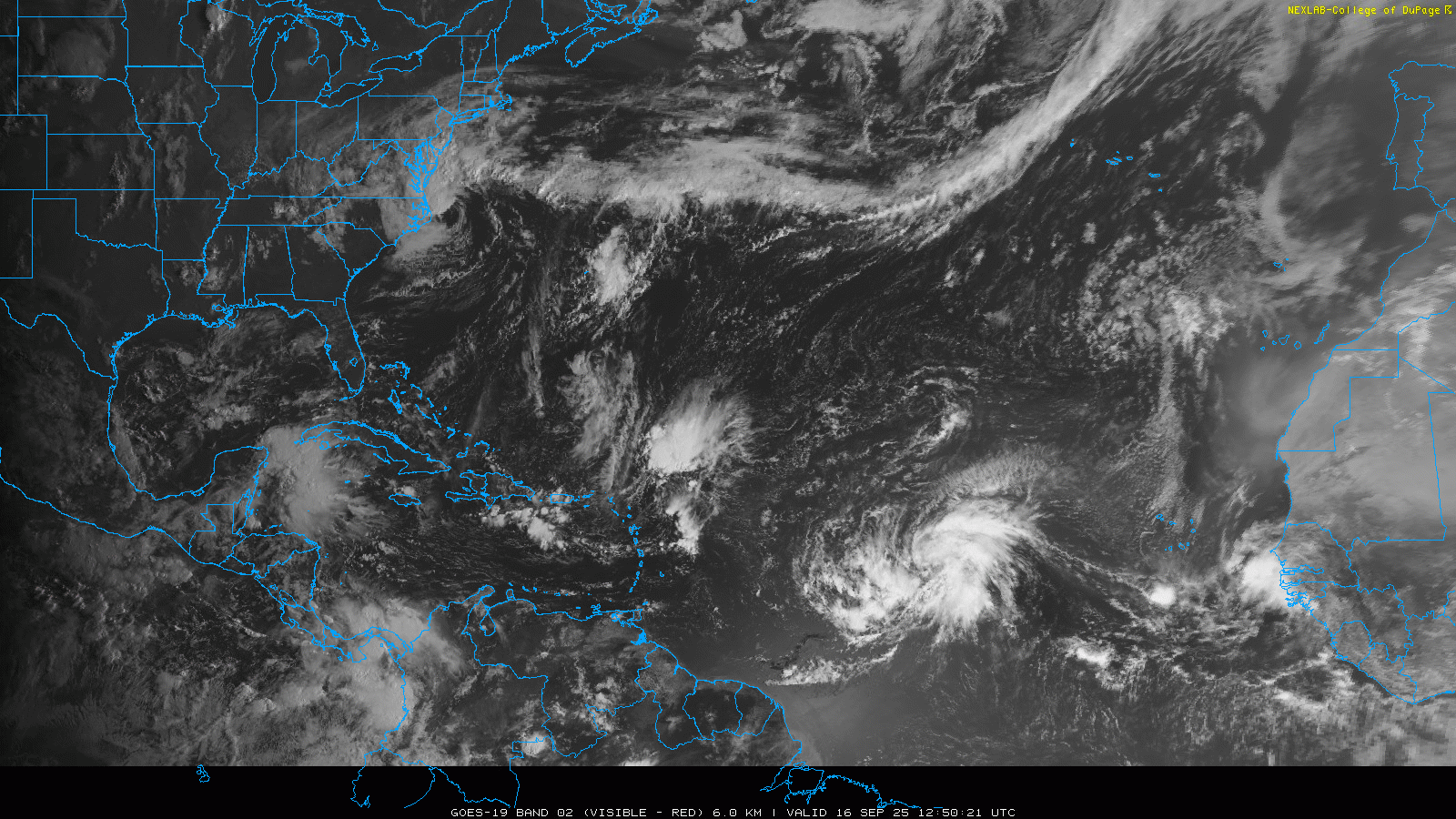
Along those lines, the morning Atlantic tropical satellite loop shows an increasingly more active basin than the last couple of weeks, with several disturbances and areas of thunderstorms. The system that is actually producing US impacts today is the low pressure center that you can see off the coast of North Carolina. This low pressure center developed from non-tropical processes, and while it is producing thunderstorms near the center of circulation, those storms are still being carried away from the center by strong winds aloft in the atmosphere, keeping the system from obtaining tropical characteristics.
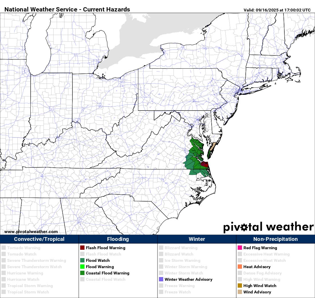
The system is producing impacts in the Tidewater region, as the thunderstorms associated with the low are producing heavy rainfall which could cause flash flooding. Gale force winds are also occurring with gale warnings and wind advisories in place.
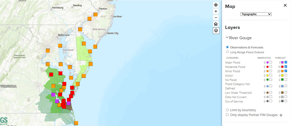
These strong onshore winds will also cause significant coastal flooding, particularly with the high tide cycle later today. Several gauges in southeast Virginia are forecast to see major flooding this afternoon and evening. The low pressure center will move inland over the next 24 hours and weaken with impacts diminishing with time.
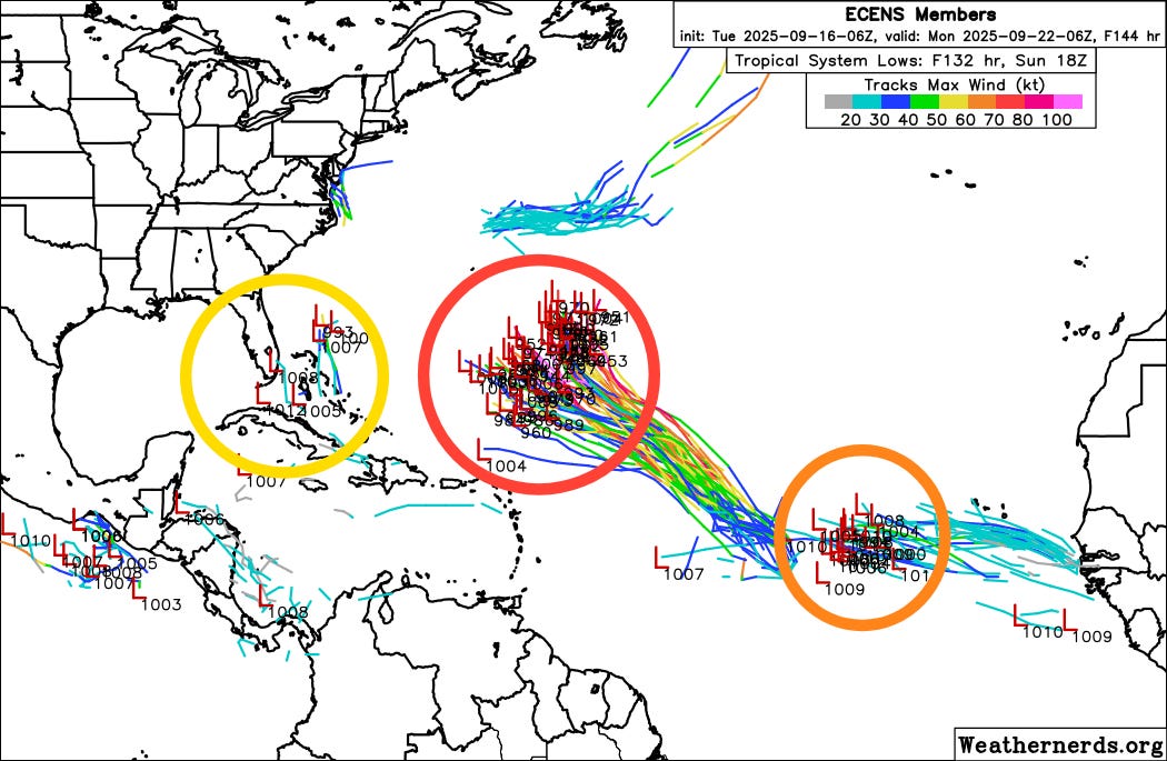
The next system to talk about is Invest 92L, which is clearly visible in the above satellite loop almost dead center between Africa and the eastern Caribbean Islands. Right now, 92L does not have a lot of thunderstorm activity, but it has a very large, broad circulation that once thunderstorms develop more consistently should result in gradual organization and intensification. The European ensemble (most latest 6 day forecast above) and Google DeepMind AI forecasts are pretty unanimous in this system developing into a tropical storm over the next several days, and likely becoming a formidable hurricane over the north Atlantic. The models are now also very consistent in showing a northwest motion the next several days to a position somewhere to the southeast of Bermuda (red circle above). While Bermuda will need to pay attention to 92L, it looks unlikely to have any other land impacts, other than maybe some surf and rip currents if it becomes a significant hurricane.
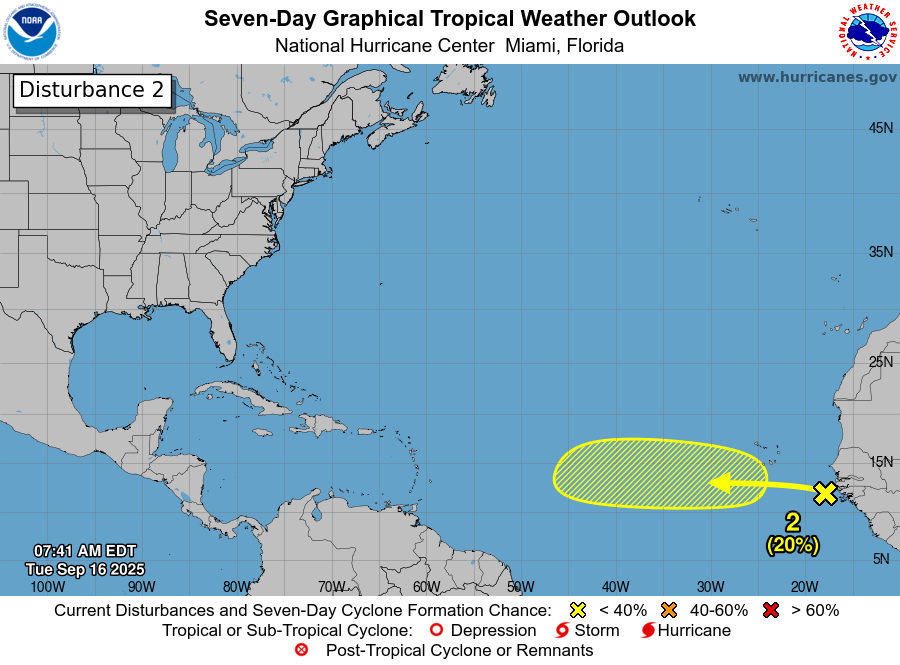
The tropical wave emerging off the west coast of Africa in the satellite loop is now being highlighted by NHC for a 20% probability of development over the next several days. The European ensemble 6 day forecast members for this system are highlighted with the orange circle above. As of now, the models suggest this system will move west for the next several days and that any development should be relatively slow to occur. Most of the long range forecasts beyond day 7 show this system eventually weakening, although a handful do carry it across the Atlantic toward the Caribbean and conditions look like they could be marginally supportive, so we will keep an eye on it of course.
The other Atlantic area I want to mention is the area of thunderstorms that you can see in the extreme northwest Caribbean between the Yucatan and Cuba. While that particular thunderstorm cluster is not expected to develop, it is indicative of the sort of system from which a closer to home tropical system could evolve. The models are suggesting that this general region will be seeing more thunderstorm activity in coming week or two and do occasionally spin up a system that then moves north, as I have highlighted in the yellow circle on the European ensemble forecast above. While right now this area is the lowest probability of development and there are no specific systems to focus on, given the overall big picture weather pattern anticipated for the next couple of weeks, a system developing like this is actually the most likely way in which we would have to deal with a threat to the United States over the next few weeks (similar to both Helene and Milton last year).

Turning to the eastern Pacific, Mario has weakened to a minimal tropical storm and is forecast to continue to weaken and eventually dissipate well west of Baja California over the next few days. However, an upper level area of low pressure west of California is expected to pick up moisture from Mario over the next few days, resulting in increasing thunderstorm activity over the Southwest later this week.


The Weather Prediction Center currently has marginal risks of flash flooding on Thursday and Friday over parts of the Southwest for this scenario. Lightning associated with thunderstorms could also enhance wildfire danger, particularly farther north in California and the Great Basin where there will likely be less moisture and hence any storms will likely have limited rainfall to help dampen fire activity.

Finally, there is a slight risk (level 2 of 5, shown in yellow above) of severe thunderstorms today across parts of the central Plains along a slow moving front running from the western Great Lakes down into the Great Basin region. Very large hail and damaging winds look to be the primary threats from any storms that develop today.

Leave a comment