Gabrielle devoid of thunderstorms, while Mario moisture brings flash flood risk to the Southwest
Sep 18, 2025
Yesterday the primary professional organizations for operational meteorology and emergency management, the National Weather Association (NWA) and International Association of Emergency Managers (IAEM), released a joint statement entitled “United in Safeguarding Communities from Weather-driven Disasters.” I encourage you to read the entire statement, but in summary, the statement is a united push back against recent moves to reduce government funding and support for meteorological research/operations and emergency management.
The statement starts off by laying out why this is an important issue — 75 to 80% of disasters worldwide are weather-related — and how the partnership between meteorologists and emergency managers is so critical to reducing the impacts of these disasters. Our nation received a sobering reminder of the importance of that partnership this summer with the catastrophic Texas Hill Country flash flooding. While there were certainly ways in which meteorological science and communication improvements could have helped with that event, as I outlined in this post back in July it seems clear that emergency management breakdowns, particularly at the county and local level and with private entities such as campgrounds, likely played the bigger factor in why that flash flood event was so impactful.
In fact, the state of Texas recognizes these failures, and earlier this month the Texas Legislature passed and Gov. Greg Abbott signed into law a bill that requires much more stringent policies for campgrounds in the state, including requiring emergency plans, installation of alert systems including requirements for camps to own and monitor NOAA Weather Radios, staff training, and mandating cabins to be out of floodplains.
All of these are emergency management related policies, and it seems clear that if they had been in place prior to July 4th that many lives could have been saved along the Guadalupe River. The Texas Tribune published a compelling story about families that lost their daughters at Camp Mystic, and who in their grief advocated forcefully for this new law. The heartbreak these families endured is described in the article — and their stories are why the meteorology and emergency management partnership advocated for in the NWA-IAEM statement is truly so important. We have the capability and knowhow to save a lot of lives and reduce the tragic impacts from these weather-related disasters, and with research and development we can save even more. However, we as a society have to commit to support the government entities and the scientists and professionals that conduct and implement this work.
Right now, the federal government as led by the presidential administration is leading us down a different path. The overall weakening of the federal scientific structure and proposed actions such as eliminating NOAA’s research arm, substantially reducing our future geostationary satellite programs, and placing even more emergency management responsibility on state and local entities, endangers our progress and threatens to damage our ability to prepare for, warn for, and respond to these weather-related disasters. Congress has of course shown little appetite for these changes, and over the next several months we will see which vision for our science and emergency management agencies prevails. Again, this period will be critical for the future of meteorology and emergency management in this country.
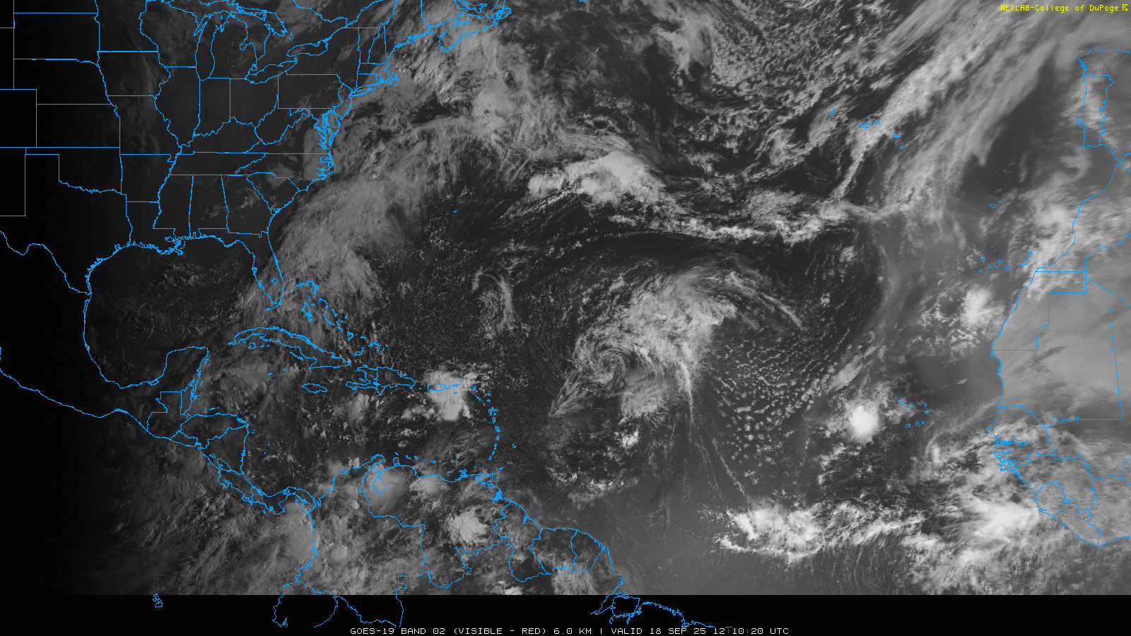
Turning to weather, will start by getting the Atlantic tropics out of the way. Gabrielle is a 50 mph tropical storm still, but to be honest at this very moment it probably doesn’t even meet the definition of a tropical cyclone. It still has a well developed area of low pressure (part 1 of the definition) – but there is almost no thunderstorm activity as it has all been eroded by dry air and wind shear.
The models continue to insist that the environment ahead of Gabrielle will become much more favorable for development in a couple of days, and this will allow thunderstorms to redevelop with the well defined low and eventual strengthening to a hurricane. Given that systems have seemed to do better this season once they get to a higher latitude, that still seems plausible.
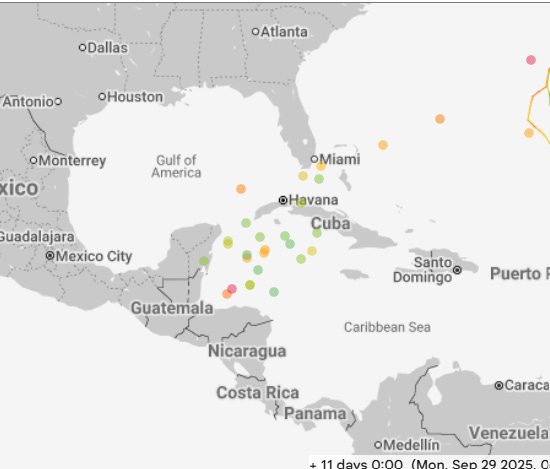
Beyond Gabrielle, the models continue to show some potential for development with a couple of trailing tropical waves — but I don’t think I am breaking any news here when I say that the background deep tropical Atlantic atmospheric environment seems more hostile to these waves than the models are picking up on. Of more interest to me is that the models — particularly the Google DeepMind AI as shown above – have become more bullish on the idea of a system developing in the western Caribbean or southwest Atlantic in about 10 days. This has shown up for several model cycles now and given that I have not really seen a signal like this — even during periods this summer when people were hyping day 12 operational model runs showing a hurricane in the Gulf — I wanted to mention it. Obviously, as of now, it is just something to keep an eye on.

As we have been talking about for a few days now, an upper level low and moisture from the remnants of Tropical Storm Mario will bring increased thunderstorm activity and a risk of flash flooding to the Southwest the next couple of days. A slight (level 2 of 4) risk of flash flooding is in place as shown in the red above.

On Friday, the risk will become more localized with a marginal risk extending across Arizona and New Mexico. A somewhat more focused area of thunderstorm activity in the central Sierra Nevada could cause an enhanced flash flood risk there, and a slight (level 2 of 4) risk is in place there.

Leave a comment