Major focus on the tropics as Gabrielle threatens Azores, Ragasa targets Hong Kong and southern China, and 2 additional Atlantic systems likely
Sep 23, 2025
A lot of weather to talk about today, both in the US today and looking at the tropics both near and longer term.

Starting stateside, a slow moving storm system in the middle of the country will bring widespread thunderstorm activity to a large region from the Southern Plains to the Ohio Valley. Severe weather risk should be focused over Arkansas and eastern Oklahoma, where a slight risk (level 2 of 5) of severe thunderstorms is in place. Morning upper air balloon data from the region suggests an environment relatively favorable for supercell thunderstorms, with decent instability and increasing wind shear. Hence, all modes of severe weather — damaging winds, large hail and a few tornadoes — look possible, mainly this afternoon and evening.
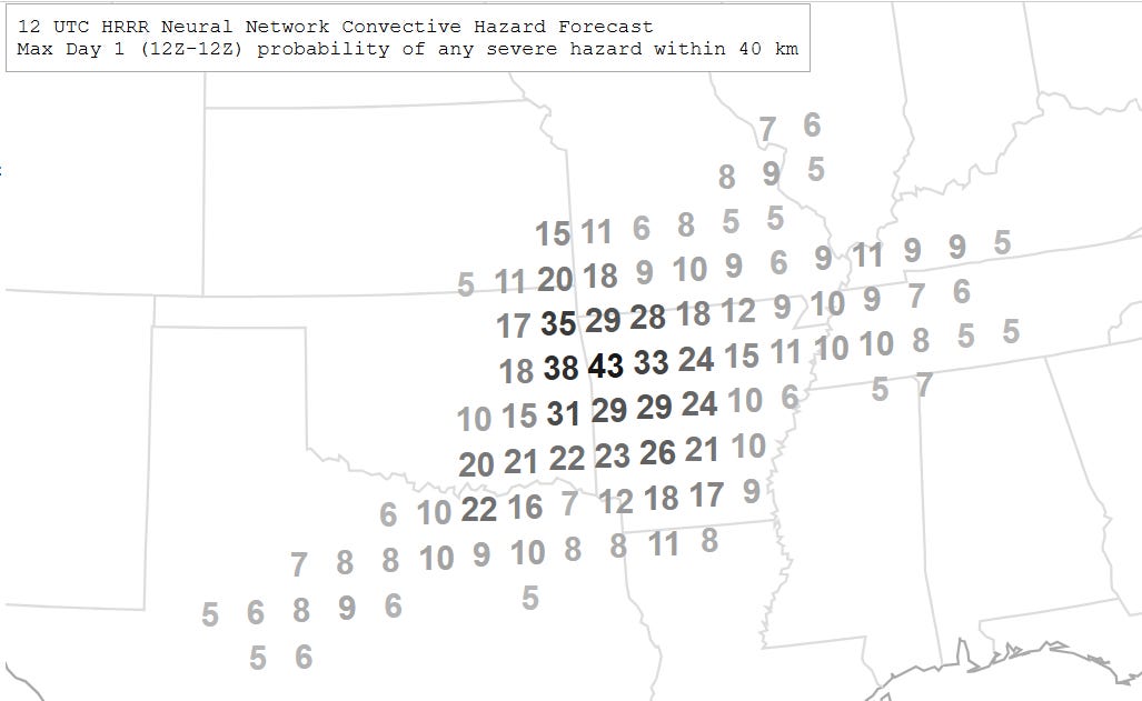
The morning run of the National Center for Atmospheric Research (NCAR) AI severe weather probabilistic system suggests a maximum in risk across northwest Arkansas and northeast Oklahoma, and the Storm Prediction Center in their morning discussion also highlighted this area as an area for potentially enhanced tornado risk that could need to be upgraded to a level 3 risk at some point today.
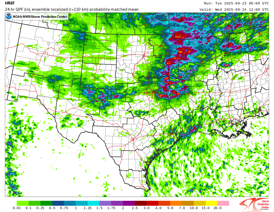
In addition to the severe weather risk, high (but not insane like we have seen much of the summer) levels of moisture will support intense rainfall rates with the storms, and where training occurs the High Resolution Ensemble Forecast system (above, 24 hour localized mean precip forecast ending at 7 am CT Wed) suggests localized rainfall amounts of 4-7” possible from northeast Texas into southern Missouri and the lower Ohio Valley. A slight (level 2 of 4) risk of flash flooding is in place here.
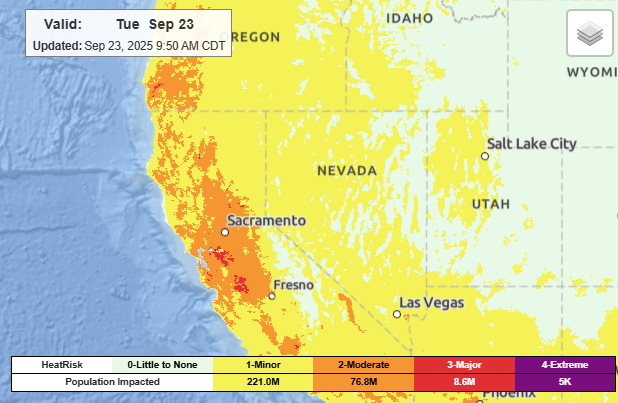
California will be another area with impact weather the next 24-48 hours due to an upper level low pressure center currently offshore southwest of southern California. Easterly offshore winds north of this low will enable heat to build across central California down to near coastal areas. This will result in widespread moderate to major heat risk today, and heat advisories are in effect for much of the Bay Area.
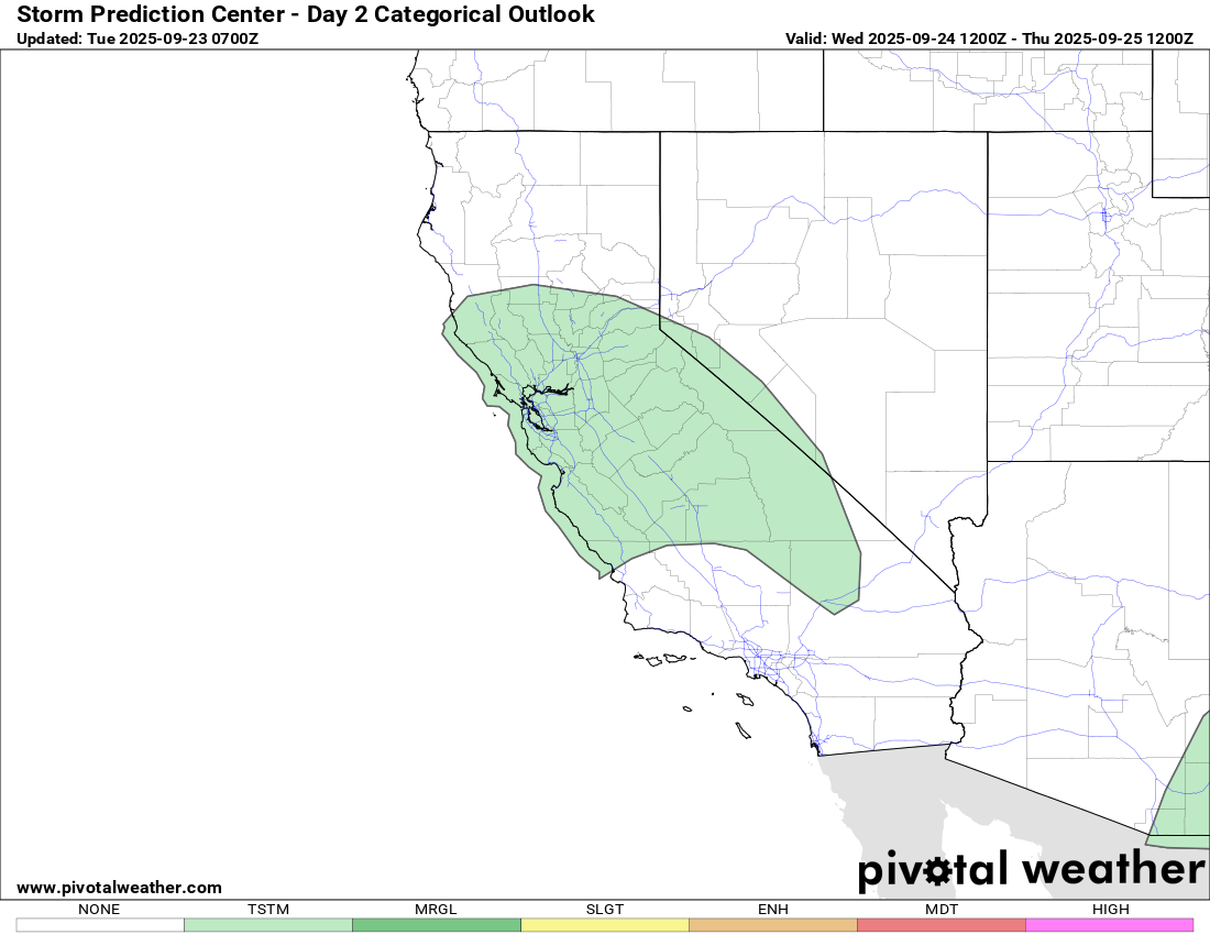
As the low moves north toward the coast the next 24 hours, moisture and instability associated with it will result in scattered thunderstorms, initially in coastal areas north of Los Angeles tonight and then across much of central California and the central Sierra on Wednesday (shown above). This will also bring an end to the unusual heat in the region.
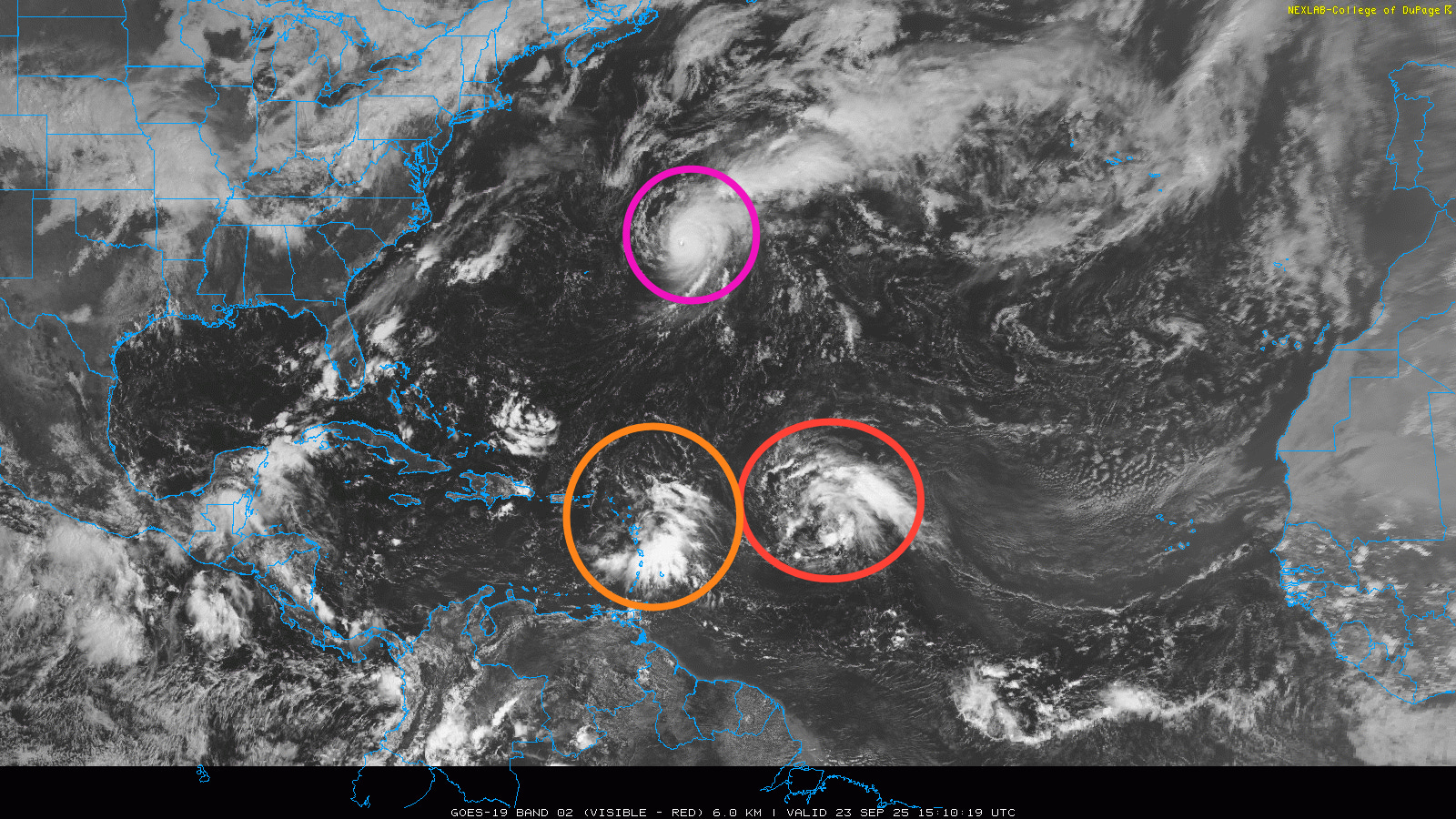
Turning to the tropics, morning visible satellite imagery shows a much more active Atlantic than we have seen than at pretty much any time this season with major hurricane Gabrielle (purple), Invest 93L (red) and Invest 94L (orange) — both of which seem likely to develop into tropical cyclones in the next week.
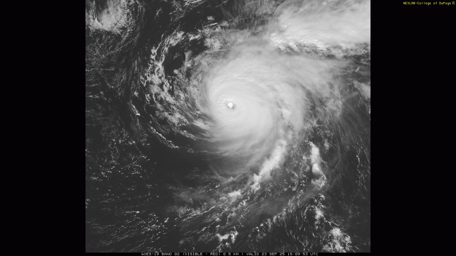
Gabrielle is an extremely impressive category 4 hurricane still this morning with maximum sustained winds of 140 mph. However, the most recent satellite imagery shows the beginnings of upper level westerly shear starting to impact the storm as the bright cloud tops west of the eye start to get eroded. This is the start of a weakening trend that should result in Gabrielle weakening below major hurricane intensity by sometime tomorrow.
While Gabrielle will weaken over the next few days, it will get some favorable atmospheric interaction with an upper level of trough of low pressure approaching it from the west and northwest which should keep it at hurricane strength as it passes near or over the Azores Thursday into Friday. A hurricane watch is now in effect for all of those islands.
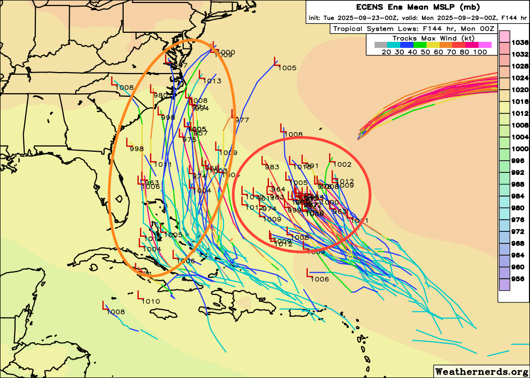
Overnight, NHC designated the disturbances we have been talking about the last few days as official invests: 93L for the easternmost and 94L for the western. The models have continued to trend more bullish with these systems, with the European physical ensemble model system now showing most of its members developing both systems into tropical cyclones, following the lead of the last few days of AI model runs.
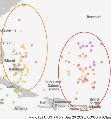
The most recent Google DeepMind (GDM) AI model continues to show strong consensus on a significant hurricane evolving from 93L to the south of Bermuda by Sunday, while it also shows a likely strong tropical storm or hurricane with 94L, most likely in the vicinity of the Bahamas.
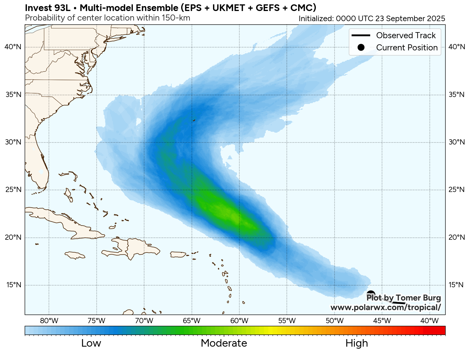
While having the typical uncertainty that exists without a fully formed system, the forecast scenario for 93L seems a bit more straightforward than what I will discuss below with 94L. 93L already has a relatively well defined broad area of low pressure with it, and as it gets into a more favorable environment we should see thunderstorm activity continue to increase and the system should become more organized. The steering flow suggests this system should tend to recurve more to the north and eventually northeast in about a week — and Bermuda definitely looks to be more at risk with this system than Gabrielle.
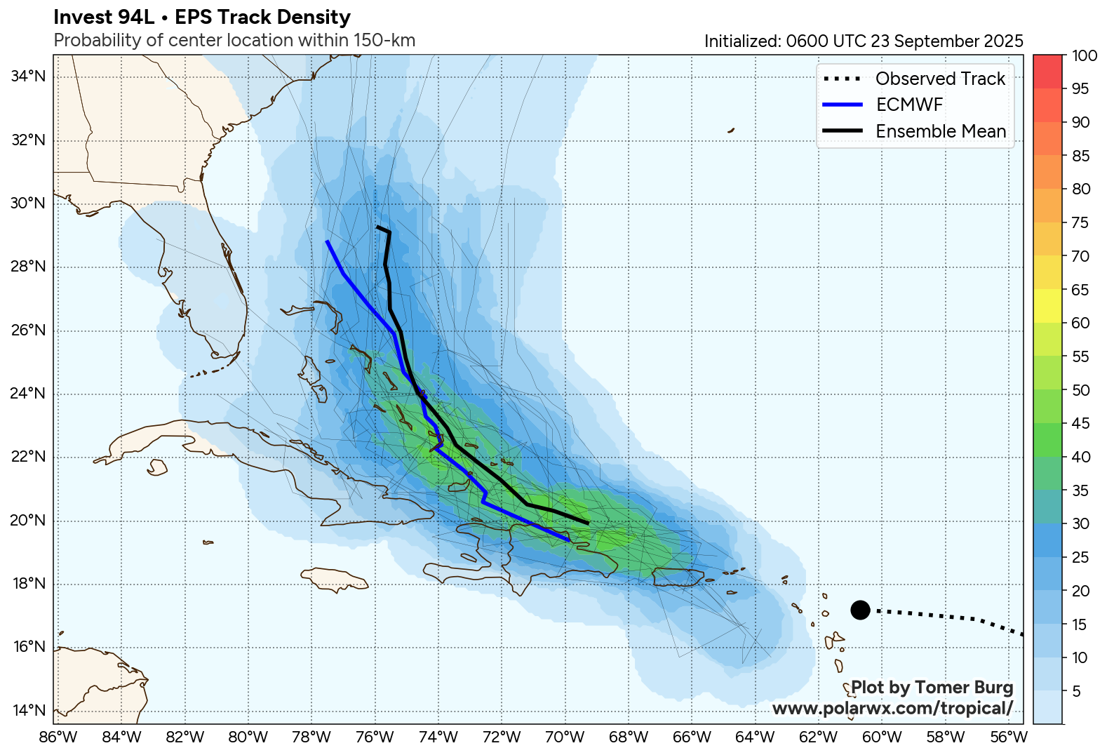
94L is less developed currently, and is under stronger northeast upper level wind shear and will be interacting with the islands of the northeast Caribbean, all of which adds uncertainty to when and where it will eventually develop.
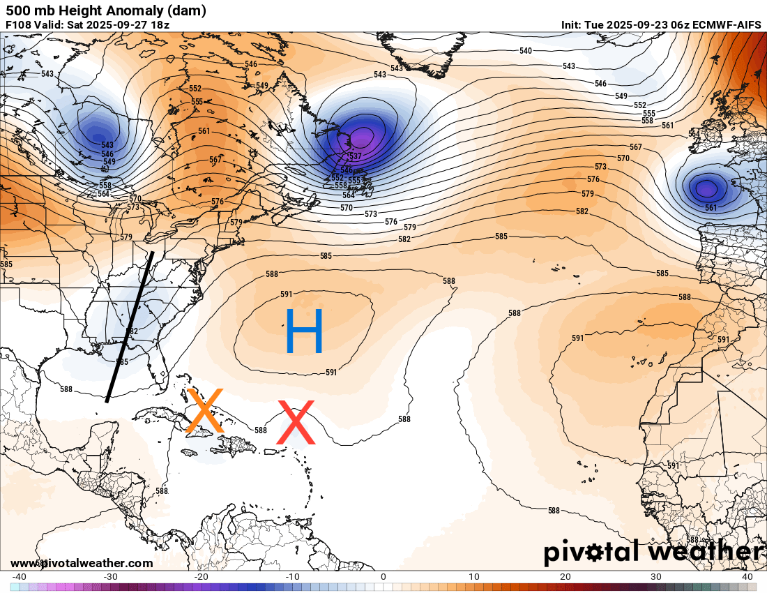
Furthermore, the overall upper level weather pattern will become very complicated in the southwest Atlantic vicinity early next week, as the persistent upper level trough (black line in 500 millibar map above) erodes and lifts northeast. As this happens, it will likely leave behind a weaker upper level low in the vicinity of Florida. How that evolution happens, where exactly the two tropical systems (orange and red Xs) are located, and the strength and location of the upper level high center near Bermuda are will play a huge role in how strong 94L gets and where it ends up going.
Needless to say, the bottom line is that there are way too many unknowns at this point to have any confidence in a solution. However, it is becoming increasingly clear that interests from Cuba and the Bahamas north along the East Coast including Florida should be keeping an eye on the latest in the tropics for the next several days.
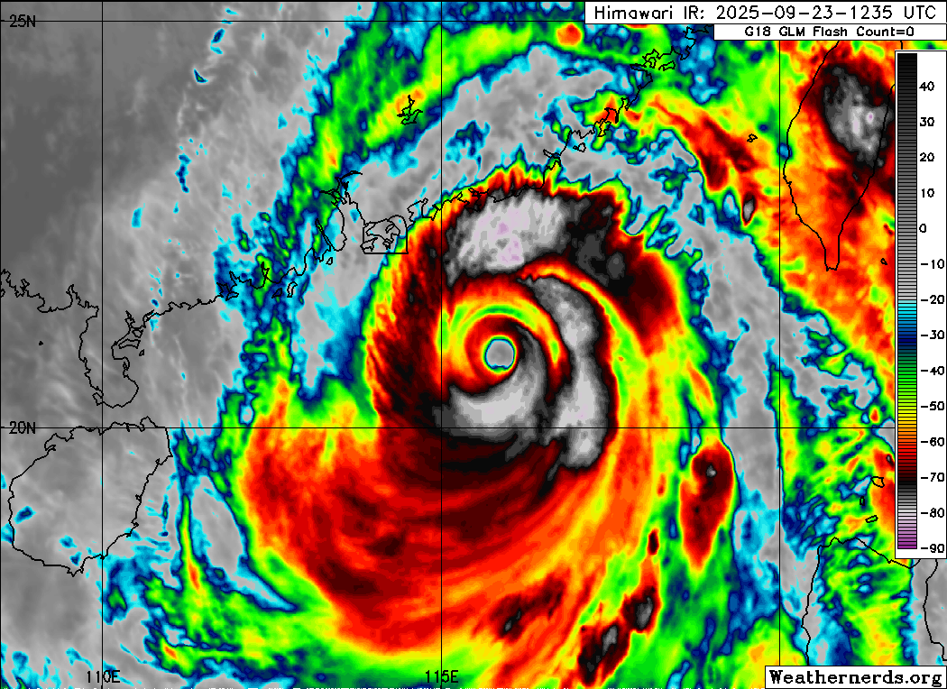
Finally, typhoon Ragasa has continued to gradually weaken as anticipated, but is still the equivalent of a category 4 hurricane on the Saffir-Simpson Hurricane Wind Scale with maximum winds of 130 mph. It is approaching Hong Kong and Macao from the southeast and the eye is expected to pass to their south, putting them in the worst quadrant of the storm. Major impacts are anticipated there and in China’s Guangdong province as the storm makes landfall in 18-24 hours.

Leave a comment