Tropics remain busy into early October
Oct 01, 2025
Happy first day of October! A quick morning update from my travels, today in Manchester, NH.
With the first day of October, we also have a federal government shutdown. The National Weather Service continues to operate as normal with regard to provision of forecasts and warnings, but most of the rest of NOAA and scientific research agencies, including NOAA Research, is mainly shutdown and employees furloughed. The administration continues to threaten broader permanent layoffs of federal employees as part of the shutdown, so obviously we will continue to monitor that with regard to the federal science apparatus.
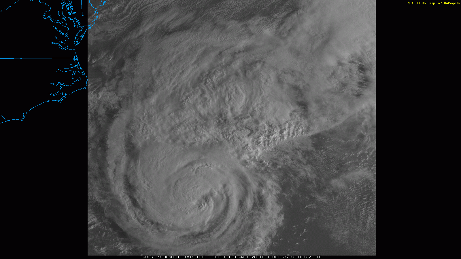
Looking at the weather, we will start in the busy tropics. Imelda has continued to gradually intensify, and is now a strong category 1 hurricane with maximum sustained winds of 90 mph as it moves east in the general direction of Bermuda.
The models have shifted a bit south on the forecast track of Imelda, and the center of the storm is expected to move near or just south of Bermuda in about 24 hours as a category 2 hurricane. A hurricane warning is in effect for Bermuda, and significant wind and rain impacts are expected there. It should become post-tropical as and after it passes Bermuda, but should remain a powerful storm system. The model forecasts become rather uncertain after is passes Bermuda but it should generally move northeast.
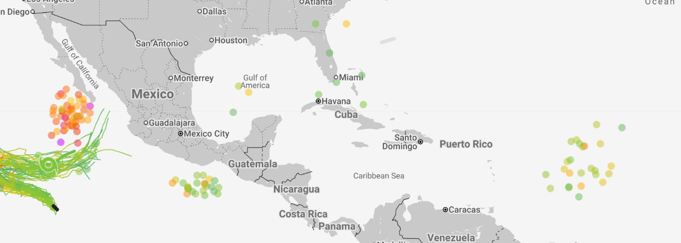
The tropics look to remain a big focus as we go through early October, as the ensembles (most recent Google Deep Mind AI system 7 day forecast shown above) show the likelihood of a significant hurricane developing in the eastern Pacific over the next several days, with at least some potential risk for Baja California. Meanwhile, in the Atlantic the models continue to be relatively bullish on development of the next tropical wave east of the Caribbean. Another area to monitor is the southwest Atlantic, where the models show some signs of development over the next week, but the specific location and timing remains very uncertain and for now it is just something to keep an eye on.
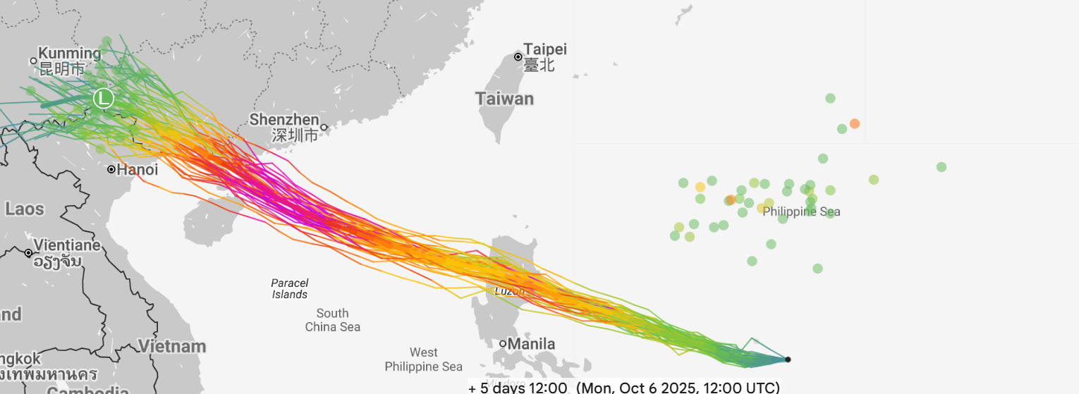
The Western Pacific also looks to remain active, as a new tropical depression east of the northern Philippines should become a significant typhoon with threats again likely to southern China and Hong Kong in several days (GDM 5 day forecast shown above).

Stateside, the relatively low key fall weather should continue the next few days with unseasonably warm conditions persisting for many.
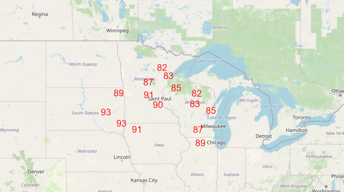
Numerous record warm temperatures are anticipated in the upper Midwest and Great Lakes region by the end of the week (NWS forecast temperatures near or above record maximum temperatures for Friday shown above). Even greater record warmth is anticipated north of the border in Canada.
Programming note: posts and updates will continue to be more sporadic than normal the next several days as I travel. I am hoping to have some live content from Mt. Washington, NH — a meteorological destination! — tomorrow, but that will be dependent on cell coverage and what is allowed at the observatory there.

Leave a comment