A short video tour of Bay St. Louis harbor and discussion of the storm surge event. And updates on severe weather risk Saturday and Caribbean tropical possibilities next week.
Oct 17, 2025
Good Friday evening from the Florida Panhandle. I am going to be busy in the morning, so wanted to share a quick post this evening. While on our travels, we trekked along the Mississippi Gulf Coast, and stopped in Bay St. Louis for lunch and for me to do a Substack Live talking about the storm surge impacts of Hurricane Katrina and my memories of being on that beach a few days after Katrina’s landfall. You can watch the video here.
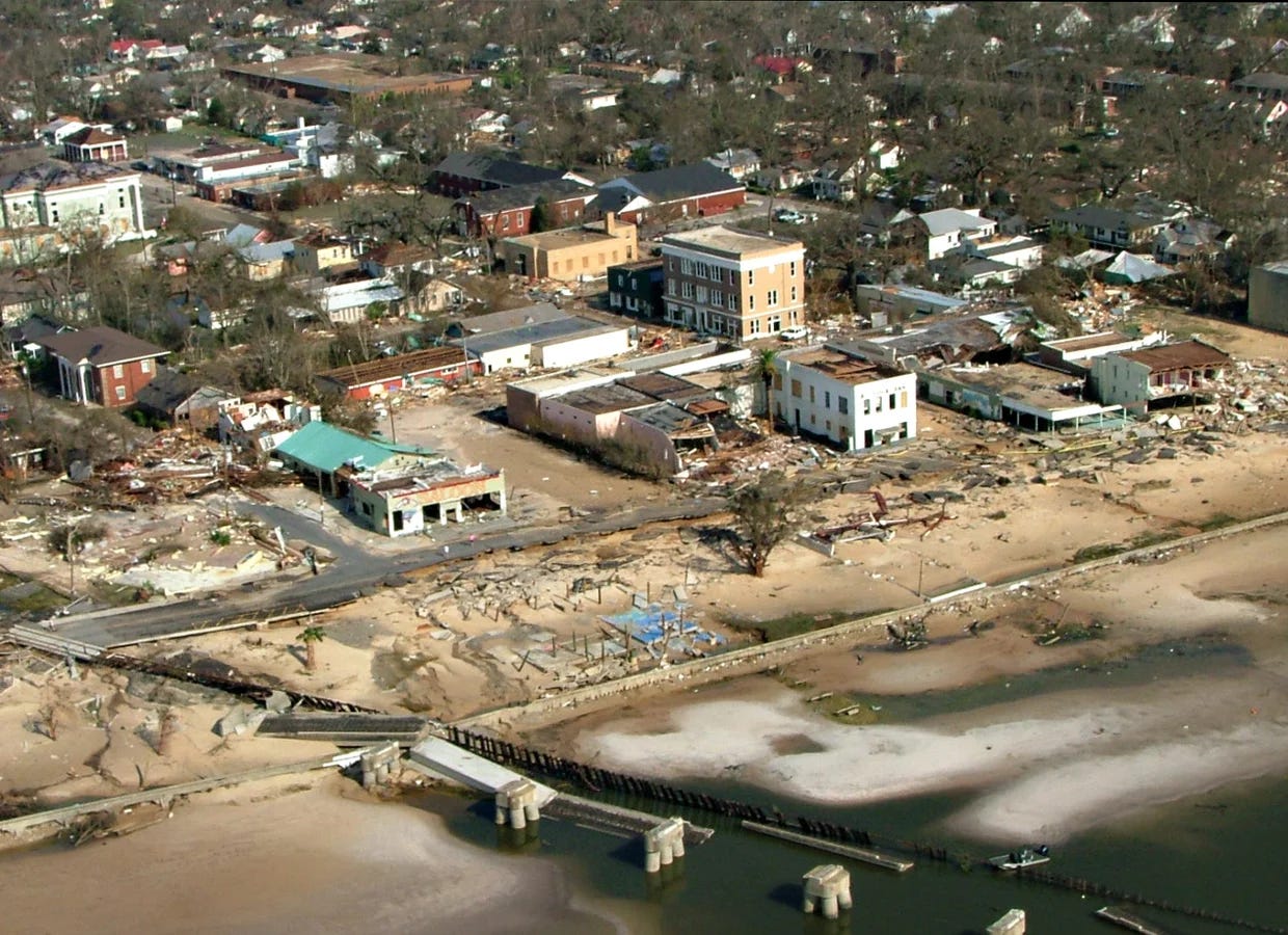
For context with my Substack Live, the picture above from the immediate aftermath of Katrina is pretty much of the area I spoke from this afternoon — the bridge in the foreground is the railway bridge I reference in the video. You can get more perspective from this picture of just how high and far inland the storm surge penetrated.

This is an image of the vehicular bridge over St. Louis Bay after Katrina — again, the region around St. Louis Bay was the area of peak storm surge with Katrina with a high water mark of 27.8’ in Pass Christian on the east side of the bay (I misspoke and said 28.5’ on the video). This bridge has been rebuilt at a higher elevation to try to better protect against future storm surge events. As we traveled along US Highway 90 this afternoon from Bay St. Louis to Biloxi, along with just being impressed with the incredible recovery I was also really heartened to see that most structures near the beach have been elevated to a significant height on piers. Like I discussed in the video, the next major surge event for this region is not a matter of if but when, and mitigation is key to reducing impacts and recovery time after that next major hurricane landfall.
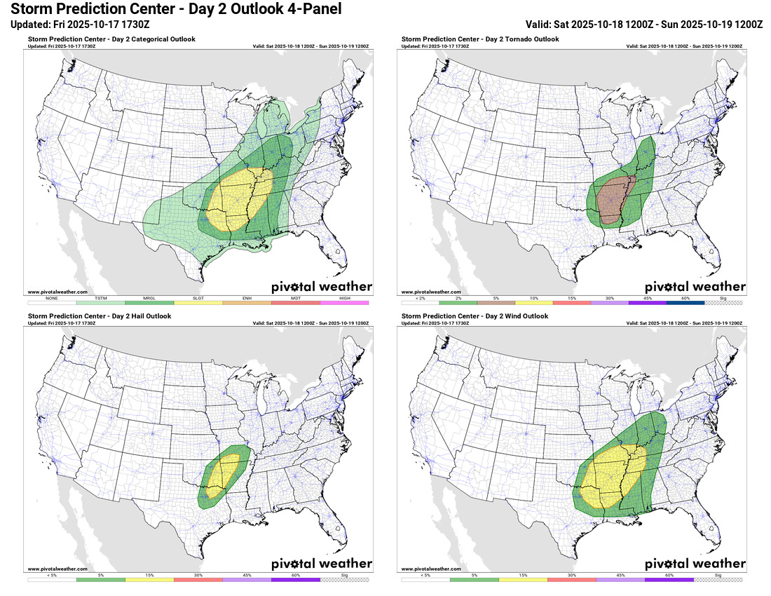
Taking a quick look at the weather, the severe weather expectations for tomorrow still look relatively similar as to what we talked about this morning per the updated Storm Prediction Center outlook. The evening high resolution model runs do suggest the potential for a bit greater tornado risk late Saturday night into early Sunday morning in the southern part of the severe weather risk area, primarily in the Interstate 20 corridor from Shreveport to Jackson. So that is something we will be keeping an eye on with later forecasts.
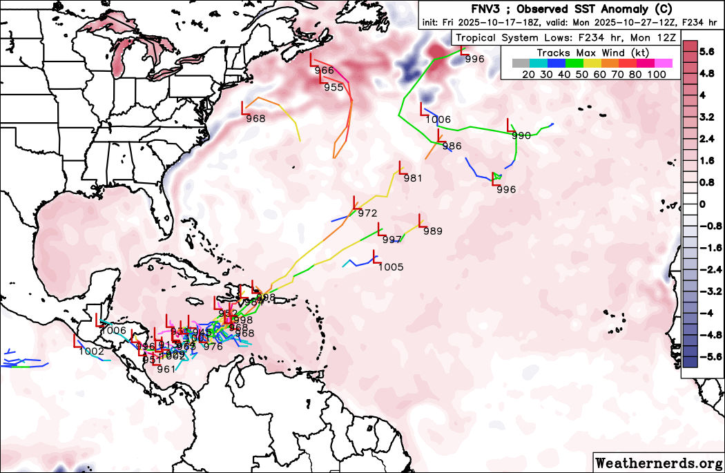
With the potential tropical system next week in the Caribbean, NHC has held the probability of development at 30%. The biggest change in the models today is that the AI models — Google DeepMind shown above — trended toward the physical European ensemble with slower development that stays focused primarily in the Caribbean rather than lifting out to the north. If anything, the European ensemble became even more focused on slow development in the western Caribbean. Again, we have a number of days to watch this.
Programming Note: I will be traveling the next several days on a road trip to and from Florida. As of now, I am planning to keep a relatively typical level of posts going, but there will likely be some delays and posts at unusual times (e.g., this usual Saturday morning post coming on Friday evening).

Leave a comment