Stateside, severe weather risk ramps up next 24 hours
Oct 17, 2025
Good Friday morning from Louisiana! I want to start off this morning by following up on last weekend’s catastrophic storm surge event in western Alaska that I did a deep dive on in Monday’s post. As Rick Thoman noted in his remarks to me for that piece, with winter coming into this isolated area there is no realistic time for recovery and because of that hundreds of residents were evacuated from the region yesterday.
Rick and I contributed to an excellent piece by Bloomberg reporter Lauren Rosenthal with further analysis on the likelihood that lack of typical upper air balloon data due to NWS staffing and budget issues caused the forecast issues for this event. Lauren was able to talk to some scientists with expertise in numerical weather prediction including a led scientist at the European Centre for Medium Range Forecasting (ECWMF), the agency that produced the European models that are recognized as the best in the world. They echoed concerns about the forecast for the track and intensity of the post-tropical system that developed from Halong, noting that all models unusually struggled with the forecast.
It is important to recognize that even if forecasts for the path and intensity of the Halong produced storm system and its associated flooding got more on track closer to the event, this vulnerable part of Alaska needs days of lead time to be able to adequately prepare. Because the forecast track was too far west a few days ahead of time, the areas where evacuation and preparation was initially focused was too far west. The scientists Lauren interviewed in addition to myself appear to agree that this was an unusually poor forecast, and it seems highly unlikely that missing upper air data didn’t at least contribute to the errors. I encourage you to read Lauren’s article for more details.
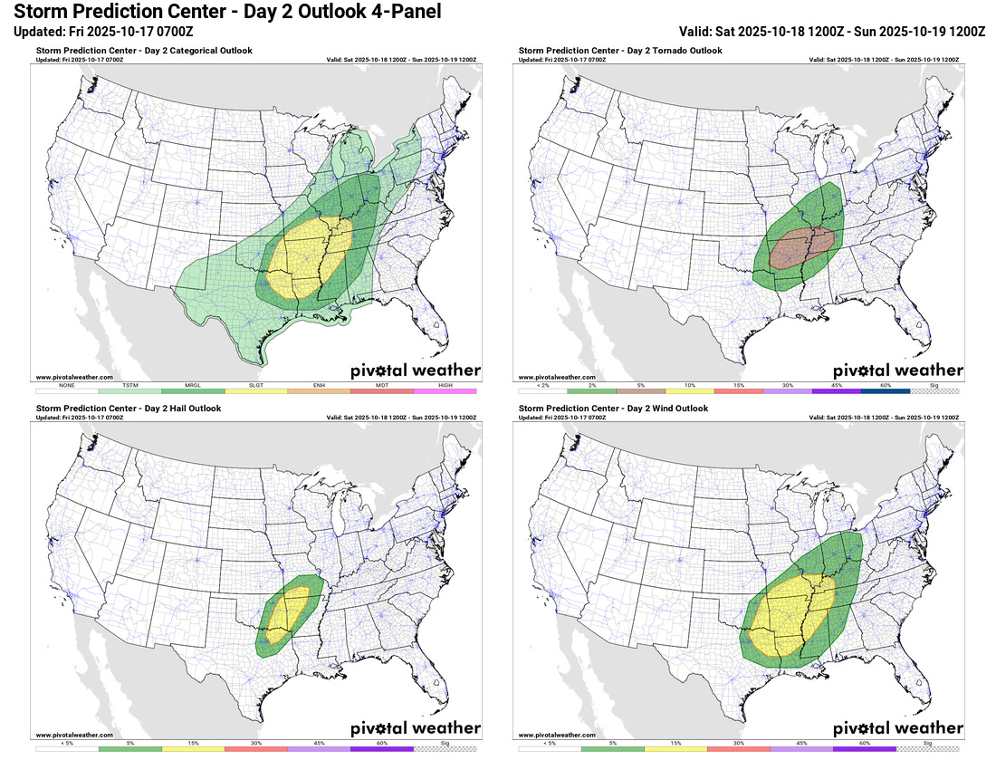
For the lower 48, the main weather focus going into this weekend will be on a strengthening storm system which is expected to bring increasing risks from thunderstorm activity. After a marginal (level 1 of 5) risk of severe storms from Oklahoma into western Missouri today and tonight, the risk of severe storms will increase on Saturday across much of the Mid-South and lower Ohio Valley regions as the storm system wraps up and encounters increasing Gulf moisture. The area from northern Arkansas into western Kentucky and Tennessee right now looks to be the region where the most favorable overlap of dynamics and unstable air will lead to the greatest risk of storms with damaging winds and possibly a few tornadoes.
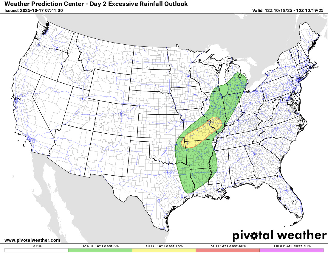
The increasing Gulf moisture will also mean heavy rainfall rates will occur with the most intense storms. Much of this region has been quite dry recently so flash flooding is not anticipated to be a major risk, but still there could be some isolated to scattered reports of localized flash flooding where the heaviest rainfall occurs.
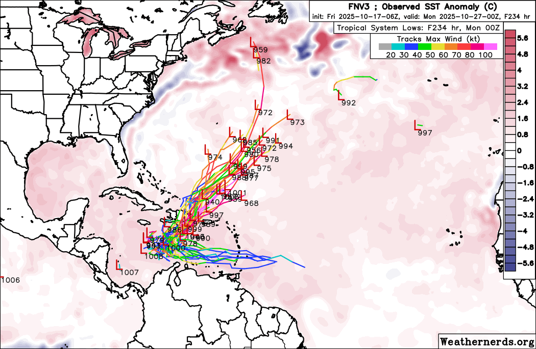
Turning to the tropics, the models continue to show the potential for a westward moving tropical wave to develop in the Caribbean next week, and NHC is now highlighting the system as a potential (30%) risk for development. There seems to be a rather clear difference in the models today between the AI systems like Google DeepMind (GDM, shown above) and the European physical based ensembles. The GDM is now quicker to develop a well organized system, and because of this most of its members show a stronger system turning north across the region around Hispaniola and then moving into the northern Atlantic.
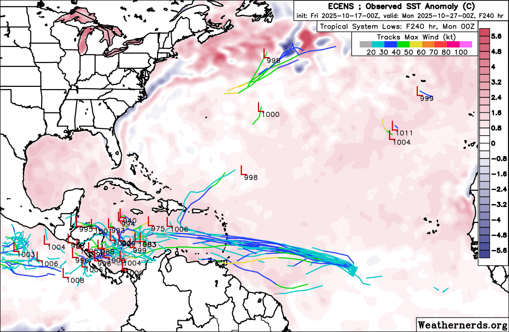
Meanwhile, most of the European ensemble members show a much slower developing system that meanders around the central and western Caribbean for days. Again, any development is still many days away, so plenty of time to watch model and observational trends.
I will be traveling the next several days on a road trip to and from Florida. As of now, I am planning to keep a relatively typical level of posts going, but there will likely be some delays and posts at unusual times. Today as I am traveling along the Mississippi Gulf Coast, I am planning to do a Substack Live around midday, talking about my memories from Katrina and my visit to the region a few days after landfall. As a reminder, access to live video and chats is a primary benefit of supporting Balanced Weather with a paid subscription.

Leave a comment