This increases the likelihood of Melissa becoming a significant hurricane with serious, prolonged impacts in parts of the western and central Caribbean region
Good evening, I may be busy in the morning and unable to post, so I wanted to provide a quick update on Tropical Storm Melissa. All of the data this evening indicates that Melissa is not really any better organized than this morning. The thunderstorm activity is still all to the east and southeast of the center, which reconnaissance aircraft shows is due south of the southwest peninsula of Haiti. Reconnaissance data also indicates that the circulation of Melissa is rather broad at the surface and tilted with height, also indications of wind shear impacting the system and keeping it from intensifying. On the most recent NHC advisory, it had maximum sustained winds of 50 mph, same as this morning.
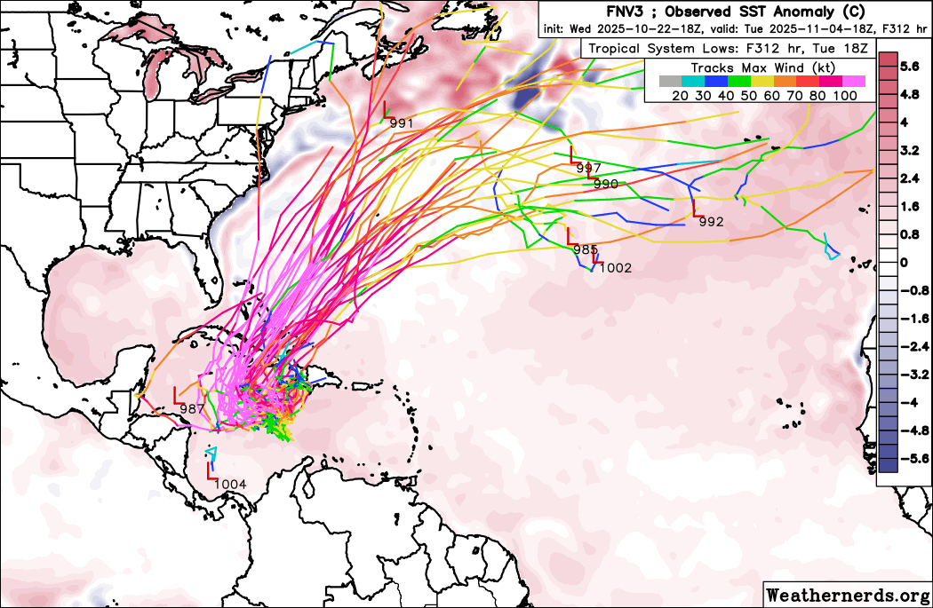
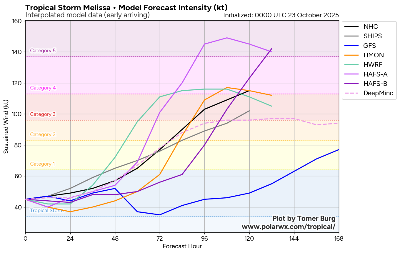
The storm is drifting ever so slightly west, and the lack of any significant intensification today further increases the likelihood that the scenario of a slow track to the west for the next for several days as consistently shown by the European ensemble model will pan out. In fact, the Google DeepMind AI system — which an analysis by tropical researcher Brian McNoldy shows has been the most accurate model so far this year for track and intensity forecasts — has now come much more inline with that scenario as well.
This also means that Melissa will be over the extremely warm water of the central and western Caribbean for the next several days, and with wind shear expected to decrease substantially, this further increases the likelihood that Melissa will become a powerful hurricane over the Caribbean by this weekend.
![[Key Messages]](https://substackcdn.com/image/fetch/$s_!EiGc!,f_auto,q_auto:good,fl_progressive:steep/https%3A%2F%2Fsubstack-post-media.s3.amazonaws.com%2Fpublic%2Fimages%2F98607b41-2387-4361-86b8-920601fe934a_897x736.png "[Key Messages]")
A slow moving hurricane growing in size and intensity means prolonged impacts to the region. Heavy rain and serious flash flooding and mudslides continue to be a major risk to portions of Jamaica and Hispaniola. It is important to note that the rainfall forecast shown above is just for the next 72 hours — additional heavy rain is expected beyond that time which could also expand to include more of Jamaica and Hispaniola as well as parts of Cuba. Totals of 20” or more of rain will be possible in some of these areas.
While the general idea of a slow motion to the northwest and west the next several days has come more into focus, there is obviously still a lot of uncertainty on the exact path and speed of the track. It still looks like at some point next week the drift to the west will eventually stop, and the hurricane will lift north or northeast out of the Caribbean and into the North Atlantic. Interests in the Bahamas and Cayman Islands should be monitoring forecasts for Melissa given this expected evolution.

Leave a comment