Weather pattern continues to trend wetter and stormier for the central US
Nov 17, 2025
Good morning and welcome to a new work week. In weather, this week should feature unseasonable warmth for much of the country, along with the transition of the upper level weather pattern toward one dominated by a trough of low pressure in the West and ridge of high pressure in the East, which should yield a wetter and more active pattern for the central United States.
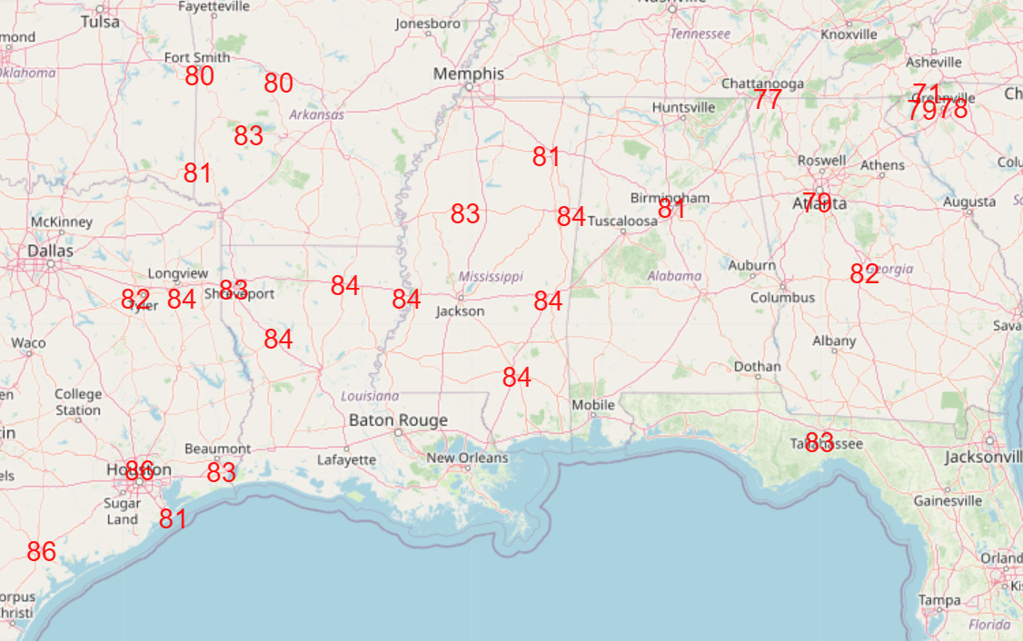
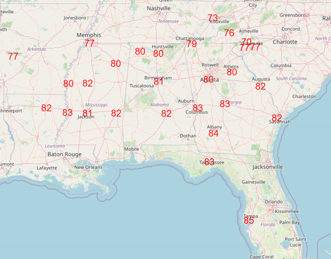
Several record high temperatures were set in Texas on Sunday, including Brownsville (91F), Houston Hobby (86F) and Austin (87F). Additional record warm temperatures are anticipated in Texas and Oklahoma today, and this record warmth will expand to much of the Southeast over the next few days, with numerous record highs expected Wednesday (top graphic) and Thursday (bottom graphic).

The next in a series of upper level low pressure areas will move onshore into California today, bringing more heavy precipitation to the region the next couple of days. Some localized flash flooding issues are possible in southern California, and higher elevation snows are expected in parts of the Sierra Nevada. Meanwhile, an upper level weather disturbance moving through the Midwest will bring showers and thunderstorms from the Midwest to the Mid-Atlantic through Tuesday.

The upper level low moving into the West along with an additional system moving in during the midweek period will continue to move the upper level weather pattern toward one dominated by an upper level trough in the western states and an upper level ridge in the east. In between, a wetter and more active weather pattern will become established in the central US, with the initial peak in rain and thunderstorm activity expected on Thursday (precipitation forecast above). While a few severe thunderstorms and some localized flash flooding are possible, overall this rainfall should be beneficial as much of this region has been quite dry over the last several weeks.
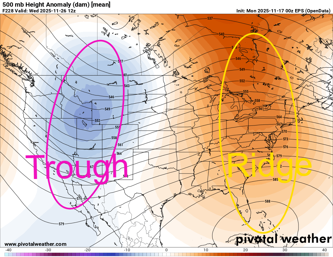
This overall weather pattern looks to persist into at least the first half of Thanksgiving week as shown by the European ensemble 500 millibar (18K ft AGL) forecast weather map for next Wednesday. There are signs that this pattern will start to break down — at least temporarily — around or shortly after Thanksgiving. Until then, though, this pattern should bring cooler and occasionally wet weather to the west, wetter and stormier weather to the central US, and and unseasonably warm weather for much of the eastern half to two-thirds of the country.

Leave a comment