Unusually strong cyclone for so early in the season there. In the US, severe weather and flash flood threats today in the south central states.
Nov 24, 2025
Happy Thanksgiving Week! It’s Monday, and there’s some activity in the global tropics to talk about, so we are going to start there.
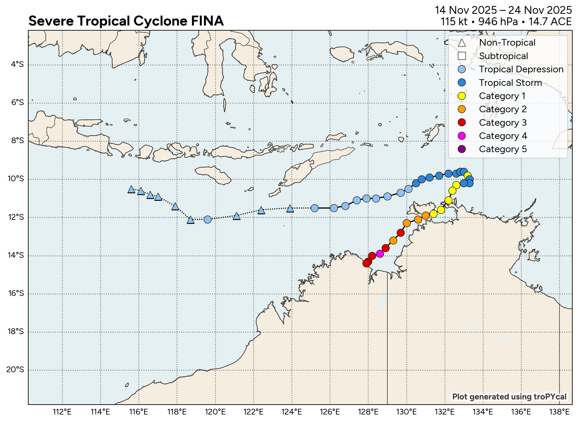
Over the the last few days, Tropical Cyclone Fina has been intensifying off the northern coast of Australia. It intensified into the equivalent of a category 2 hurricane as it passed just offshore Darwin on Friday night (Australia time), the capital city of Australia’s Northern Territory, with a population of about 140,000. Fina produced wind gusts of 107 km/h (67 mph) in Darwin, knocking out power to nearly 20,000 customers and producing 168.6 mm (6.6”) of rainfall. Long time residents said it was the worst tropical cyclone impacts in the city since infamous Cyclone Tracy, an intensifying tropical cyclone that struck the city directly causing devastation and killing 66 people.
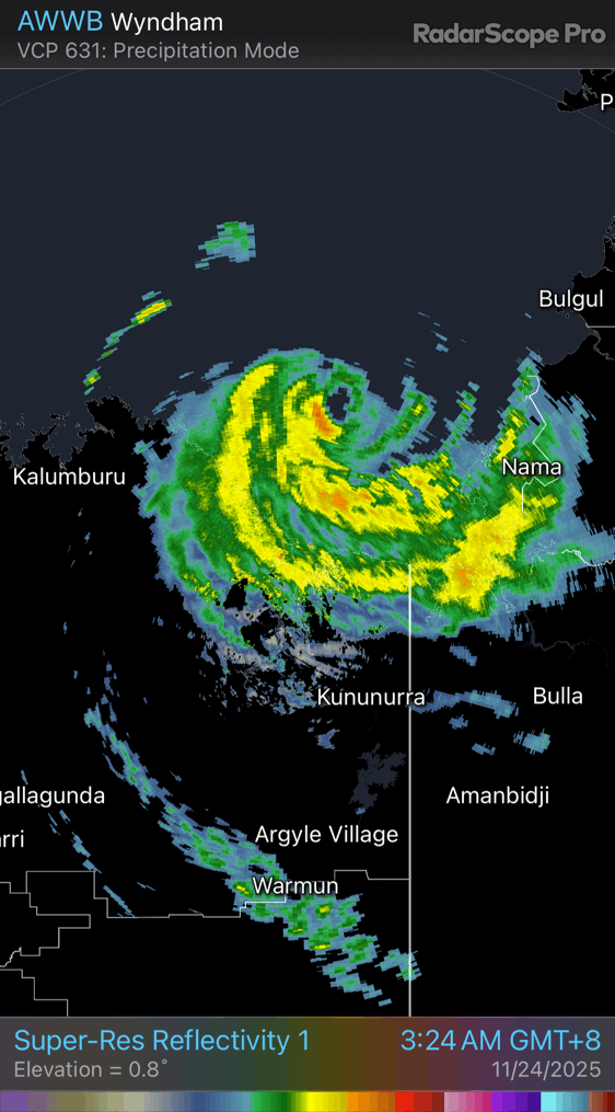
After passing by Darwin, Fina continued to intensify, becoming the equivalent of a high end category 3 or low end category 4 hurricane at the time of this Bureau of Meteorology radar loop from late Sunday afternoon US time. A well defined eye is clearly visible, and the eyewall contained a lot of lightning activity, also indicative of an intense tropical cyclone. My friend and colleague Bill Read, former director of the National Hurricane Center, pointed out on Facebook last night that this is likely the earliest occurrence of a tropical cyclone of this intensity in this region; tropical cyclone season in Australia starts in November, but as the Bureau of Meteorology tropical cyclone climatology website notes, November cyclones are relatively rare. La Nina tends to support more active tropical cyclone seasons around Australia, so this could be the start of an active year for them.
Fina weakened slightly before it made landfall on the northeast Kimberley coast several hours ago. The above radar loop shows the system slowly moving inland. This area of Australia is sparsely inhabited, but certainly significant storm surge and high winds occurred near where the eye made landfall. Intense rainfall is occurring in the vicinity of Cambridge Gulf. Fina will continue to slowly move inland and weaken, with heavy rainfall continuing to be a risk.
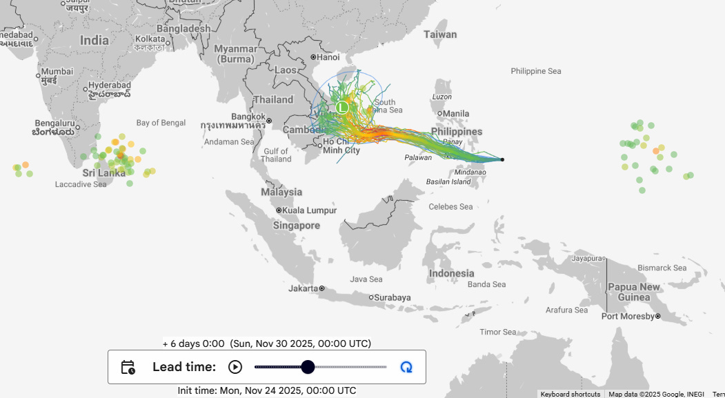
Elsewhere in the global tropics, Invest 92W near the Philippines this morning is forecast to develop into a tropical storm and potential typhoon as it moves west across the South China Sea over the next several days. A new tropical cyclone also looks likely to develop in the vicinity of Sri Lanka as the week goes along, and should be drifting north off the southeast coast of India by this weekend as a new system develops well east of the Philippines.
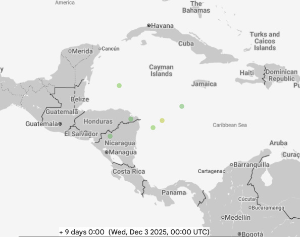
Meanwhile, it is still technically hurricane season in the Atlantic, although we have not really had anything to track since Melissa dissipated. There has been some social media traffic about the US global model (GFS) showing a strong cyclone developing in the western Caribbean several days from now. While that is almost certainly overdone and a result of a long known bias of the model, there are a handful of members in both the Google DeepMind AI ensemble and the European AI ensemble showing development of a weaker, late season system in the western Caribbean in 7-10 days. There has been an unusually strong upper level area of high pressure over this region and sea surface temperatures are unusually warm — so it is not impossible that a tropical depression or storm could form in this area. It will be something to keep an eye on.
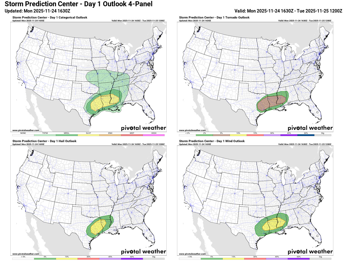
Coming back stateside, the main focus for today will be on the storm system moving through the center of the country, which will bring active thunderstorm activity to the south central states. Conditions appear to be coming together for a number of rotating thunderstorms capable of wind damage, hail and potentially tornadoes, starting this afternoon in eastern Texas and spreading east into southern Mississippi overnight. A slight (level 2 of 5) risk of severe weather is in place here, and just recently a tornado watch was issued by the NOAA/NWS Storm Prediction Center for eastern Texas.
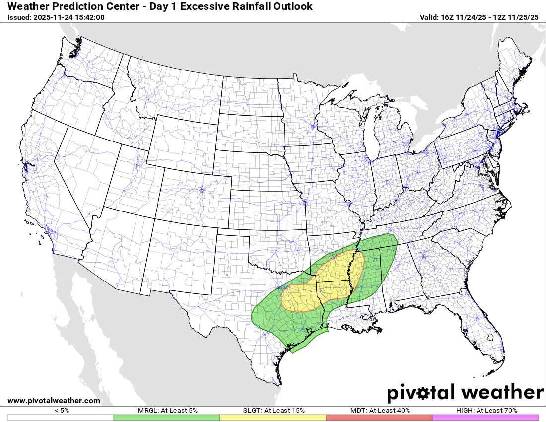
Repeat thunderstorms with heavy rainfall could also cause some flash flooding from the Arklatex across the Mississippi Delta, and a slight (level 2 of 4) risk of excessive rainfall is in place from the NOAA/NWS Weather Prediction Center.

Looking ahead to the big Thanksgiving travel day on Wednesday, much of the country will be relatively quiet, with the Pacific Northwest and eastern states being the primary exceptions. A storm system and cold front bringing some gusty winds and colder air to the central and eastern states will bring precipitation to the East, but most areas will be warm enough for rain. Some light wintry mix is possible around the Great Lakes and into northern New England and Maine, while heavy lake effect snow will develop in the vicinity of Lake Superior. A series of storm systems moving into the Pacific Northwest will keep periodic rain and mountain snow in the forecast much of this week.
I will be keeping an eye on the severe weather setup in the south central US today. I will provide updates via Substack Notes and BlueSky, and if things get particularly active, I plan to do a Substack live chat to provide real-time updates and insight on the evolving severe weather threats. As a reminder, live chats and videos are a benefit for the folks who support Balanced Weather with paid subscriptions. If you are able and inclined to become a paid (or free of course) subscriber, you can do so at the link below. Thanks as always to all of the subscribers and followers of Balanced Weather for your support!!

Leave a comment