Large swath of 6 or more inches of snow expected
Nov 29, 2025
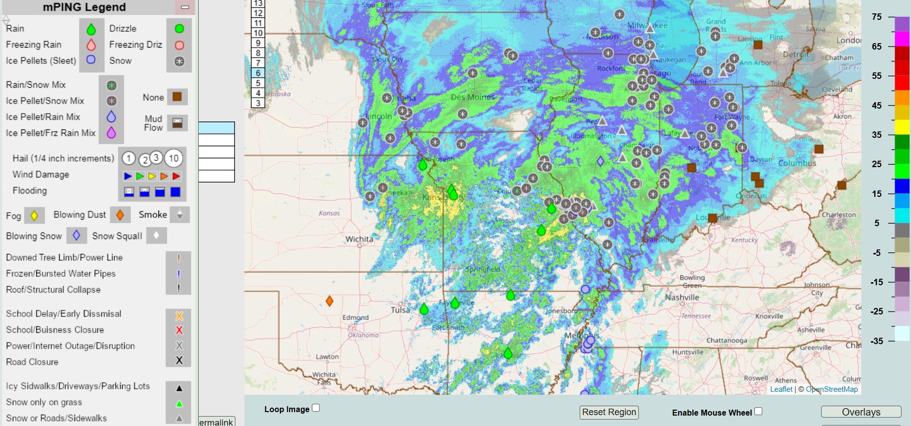
The long advertised winter storm is in full swing this morning across the Midwest. Widespread moderate to heavy snow is occurring from St. Louis north across much central and northern Illinois, northern Missouri and much of Iowa. Totals of up to 8” have been reported in these areas, and overall the forecast still looks on track for widespread storm totals of 6-12” of snow across this region and into the Lower Peninsula of Michigan and northern Indiana. Obviously, travel will be difficult in these regions today, and air travel will likely be significantly impacted by the heavy snowfall in the hub city of Chicago.
I have been highlighting the area along I-70 from St. Louis to Indianapolis as a particular trouble spot for the forecast for this system, with a very tricky setup for how much snow would fall before precipitation changed over to rain. The St. Louis area definitely ended up hitting the jackpot as far as snowfall, as amounts of 5-8” have been common this morning in St. Louis proper and in the northern and eastern sides of the metro area. Heavier precipitation along with warmer low level air moving in on the slow side of forecasts resulted in a longer and heavier period of snow this morning. Warmer low level air is still expected to eventually help change the precipitation over to rain from the south, but the area is definitely getting an impressive first snow of the season.


This storm system will move northeast over the next 24 hours and will spread some wintry precipitation farther as it does so, but the system will be weakening with time and amounts will not be nearly as heavy or impactful the farther east it moves. On the warm south side of the system, showers and thunderstorms will spread east as well. A few severe storms are possible in the western Gulf Coast region today into tonight as well as some localized heavy rainfall, but overall this does not look to be a particularly impactful system as far as severe weather or flash flooding. Meanwhile, a new storm system will spread light to moderate snow across the Intermountain West and eventually out into the central Plains by Sunday.

Leave a comment