More snow for the Midwest, while first big snow for Northeast – west of the I-95 corridor – looms Tuesday
Nov 30, 2025
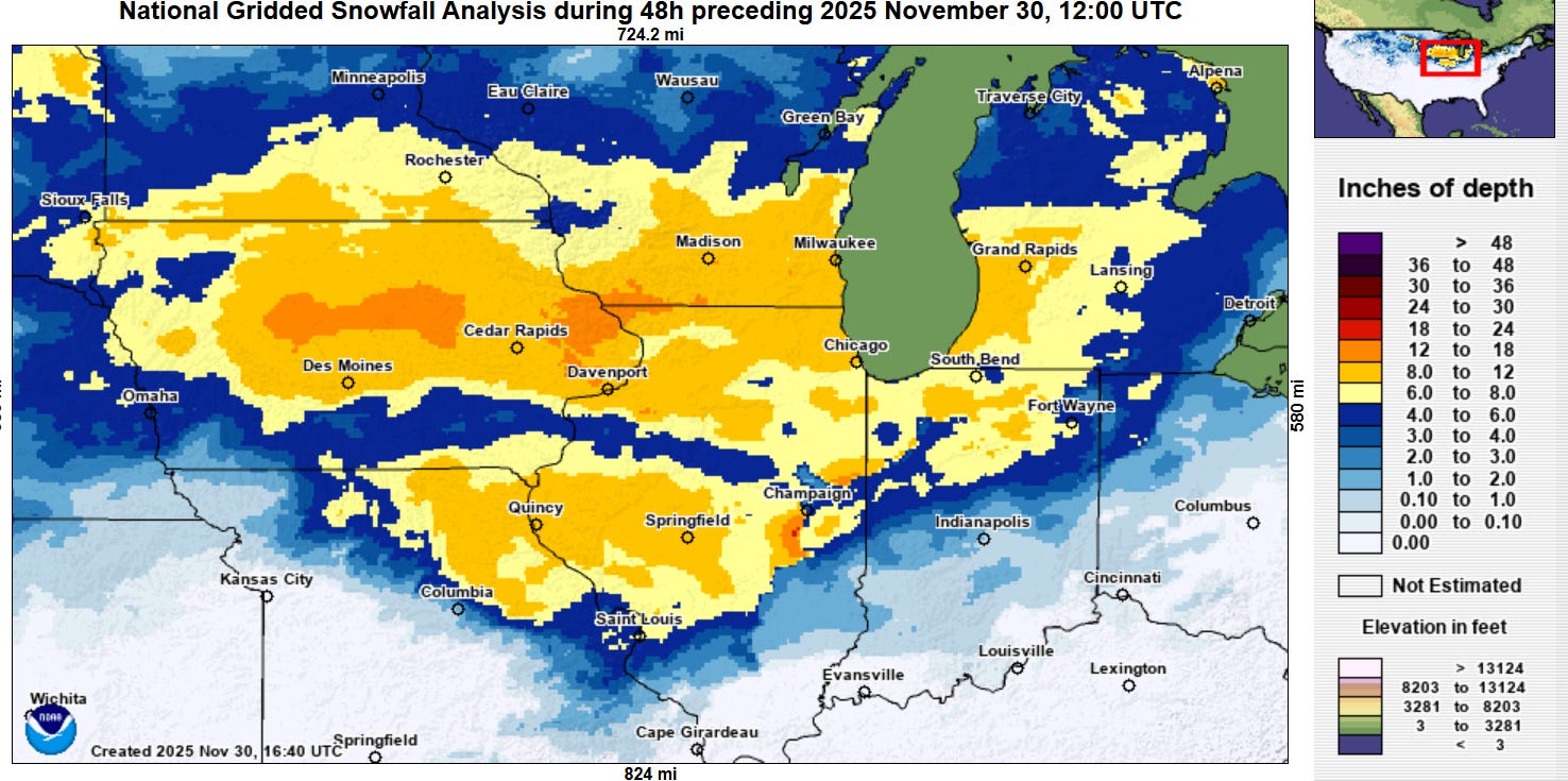
This morning’s 48-hour snowfall analysis from NOAA’s National Operational Hydrologic Remote Sensing Center (NOHRSC) shows that the major winter storm across the Midwest the last couple of days worked out pretty much as anticipated. The heaviest snow of 12-15” fell along a west-east band to the north of Interstate 80 in Iowa and into extreme southwest Wisconsin and northwest Illinois. The highest snowfall total on the NOAA/NWS Weather Prediction Center storm summary was 15” near Fort Dodge, IA.
While the snowstorm is winding down in this region, the impacts to travel continue. Business Insider reported that 1,500 flights in the hub city of Chicago, and an additional 240 have been cancelled this morning.

The storm system will continue to produce light wintry precipitation across the Great Lakes and Northeast today with fairly minor impacts, except for some heavier lake effect snow downwind of the Great Lakes. A new storm system in the Southwest will spread light to moderate snow from the Intermountain West across the central Plains.

As the upper level energy from the Southwest storm system moves into the Mid-South and Tennessee Valley regions on Monday, a new and stronger storm system will begin to develop.
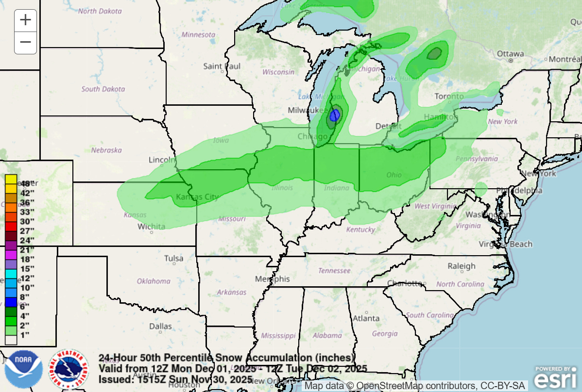
A wide swath of accumulating snow is expected Monday into Monday night from the Midwest into the lower Great Lakes. While not nearly as heavy as what was seen with this weekend’s storm, widespread 2-4” of snow with some localized heavier amounts — as shown above in the WPC 24 hour snowfall forecast map ending Tuesday morning — will cause travel issues. Some mixed wintry precipitation will occur farther south across the Ohio Valley with the potential for some accumulating snow Monday night as the system gets far enough east for colder air to begin to wrap around it.
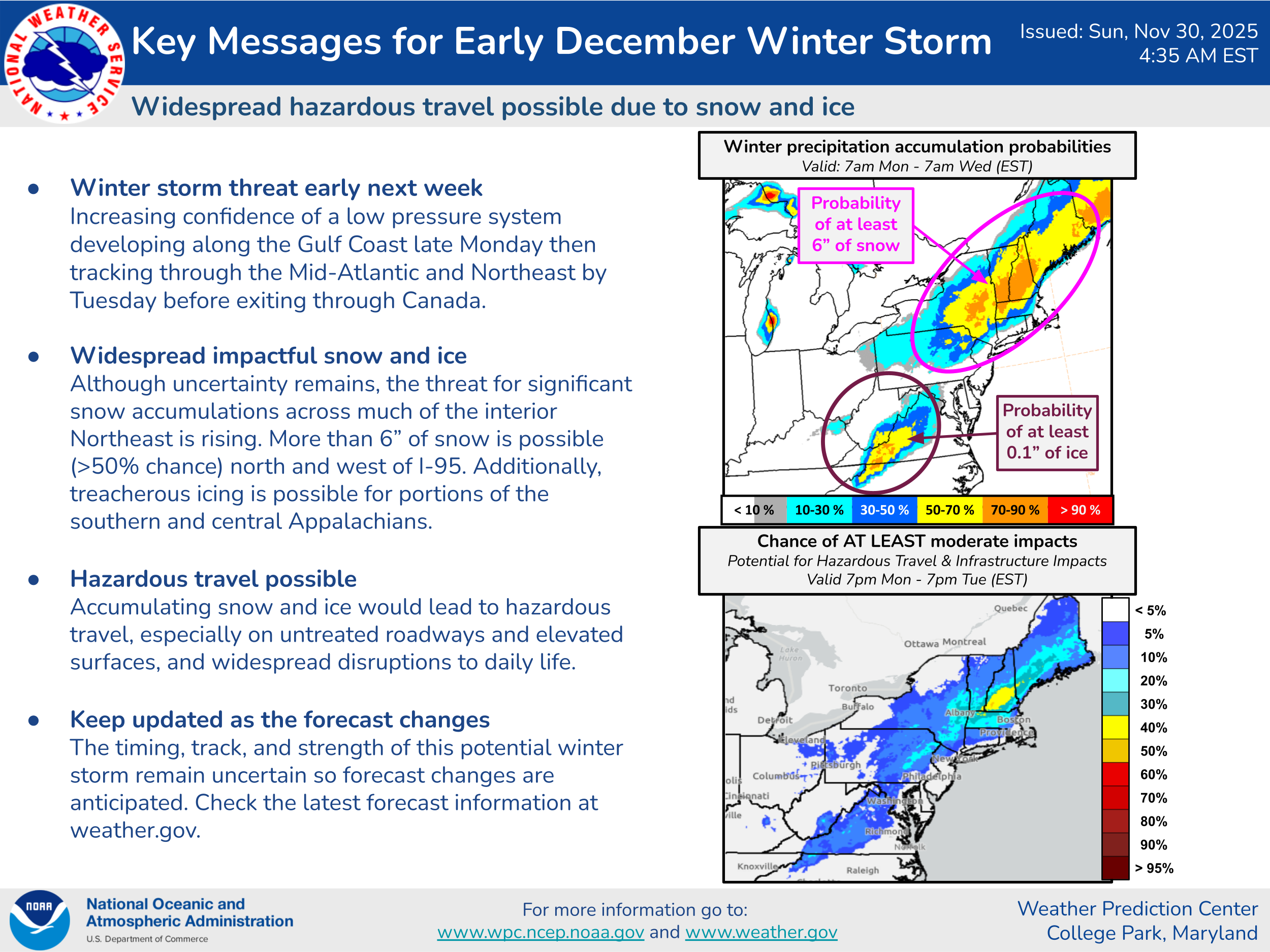
The upper level disturbance will enable a new surface low pressure center to develop farther south and move northeast across the Mid-Atlantic. This will produce a swath of heavy snow Tuesday across the inland Northeast to the west of the Interstate 95 corridor. Significant icing from freezing rain will be possible in the central Appalachians region.
Yet another winter storm looks possible for parts of the Midwest and East as we approach next weekend — more to come on this system. Meanwhile, the recent wet weather pattern in the Northwest looks to continue this week, while California will see the drier weather pattern of the last several days continue along with a warming trend.

Leave a comment