Meanwhile, final stats for autumn are coming in, showing many areas had record warmth
Dec 05, 2025
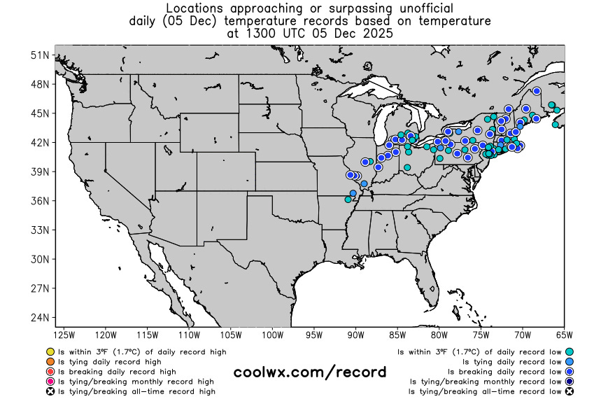
Happy Friday! The big weather story today is the record cold from the Mid-Mississippi Valley to the Northeast, as shown above in this morning’s graphic of sites near or breaking record low temperatures from Robert Hart’s CoolWx site. Record lows this morning include -3F at Fort Wayne, IN (previous -2F in 1964) and 20F at LaGuardia NYC (previous record 21F in 1942).
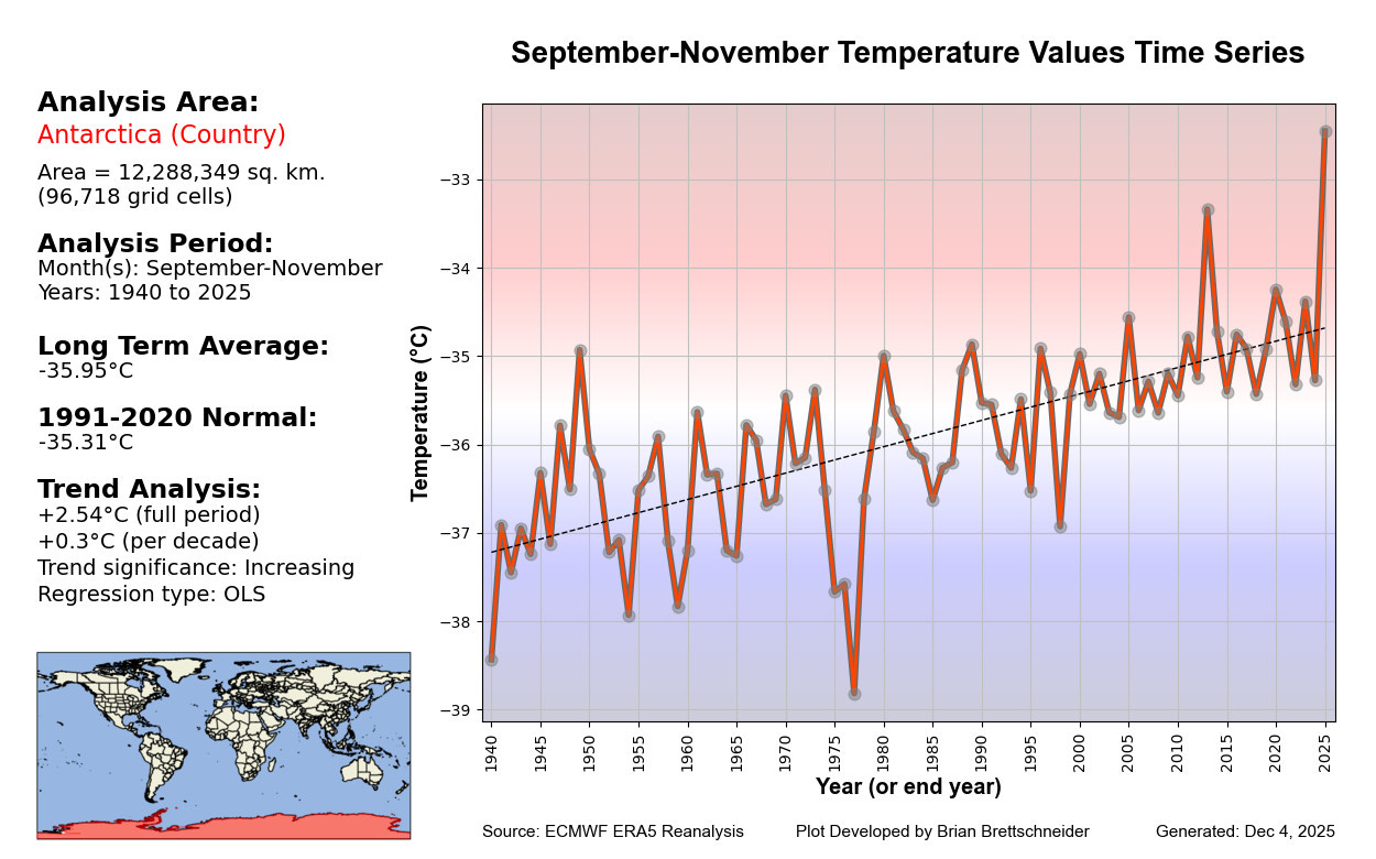
On the flip side of record cold, final statistics for the fall season are coming in, and Antarctica had its warmest autumn on record by a significant margin per climatologist Brian Brettschneider.

As did Canada. For the third year in a row. The combined US/Canada region had its warmest fall on record, as did the state of Texas. Europe also had its warmest fall on record per Brian, but it barely beat out 2013 for this mark. Brian is a great follow if you are interested in climate statistics (and moose pics) – you can find him on BlueSky at this link.
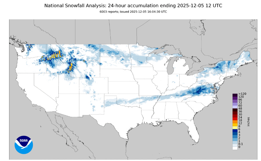
Coming back to today’s weather, as anticipated the storm system moving along the Gulf Coast was far enough south to only support light wintry precipitation along the very northern fringe of its precipitation shield over the last 24 hours from the Southern Plains to the Tennessee Valley, but as it got closer to the coast some heavier and more impactful winter precipitation evolved. Through 7 am ET this morning, snowfall amounts of up to 5” were reported in parts of the central Appalachians, with lighter amounts farther east to the coast. Some freezing rain and sleet occurred south of this area. Meanwhile, the parade of systems that has been impacting the west produced heavy snow over the Northern Intermountain region, and snow squalls occurred over the Northeast especially downwind of the Great Lakes.
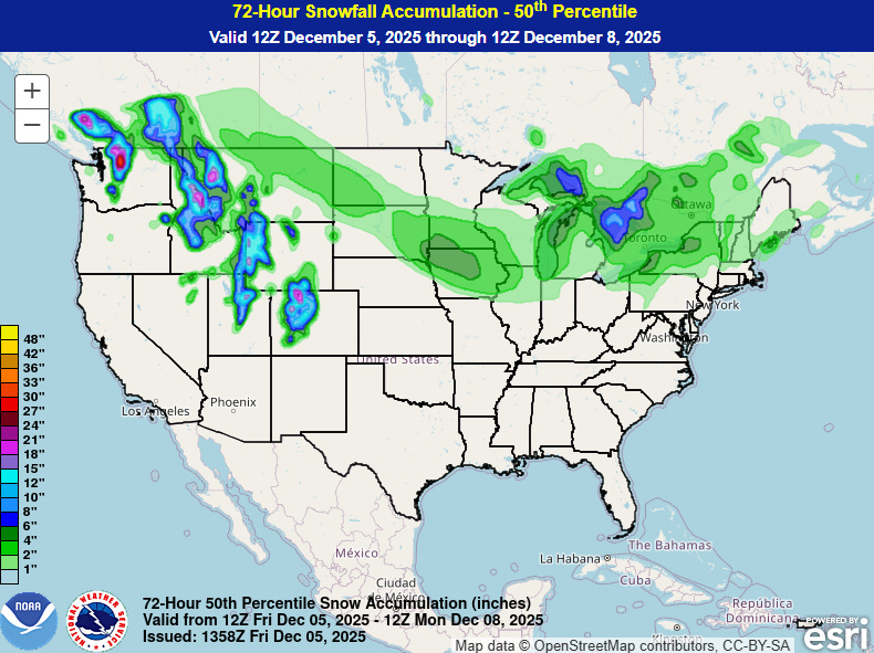
While temperatures will moderate a bit into this weekend, overall cold conditions are anticipated over much of the eastern half of the country (except peninsular Florida). Another storm system will produce light to moderate snow over the next few days in a swath from the northern Rockies to the lower Great Lakes, with the heaviest snow expected over parts of Iowa where winter storm watches are in effect for Saturday into Saturday night.
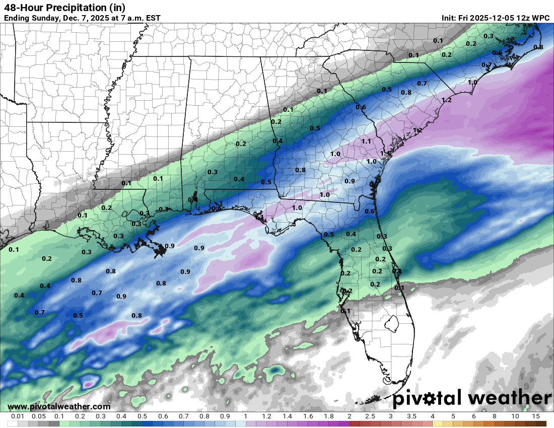
Over the Southeast, some much needed rainfall will occur along the Gulf and Atlantic coasts as a series of upper level weather disturbances move through the area.
Looking west, a large and unseasonably strong area of middle and upper atmospheric high pressure looks to be in the process of building east from the eastern Pacific across the West over the next week to 10 days. While storm systems will continue to rotate through the Northwest around this high pressure area and bring heavy precipitation to that region for the next several days, much of the area from central California and Nevada south will be continuing their trend toward warmer and drier weather for the foreseeable future. After a record wet mid-November period, much of this region has went completely dry over the last 2 weeks and that trend looks to continue for at least the next 7 to 10 days.

Leave a comment