And why the West will be so warm this week
Dec 08, 2025
The term “polar vortex” has become pretty ubiquitous in the mainstream media in recent years, and how they use the term varies but tends to focus more on the impacts, i.e., “Polar Vortex to bring cold and snow to the Northeast.” Polar vortex is a real meteorological term though, and it really has two different meanings as this nice webpage from the National Weather Service in Bismarck. There is a tropospheric (or lower atmosphere where we live) polar vortex that is a normal feature of the jet stream at high latitudes, and then there is the stratospheric (upper atmosphere) polar vortex that has a much more complicated but at times highly impactful influence on our weather.
In recent weeks, if you’ve heard about the “polar vortex” it is more likely that the reference is to the stratospheric version. You can read more detail about this at the NWS Bismarck page linked above and at this Climate.gov post, but in a nutshell, the stratospheric polar vortex is a cyclonic band of strong westerly winds that rotates around the North Pole. When an event called a “sudden stratospheric warming” (SSW) occurs, this vortex is disrupted which results in a corresponding disruption in the hemispheric weather pattern making cold air intrusions into the mid-latitudes more likely. However, this process is complex and generally not well handled by our standard weather models, so knowing where these resulting cold outbreaks will occur and when they will happen — it can take many weeks for the resulting arctic outbreaks to manifest — is challenging. The overall theme that meteorologists generally take away when a SSW event occurs is that there will be an increased probability of cold weather and arctic outbreaks over the next several weeks.
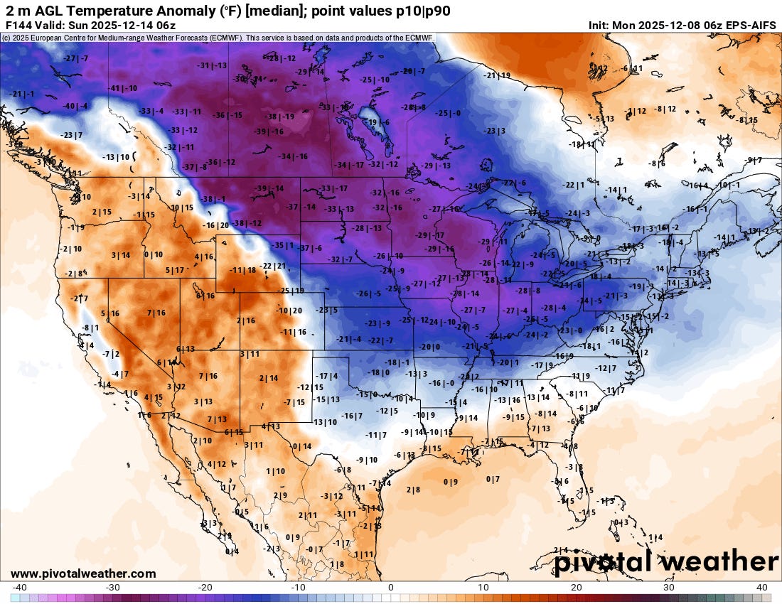
Unusually early stratospheric warming from late November into early December has likely played a role in the record cold and snowy start to the winter that we have seen over the Midwest. Another surge of arctic air looks poised to come down into the Northern Plains and Midwest by this weekend, with model forecasts (ECMWF AI ensemble forecast surface temp anomaly for Saturday night above) up to 30F below normal. While right now this cold surge does not look as record breaking as the event last week, there could still be some record cold temperatures especially in the Ohio Valley.
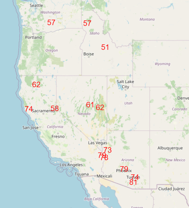
While the disruption in the polar vortex has helped bring the colder air to the east, upstream over the West, an unusually strong upper level area of high pressure will continue to build through the upcoming week, meaning unusual warmth. Record warm temperatures will become increasingly common across the region as the week goes on (forecast record highs for Friday shown above).

Unusual warmth and moisture will continue to feed heavy rainfall with abnormally high snow levels across the Northwest through the week as weather disturbances rotate around the upper level high over the Southwest (NWS Weather Prediction Center 5-day precipitation forecast above).
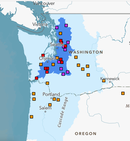
As we’ve been discussing, this will mean a significant risk of flooding across this region this week. This NOAA/NWS National Water Center 7-day flood outlook highlights western Washington for considerable flood risk (darker blue) with the potential for numerous river gages to go into moderate (red squares) and major (purple squares) flooding.

Elsewhere across the US today, a low pressure system moving across Florida will spread some light to moderate snowfall and mixed wintry precipitation along the northern part of its precipitation shield, with the heaviest snow expected in parts of Virginia. It will also produce some showers and a few thunderstorms farther south.

Leave a comment