The rest of the country is almost equally divided this weekend: unseasonably warm West, unseasonably cold East.
Dec 13, 2025
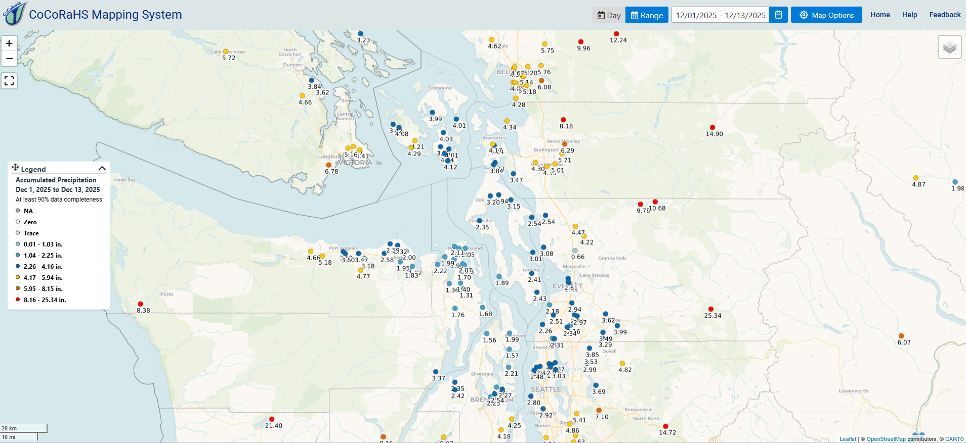
Starting off this morning with a quick recap of the flooding in Washington state. Rainfall totals just this week totaled 12-16” in parts of the Olympic and Cascade ranges, and as shown above in the map of volunteer CoCoRaHs gage reports for December, some locations have received 20-25” of rain already this month.
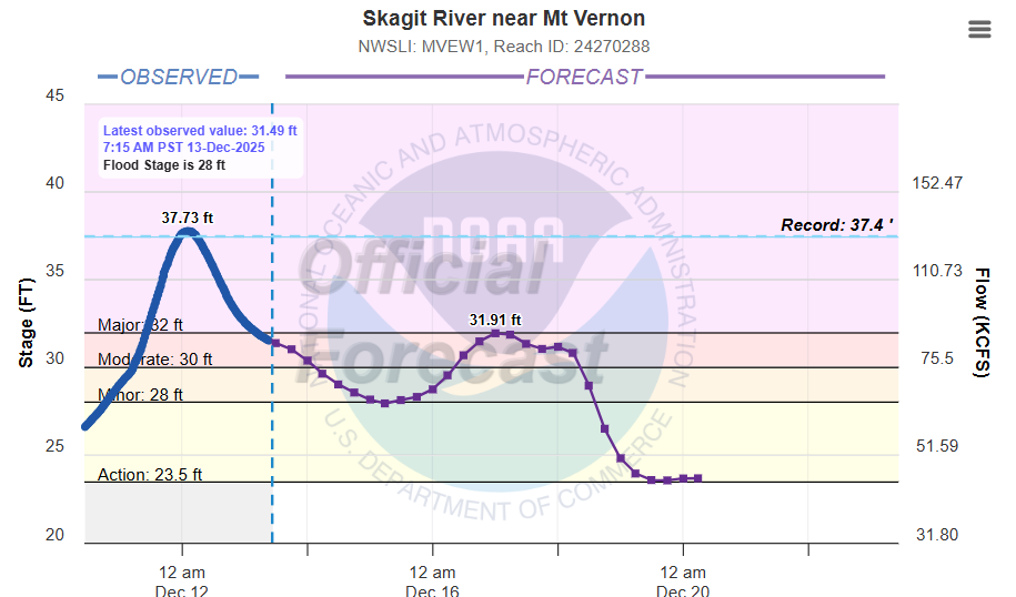
While the Skagit River north of Seattle did not reach the insane (5’ above previous record) levels forecast earlier in the week, it did set a new record around midnight Thursday night, still impressive for a gage site with more than 100 years of records. Numerous rivers in the Cascades north and east of Seattle set all-time records this week. Widespread, major damage has resulted from the flooding, along with numerous water rescues though amazingly no fatalities have yet been reported. President Trump signed a major disaster declaration for the flooding yesterday.
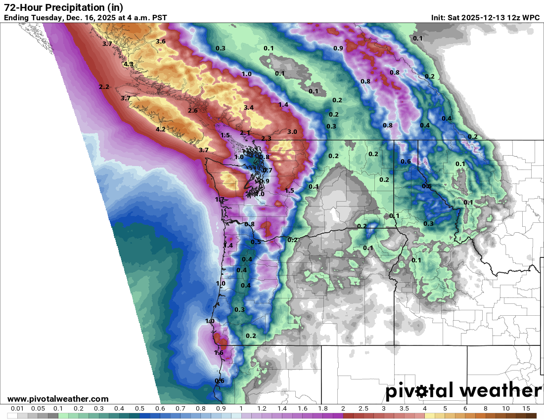
While rain has tapered off across the region, a new strong weather system with a moisture connection to the deep tropics southwest of Hawaii will impact western Washington later Sunday through Monday. Snow levels will remain high and additional flooding is anticipated — however as can be seen in the forecast for the Skagit above, right now the forecast rainfall amounts do not bring the rivers back to the major/record levels seen the last few days. Still, more flooding impacts are expected including increased risks for landslides and debris flows — and obviously rainfall forecasts will be monitored closely for any potential increases. Beyond Tuesday, somewhat colder air will move into western Washington, which will allow snow levels to fall to more normal levels and help reduce the flood risk even though waves of heavier precipitation will continue.
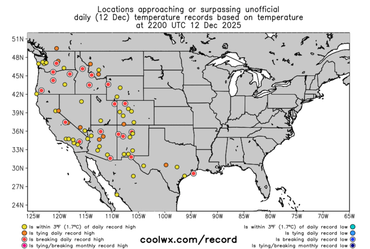
For much of the rest of the western United States, the unseasonably warm temperatures continue to be the major weather story, with numerous record high temperatures set again on Friday.
Something I want to mention while talking about western weather is that obviously weather in this part of the country is very dependent upon the complex terrain and local effects. While I try to cover weather in the region as best I can, I do not have the years of experience needed to really dive into some of these localized forecast issues. I strongly encourage you to follow local NWS offices and excellent western US focused meteorologists like Daniel Swain, Jan Null and Anthony Edwards for more in-depth info about this region.
Heading to the East, the big story is another shot of arctic air overspreading much of the country east of the Rockies. While this airmass will not be as record setting as earlier outbreaks this winter, a number of record cold maximum temperatures are expected Sunday in the Midwest where the core of the coldest air is anticipated.
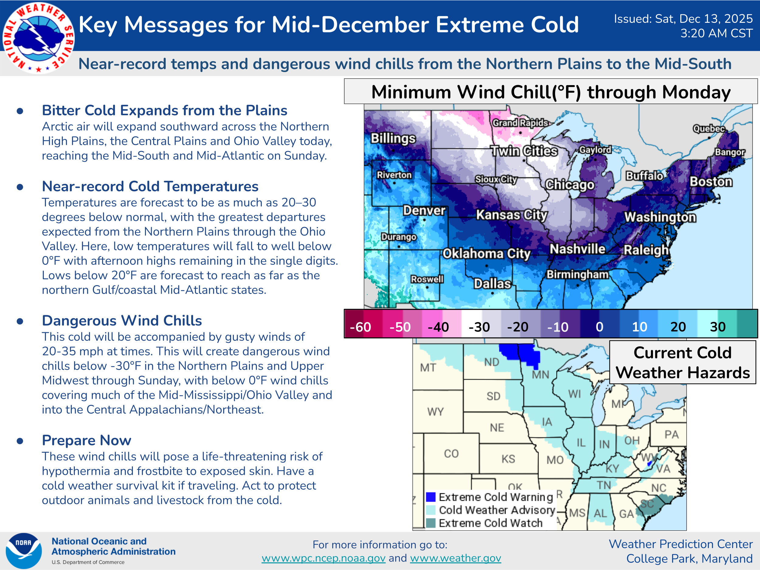
Below zero wind chill readings are expected over a large region of the Midwest, Northeast and Mid-Atlantic on Sunday, and cold weather advisories are in effect for most of the region from the Southeast to the Northern Plains.
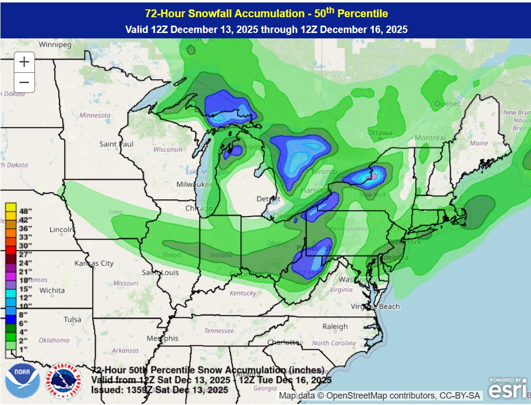
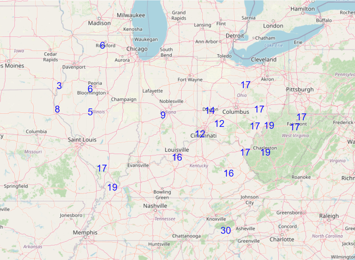
The storm system bringing this colder air south will spread a swath of snow across the Midwest and East this weekend, along with heavy lake effect snow bands as the arctic air sweeps in over the relatively warm Great Lakes.
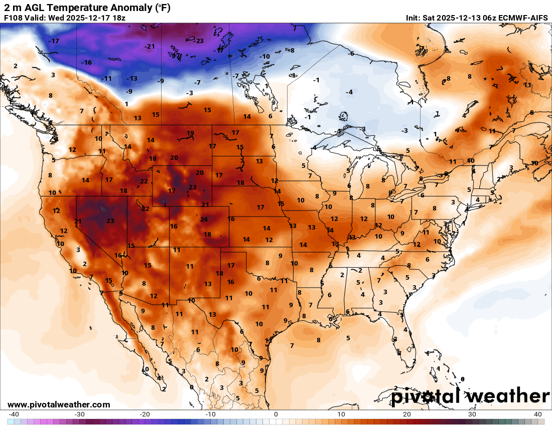
This latest shot of the cold weather and snow for the eastern half of the country looks short lived, as the warm air over the western United States will rapidly spread east early in the week, with above normal temperatures expected pretty much coast to coast by midweek (forecast temperature departure from normal for Wednesday from the European AI model shown above).

Leave a comment