And more flooding concerns for the Pacific Northwest
Dec 14, 2025
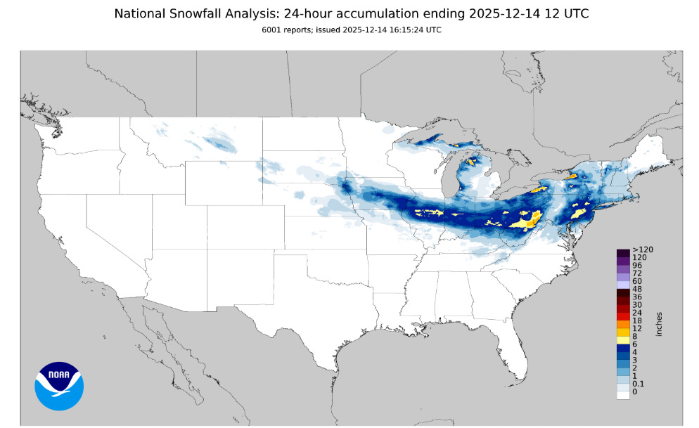
The first several weeks of this winter season have really been very dichotomous over the United States: the East has been unusually cold and snowy, while the West has pretty much been the exact opposite. The last 24 hours has epitomized that pattern, as another in a series of Alberta Clipper type storm systems spread a swath of moderate to heavy snow across the Midwest, and this time into parts of the Mid-Atlantic and Northeast.
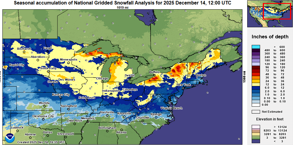
Looking at a seasonal snowfall analysis, much of the upper Midwest has already picked up more than a foot of snow this season, with parts of northern and central Iowa being the jackpot area (outside of lake effect snowbelt regions) with 2+ feet of snow so far.
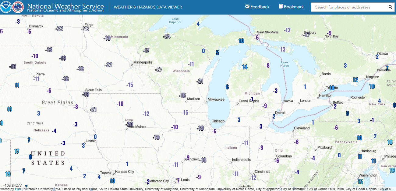
This storm system also ushered in another blast of arctic air with sub-zero wind chill readings over much of the Midwest and Great Lakes. Several record low temperatures look to have been set this morning, including at Cincinnati whose morning low of 0F tied a record low set in 1901.
A number of record low maximums are expected over the region today as temperatures struggle to reach the single digits and teens.
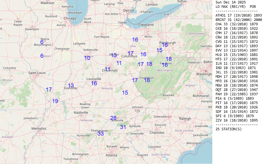
The cold air will overspread the Mid-Atlantic and Southeast as well, and some record lows are possible in this region Monday morning. Cold weather advisories are in effect all the way south to the central Gulf Coast and Florida Panhandle.
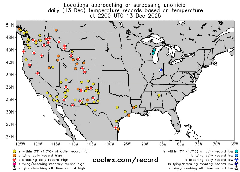
Meanwhile, the western half of the country saw yet another day in its unusually warm start to December, with a number of record highs set. Many locations in the Pacific Northwest including Seattle, Portland and Olympia have seen their warmest start to December on record (through yesterday), and many more locations in the West are seeing at least a top 10 warmest start to the month.
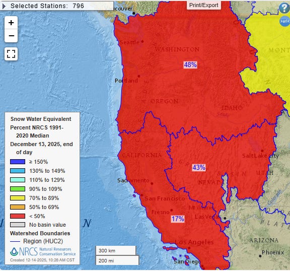
This warmth has meant that even with generally above normal precipitation, snow pack so far this season is well below normal across much of the west (current snow water equivalent compared to normal shown above). California in particular is well below normal as since the wet period in mid-November, precipitation has pretty much shut off and temperatures have been well above normal.
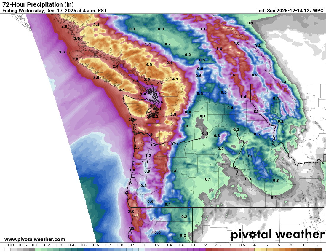
Another series of storm systems with moisture emanating from the tropics will impact the Pacific Northwest over the next 72 hours, with the heaviest precipitation once again in the Cascade and Olympic ranges of northwest Washington. While this rainfall still does not look as heavy as last week’s, with snow levels again quite high — especially during the first half of this event — significant flooding impacts are possible, including potential landslides and debris flows.
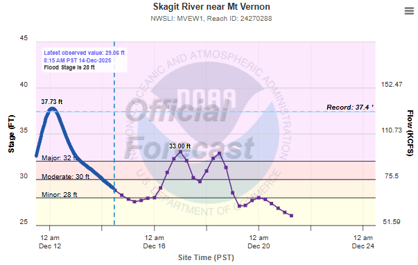
The Skagit River north of Seattle is now forecast to again go into major flood stage by the middle of the week due to this next wave of heavy precipitation, and NWS Seattle has indicated that the lower Snoqualmie could also return to major flood stage.
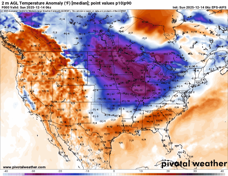
As we go through the next 2 weeks leading to Christmas, medium and long range ensemble model forecasts (European AI model 15-day loop of temperature anomaly shown above) suggest that the unseasonable warmth we have been seeing in the West will expand to encompass much of the country. The upper Midwest, Great Lakes and Northeast will likely remain vulnerable to occasional shots of arctic air from western Canada, with one in particular forecast again for late this week. Overall, though, the trend certainly seems to be toward a warmer pattern for much of the country heading into Christmas. This upcoming week will again see numerous record warm temperatures — both record highs and record warm minimums — across the western United States, with the potential for records gradually expanding east as the week progresses.

Leave a comment