Strong winds, flooding, mountain snow and some severe thunderstorms impacting state. Unseasonable warmth continues for much of the rest of the country into Christmas.
Dec 24, 2025
Happy Christmas Eve! Our focus today continues to be on the high impact weather in California and adjoining areas, and the unseasonable warmth dominating much of the rest of the nation.
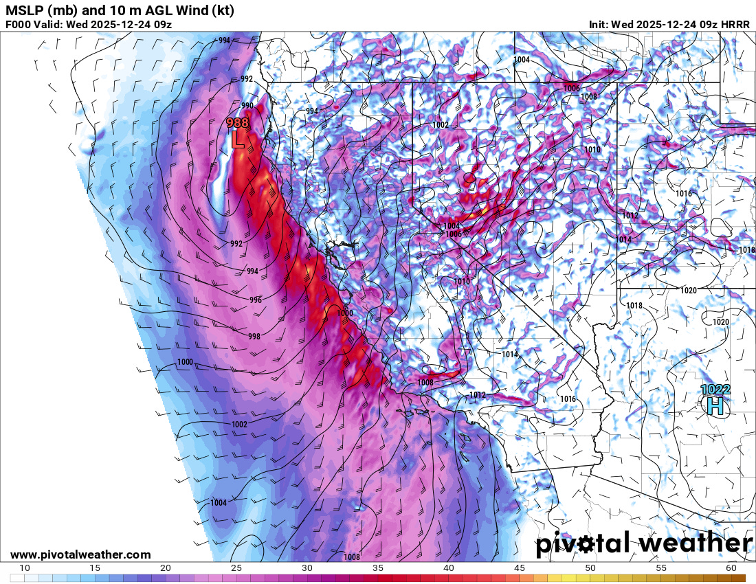
I posted a note last night about how the evening high resolution models had trended a bit stronger with the surface low pressure system moving toward the California coast last night. The models over the last several days have struggled with the forecast for this low, showing varying levels of intensification. For example, a few days ago the European suite of models had shown a stronger surface low and then backed off, while the American (GFS) models showed the opposite trend, and by yesterday’s forecasts it was much stronger than the other models. The above initial surface analysis from the 0900 UTC (1 am PT) High Resolution Rapid Refresh (HRRR) shows that the low bottomed out at 988 mb (29.18 inHg), stronger than what some models were showing but not as intense as the stronger GFS forecast from yesterday (and not quite as strong as the evening HRRR I posted last night).
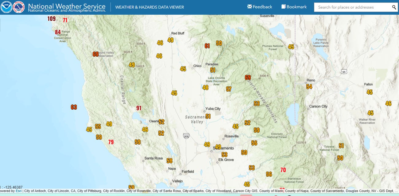
Regardless of the exact intensity, the well organized and rather intense low produced strong winds in northern California overnight, with a maximum gust of 109 mph reported at an elevation of ~1000’ MSL just southwest of Eureka. PowerOutage.us shows that nearly 150K customers are without power across northern California this morning.
Meanwhile, as my colleague Daniel Swain posted on BlueSky, a narrow band of convection has developed along the cold front in southern California. It has produced severe wind gusts and heavy rainfall as it progresses east across the region, resulting in the NWS issuing severe thunderstorm warnings for the area.
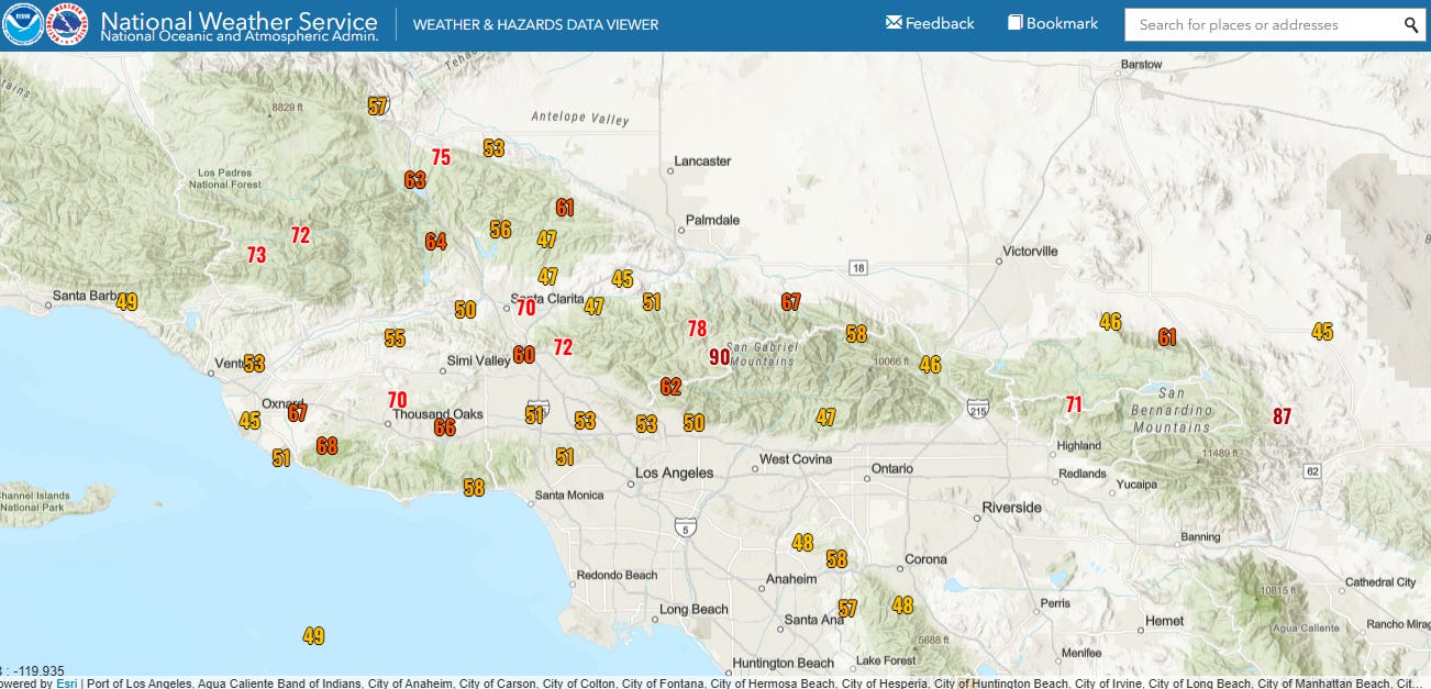
Numerous measured severe wind gusts have been recorded across Ventura County, including a 66 mph gust as the Camarillo Airport official observation site and an 82 mph gust at a Southern California Edison observation site near Thousand Oaks.
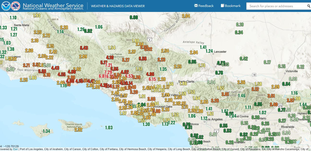
This band of showers and occasional thunderstorms is a part of the anticipated dramatic increase in rainfall that occurred across southern California overnight. Rainfall has been very heavy in the higher terrain, with numerous locations in Ventura and eastern Santa Barbara counties reporting in excess of 4” of rain in the last 12 hours, with maximum amounts of 7-8” in western Ventura county. Rainfall rates of up 1.25” per hour have been occurring with the heaviest showers, and flash flood impacts seem to be increasing across the region, with recent reports of mudslides and urban flooding in Los Angeles County, including nearly all lanes of Interstate 5 northwest of Burbank flooded.
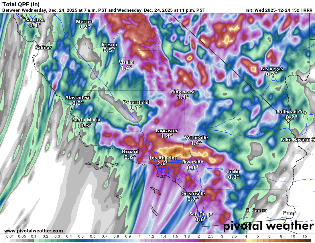
Moderate to heavy rainfall will continue across southern California through this evening, with the most recent run of the HRRR model initialized at 1500 UTC (7 am PT) shows that the heaviest rainfall will be focused in the eastern half of the LA metro area as the cold front and associated band of moisture slows its eastward progression. Maximum amounts of up 10 additional inches are forecast by the model in the San Gabriel Mountains northeast of Los Angeles. Needless to say significant urban and flash flooding continue to be anticipated across this region through this evening.
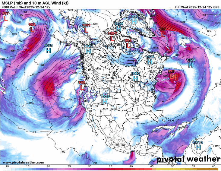
A break in the heaviest rainfall across southern California is expected later this evening, and attention will turn to the next low pressure system forecast to impact the West Coast later tonight and into Christmas morning. The models have been struggling with the forecast for this low as well, but the overall trend (most recent GFS model shown for illustrative purposes) has been for an intensifying low to slowly meander off the northern California and Oregon coast before beginning to weaken later on Christmas.

This low pressure center will bring another wave of moderate to heavy precipitation to much of California on Christmas Day. This system will not have as strong of a connection to tropical moisture as today’s system, hence it is not expected to produce quite as heavy of rainfall as today.
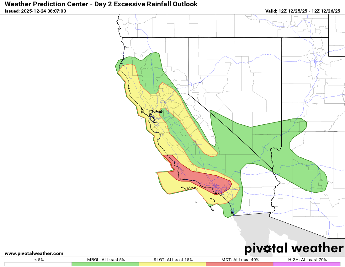
However, given the very wet conditions and high rivers from the recent rainfall, it will not take as much rainfall to exacerbate ongoing flooding or produce new flooding. A moderate (level 3 of 4) risk of excessive rainfall and flash flooding is in place for a large part of southern California including much of the LA basin, while a large slight (level 2 of 4) risk extends into northern California including the Bay Area.
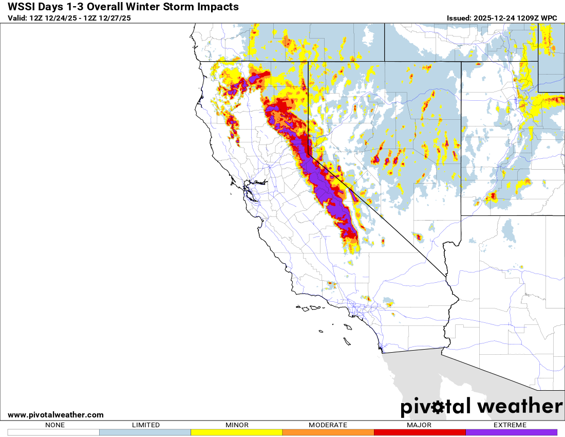
This system will also be cold enough to lower snow levels down to the 4000-5000 foot range, resulting in very heavy snow (multiple feet) at higher elevations of the Sierra Nevada and coastal ranges. Travel will become difficult or impossible across the mountains.
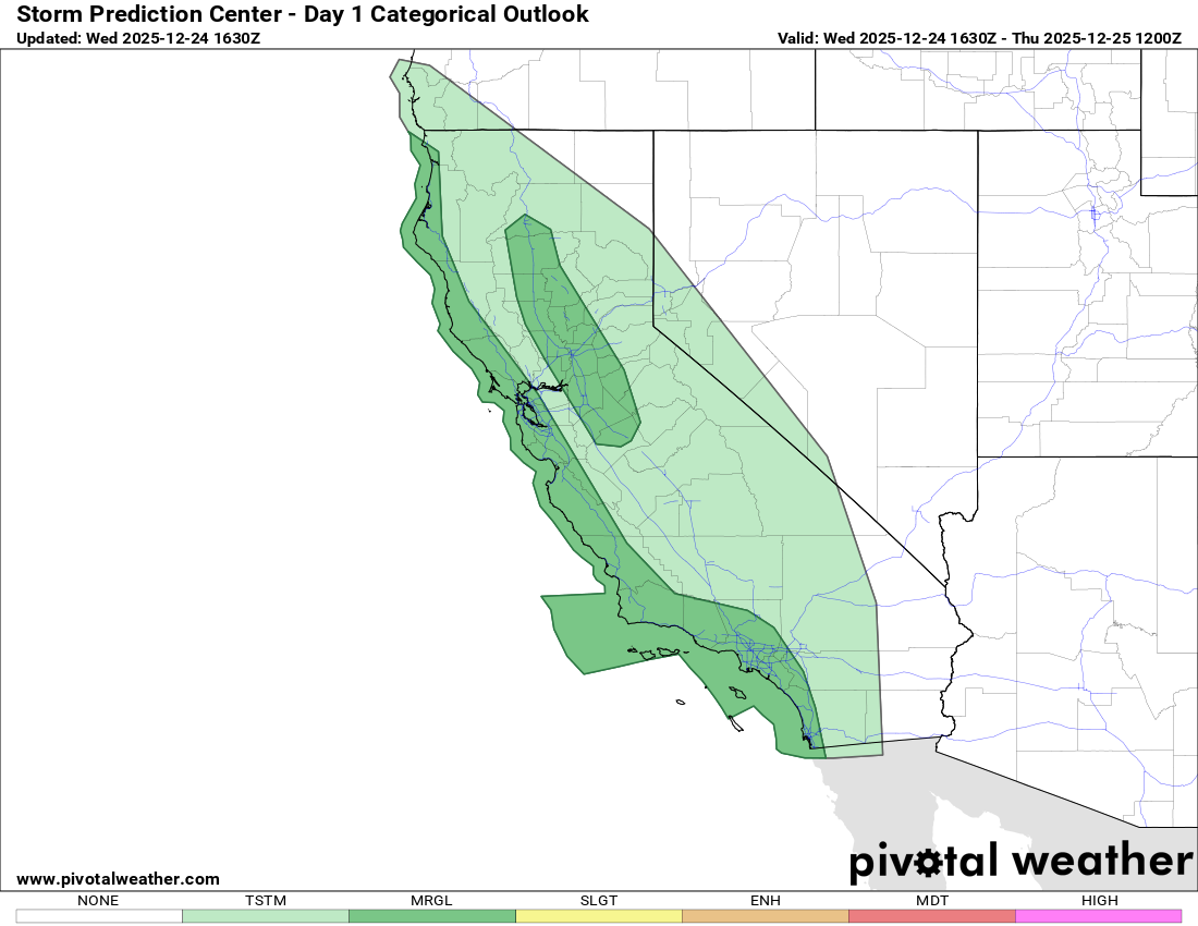
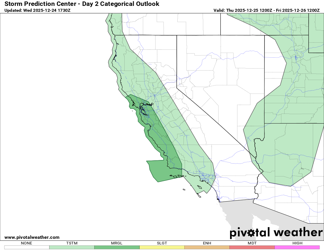
Finally, a few severe thunderstorms will continue to be possible across parts of California the next 48 hours as shown above in the outlooks from the Storm Prediction Center for today and tonight (top) and Christmas Day/Night (bottom). Damaging wind gusts and a few brief tornadoes are the main threats.
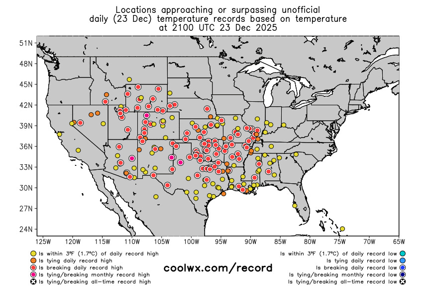
Turning now to the warmth — dozens of record warm temperatures were broken again on Tuesday with record highs shown above. With a high of 84F, Lubbock would have set a new all-time December record maximum temperature, except a new record of 85F was set on Monday. Phoenix set a new record high with 80F, and it was the third consecutive day with highs at 80F or above. As pointed out by Don Sutherland on BlueSky, this set a record for the latest 3-day stretch of 80F at Phoenix, breaking a record set just last year. The low this morning at Phoenix of 63F would set a new all-time record warm minimum for December if it holds as the low for the day.
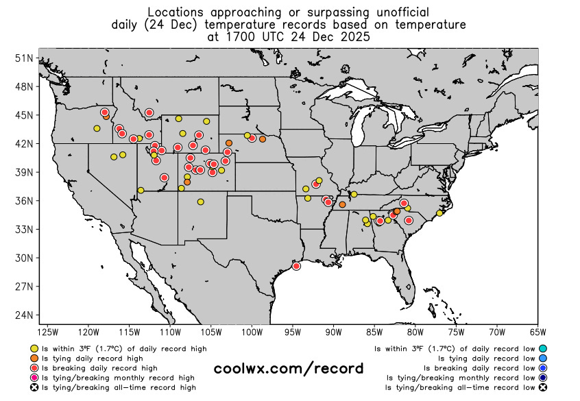
The Coolwx.com real-time record graphic shows that a number of locations have already reached daily record high temperatures during the late morning to midday hours today. Dozens of record warm temperatures are expected for the next several days across much of the country.
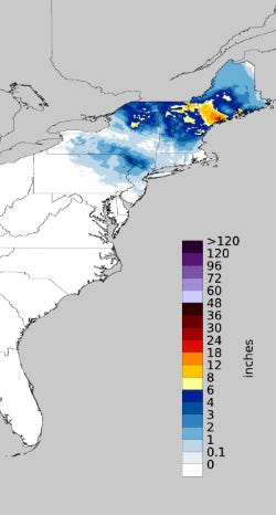
The Northeast continues to be the lone holdout on this warmer weather, and wintry precipitation impacted the region in the last 24 hours, particularly north and northwest of the major metro areas. A trough of low pressure focused heavy snow in parts of Maine, with more than a foot in areas northeast of Portland.
The Northeast will warm up briefly ahead of the next cold front that will move across the eastern half of the country early next week, bringing a return to more winter like temperatures to much of this part of the country.

Leave a comment