Salt Lake City sees three warmest December mornings on record. Northeast the lone holdout to warmth, with some snow expected later on Friday.
Dec 25, 2025
Merry Christmas! Here is a quick holiday weather update.
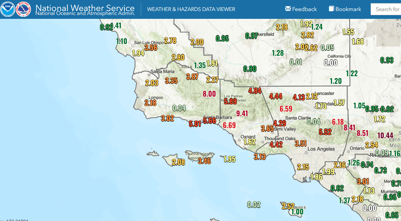
Southern California was inundated with heavy rainfall on Christmas Eve. As expected, the highest amounts were in the foothills and mountains north of Los Angeles, with widespread amounts of 5-9” and isolated amounts over 10”. Flooding impacts were extensive across the region, with the most severe impacts appearing to be in the San Bernardino Mountains where severe flash flooding and mudslides impacted areas around Wrightwood north of Ontario, resulting in the need for people to be rescued by helicopters.
The next low pressure system brought bands of strong to severe thunderstorms to the Bay Area overnight, resulting in flash flooding and high winds. San Francisco International Airport reported a wind gust of 73 mph, and as of 11 am CT PowerOutage.us shows that nearly 140K customers are without power in northern and central California. Much more detail about the impacts from the dangerous weather across California can be found in this article from Andrew Freedman at CNN.
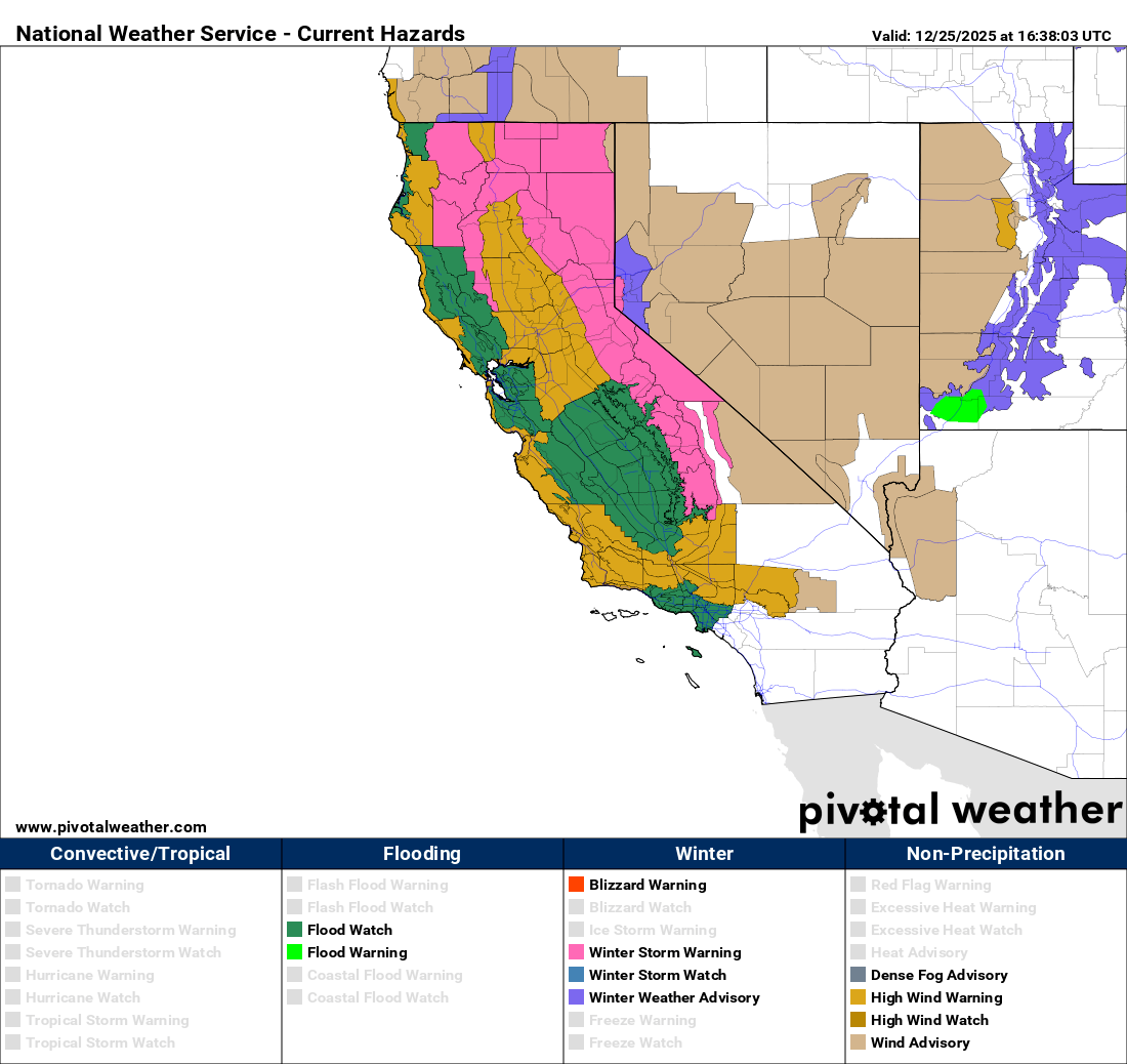
High impact weather will continue across the state today, with very heavy snow in the mountains above about 4000’, strong wind gusts (which will also impact parts of the Pacific Northwest and Great Basin), and flash flooding. Multiple watches, warnings and advisories are in effect as shown above.
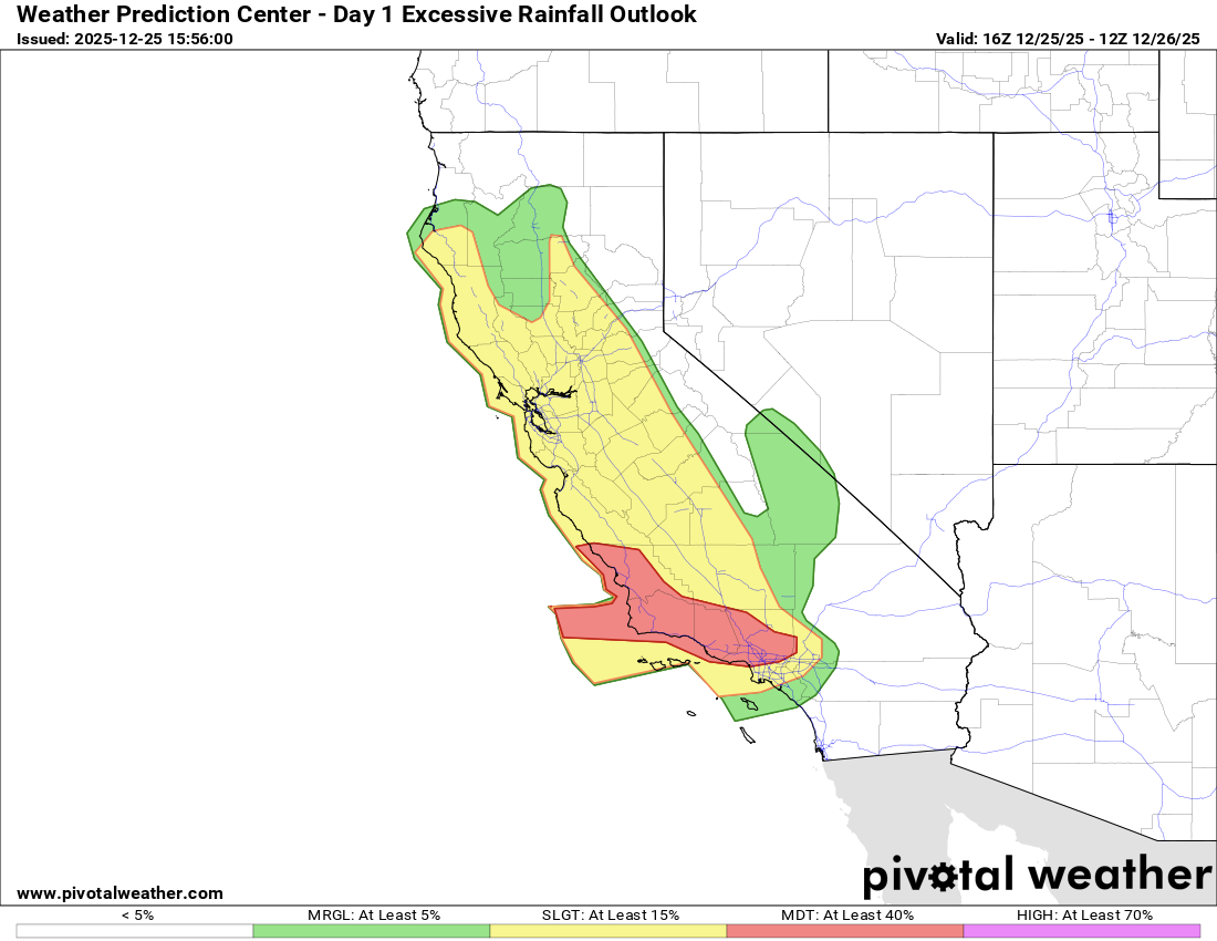
While rainfall will not be as heavy as yesterday, rivers are high and ground conditions are very wet from the earlier rainfall. Heavy rainfall from showers and thunderstorms moving across the state will runoff quickly and potentially cause additional flash flooding or exacerbate ongoing flooding. The greatest risk of flash flooding will continue to be across the higher elevations of southern California that saw the heaviest rainfall yesterday.
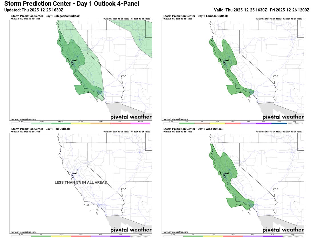
A few more severe thunderstorms with damaging winds and brief tornadoes are also possible as shown in the outlook from the Storm Prediction Center.
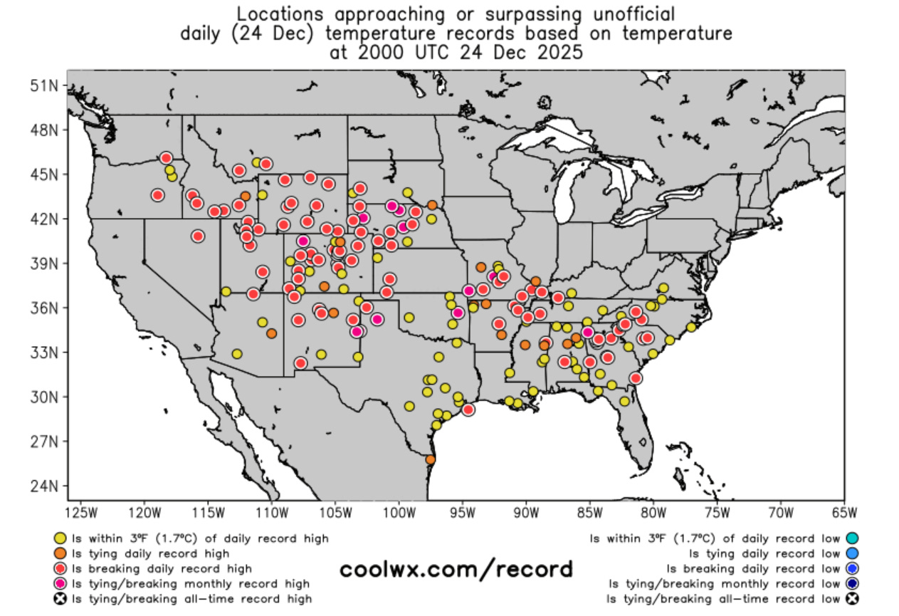
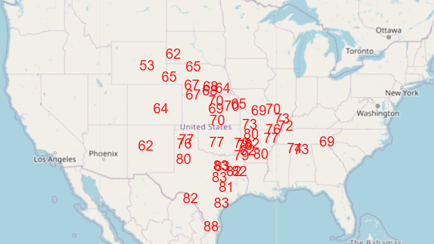
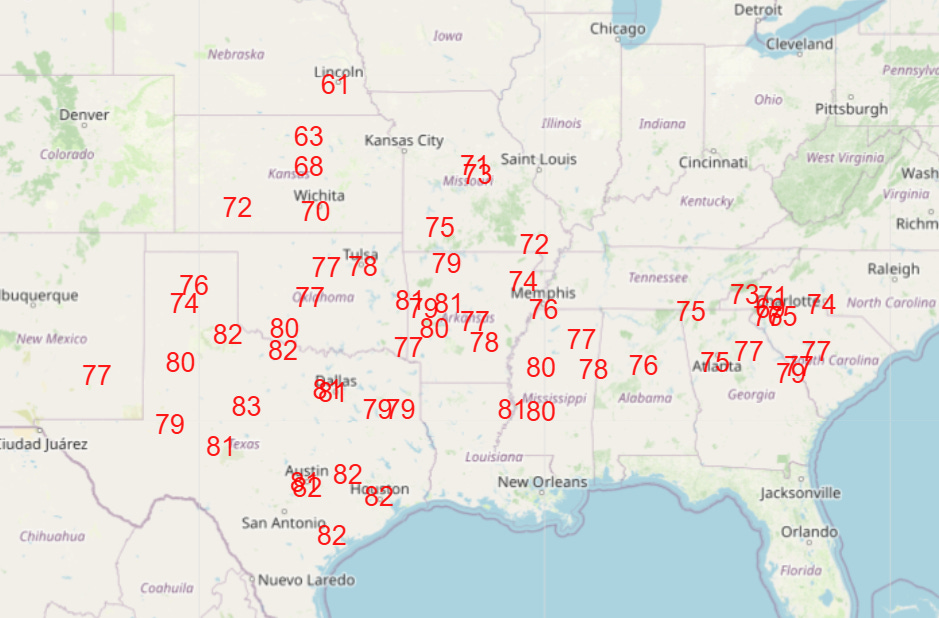
Much of the rest of the country experienced record warmth on Christmas Eve, with record high temperatures from coast to coast as shown in the map from coolwx.com above. Amazingly for late December, several monthly records were set again (the magenta dots above). Sites setting new monthly records included Amarillo (84F), Joplin MO (77F) and North Platte NE (78F). Phoenix set an all-time December record warm minimum temperature with a low of 63F.
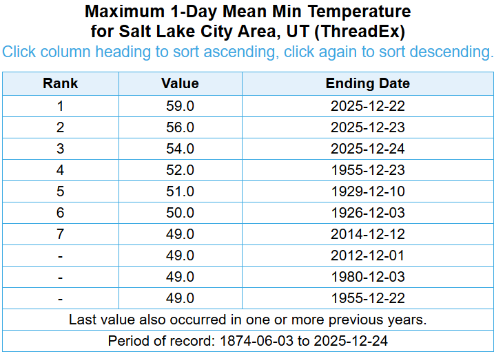
Salt Lake City has climate records back to 1874 — and incredibly the three warmest December mornings observed there were the last three mornings. The low of 59F on Monday was 7F warmer than any prior December morning — and as I discussed Tuesday, was 2 degrees warmer than the daily record high temperature.
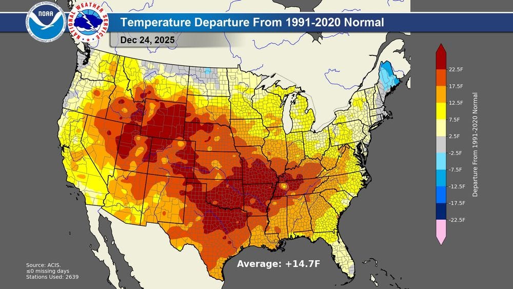
Climatologist Brian Brettschneider posted this image on BlueSky that the average national temperature for Christmas Eve was nearly 15F above normal.
While somewhat cooler air will start to spread into the western United States, record warmth will continue across much of the central and southeastern United States through the weekend (NWS forecast record high temperature maps above for today, Friday, and Saturday).
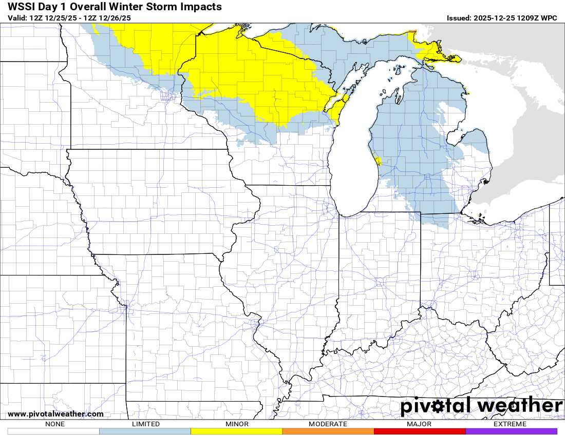
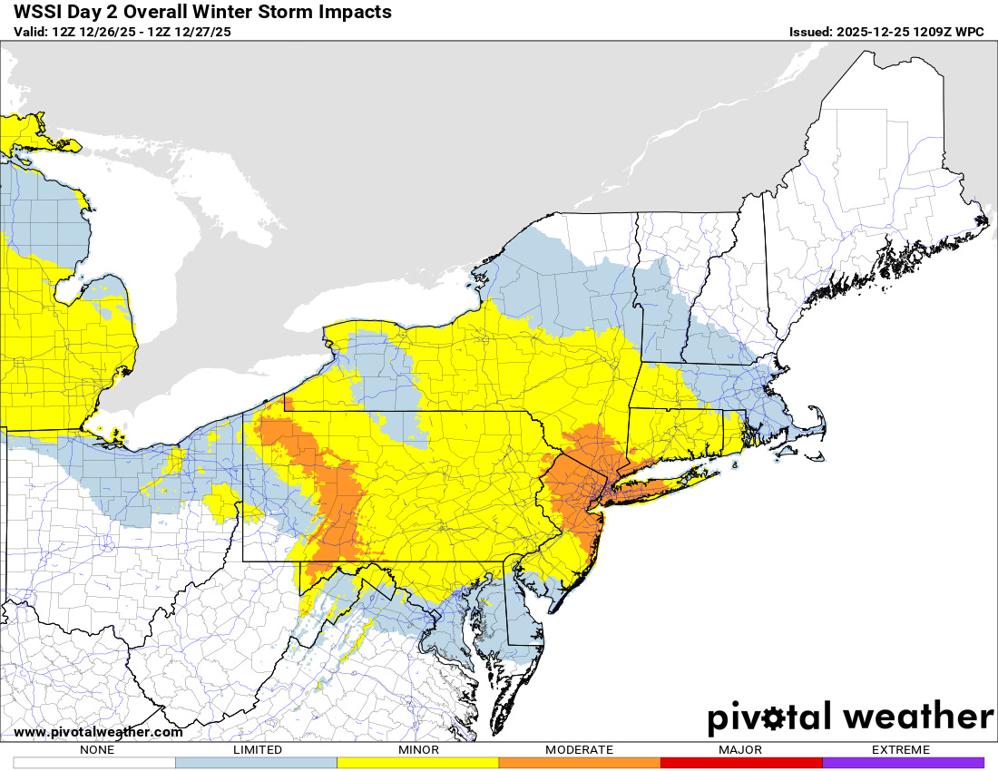
The Northeast and parts of the Upper Midwest are the one part of the country not experiencing the unseasonable warmth, and a southeast moving low pressure system will spread wintry precipitation across this region the next couple of days, with some moderate to heavy snow expected later on Friday in parts of the Northeast, including areas around New York City and parts of southern New England.
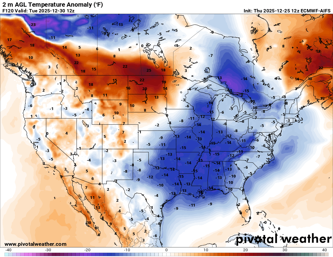
A cold front is still expected to bring colder air to the eastern half of the country early next week.

Leave a comment