Northeast remains the lone holdout and will experience a decent winter storm the next 36 hours.
Dec 26, 2025
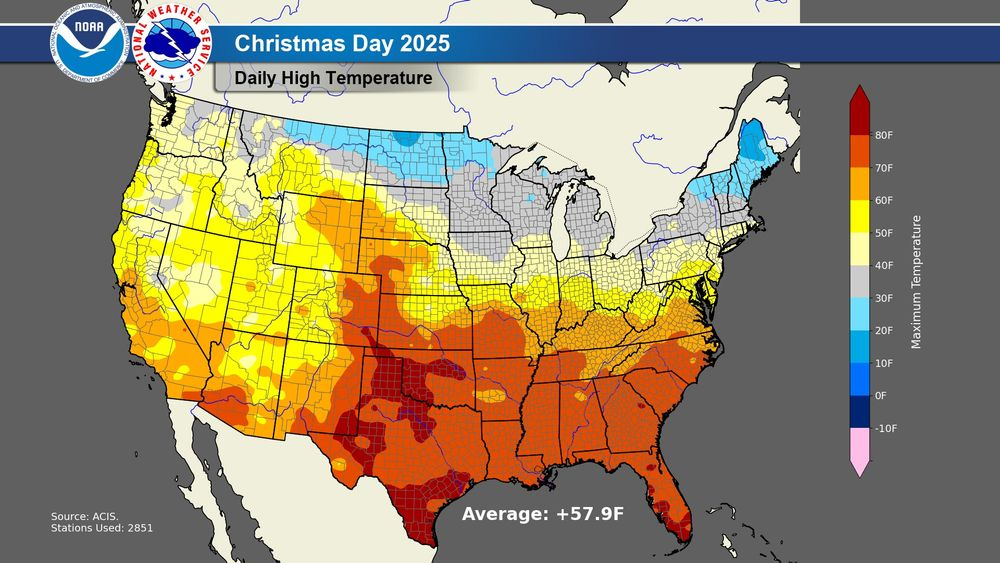
Happy Boxing Day! There’s only one way to start the newsletter today — with the incredible warmth that dominated Christmas Day. Climatologist Brian Brettschneider posted on BlueSky the incredible summary — Christmas Day 2025 was by far the warmest Christmas Day for the contiguous United States on record. He calculated the average national high temperature (shown above) as 57.9F and the average national low temperature as 36.6F. Both of these were a full 3F above the previous records for warmest Christmas Day temperatures.
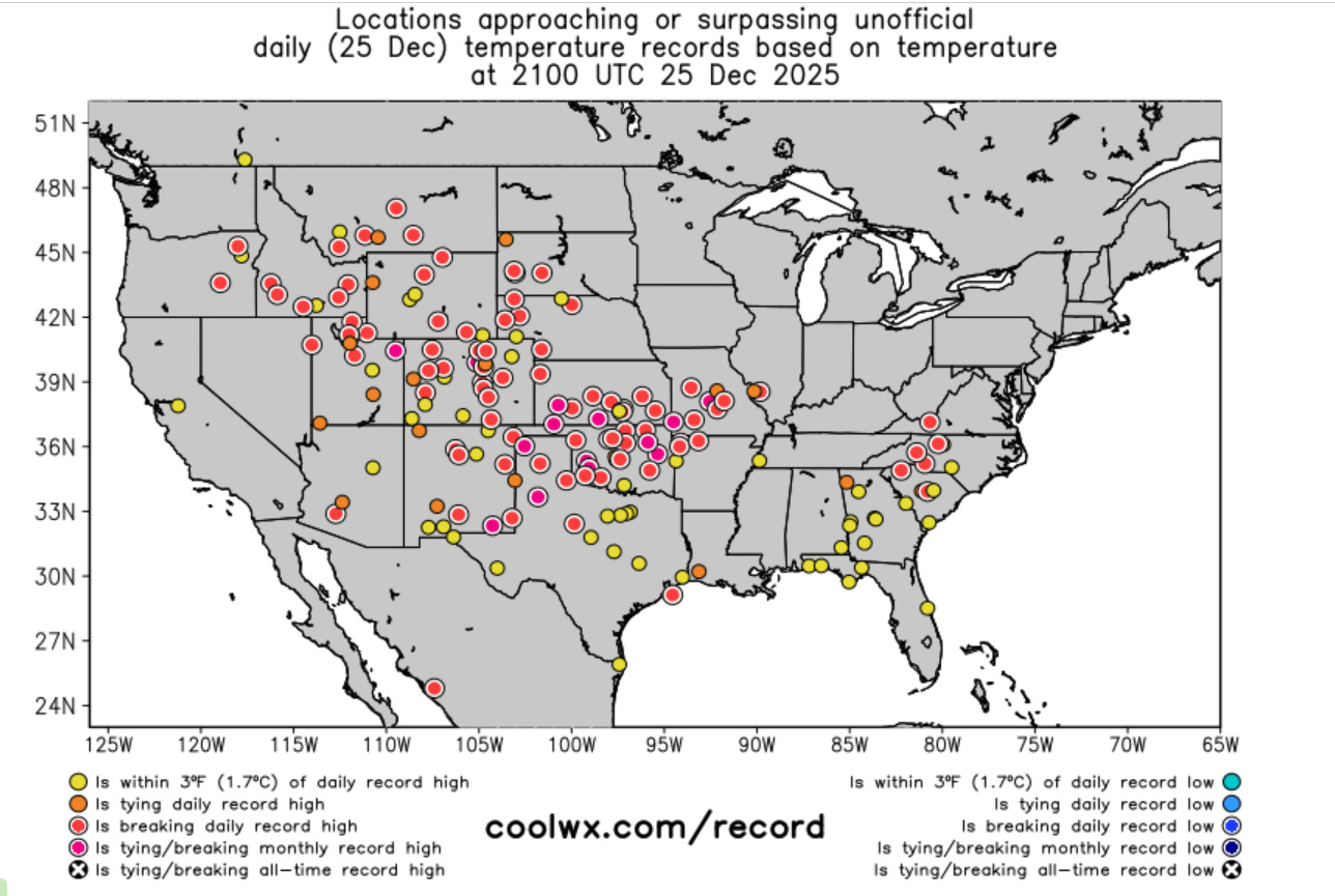
Breaking a national daily record by 3F is truly insane. Needless to say, dozens of record warm temperatures — both maximums and minimums — were broken across the country to enable such a record to occur. Once again, some of the records were all-time December records, and in some cases by serious margins — and of course, this was the culmination of a week of unseasonable warmth that has also seen a number of locations set records over multiple days. A few of the more impressive locations to highlight:
- Lubbock set a December monthly high temperature of 86F today, breaking the previous Christmas Day record by 10 degrees. This high temperature was 32 degrees above the normal high of 56F. The top 3 warmest December high temperatures in Lubbock (records back to 1911) occurred in the last 4 days.
- Phoenix had its two warmest mornings on record on Christmas Eve and Christmas Day, with lows of 63F and 62F, respectively.
- Joplin, MO set a December monthly record for the second consecutive day with a high of 79F. This broke the record of 77F set on Christmas Eve, and broke the prior monthly record set on December 15 2021 by 3F. Joplin’s records go back to 1902.
- As I have discussed, Salt Lake City has climate records back to 1874 — and incredibly the three warmest December mornings observed there were the last three mornings. The low of 59F on Monday was 7F warmer than any prior December morning and 2 degrees warmer than the daily record high temperature. The low on Christmas Day of 51F tied for the fifth warmest December morning on record (and of course, set a daily record warmest minimum).
- Casper, WY set a daily record high temperature for the fifth consecutive day with a high of 61F. As posted by Don Sutherland, this also resulted in Casper setting a December record of six days of highs in the 60s.
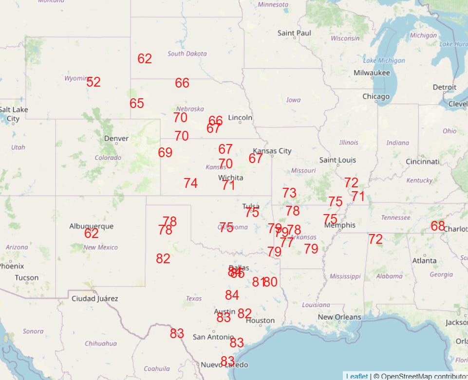
Today is going to be another day of widespread record warmth, and the warmth will continue into the weekend. A weakening in the upper level high pressure system responsible for the days of warmth will finally allow a cold front to move into the central and eastern US by early next week, bringing colder, more winterlike temperatures to much of the eastern half of the nation for next week.
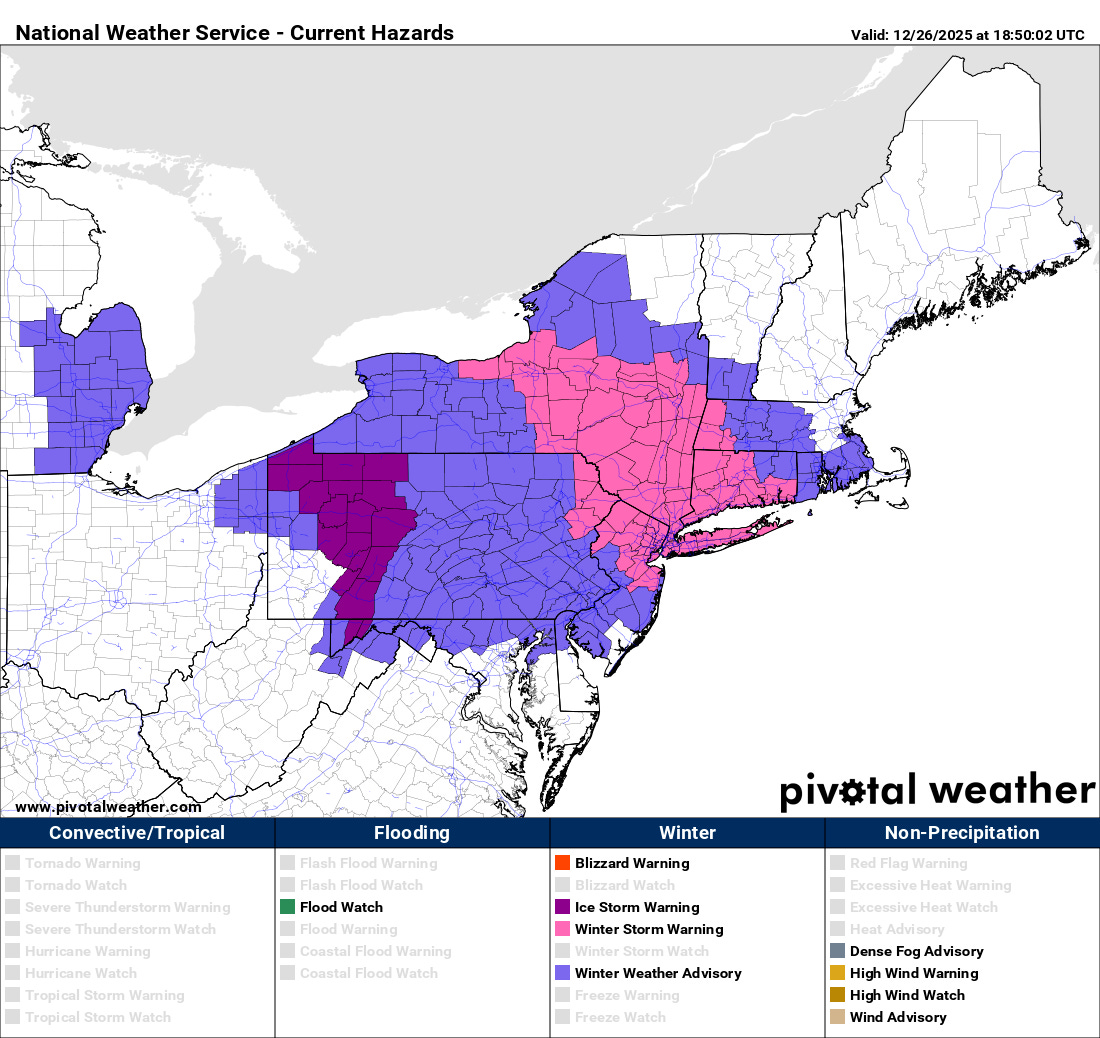
The Northeast is the one part of the country that has not been fully participating in this unseasonable warmth, and a storm system moving southeast across the region is bringing significant winter weather impacts to the region over the next 24 to 36 hours. Moderate to heavy snow will be the main hazard in the eastern part of the area highlighted above, with snowfall of up to 8” in the winter storm warning area. Mixed freezing rain and sleet will result in a more icy situation in the western part of the impacted area, with ice storm warnings for a quarter of an inch of ice accumulation in place for parts of western Pennsylvania and Maryland.
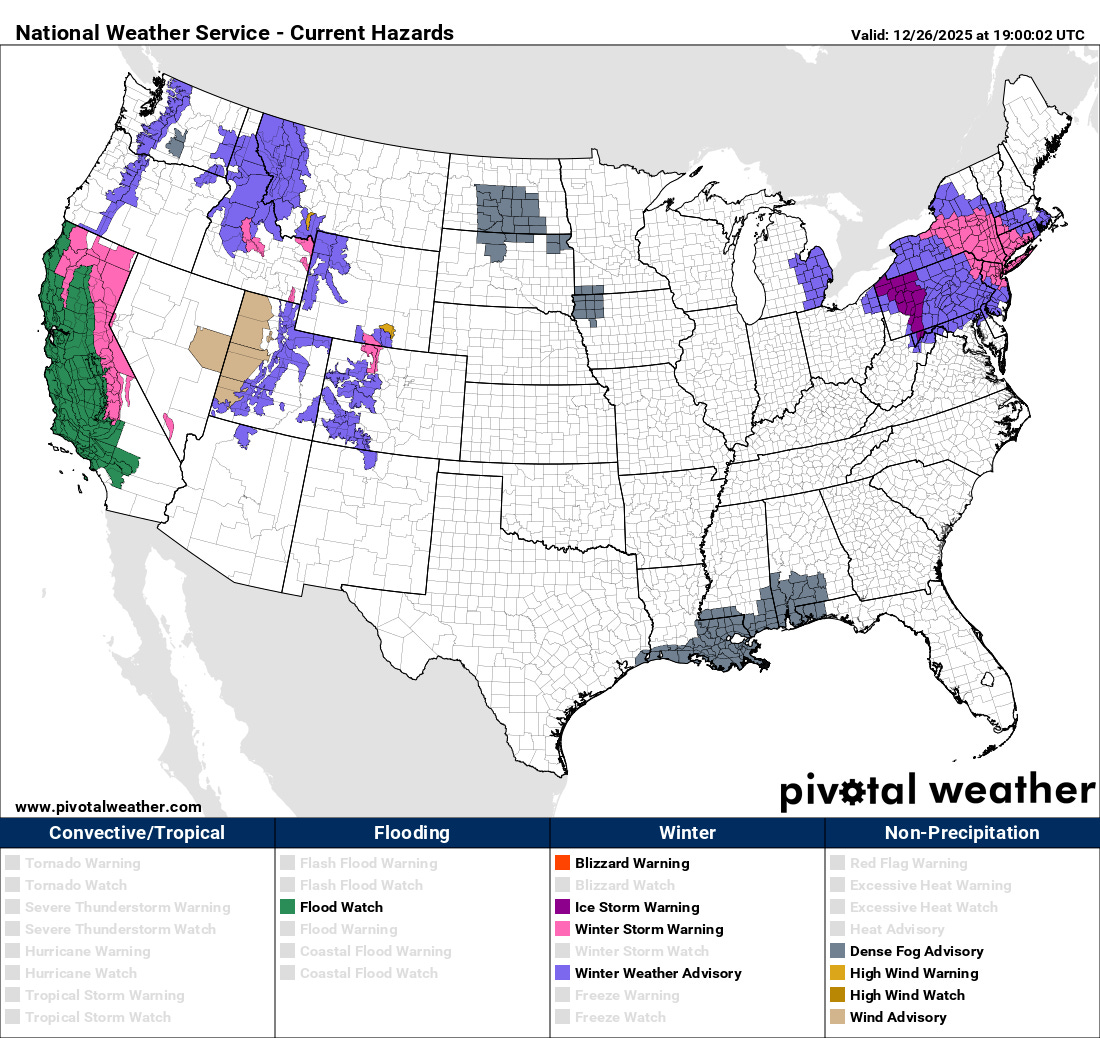
Meanwhile, impact weather continues in the West. Winter storm warnings continue in effect for the Sierra Nevada where very heavy snow will cause difficult if not impossible travel conditions, and heavy snow will also spread east to other higher elevations of the Intermountain West.
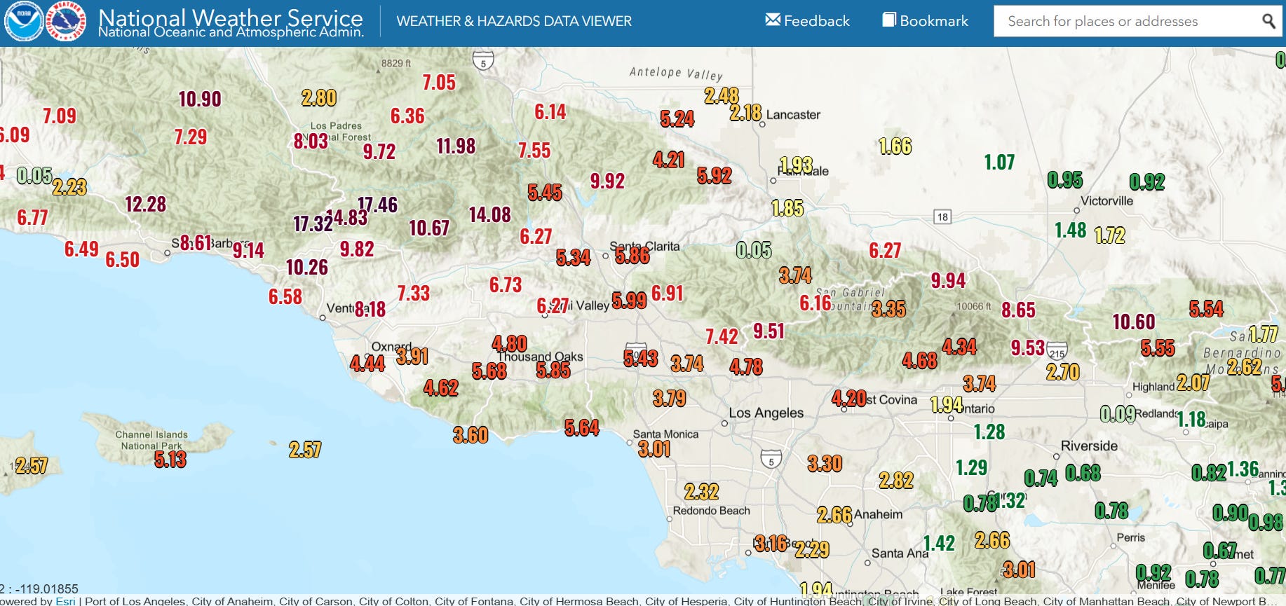
Flash flooding has been an issue in many parts of California the last several days, but today will focus primarily in southern California which has been inundated with heavy rainfall the last few days. Many locations in the higher elevations just north of Los Angeles have seen more than 10” of rain since the precipitation started late Tuesday (72 hour rainfall shown above), with some locations in the mountains north of Ventura receiving more than 17”.
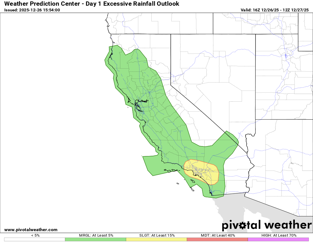
Bands of heavy rain showers will continue to bring some risk of flash flooding to this region today, with a a more isolated threat across much of the rest of California. The weather should finally begin quieting down over the western United States this weekend.

Leave a comment