Much of the country is dealing with drought and recent below normal precipitation
Dec 30, 2025
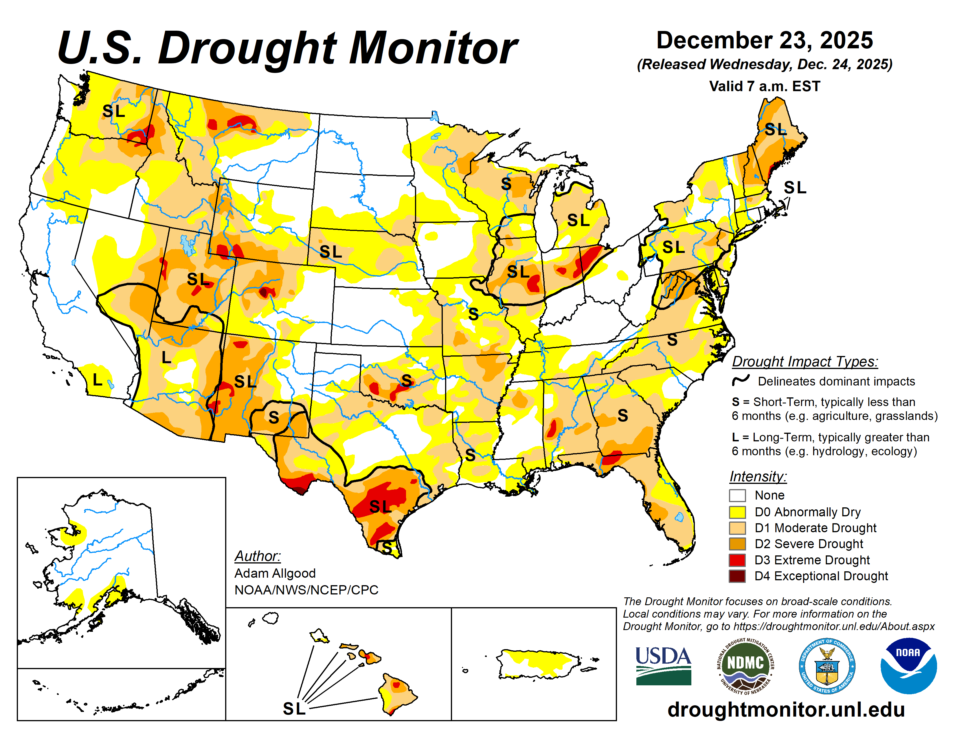
I want to spend today’s post diving a bit into the status of drought and precipitation deficits as we head into 2026. The most recent US Drought Monitor product — produced as a collaboration between the US Department of Agriculture (USDA), NOAA, and the National Drought Mitigation Center — shows that much of the country is in some level of drought currently. Some of the most severe drought is in the Intermountain West, parts of the Southern Plains and South Texas, the Lower Great Lakes, and the Southeast.
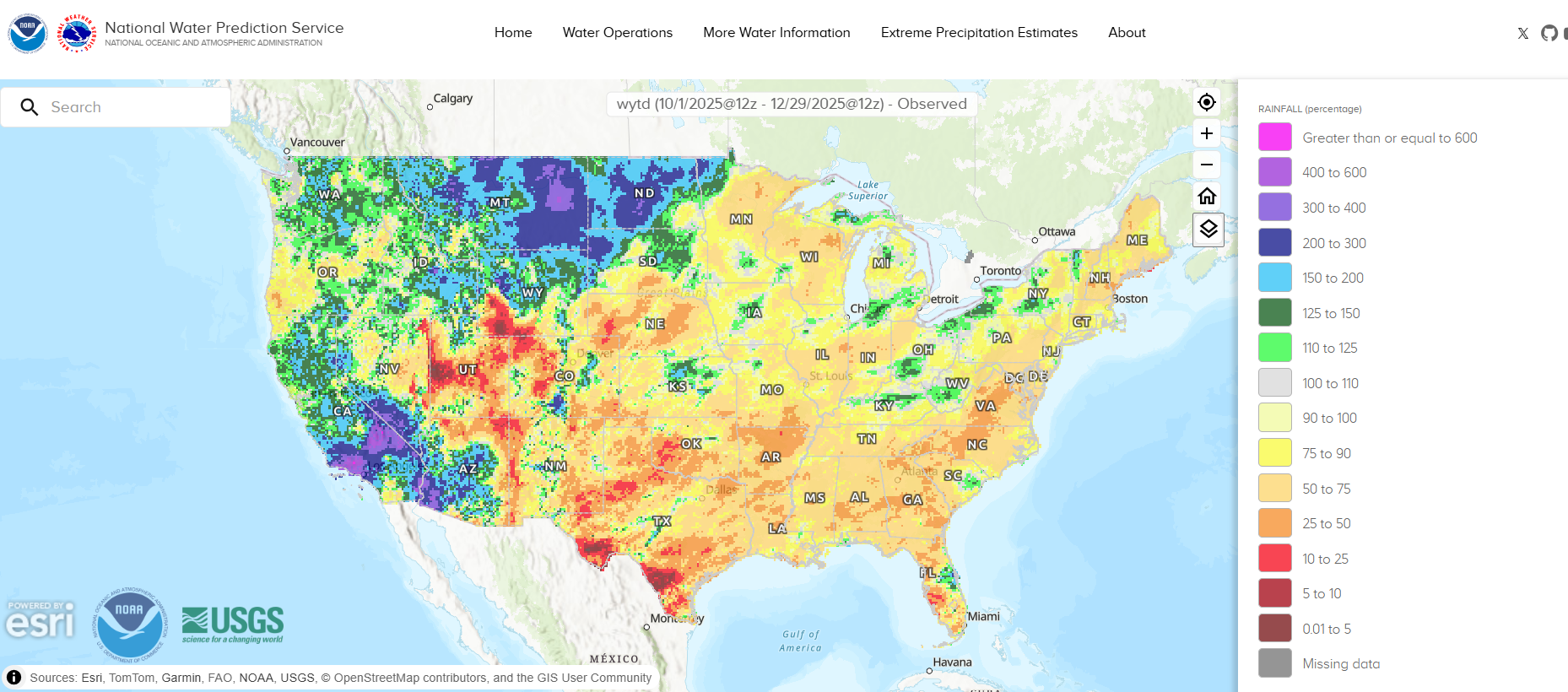
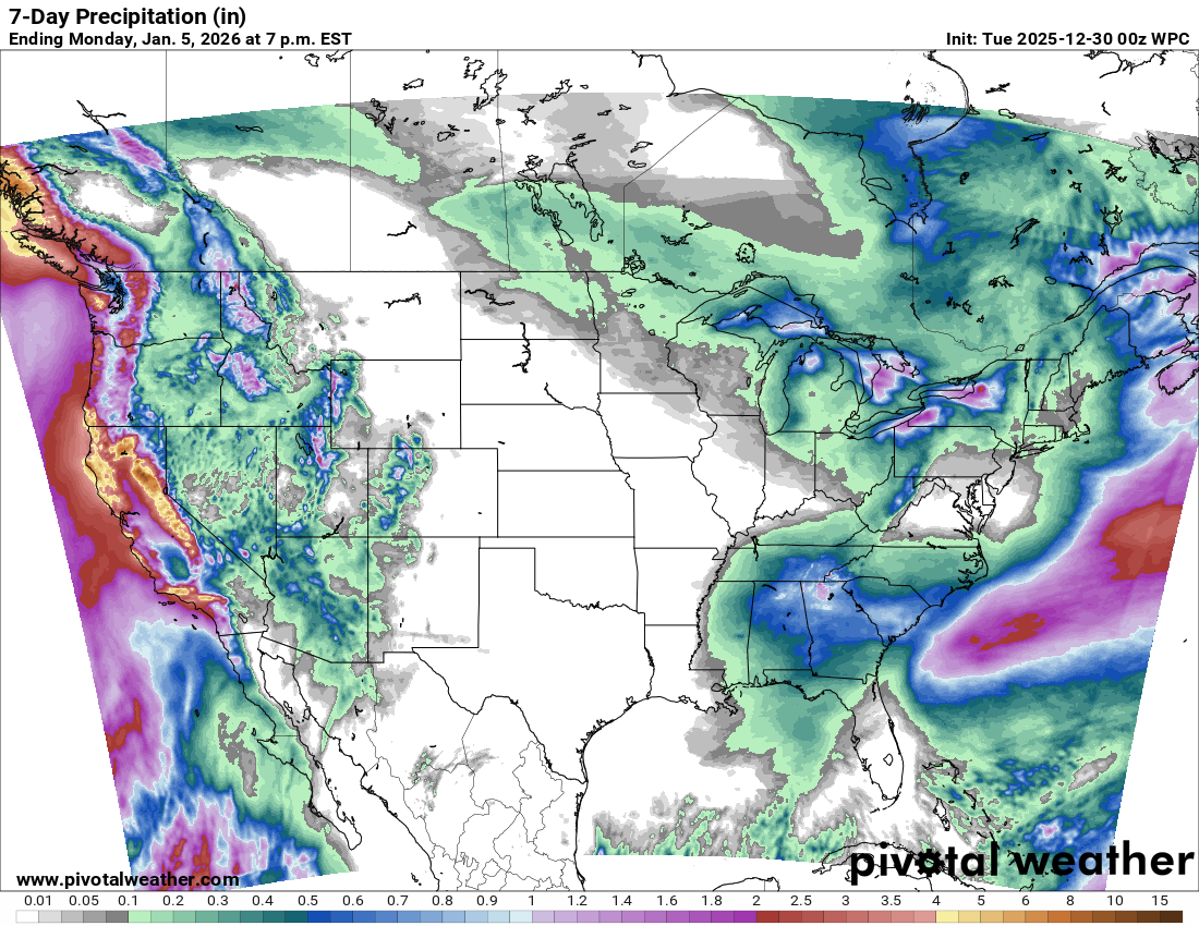
Meteorologists and hydrologists often use the term “water year” when looking at annual rainfall, because for parts of the country that have wet and dry seasons, those seasons typically revolve more around October 1st rather than the calendar year. If we look at the observed rainfall for the current water year (i.e., about the last 3 months) as a percentage of normal, we can see that much of the country has been abnormally dry. Central and southern parts of the Intermountain West, southern Texas, and areas from the Plains and across the Southeast have been particularly dry with significant areas of rainfall less than 25 percent of normal.
If you look at the Drought Monitor above, you can see that the areas of drought are highlighted with the letters “S” and “L,” which refer to whether the drought is short term, long term or both. The moderate to severe drought over parts of Oklahoma and the Southeast is primarily short term drought due to the extremely dry weather of the last few months — for most of the rest of the country experiencing drought, it is a longer term issue that has is being complicated by recent dryness.
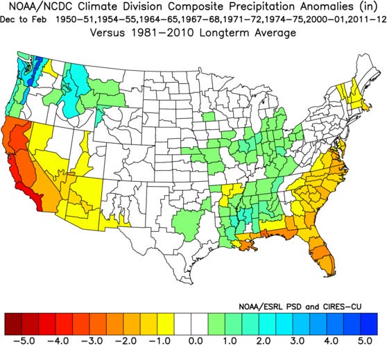
The atmosphere is currently in a weak La Nina state, and the graphic above shows the “typical” precipitation pattern during a weak La Nina. As you can see, the atmosphere is currently not completely behaving in the “typical” way as California is often dry during weak La Nina episodes but has been very wet so far this fall and early winter. The Mid-South typically fares decently well with rainfall and so far has been relatively dry.
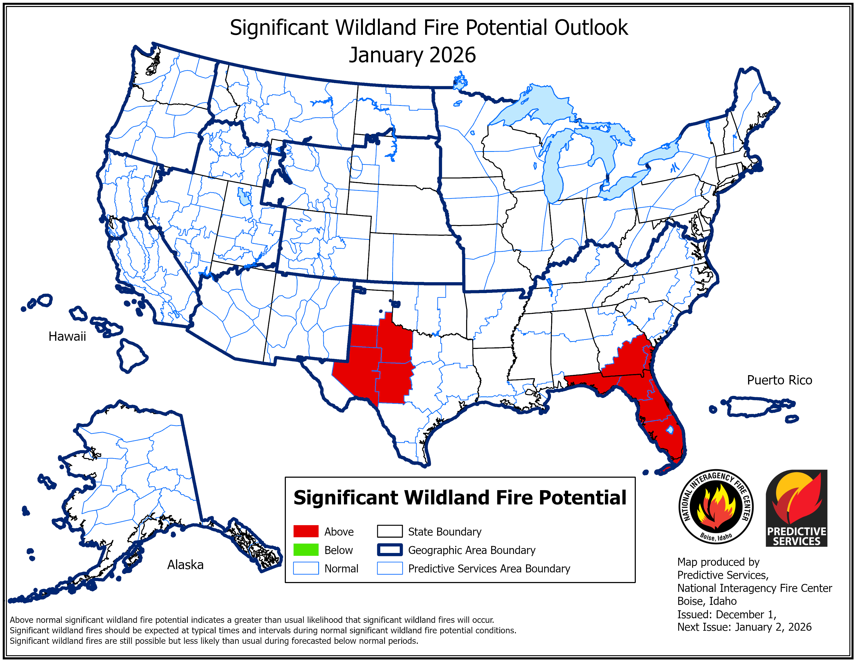
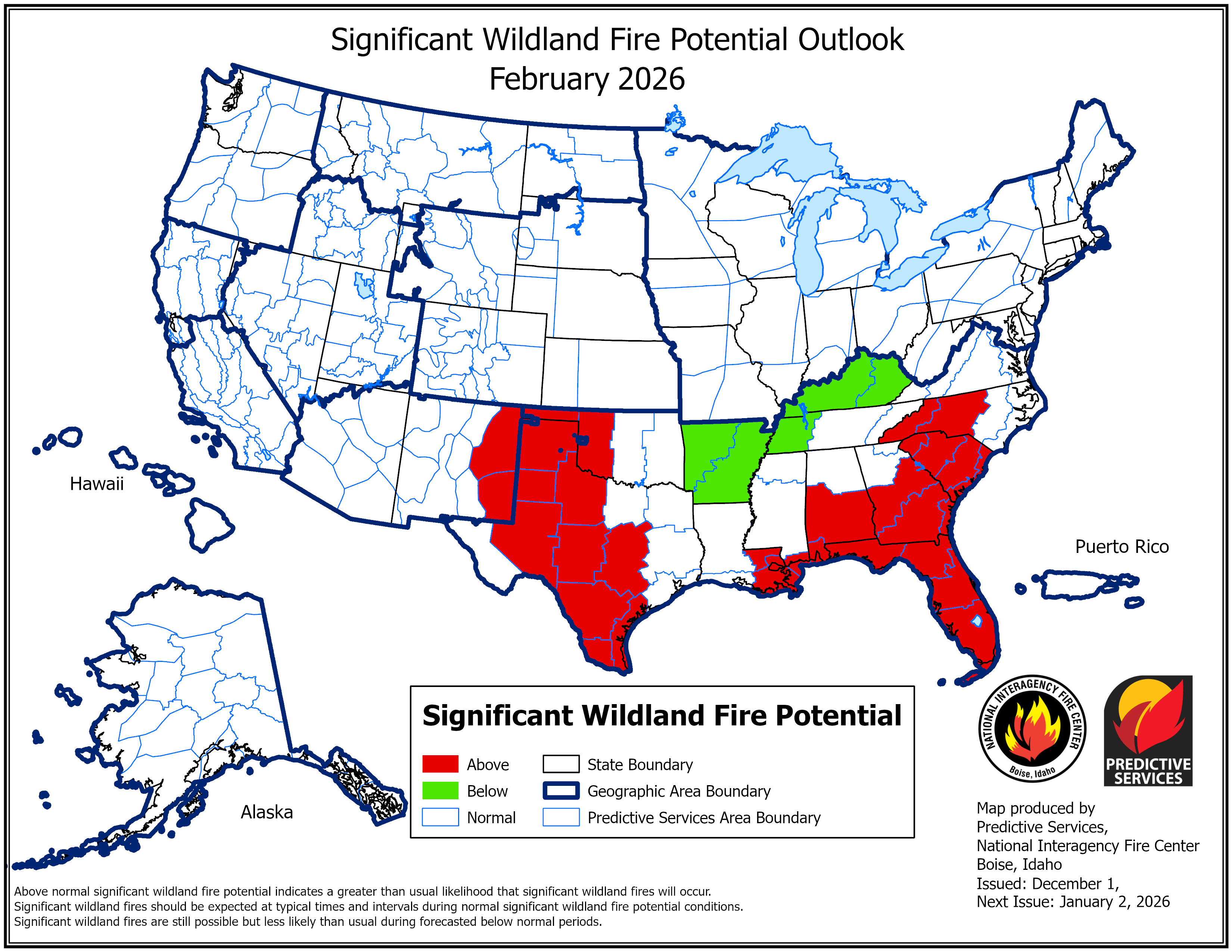
One of the main concerns with these drought conditions across the southern United States is for increased fire danger. Wildfires can start to be a significant concern here especially as we get into late winter and early spring, and the National Interagency Fire Center is anticipating above normal risks of wildfires across the Southern Plains into Texas as well as the Southeast as we head into February.
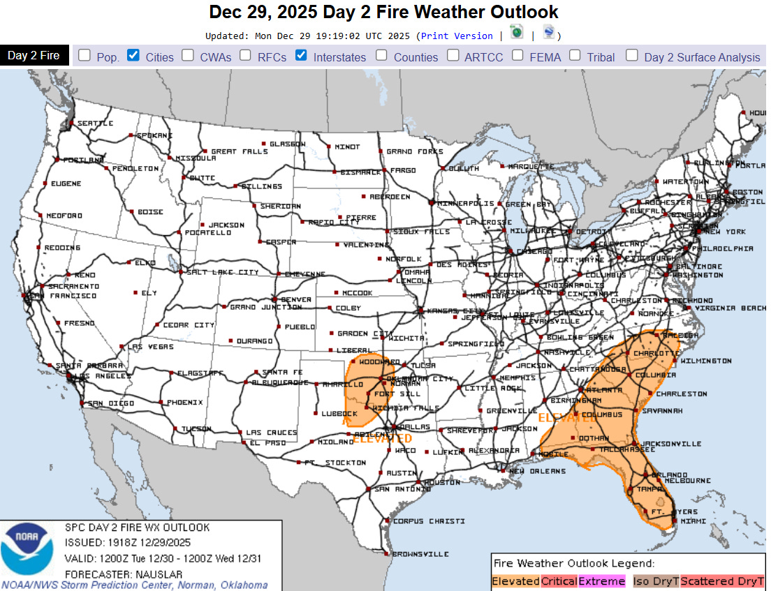
The last couple of days have actually seen increased fire danger across these areas with windy and dry conditions, and in fact I personally saw a grass fire being worked by firefighters along Interstate 35 here in central Oklahoma this afternoon, the second I have seen in the last 10 days.
Without some significant rainfall, this will be an increasing concern for these areas — and unfortunately both the short term (above) and seasonal outlooks do not suggest a trend toward above normal precipitation, although some shower and thunderstorm activity is expected in parts of the Southeast later this week.
Water supply is of course another key potential drought impact, particularly in the western United States. The water year precipitation map above shows that California into the Southwest as well as parts of the Pacific Northwest east into the Dakotas are the main areas of the US that have seen above normal precipitation.
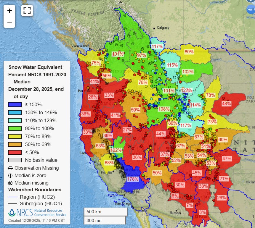
Snowpack is a major factor in water supply in the West, as snowmelt during the spring and summer months provides water during these drier months. Even though precipitation has been well above normal in parts of the West, current snowpack is actually below normal in much of the region due to the abnormally warm conditions the region has seen. The Northern Rockies and parts of the Cascades are near to above normal, and the most recent storm brought significant snow to the highest elevations of the Sierra Nevada which boosted snowpack to above normal in this region. However, much of the region from Oregon east-southeast across the Great Basin and into much of Colorado, Arizona and New Mexico have below to much below normal snowpack as we reach the end of December.
With expectations that the atmosphere will be transitioning out of its current weak La Nina state toward an eventual likely El Nino later in 2026, seasonal forecasts will likely become even more uncertain. Obviously, meteorologists and hydrologists will be monitoring the climate signals and shorter term weather forecasts in the coming weeks for the impacts on drought and water supply.
Programming note: I will be traveling to visit family starting later today and through the first part of next week. As a result, posts will be less frequent and at more unusual times.

Leave a comment