NWS issues with AI generated graphics raises concerns. In weather, record warmth feeds risks of severe weather and flash flooding.
Jan 07, 2026
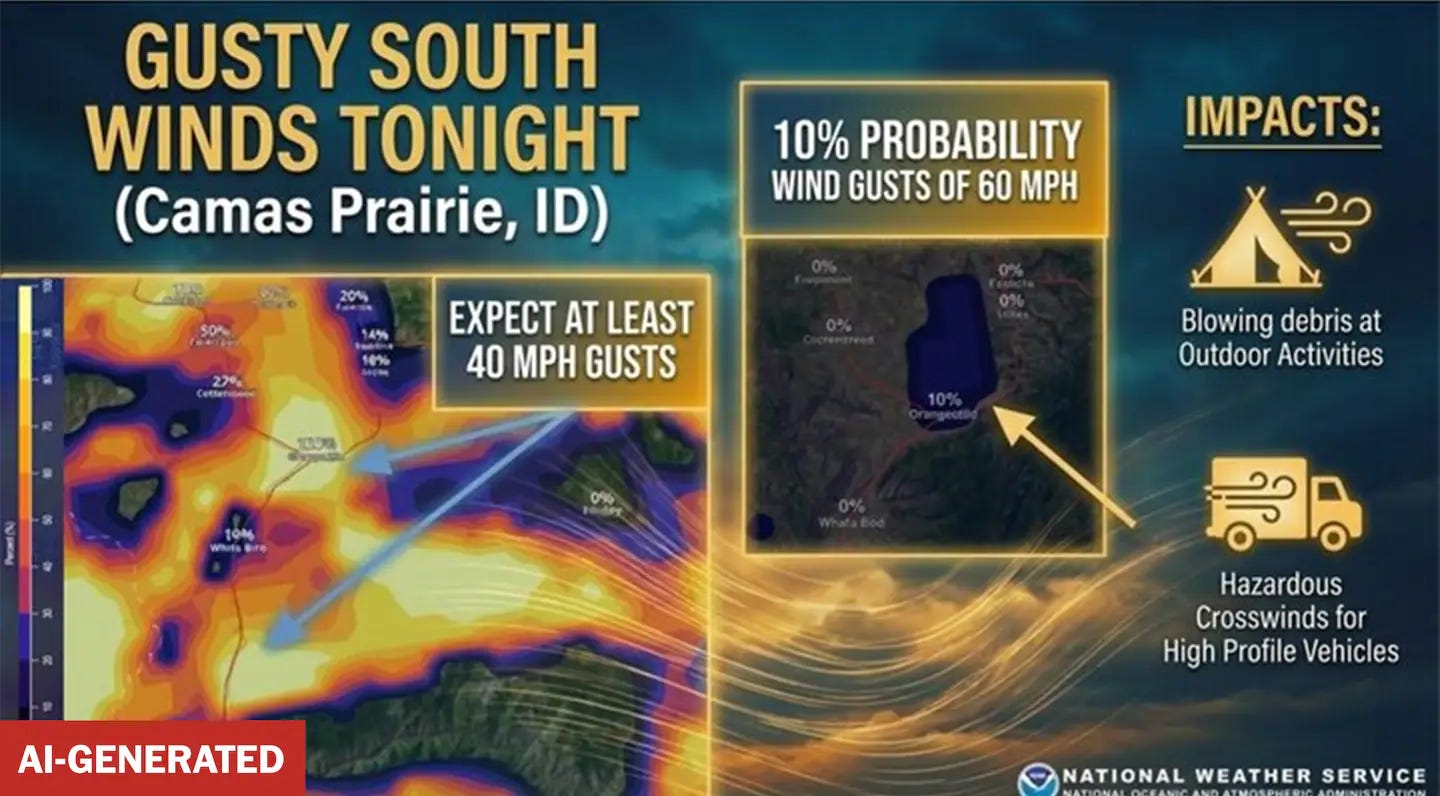
I want to start off this morning with a story that is moving beyond the weather community and into mainstream conversation. Over the weekend, the National Weather Service office in Missoula, MT posted to social media a graphic highlighting the potential for strong winds across parts of Idaho. While at a first glance this graphic looks pretty ordinary, upon closer inspection the maps on the graphic actually contained place names that do not exist like “Orangeotild” and “Whatabod.” The graphic was flagged by automated online checkers as being AI generated.
In an interview for an article in the Washington Post, an NWS spokesperson confirmed that the graphic was in fact generated by AI. From the article:
NWS said AI is not commonly used for public-facing content, nor is its use prohibited. The agency said it is exploring ways to employ AI to inform the public and acknowledged mistakes have been made.
“Recently, a local office used AI to create a base map to display forecast information, however the map inadvertently displayed illegible city names,” said NWS spokeswoman Erica Grow Cei. “The map was quickly corrected and updated social media posts were distributed.”… Cei added that “NWS is exploring strategic ways to continue optimizing our service delivery for Americans, including the implementation of AI where it makes sense. NWS will continue to carefully evaluate results in cases where AI is implemented to ensure accuracy and efficiency, and will discontinue use in scenarios where AI is not effective.” A Nov. 25 tweet out of the Rapid City, South Dakota, office also had misspelled locations and the Google Gemini logo in its forecast. NWS did not confirm whether the Rapid City image was made with generative AI.
There are a couple of issues here that I think need to be highlighted and explored, the first obviously being the use of AI. While I am by no means an expert in artificial intelligence, I do know enough that I think it is very important that we are clear that “AI” is a very broad, catch-all term, and that AI has very different flavors and uses. The AI in question here is “generative AI,” in which large language models are used to produce text, graphics, and other content through online tools such as Google Gemini as highlighted in the WaPo article.
Generative AI is what is responsible for what has come to be known colloquially as “AI Slop,” i.e., fake, incorrect or poor quality content that can still “look real” and which many experts and members of the public are decrying as dangerous. Unfortunately, it seems clear that this NWS graphic was a pretty classic example of “AI Slop.”
It is important to recognize though that generative AI is not the type of AI generally utilized in the new AI-based meteorological models and algorithms that I have highlighted in earlier articles. As I understand it, the AI technology that generates actual weather guidance is based on neural networks and deep learning techniques. I am probably oversimplifying this explanation — but essentially these networks are trained on years of actual past weather data and observations which can then be mined using current weather data and observations to generate forecast products.
In some ways, this is replicating part of what a human forecaster does, i.e., looking at current weather data and utilizing experience with past weather events to help generate a forecast. However, with AI it is being done a much deeper scale than any human can do it — and the initial results from these AI meteorological systems has been incredibly promising in a way that I think most meteorologists (well, at least me) were expecting.
I have written extensively about the Google DeepMind (GDM) tropical cyclone modeling system which preliminary analysis shows was the most accurate forecast guidance for Atlantic hurricanes in 2025. The renowned European Center for Medium-Range Weather Forecasting modeling center has had success with its AI Forecast System, and the NWS recently operationalized AI versions of its Global Forecast System. Other examples include the Colorado State University Machine- Learning Probabilities system which produces extremely useful probabilistic forecasts of severe weather and flash flood hazards, and the National Severe Storms Laboratory’s Tornado Probability Algorithm (TORP).
A number of my colleagues have been posting on social media in the last 24 hours about their concern that AI debacles like the NWS Missoula generative AI failure will get conflated in the public consciousness with the promising AI weather applications, eroding trust in all of it. I have to say that I agree, and that this is something that should make us as meteorologists extra cautious about utilizing AI applications in ways that might damage public trust. I strongly feel that the promising AI applications I talked about above (and many others) show that we could be on the verge of a true revolution in meteorological and hydrological forecasting at all time and space scales driven by these new AI approaches — and it would be tragic if the potential massive societal benefits that would result from such a revolution was derailed by “AI Slop.”
This leads me to my second overarching aspect of this incident: why is the NWS using generative AI for graphic production in the first place? Is the agency trying to find ways to streamline operational procedures due to staffing shortages? Is it being pushed to utilize generative AI by political leadership? Or is it just trying out what is hopes might be a useful new technology? Whatever the reasons, I hope that the NWS quickly sees that the potential damage to public trust in the agency and promising AI forecasting technology outweighs and potential benefit, and puts more restrictions on the use of generative AI in its operations.
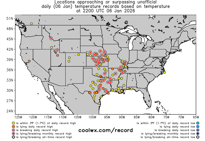
Looking at the weather across the US, record warmth continues to be a big story, as numerous record warm temperatures were set across the central part of the nation on Tuesday. Record highs included Tulsa (74F), Brownsville (86F), Houston (Hobby, 82F), Wichita (66F), and Baton Rouge (81F).
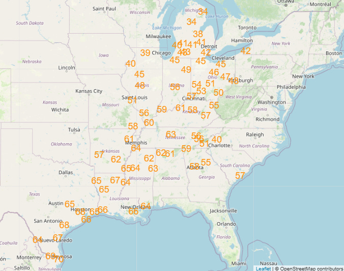
Record warmth will continue across the central and eastern US the next several days. Record warm low temperatures will become particularly widespread (forecast records for Friday shown above) as unusually warm and humid air spreads north from a near record warm Gulf ahead of a slow moving, complex low pressure system.
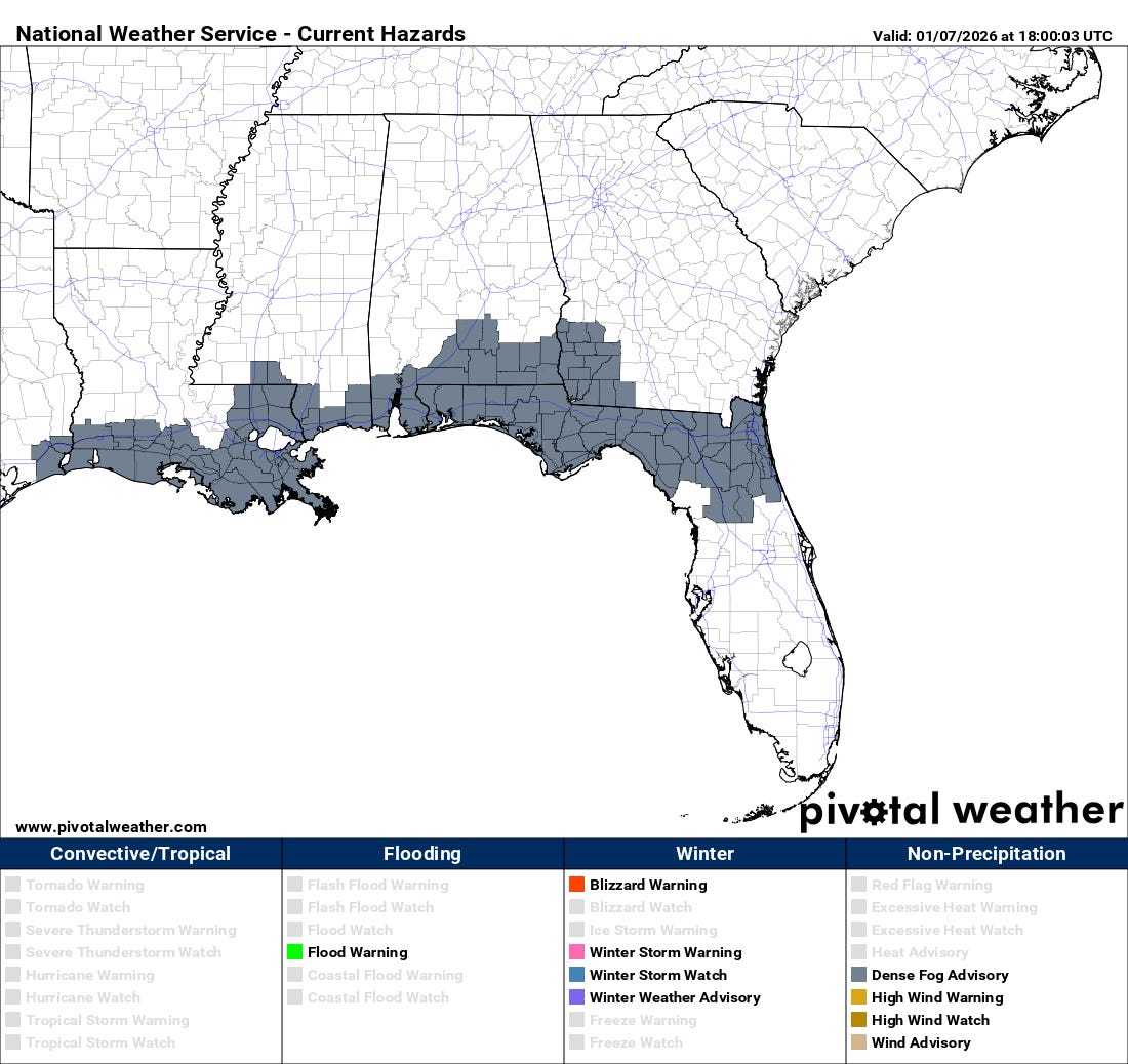
This unusually warm and humid airmass will result in widespread dense fog along the Gulf Coast, and advisories are in place for tonight into Thursday. If you’re planning travel in the region — especially on Interstate 10 — be aware.
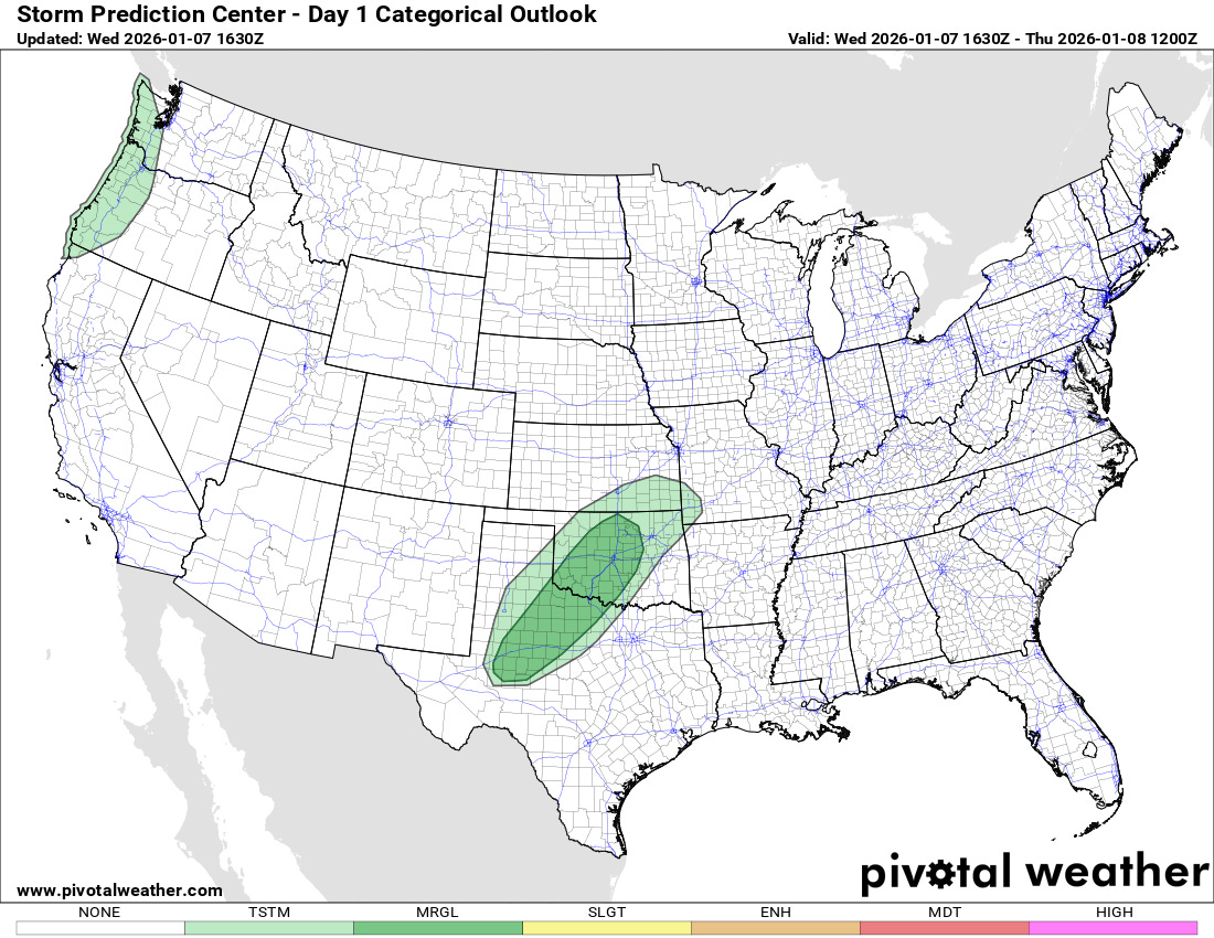
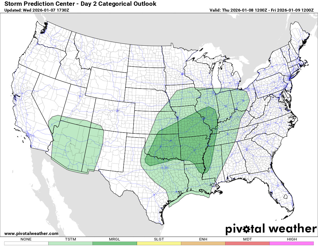
This unusually warm, moist airmass will also support some risk of severe thunderstorms as the aforementioned low pressure system slowly moves east. The NWS Storm Prediction Center has a marginal (level 1 of 5) risk for parts of the Southern Plains through tonight (top graphic), which expands into the Mid-South and Mid-Mississippi Valley regions for Thursday.
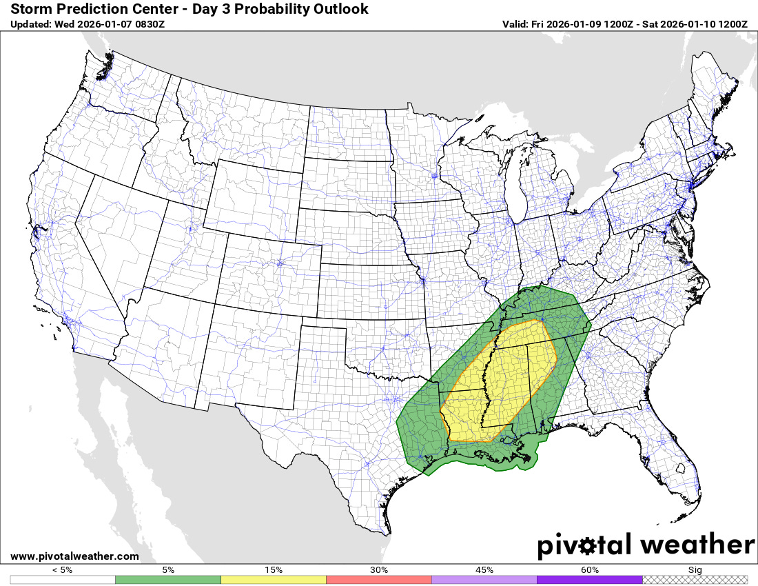
The risk of severe weather looks to peak on Friday as the storm system intensifies and pulls into the Great Lakes. A slight (level 2 of 5) risk is in place for parts of the Mid-South and Lower Mississippi Valley, with a few tornadoes possible.
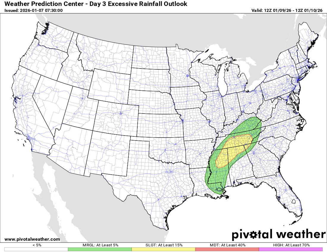
Heavy rainfall will also be a risk with these thunderstorms, and a slight (level 2 of 4) risk of excessive rainfall and flash flooding is in place in the Tennessee Valley for Thursday.
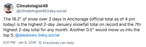
Meanwhile, winter continues in full form in the 49th state, as most of Alaska has been seeing one of its coldest periods in decades. As noted on Bluesky by climatologist Brian Brettschneider, Anchorage had its snowiest 2-day January period on record the last couple of days, picking up more than a foot and a half of snow.

Leave a comment