Some signs that an incredibly rare eastern Pacific tropical cyclone could form in the next several days, while the East gets back to winter
Jan 14, 2026
Happy hump day! Starting off this morning with a quick update on the status of the “minibus” appropriations bill that would fund most federal science agencies, including NOAA, NSF and NASA. As a reminder, the bill was overwhelmingly passed in the House and is now being considered by the Senate. The Colorado senate delegation filed an amendment to the bill on Monday to try to insert wording that would protect the NSF National Center for Atmospheric Research (NCAR) from an announced dismantling by the Trump Administration.
Yesterday, Senate Majority Leader John Thune (R-SD) filed cloture on the bill and used his prerogative as majority leader to “fill the amendment tree” which attempts to lock down the bill and ensure it is voted on “as is.” By filing cloture, the leader sets up a Senate vote — likely in the next day or so — on a cloture motion which, if approved by 60 senators, would limit debate to 30 hours after which time there will be a final vote on the bill.
While the leader’s move to “fill the amendment tree” does not prohibit consideration of “germane” amendments like the NCAR one, it combined with cloture does make it more difficult for such an amendment to be considered (at least as I understand it). Given the majority leader’s desire for the bill to approved without changes to avoid the need for a new House vote, it will be interesting to see how Colorado Senators Hickenlooper and Bennet proceed given their statements that they were not backing down from their position on NCAR that caused them to block the initial consideration of this bill in December. Obviously, the next few days will be critical for this bill and how the politics surrounding NCAR will evolve — I will be monitoring and updating as I hear of new developments.

The cold front that will be ushering in the transition to colder weather across the eastern part of the United States will be pushing across the region this afternoon and tonight. Some rain and snow showers will accompany the front, with heavy lake effect snow bands developing in the lower Great Lakes region as the cold air surges south.
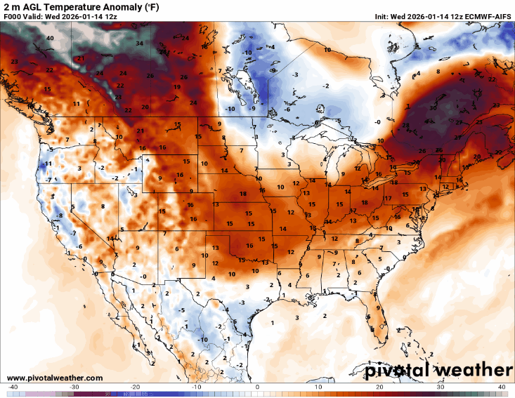
This loop of surface temperature anomalies over the next 6 days from this morning’s European AI model shows how this initial surge of cold air will move off the Southeast coast early this weekend, followed by another even colder surge of air through the Midwest, Great Lakes and East. Meanwhile, out West above normal temperatures will dominate under the unusual large upper level high pressure area we have been talking — although you can also see the signals of cooler air in the valleys where trapped cold air and/or low clouds/fog will help keep temperatures from warming as much.
While this morning’s US global model did trend toward a more significant winter storm over the Southeast and Mid-Atlantic associated with the next surge of cold air this weekend, none of the other operational models currently show any such system, and as of now the more likely scenario continues to be that the bulk of any significant accumulating snow will remain in the lee of the Great Lakes and higher interior elevations of the Northeast and Appalachians. However, some lighter snow could occur over parts of the South and Mid-Atlantic at some point during this period of colder air over the next week or so.
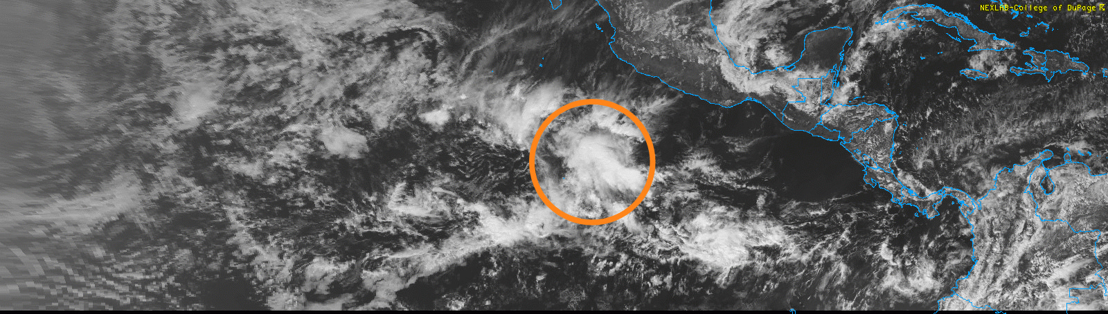
Finishing up today with an unusual (actually, unheard of) thing to be talking about in mid-January. A weak tropical disturbance (highlighted on visible satellite image above) appears to have formed in the eastern Pacific to the southwest of the west coast of Mexico. The US global model has been showing this system developing for a few days, but as I have discussed in many posts during Atlantic tropical season, the GFS has a very high false alarm rate for tropical cyclone development. However, in the last couple of days additional models have begun to show at least some minimal development, including the European model. Even the Google DeepMind AI, which I would expect would struggle in a very climatologically unusual situation like this, has some signal for development with about 10% of its members showing an organized tropical system developing.
This BlueSky post from my colleague Dr. Kim Wood gives you some idea of just how incredibly rare the development of a tropical cyclone in the eastern Pacific in January would be.
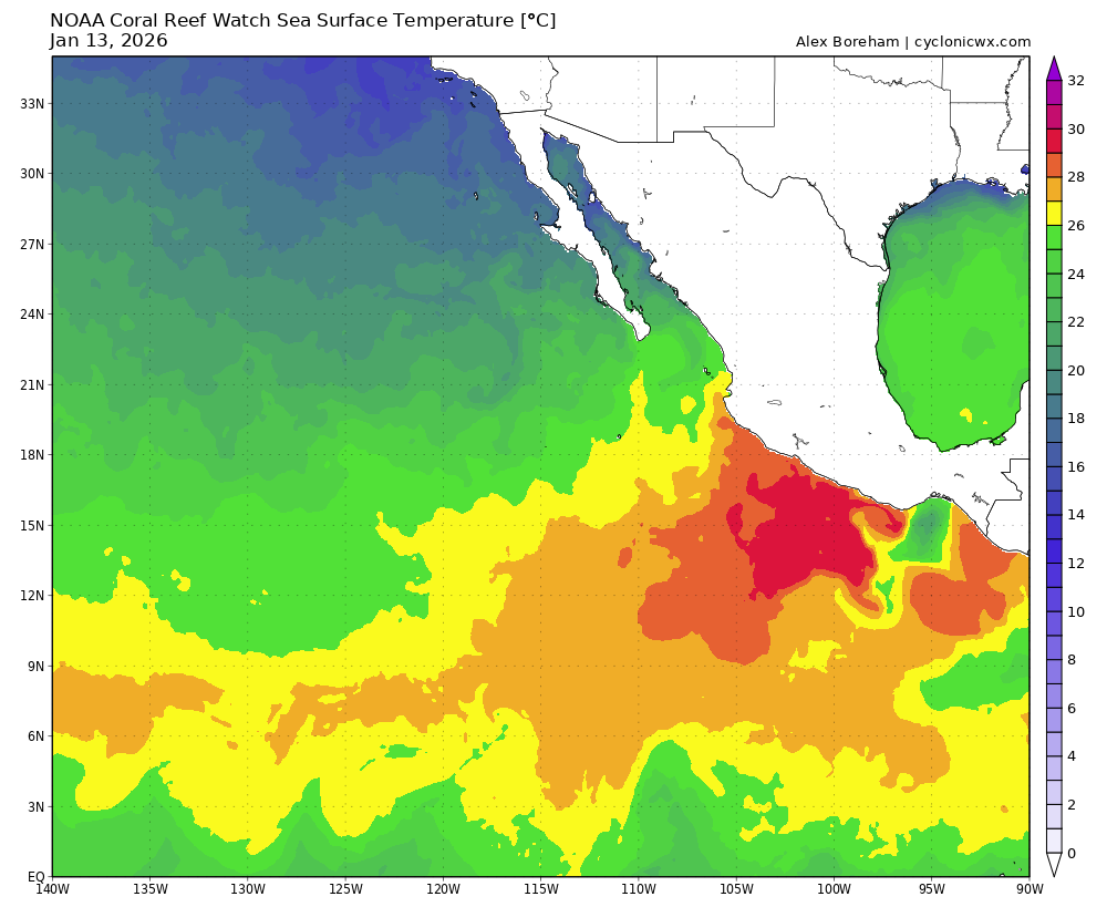
The sea surface temperatures in this region are abnormally warm for the time of year and certainly are sufficiently warm to support a tropical cyclone — and the environmental conditions do not look overly hostile. If the system becomes sufficiently organized to present a true development risk, the National Hurricane Center will begin issuing special tropical weather outlooks about it. To be clear, even if this system develops, it will mainly be of interest for its rarity and should not pose any threat to land.

Leave a comment