Officials now staying power restoration will take weeks in some of the hardest hit areas, with another Arctic outbreak looming for the weekend.
Jan 27, 2026
Hi everyone, as I mentioned yesterday, I am at the American Meteorological Society annual meeting this week so my posts will be more sporadic. However, I did want to get a quick one out this afternoon to talk about the latest with regard to the cold and winter storm impacts over the weekend, and the potential new storm for the East Coast.
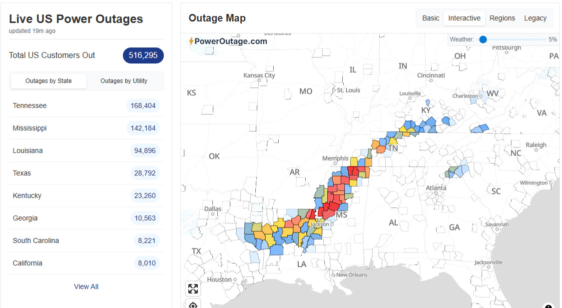
As of early this afternoon, per PowerOutage.us around 500,000 customers still remain without power due to the impacts of the severe ice storm over parts of the South. Many parts of the Arklamiss Delta region into northern Mississippi continue to have counties and parishes with a majority of customers without power.
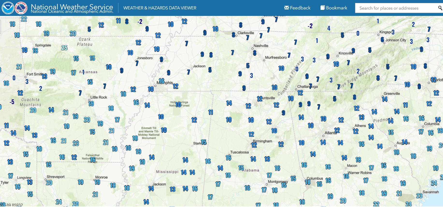
Low temperatures this morning dropped into the single digits and teens over most of this impacted area, near or below record low temperatures in many locations, particularly across Mississippi and Louisiana.
Temperatures tonight are not forecast to get quite as cold, but given the hundreds of thousands without power and temperatures still forecast to get well below freezing, the potential for hypothermia and issues with busted water pipes and main will remain significant over this region. CNN is now reporting that more than 30 people have died to the impacts of this winter storm, and a number of these appear to have been due to hypothermia.
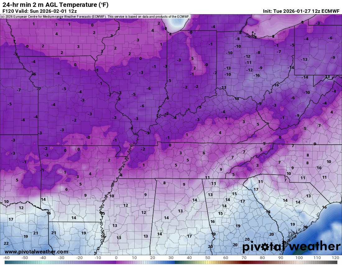
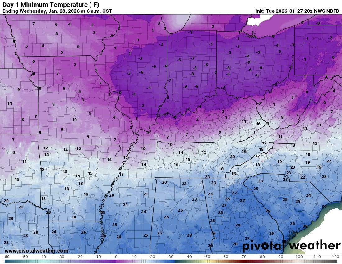
Unfortunately, the pattern will remain favorable for further intrusions of Arctic air, and another major outbreak is anticipated this weekend. While this European model forecast of minimum temperatures above for Sunday morning could be a bit too cold, the overall idea of widespread subzero temperatures through the Midwest and Ohio Valley and single digits down into parts of the Mid-South and Tennessee Valley seems reasonable. Given that officials in the hardest hit regions are now talking about power restoration taking weeks in some locations, the dangers of hypothermia and infrastructure damage due to extreme cold will be a serious concern in storm impacted areas.
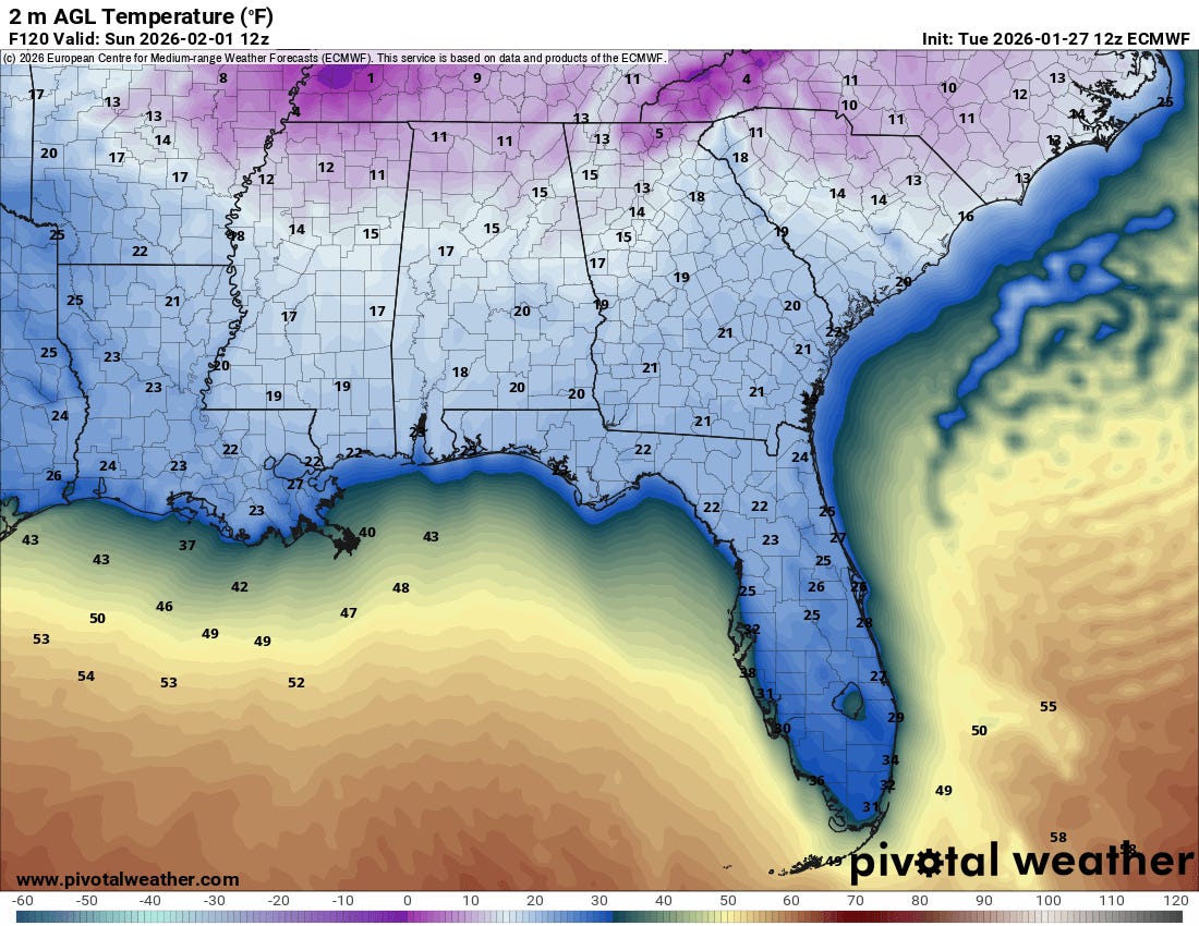
Again, at this time range it is possible these European model forecast minimum temperatures are a bit too cold, but regardless there looks to be significant potential for a hard freeze well south into Florida Sunday morning.
The strong upper level weather disturbance responsible for this weekend’s Arctic surge is also forecast to result in a very intense low pressure system off the East Coast. While the models are in agreement that this will be strong system with heavy precipitation and high winds, the track is still very uncertain with the US global models showing a track that would bring heavy snow and high winds well inland across the Mid-Atlantic, while the European suite of models show a track farther east that would mainly impact eastern North Carolina and possibly parts of the immediate coast farther north.

This graphic shows the probability of at least minor winter weather impacts based on the NWS Weather Prediction Center’s Winter Storm Severity Index (WSSI) for Saturday night into the day Sunday. Hopefully we will start to be able to get a better handle on potential impacts with this system over the next 24 to 48 hours.

Leave a comment