More than 100,000 customers still without power from last weekend’s ice storm saw temperatures as cold as single digits this morning
Feb 01, 2026
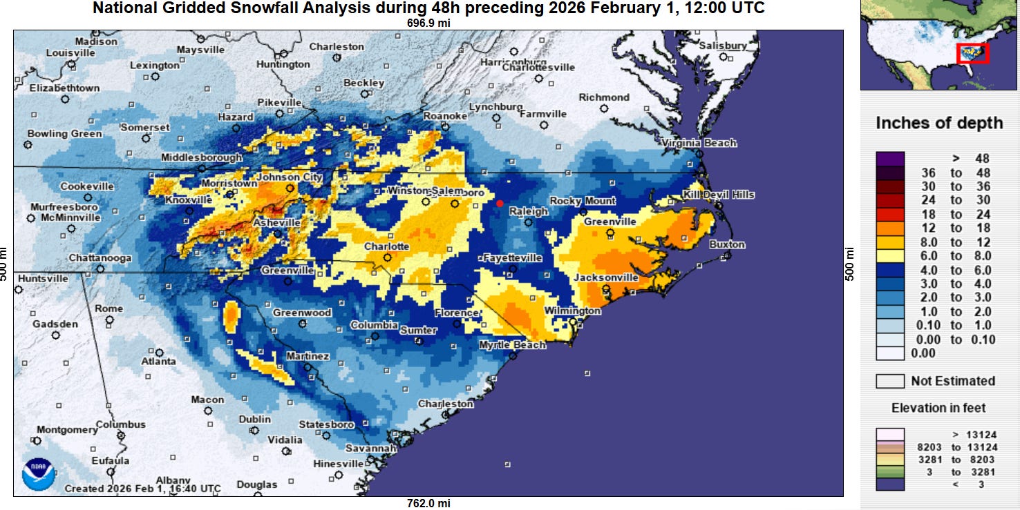
As I mentioned in my live chat Friday evening, the NWS office in eastern North Carolina had started advertising that the major winter storm for the Carolinas would be a historic snowstorm for their area — and the last 24 hours proved them correct. Much of eastern North Carolina received more than 8” of snow, with areas from Jacksonville up through just east of Kill Devil Hills receiving more than a foot. The heaviest snow I have seen reported to the NWS so far has been a measured amount of 19.5” from the public along the coast just west of Morehead City (the location of the NWS office). Per the NWS office, this certainly seems to be the heaviest and most impactful snowstorm for this region since the 1980s.
Heavy snow also fell in the mountains of eastern Tennessee and western North Carolina, and adjacent regions around Charlotte and Greensboro where localized bands of 10-14” fell. The models — especially the high resolution models — did a pretty good job of showing that there would be a relative minimum in snowfall between that area of heavy snowfall and the coastal heavy snow, with the Raleigh-Durham metro area lying in that minimum as shown in the 48-hour snowfall map above from the NOAA National Operational Hydrologic Remote Sensing Center (NOHRSC).
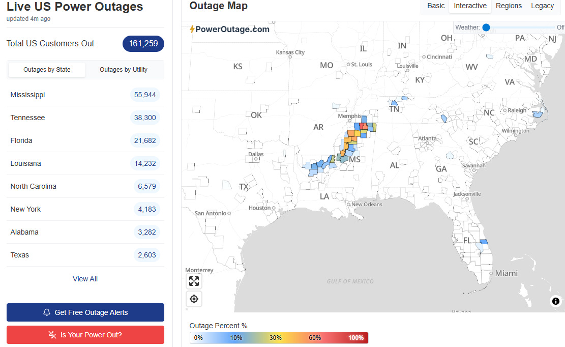
As of 9 am ET, the low pressure system off the Carolinas had intensified about 27 millibars in 24 hours, not quite as much as some of the models had suggested, but still incredibly impressive and well in excess of “bomb” status for this latitude. Luckily, the winds and coastal flooding were not quite as severe as forecasts had shown, with Duck, NC barely reaching into major flood category. Still, there were significant impacts, including another home being washed away on the Outer Banks. Sporadic power outages occurred in North Carolina and Florida, with nearly 30,000 customers without power in these areas.
However, by far the most power outages continues to be in the ice storm impacted regions of Mississippi, Louisiana and Tennessee, where more than 100,000 customers remain without power more than a week after the storm. Jim Whitfield, my longtime emergency management colleague in the Mississippi Delta, did an excellent post on the situation there, what emergency management can and cannot do to help people, and how our society’s increasing reliance on technology may also be making us less resilient after disaster’s like last weekend’s ice storm.
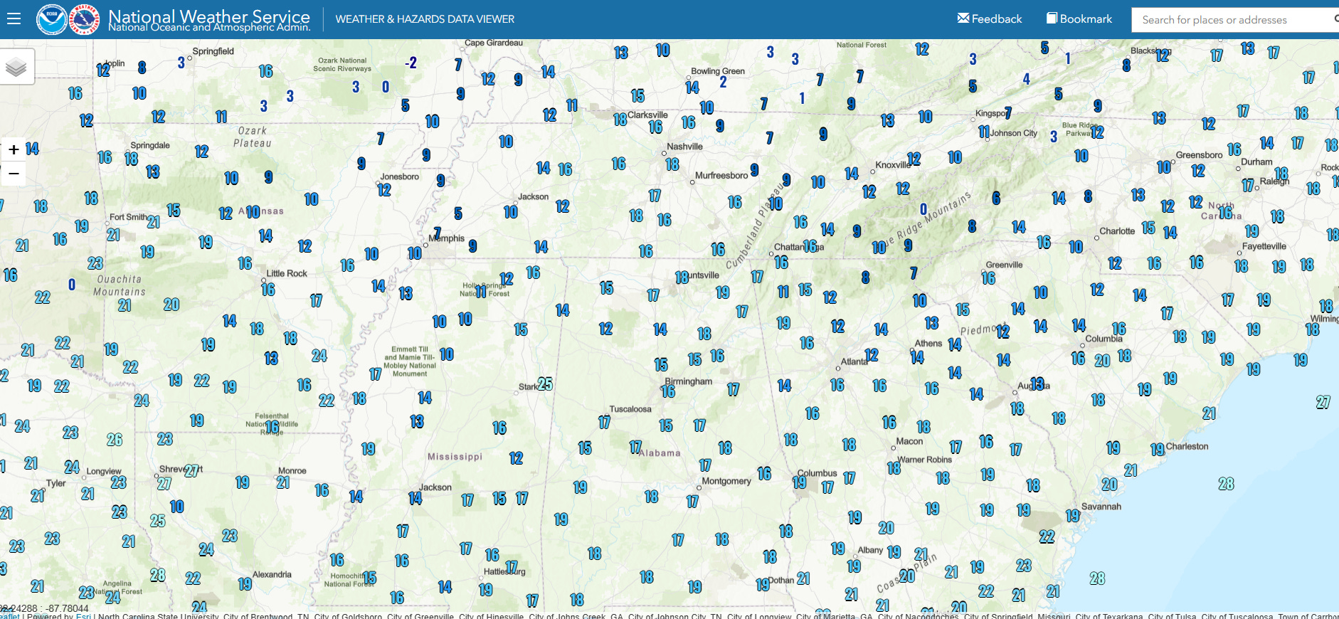
Low temperatures in this region this morning were in the single digits and lower teens in many areas, breaking daily records at many locations. Luckily, this morning will be the coldest morning for most areas, and a gradual warming trend will be in store into the middle of the week.
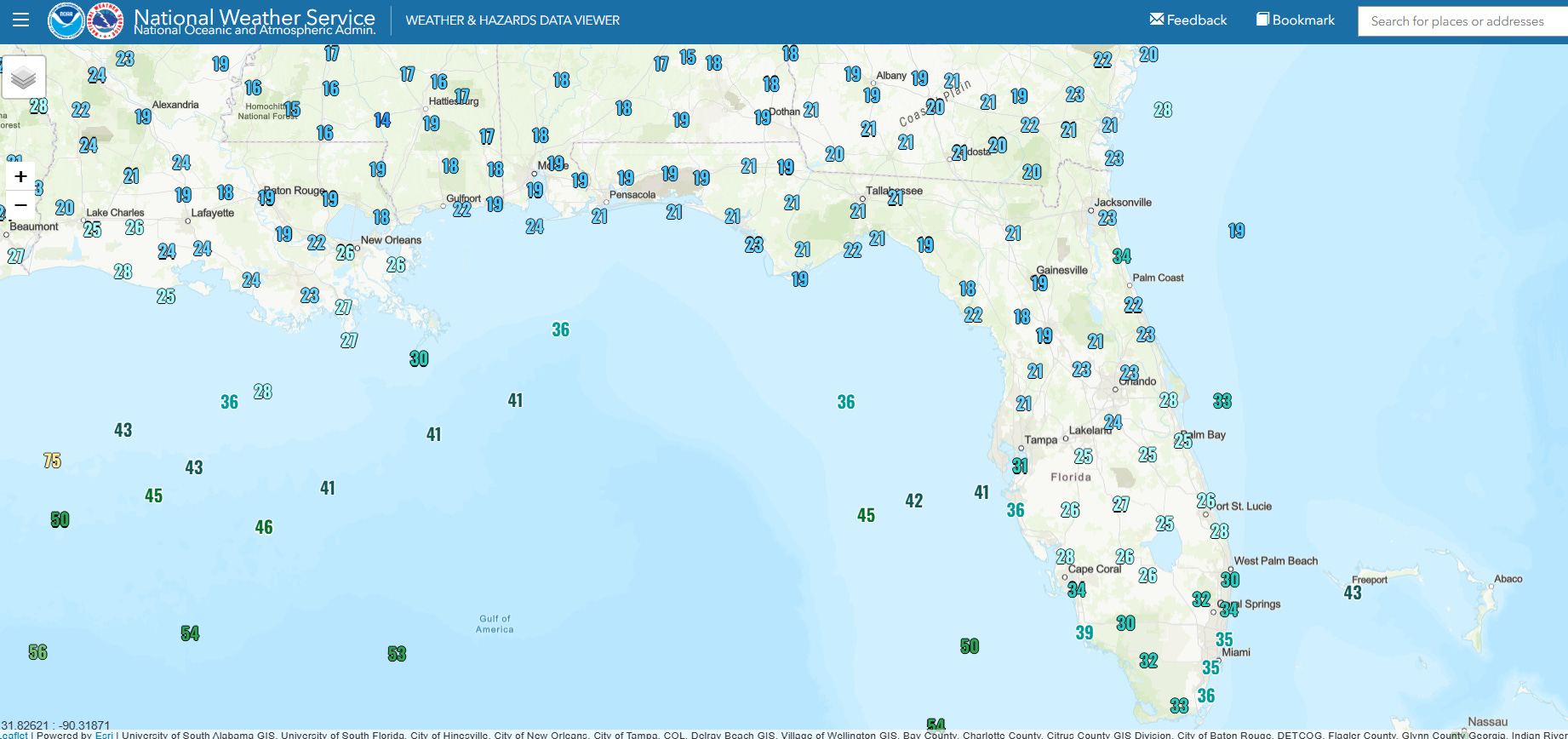
Meanwhile, along the Gulf Coast and into Florida, Arctic air resulted in some of the coldest morning low temperatures in years, with numerous record lows and hard freeze well south into the Florida Peninsula. Strong winds in the wake of the intensifying low pressure system resulted in highly unusual wind chill readings — the lowest wind chill reading at Orlando International Airport this morning was 11F, and Sanford Airport just north of Orlando had a wind chill of 9F.

The intensifying low pressure center will pass well southeast of coastal New England, but is brushing southeast New England with some snowfall. Overall, though the weather will be quieter for much of the country today, with some rain and snow in the Pacific Northwest and some light snowfall across the upper Midwest.

Leave a comment