“Norlun trough” bringing locally heavy snow to southeast New England
Feb 07, 2026
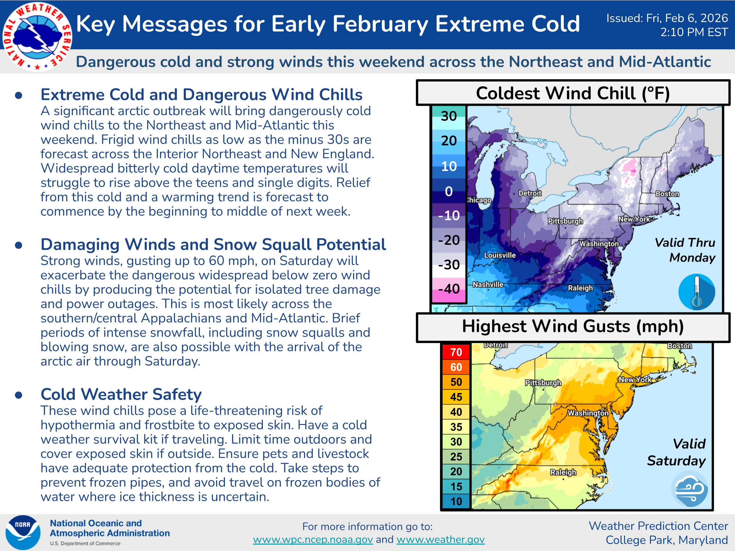
Happy Saturday! I’ve spent the last few days covering weather community story and issues — so let’s get back to looking at actual weather today. The major weather story is another weekend of record cold and strong winds in the eastern United States, particularly in the Northeast and Mid-Atlantic.
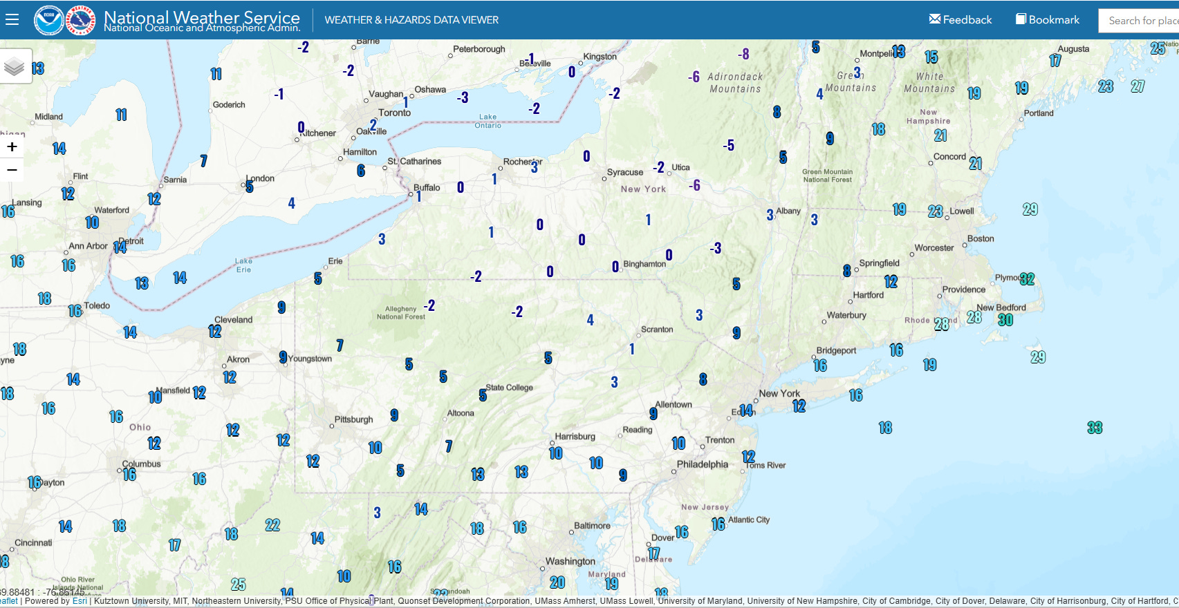
Arctic air is moving south into the region, and air temperatures just before midday were in the single digits above and below normal across much of New York state and northern Pennsylvania.
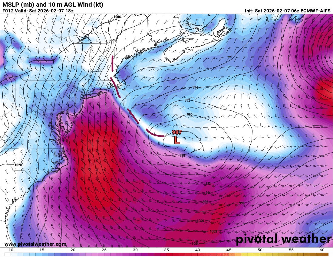
The upper level weather disturbance driving this Arctic outbreak is causing a strong low pressure system to develop offshore of the Mid-Atlantic. While this system is well off the coast, strong northwest winds in the wake of the low across the Northeast and Mid-Atlantic will drive the bitterly cold air farther south and also produce dangerously low wind chills and gusts of up to 60 mph that could cause power outages.
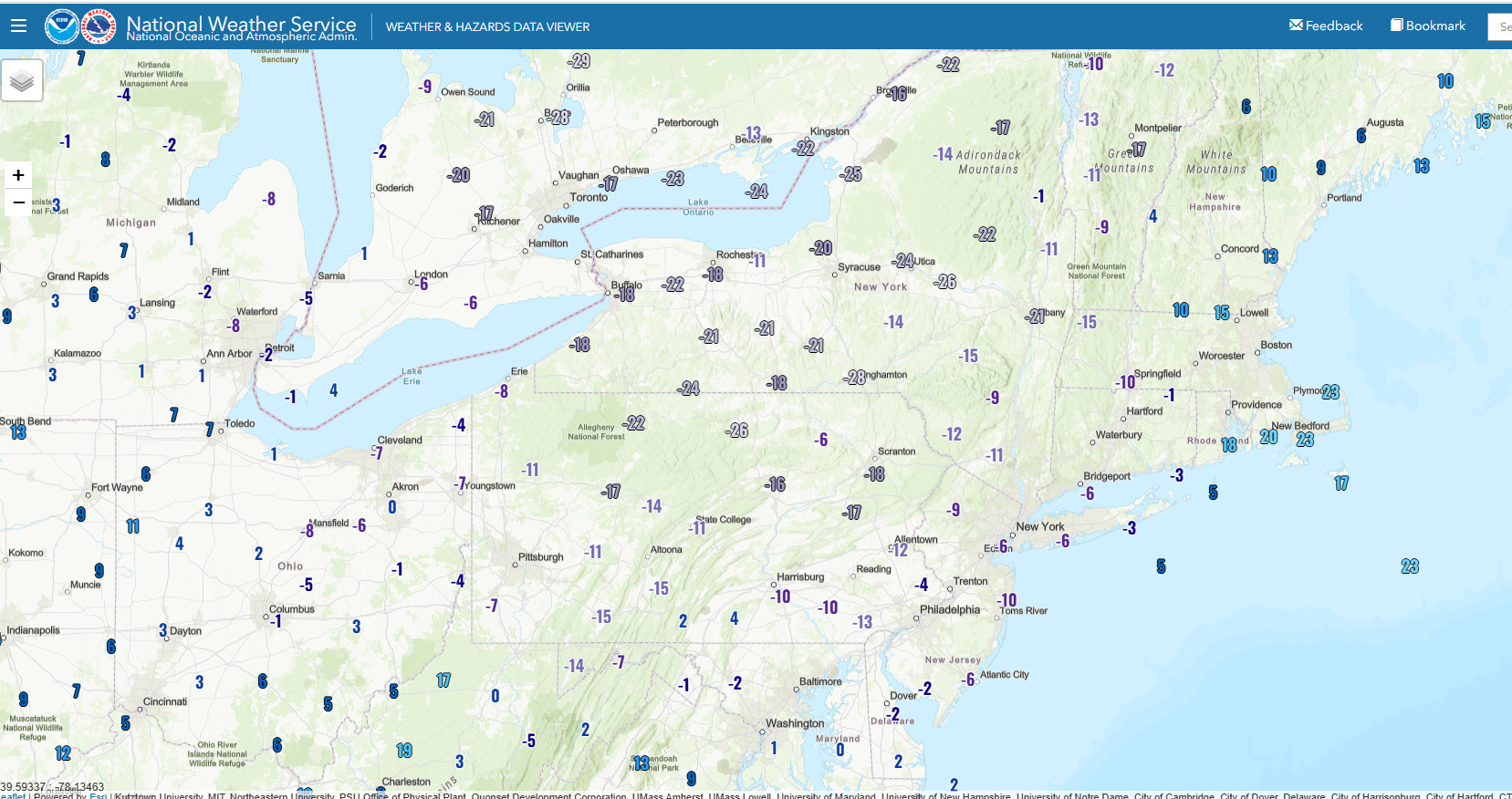
Wind chill readings in the New York state and northern Pennsylvania area were in the -20 to -30 range at midday, and these sorts of wind chill values will continue across the region and into New England through tonight, with subzero readings as far south as Virginia.
While the low pressure system is developing far enough offshore to keep the bulk of the widespread precipitation associated with it also offshore, a trough of low pressure extending north from the low (the dashed brown line I have sketched in on the midday forecast of pressure and wind from the European AI model above) is producing some moderate to heavy snow across parts of southern New England.
A trough of low pressure extending northwest from the low is called an inverted trough in meteorology, and because of the configuration of the coast these troughs can bring localized very heavy snow amounts to this region. Meteorologists in the Northeast refer to this weather feature as a “Norlun trough,” named after two meteorologists who documented the feature and its role in localized heavy snow events in the early 1990s.
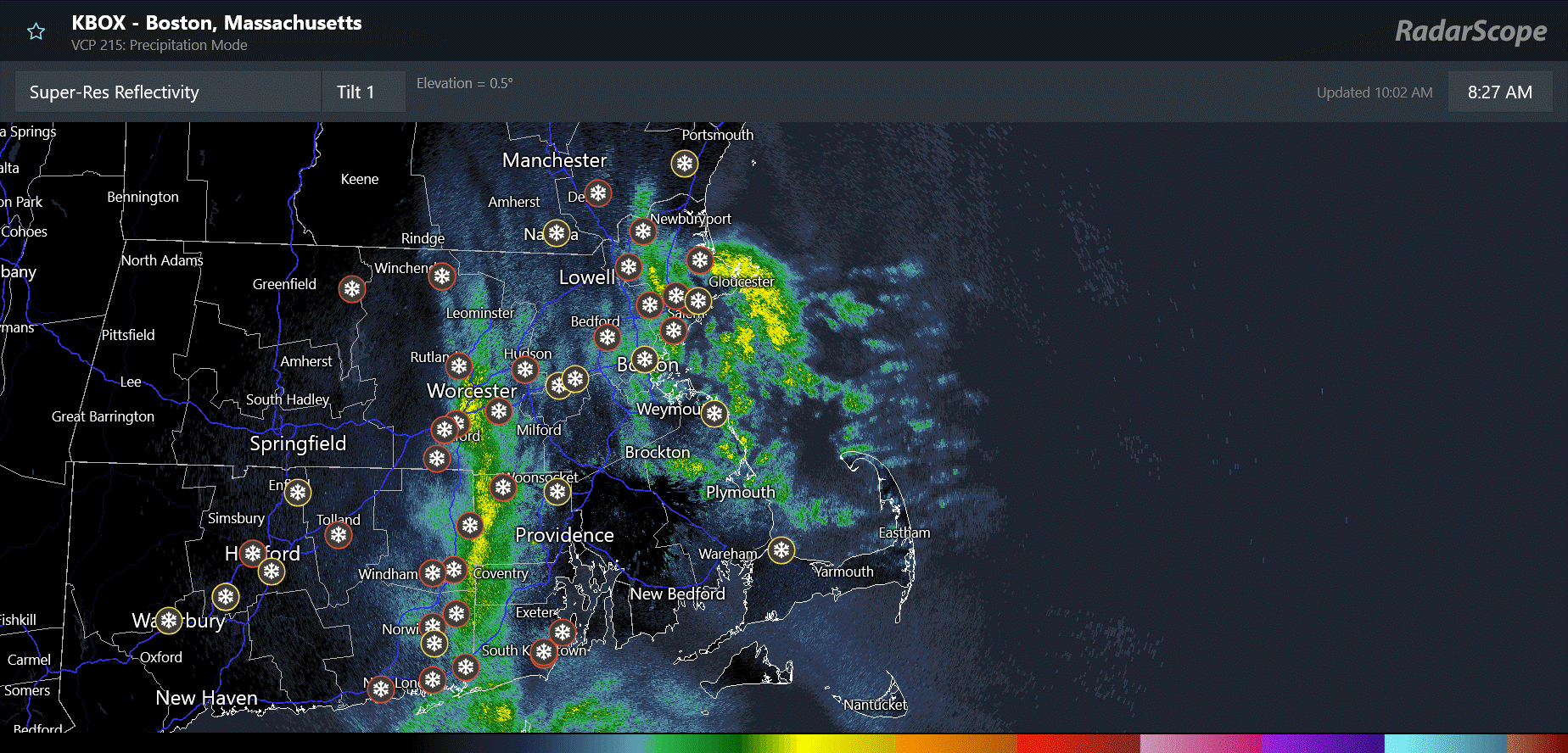
In the radar loop above, you can see how northeast winds on the east side of that trough are bringing bands of heavy snow inland off the ocean into eastern Massachusetts, while other bands of heavy snow associated with the converging low level flow along the trough axis are farther west. With the low intensifying and moving only very slowly, the “Norlun trough” remains rather stationary, causing this setup to persist for a number of hours which can result in some localized hefty snowfall totals. In this situation today, a number of locations from eastern Massachusetts across Rhode Island and eastern Connecticut had already received 4-8” of snow as of midday with some localized amounts of up to a foot. There will likely be some isolated 12-18” amounts when all is said and done, especially across eastern Massachusetts.
Today’s weather pattern is also favorable for the development of localized intense snow squalls downstream of the Great Lakes, and these will be most likely this afternoon and evening across the Mid-Atlantic and central Appalachians as discussed in the Weather Prediction Center Key Messages above.
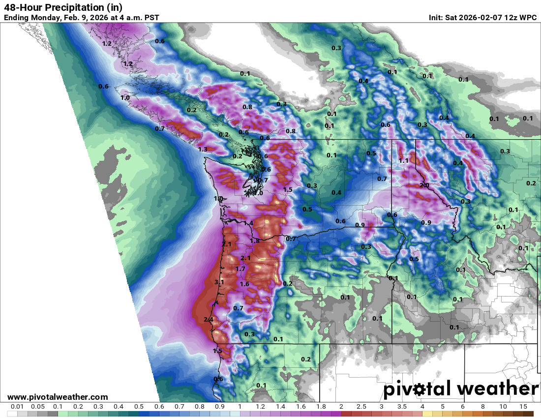
While the persistent upper level area of high pressure we have seen the last cuple of weeks will continue to dominate much of the West this weekend, in signs of an upcoming pattern change an upper level weather disturbance and westerly surge of moisture off the Pacific will bring waves of moderate to heavy precipitation to the Northwest this weekend. With above normal temperatures, much of this precipitation will fall as rain, but heavy snow will occur at some of the highest elevations. Some colder air will start to filter in later on Sunday and start to lower snow levels.
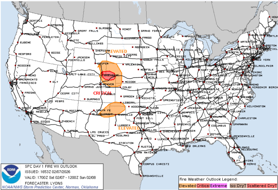
In between the western and eastern systems, dry and unseasonably warm conditions are expected across the central part of the country. Gusty southwest winds combined with persistent drought conditions will result in areas of elevated to critical wildfire danger as shown above.
This warmth will continue into early next week, with a number of record high temperatures forecast on Monday.

Leave a comment