Concern about how job reductions could affect disaster response and aid.
Feb 08, 2026
Happy Super Bowl Sunday! Sorry I am running a bit late today, I had a very busy morning. I wanted to start off this morning with sharing a couple of FEMA related news articles. Yesterday, the Associated Press reported that FEMA is planning to resume the job cuts that it paused during the major winter storms of the last couple of weeks. As the article notes, these positions are part of Cadre of On-call Response/Recovery (CORE) program at FEMA, which is designed to enable rapid surges and drawdowns in staffing based on agency needs given the vagaries of disaster size and timing.
People working under CORE typically work under two and four year contracts designed to allow reduction in positions if and when needed. However, FEMA managers quoted in this and other media articles indicate that the current planned job cuts are being done in an indiscriminate manner “without taking into account the importance of their role or their years of experience. The hundreds of CORE dismissals have wiped out entire teams, or left groups without managers.”
This comes in the wake of Politifact publishing an article last week regarding Rep. Jared Moskowitz (D-FL) — who is the former director of emergency management for the state of Florida — stating that the FEMA federal disaster declaration and aid process has the greatest backlog of unapproved applications in its history. While Politifact could not verify it is the largest backlog in history, it did confirm that delays have become much more substantial in the last year and the backlog of unapproved applications is significant.
FEMA told Politifact that President Trump is providing applications more scrutiny and that the delays are a “feature not a bug.” However, the reality is that in disaster situations, time is often of the essence — and while increased scrutiny in and of itself is not be a bad thing, that scrutiny can and should be performed with all deliberate speed. Making massive staff reductions within the staffing of the agency — both with these imminent CORE staff reductions and the major staff reductions that are reportedly in the FEMA report that is now months overdue — would not seem prudent for improving the timeliness in processing these critical disaster applications.

Turning to weather, the 48 hour snowfall analysis from the NOAA National Operational Hydrologic Remote Sensing Center (NOHRSC) shows that areas just north of Boston and in southwest Rhode Island and extreme eastern Connecticut ended up being the “jackpot” areas from the “Norlun trough” snow event I talked about yesterday. Several locations in the coastal suburbs just north of Boston had a foot or more of snow, with a CoCoRaHS site just southwest of Beverly reporting nearly 14”. The maximum amount in Rhode Island was 11.6” near Westerly, also at a CoCoRaHS site.
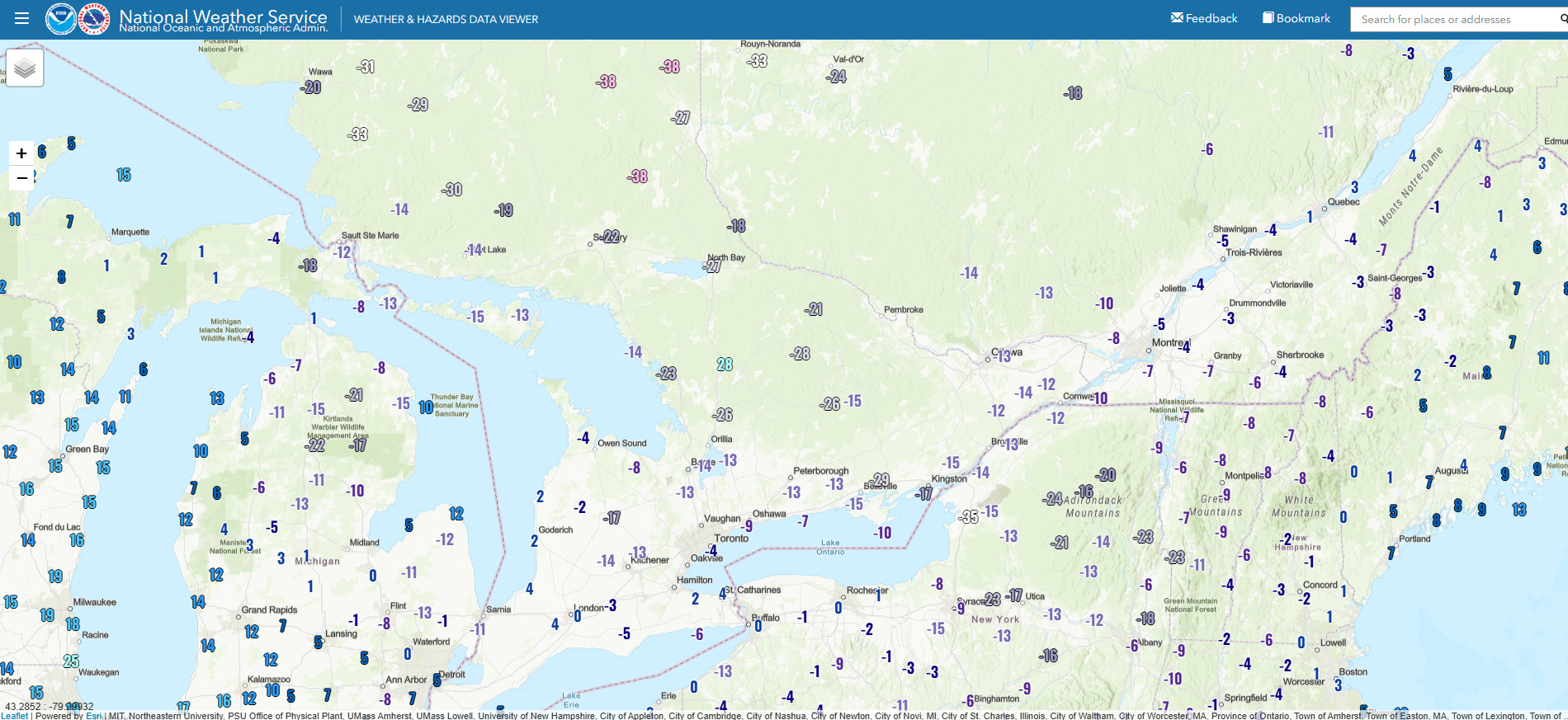
Some incredibly cold air surged across Ontario, Quebec, upstate New York and New England in the wake of the intensifying low pressure system off the East Coast. The -36F low at Watertown, NY tied for the seventh coldest minimum temperature ever observed there (records go back to 1949), and was the coldest low temperature since -37F on February 14, 2016.
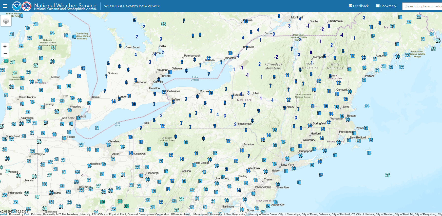
Temperatures are still very cold across much of the Northeast at mid-afternoon, but have warmed above zero in most areas.

Quiet weather is dominating the country today, with precipitation mainly limited to the Pacific Northwest, as well as some snow squalls downstream of the Great Lakes.

This week looks as if it will be a transitory week in US weather. The area of high pressure over the West that has dominated the middle and upper level weather pattern (as shown by 500 millibar /~18K ft AGL/ European ensemble model forecast for Thursday) will be breaking down and replaced by a weak trough. While a persistent trough will continue over the East and keep shots of colder air moving south, it will begin to shift more offshore as the week goes on with the colder air becoming increasingly confined to the Northeast. In between, a large ridge of upper level high pressure will bring unseasonably warm — and at times record — temperatures to the middle of the country.
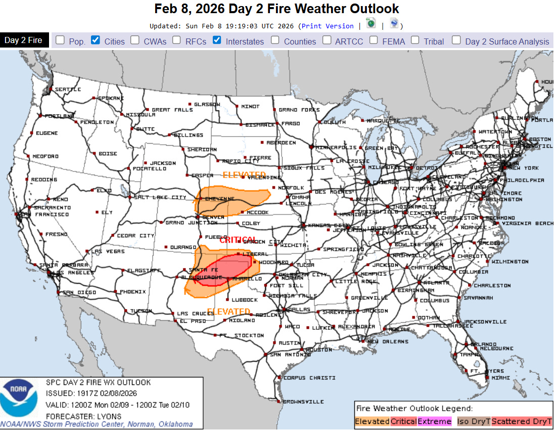
Given ongoing drought conditions, the warm and dry weather in the central US will also result in elevated wildfire conditions when winds become gusty. Monday will see critical fire danger across parts of the Southern Plains.

Leave a comment