Impacts on computing resources for atmospheric science research unclear
Feb 13, 2026
Starting off this morning with news that broke yesterday about the National Science Foundation’s (NSF) National Center for Atmospheric Research (NCAR). NSF formally announced that it intends to move the operation of the NCAR supercomputing facility in Cheyenne, WY to “a third-party operator consistent with the terms of NSF’s cooperative agreement with the University Corporation for Atmospheric Research.” NSF did not provide any details beyond this other than saying it would work on “continuity of operations.” The NCAR center in Cheyenne is a world class supercomputing facility that serves the earth science research community. Atmospheric sciences research often requires very large computing resources, particularly for modeling and artificial intelligence (AI) R&D, and this crucial facility has provided those needed resources for more than 4,000 research scientists since 2012. A number of my colleagues have posted on social media in the last 24 hours about the importance of this facility in their research and expressed their dismay at the potential loss of it.
Given the lack of detail in the announcement by NSF, the exact implications of these announced plans as far as tangible impacts for the meteorological community going forward is unclear. Andrew Freedman from CNN reported earlier today that NCAR Director Everette Joseph e-mailed staff about the NSF move, and acknowledged there are more questions than answers:
“We do not yet know who the new managing entity will be nor do we know the timeline for this transition,” Joseph stated. “I understand that this is difficult news and that it raises many questions, most of which I cannot answer at this point. However, we will be working to get more details as soon as possible from NSF, including how this will impact our science and the community we support,” he said.
Regardless, moving operational control of the facility from UCAR — the consortium of universities and academic partners that operate NCAR with funding from NSF — to a third party appears to be the next step in the Trump Administration’s plans to dismantle NCAR as a defined research entity. The future of NCAR was a key point of debate during the Senate’s passage of the budget bill that funds the federal science agencies, with the Colorado delegation trying but ultimately failing to obtain an amendment to the bill to protect NCAR.
The bill that passed and was signed into law did have wording about requiring NSF to continue to fund all of its research facilities, so it will be interesting to see if the Colorado delegation pushes back on this NSF announcement in the context of that legislation. I will obviously continue to provide updates as developments occur.
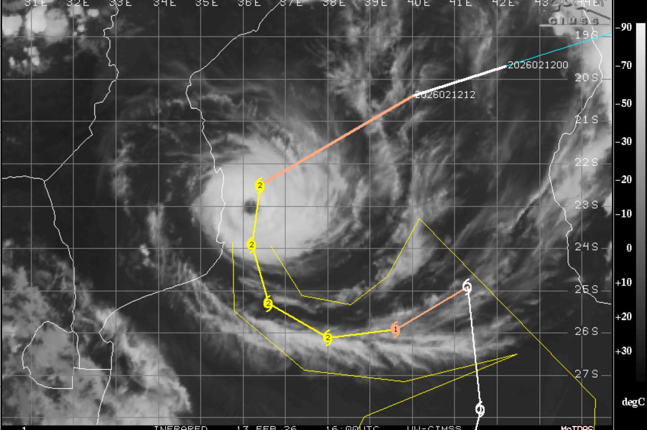
I also wanted to provide a quick update on Cyclone Gezani. Gezani has continued to intensify over the last 24 hours, and in the infrared satellite image above you can see the very distinct eye at the center of the storm. Recent automated satellite estimates now suggest that Gezani has intensified back to near the equivalent of major hurricane status. The forecast track from the Joint Typhoon Warning Center that you can see above has shifted a bit east. This is good news for the coast of Mozambique, but you can also see that currently the center of Gezani is a bit west of the forecast track, and the coast of Mozambique is certainly still within the potential path of the storm.
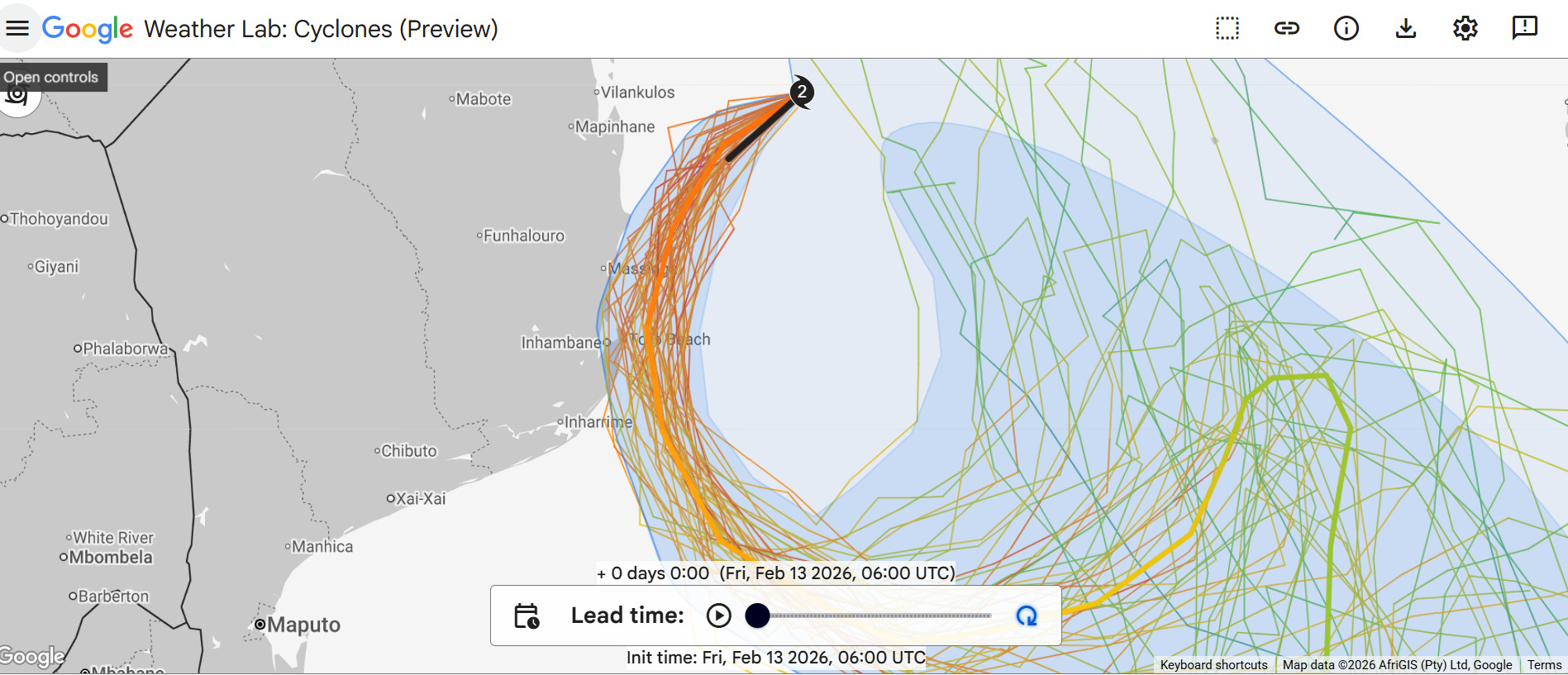
This can be seen in the latest forecast from the Google DeepMind AI with a number of ensemble members are passing the center of Gezani near or over the coast near Inhambane. People in the region will be monitoring the track closely the next several hours and hoping for a track more to the east. At a minimum, heavy rainfall and high winds are expected along the coast.
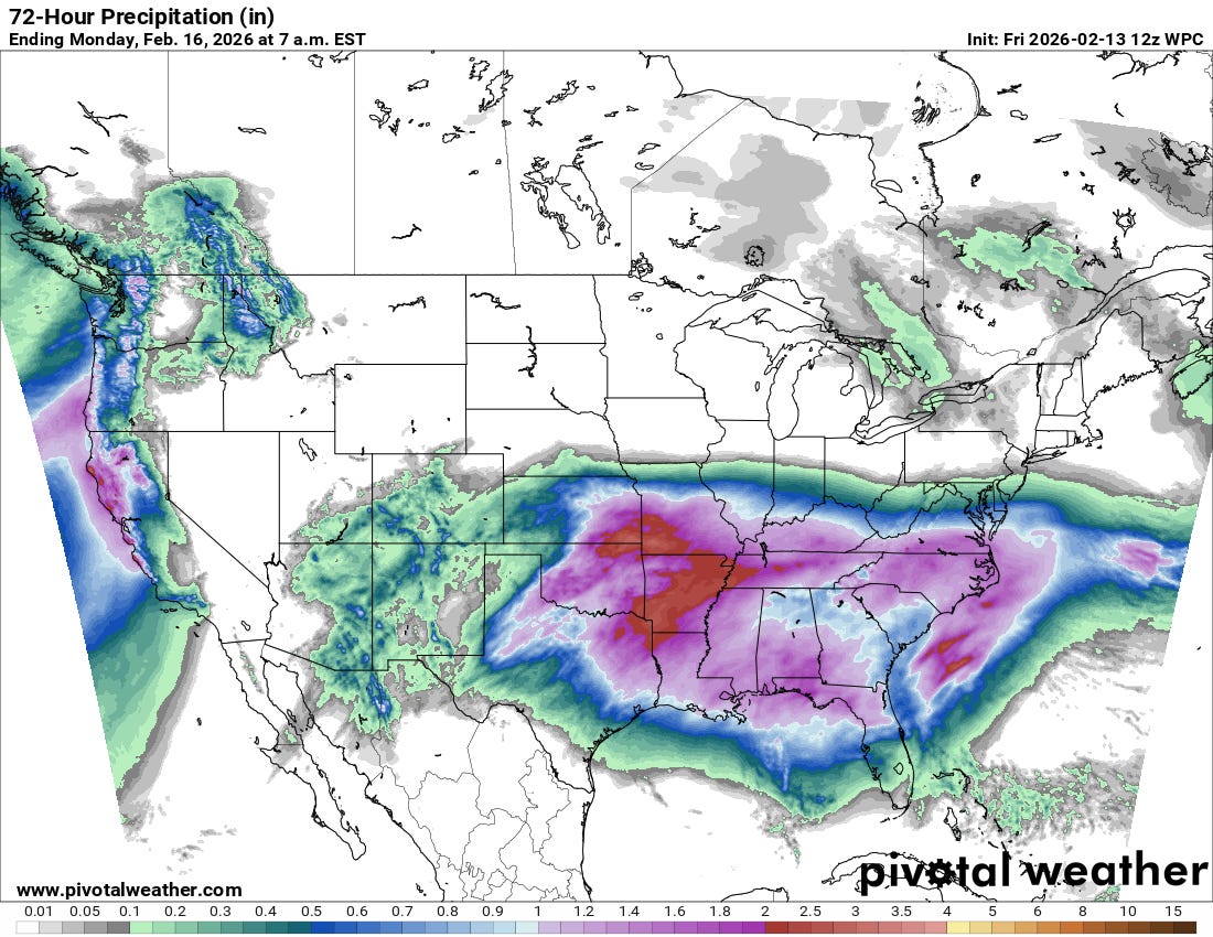
Finally, I want to finish up talking about the storm system that will be bringing much needed rainfall from the Southern Plains to the Southeast Coast the next few days.
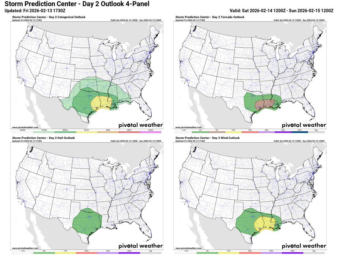
As I have been talking about the last few days, this system will also bring a risk of severe thunderstorms, with a marginal (level 1 of 5) risk today across parts of the Southern Plains. With the low pressure system expected to intensify and bring up sufficient Gulf moisture on Saturday, the risk of severe weather should increase Saturday afternoon and night as a line of strong to severe storms develops in the western Gulf Coast region and moves east. The NWS Storm Prediction Center now has a slight (level 2 of 5) risk for this region, with damaging winds and tornadoes looking to be the main risks.
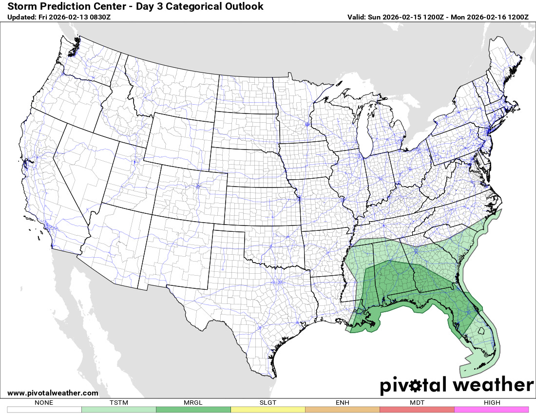
There will be a severe risk farther east on Sunday as everything pushes east — but as of now it appears as though the Gulf moisture will be more limited there and keep the risk at more of a marginal (level 1 of 5) level.
The large storm system for early next week for the West Coast that will bring heavy rainfall and significant mountain snow to California still looks to be on track, with Monday into Tuesday looking to be the most impactful period. More on that storm system tomorrow.

Leave a comment