Heavy mountain snowfall, strong winds, and significant wildfire danger all anticipated. Also – recapping a busy weekend of severe weather.
Feb 16, 2026
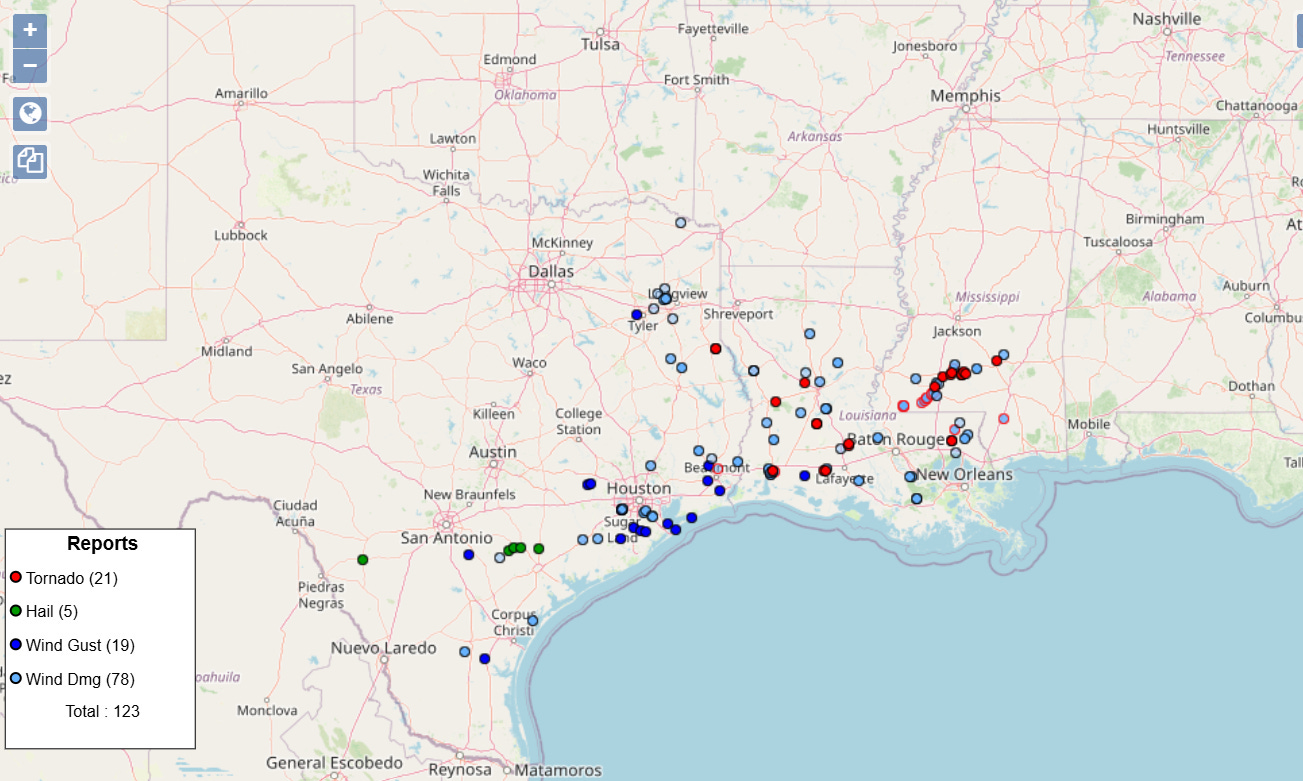
Starting off today with a recap of the severe weather over the weekend. Saturday afternoon and night ended up being the busiest period for severe weather, with over 100 reports of wind damage and tornadoes from southeast Texas across southern Mississippi. A few reports of marginally severe hail occurred as the initial storms were developing over south central Texas Saturday afternoon.
The severe weather was the result of an intense squall line — what meteorologists refer to as a quasi-linear convective system (QLCS) — that swept across the region along a cold front south of an intensifying low pressure system.
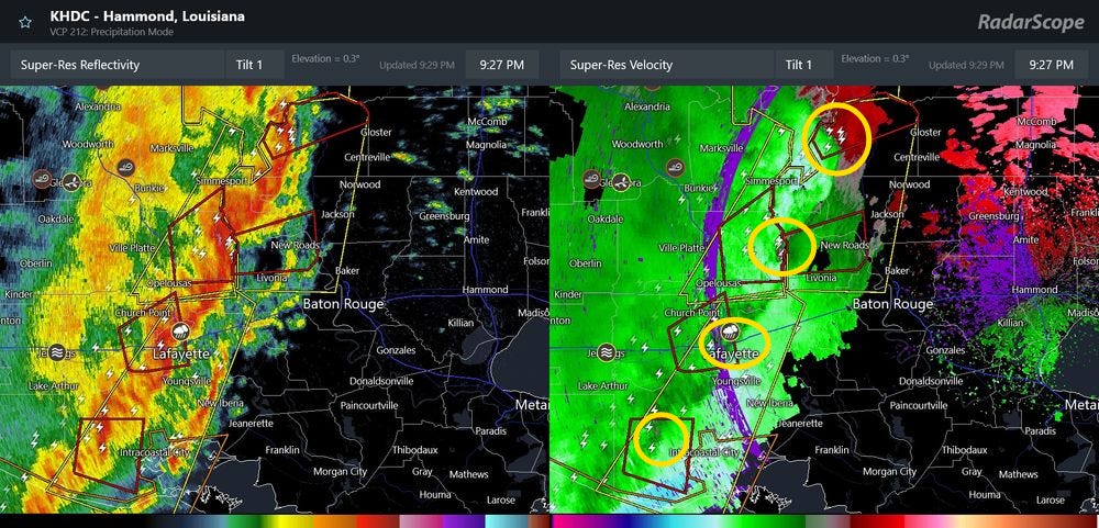
As I talked about in my post late Saturday evening, very small but intense areas of low pressure and rotation called mesovortices (yellow circles on the Doppler velocity/wind image above) are the focus for meteorologists in QLCS events, as the mesovortices can produce tornadoes and enhanced straight line winds. A number of measured severe wind gusts (58+ mph) occurred with this QLCS — including a 73 mph gust at the Lake Charles NWS office when a mesovortex moved across. NWS Lake Charles also reported a 132 mph gust from a mesonet site in Acadia Parish, LA — a mesovortex also moved through this region, and it would seem possible that the site was actually impacted by a tornadic circulation.
Obviously, this is just one of a number of mesovortices NWS meteorologists will have to survey from this event to determine if and where tornadoes occurred and their intensity. It seems likely though based on initial reports and the numbers of tornadic debris signatures that were observed on radar that more than a dozen tornadoes occurred from this regional severe weather episode.

As expected, these storms weakened as they moved farther east and encountered less favorable moisture in lower levels of the atmosphere — but then did reintensify across the Florida Panhandle and extreme southern Georgia as they encountered another surge of Gulf moisture. A number of wind damage reports were received from this area Sunday afternoon.
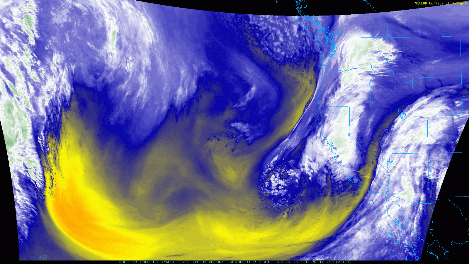
Attention is now turning to large, complex and intense upper level storm system that NOAA water vapor satellite imagery shows moving across the eastern Pacific and into the western United States this morning.
Mosaicked radar data from the NOAA/NSSL Multi-radar Multi-sensor System shows that moderate to heavy precipitation is streaming over much of California this morning, including very heavy snow in the higher elevations of the Sierra Nevada.
As this storm system pulls east toward the Rockies the next couple of days, it will bring a variety of hazards to the western half of the country, including strong winds and heavy mountain snows.
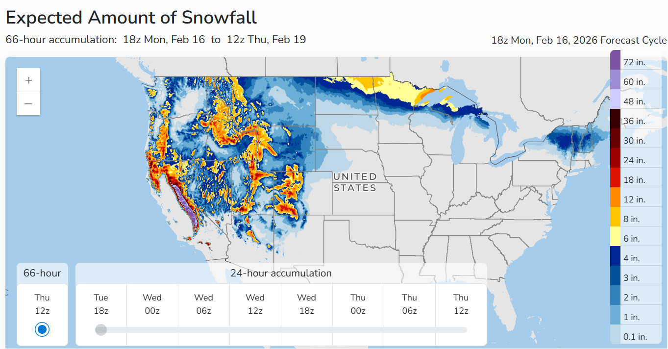
While the impacts from this storm system will be over a broad region, the primary focus for heavy precipitation will definitely be over California, where multiple feet of snow are expected in the higher elevations of the Sierra Nevada, making for difficult to impossible travel.
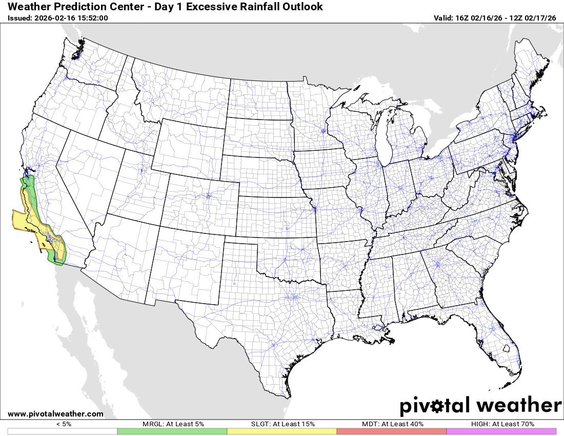
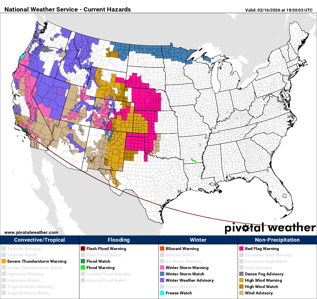
Heavy rainfall will also bring a level 2 of 4 risk of flash flooding to parts of central and southern coastal California, mainly through Tuesday morning. The flash flooding risk will be maximized in urban areas and wildfire burn scars.
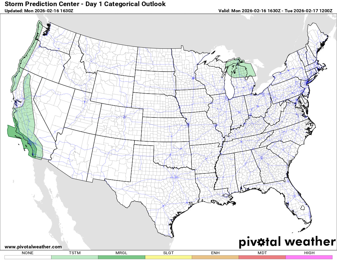
Some thunderstorms will also be possible along the West Coast the next few days, and along with the risk for flash flooding, they could also produce a few reports of severe weather across central and southern coastal California through Tuesday morning.
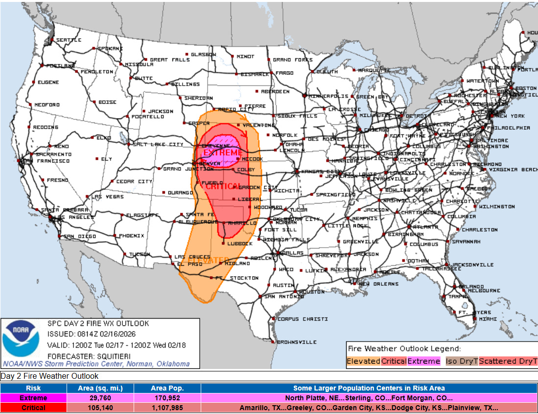
Another serious hazard that will evolve as this storm system shifts east is a significant risk of wildfires in the precipitation starved Plains region. The NWS Storm Prediction Center has issued a relatively rare extremely critical (level 3 of 3) fire weather conditions for northeast Colorado, northwest Kansas and southwest Nebraska, with much larger surrounding critical and elevated fire weather areas. Widespread wind gusts of 40 to 60 mph are expected across the Plains Tuesday afternoon with low relative humidity values — as low as less than 10% in the extremely critical region.
Programming note: I will be on family travel the rest of the week. I am planning to put together newsletters and updates occasionally — but the posts will not be on the typical cadence of daily issuances around midday.

Leave a comment