Additional critical wildfire conditions expected on Wednesday in the central and southern Plains
Feb 17, 2026
I wanted to provide a quick update on the high impact winds — including major wildfires — that occurred in the Rockies and Plains today as the large storm system we discussed on Monday pulled into the region.
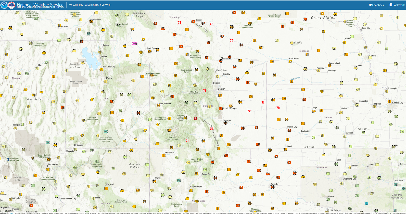
Strong southwest to west winds buffeted the region this afternoon as a strong low pressure system passed through the Northern Plains. Wind gusts of 50 to 70 mph were common. The winds caused areas of blowing dust with very low visibilities, including near Pueblo, CO this morning, resulting in a tragic multi-vehicle accident on Interstate 25 that left four people dead and nearly 30 hospitalized. Another serious multi-vehicle accident occurred along Interstate 70 near Oakley, KS.
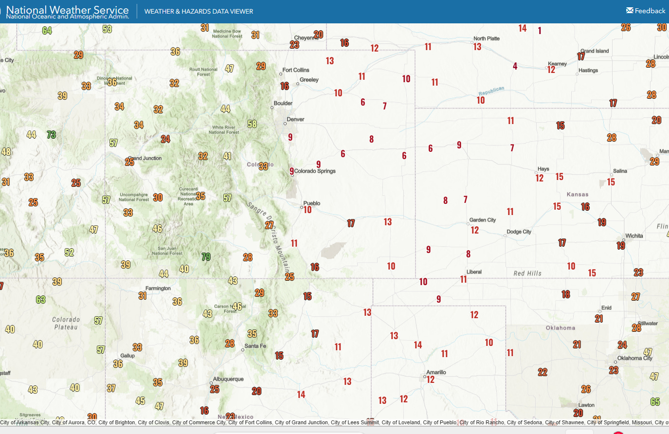
Dry air surged east on these west to southwest winds, with minimum relative humidity values dropping to the single digits across many parts of northeast Colorado, western Kansas, and the Oklahoma Panhandle.
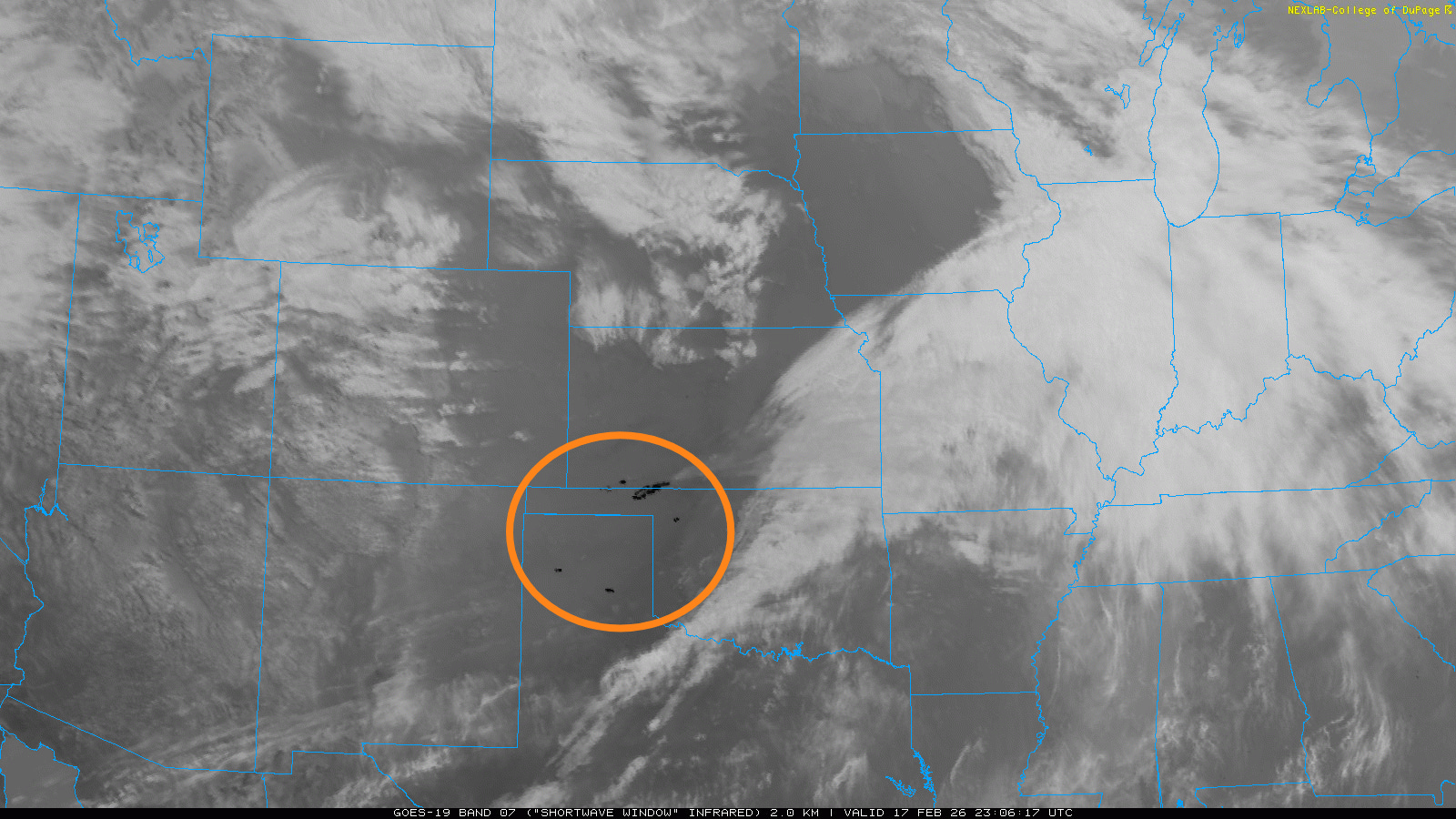
As expected, the strong winds and dry air combined with very dry fuels from ongoing drought conditions to cause dangerous wildfire conditions across the Plains. Several large wildfires erupted — the black areas within the orange circle on the shortwave infrared satellite imagery above are where the imager was detecting the heat from wildfires.
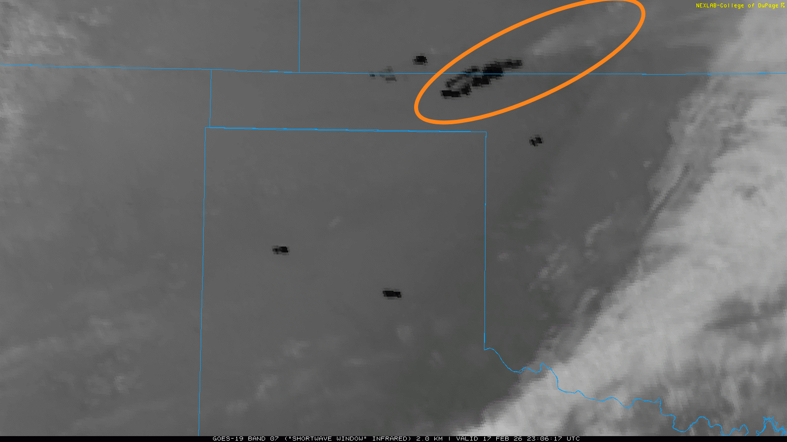
By far the largest and most rapidly spreading wildfire broke out in the Oklahoma Panhandle and spread rapidly east northeast across the border into Kansas as seen in this shortwave infrared satellite image from around 5 pm CT. You can see the large black heat signature, with the large greyish white smoke plume spreading downstream from the fire. This fire rapidly grew to more than 15,000 acres and resulted in the evacuation of town of Tyrone, OK. Oklahoma Governor Kevin Stitt mobilized resources from across the state to battle this and other wildfires in the Panhandle and northwestern part of the state.
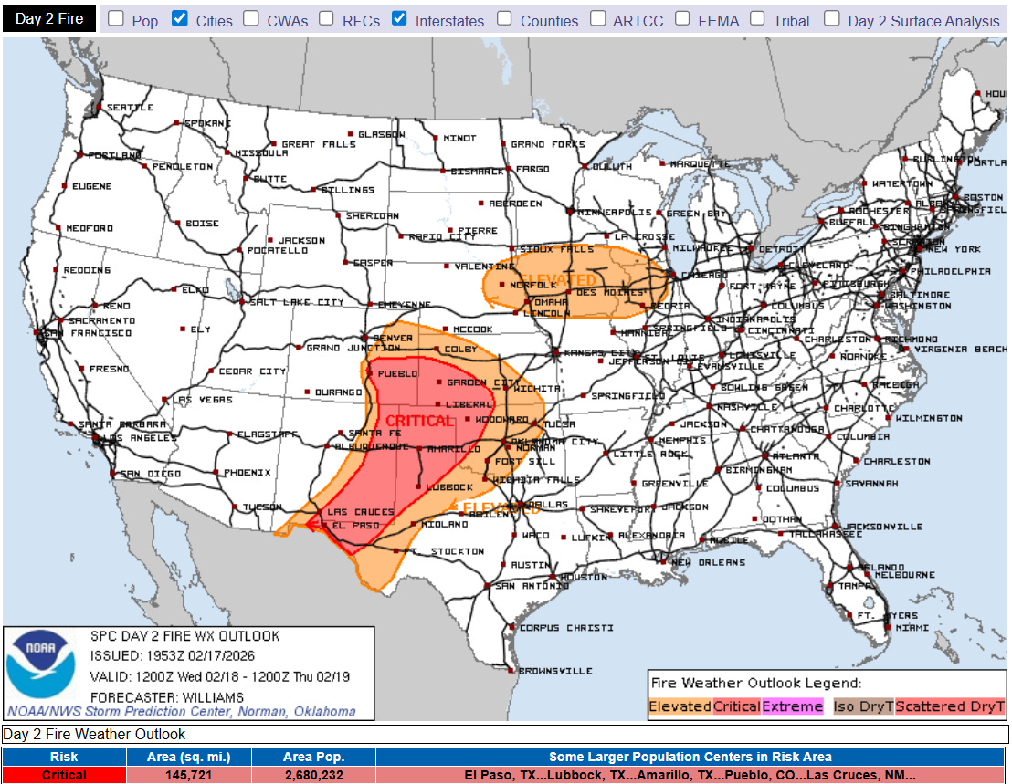
Another disturbance rotating through the large upper level trough of low pressure over the western United States will produce another rather strong low pressure system in northeast Colorado on Wednesday. While conditions are not expected to be as extreme as today, strong wind gusts and dry conditions are expected to produce critical wildfire conditions across the southern and central High Plains, including in the areas of Oklahoma and Kansas where the large wildfires erupted today.

In addition to the critical wildfire conditions, the large western storm will produce widespread mountain snow with the heaviest in the Sierra Nevada and the higher elevations of western Oregon and northwest California. Meanwhile, a southeast moving series of upper level weather disturbances will produce some light to moderate wintry precipitation across parts of the Great Lakes and Northeast, with some heavier snow across the far upper Midwest.
Programming note: I will be on family travel the rest of the week. I am planning to put together newsletters and updates occasionally — but the posts will not be on the typical cadence of daily issuances around midday.

Leave a comment