Very heavy snowfall and avalanches in the West, wildfires and wind in the central states, and severe weather and snowfall risks in the East
Feb 19, 2026
Catching up after a day off, and a lot of weather related stories are ongoing. I am just going to take them one at a time.
Heavy snowfall and avalanche danger in the West
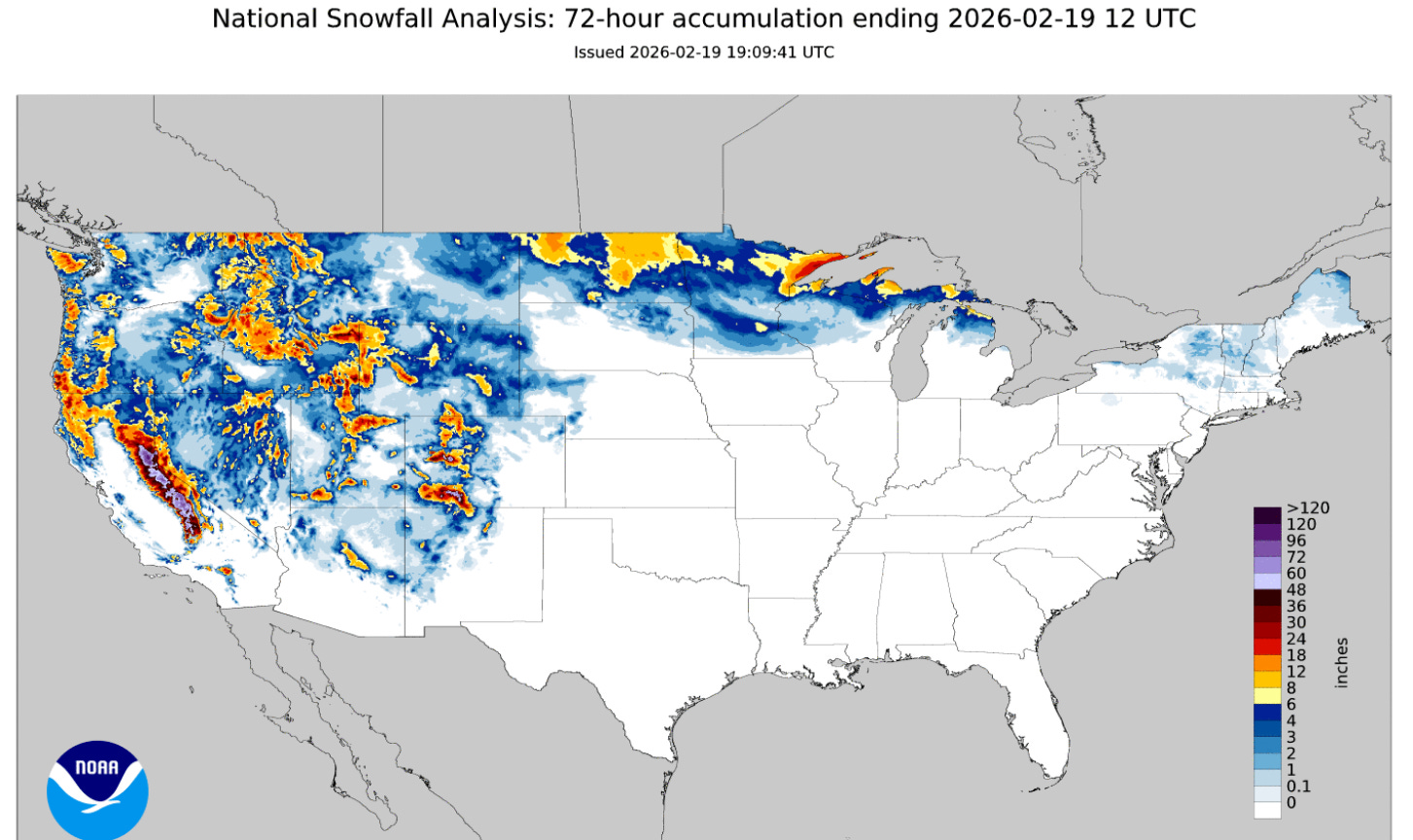
The National Operational Hydrologic Remote Sensing Center (NOHRSC) 72-hour snowfall analysis ending this morning shows that as expected heavy snow has been impacting the mountains of the Western US, but also as expected by far the heaviest snowfall has been in the Sierra Nevada, with amounts of more than 4 feet reported at some of the highest elevations.
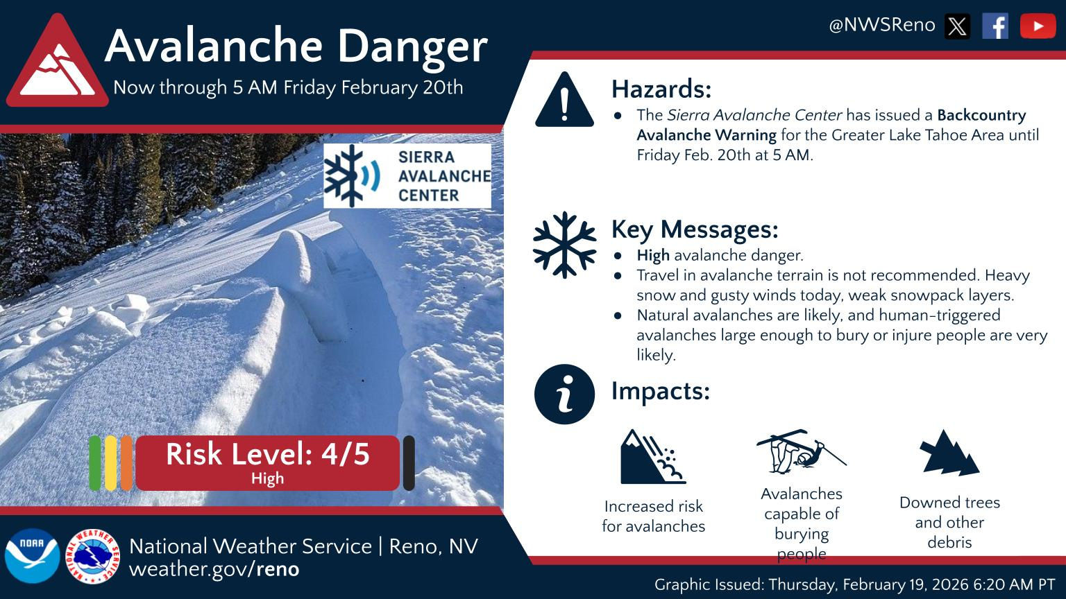
The combination of recent very heavy snowfall and strong winds has resulted in high avalanche danger in the region and the issuance of avalanche warnings. Unfortunately in what has been a major national story, one of the deadliest avalanches in years occurred on Tuesday morning northwest of Lake Tahoe.
Nine people were killed when an avalanche overwhelmed a group of 11 skiers and four guides in the backcountry near Frog Lake Cabins during near blizzard conditions. The San Francisco Chronicle has an excellent article (gift link) summarizing what happened and the many questions surrounding the tragedy given that the storm was well forecast and avalanche warnings were posted when the group decided to venture out.
With the upper trough of low pressure lingering in the region, additional heavy snow is expected the next few days, with the heaviest in southern Sierra Nevada.
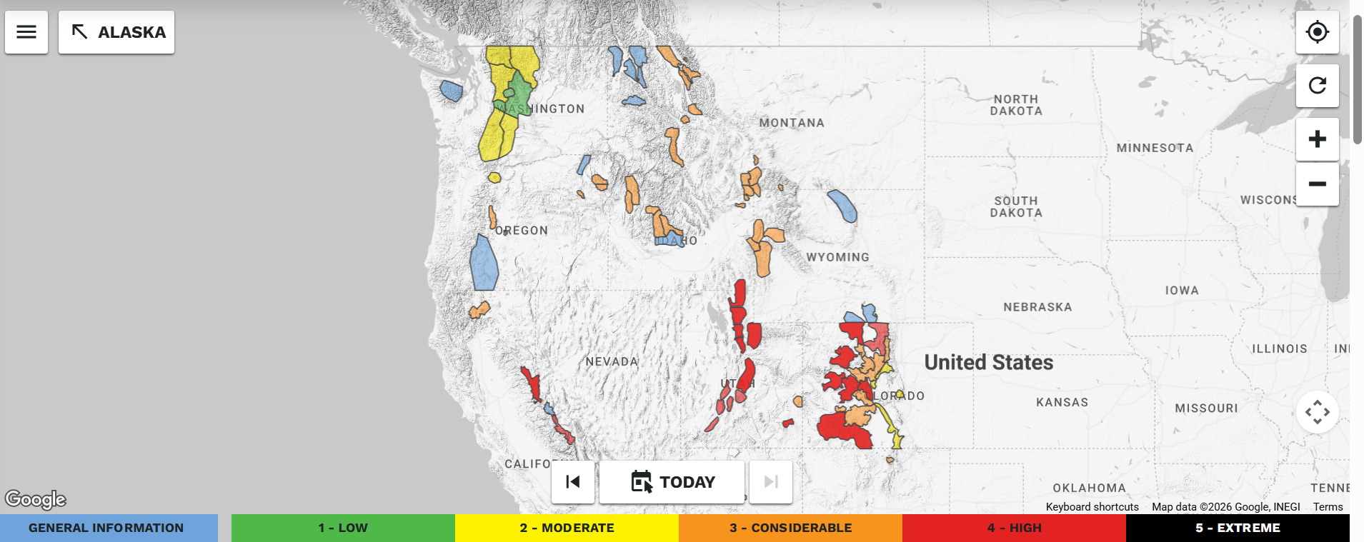
Per the US Forest Service avalanche danger levels on avalanche.org, this will keep high avalanche danger across the Sierra Nevada and higher elevations of Utah and western Colorado.
Central United States Wildfires
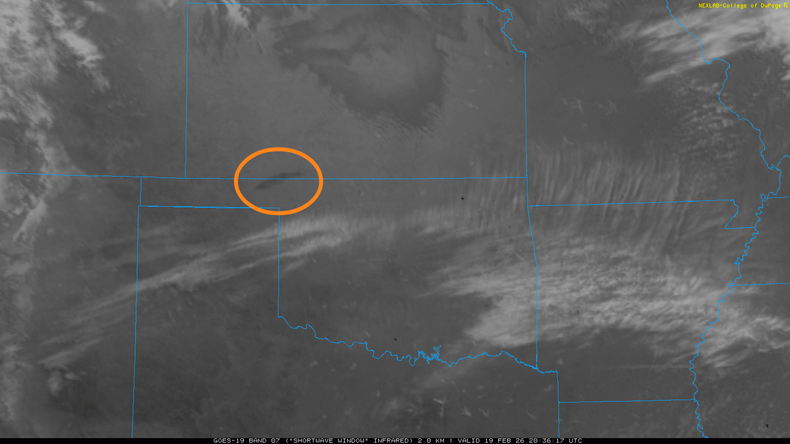
While not as volatile as Tuesday, Wednesday was another day of dry conditions and gusty winds across the Plains, resulting in a few new wildfires. The morning shortwave infrared satellite image shows the elongated heat signature (in the orange ellipse) of the largest wildfire that has been burning across northwest Oklahoma and adjacent southwest Kansas. This fire has burned nearly 300,000 acres itself, forced evacuations and has destroyed a number of structures in the region. Four firefighters were injured battling this wildfire on Tuesday.
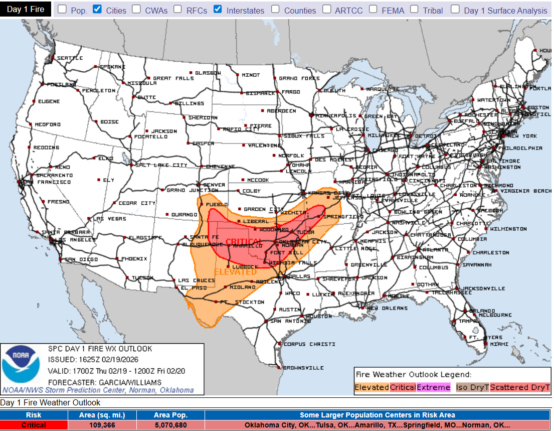
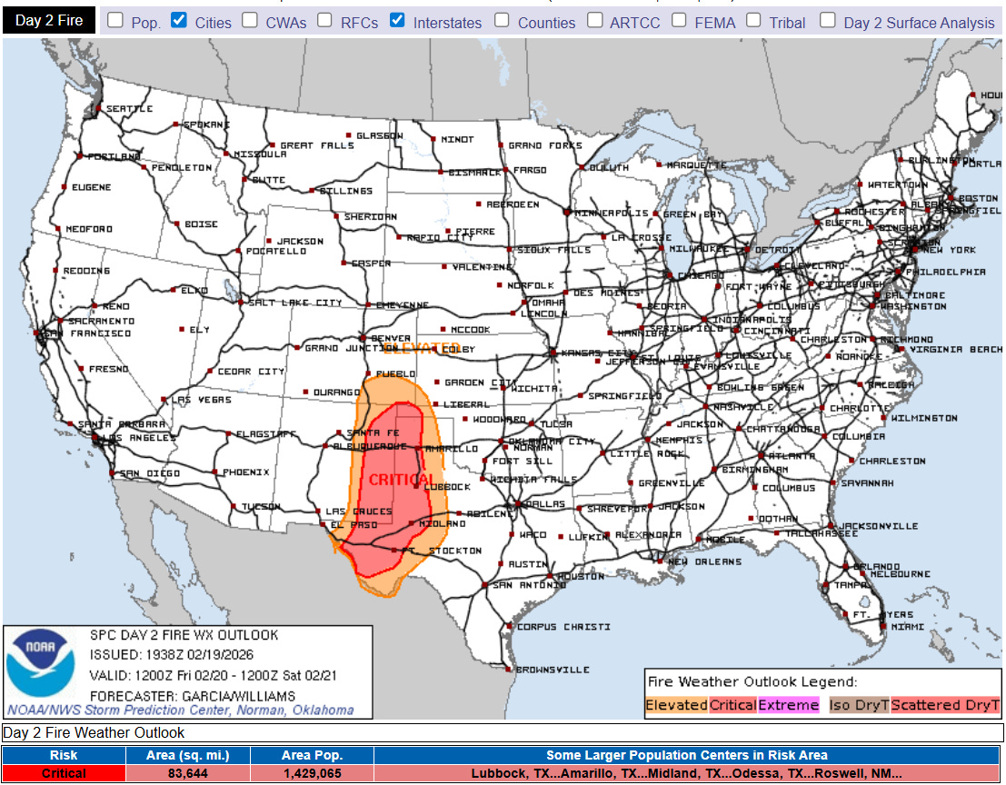
Unfortunately, critical wildfire danger is expected to continue the rest of today (top graphic) and on Friday as upper level weather disturbances continue to swing east out of the Western US trough and bring gusty winds and dry surface air to the region.
Severe weather into this evening across the Ohio Valley
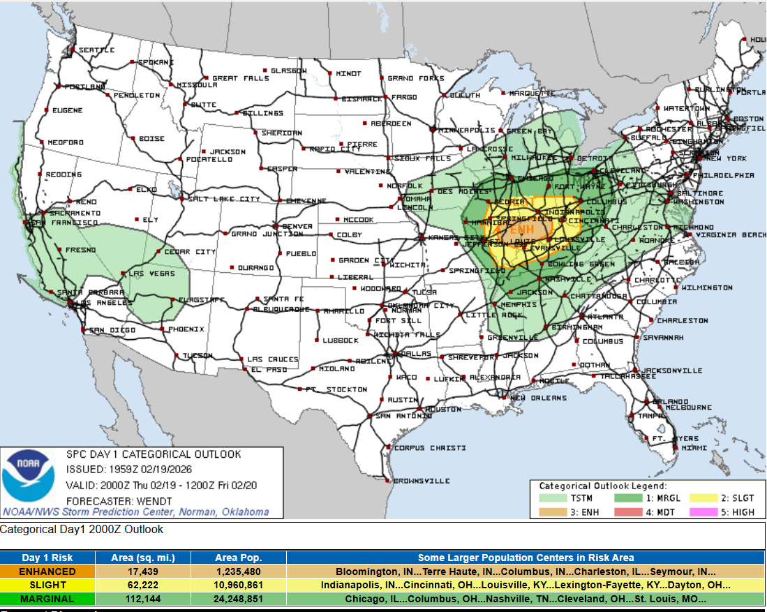
As an upper level disturbance swings into the Midwest and an associated surface low moves across northern Missouri toward northern Illinois, a favorable area for supercell severe thunderstorms is evolving across the lower Ohio Valley region. While the low level moisture will be a bit marginal, strong low level wind shear will be supportive for tornadoes with the most intense storms, and a few strong tornadoes are possible into tonight, particularly in the enhanced (level 3 of 5) risk area in the NWS Storm Prediction Center outlook.
Snowfall in the Midwest and East
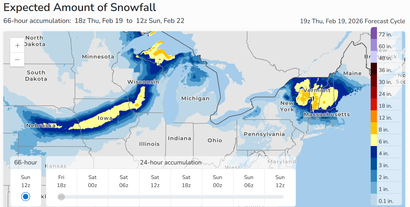
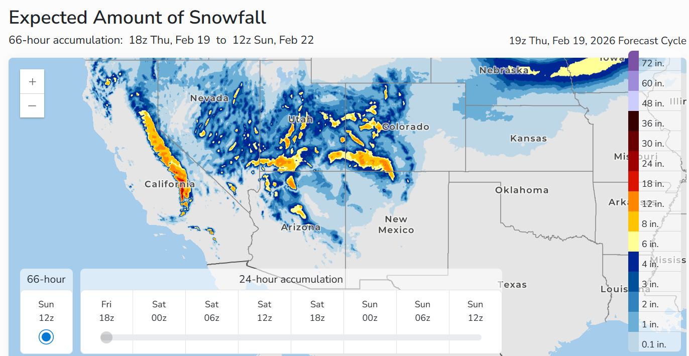
The same low pressure system is also producing a band of heavy snow to its northwest as shown in the NWS Weather Prediction Center snowfall forecast through Saturday morning. Moisture from Lake Superior will result in an expanding area of heavier snow in the Upper Peninsula of Michigan.
Meanwhile, this weather pattern will result in the development of a new surface low pressure off the New England coast Friday, which will result in moderate to heavy snowfall there. An additional upper level weather disturbance is expected to drop southeast along the East Coast early next week, resulting in the development of an intense low pressure storm system over the Western Atlantic. Most of the models right now suggest this development will occur far enough to the east to result in just some light to moderate snow potential across the Mid-Atlantic with it. However, the US Global Forecast System model and some ensemble members suggest a more impactful snowfall, so obviously given this is still several days away, we will need to keep an eye on it.
Programming note: I will be on family travel the rest of the week. I am planning to put together newsletters and updates occasionally — but the posts will not be on the typical cadence of daily issuances around midday.

Leave a comment