Very heavy, wind driven snow, power outages and coastal flooding expected
Feb 21, 2026
Good Saturday evening! First, thanks to all for their patience for the more sporadic posts this past week as I have been traveling and doing activities with my family. I will still be road tripping through the first half of the upcoming week — but should be on a more regular posting cadence starting Monday.
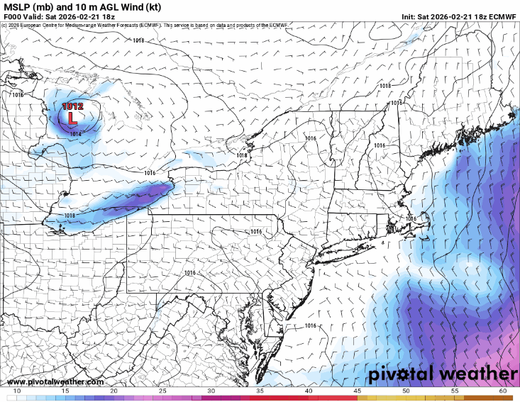
The main focus of this evening’s post will be on the major blizzard now forecast to impact the coastal Mid-Atlantic and New England the next couple of days. In my last main post on Thursday, I talked about this intense storm system forecast to develop over the western Atlantic, and how it bore watching for a higher impact evolution given some of the ensemble forecasts and the US Global Forecast System (GFS) showing a major blizzard.
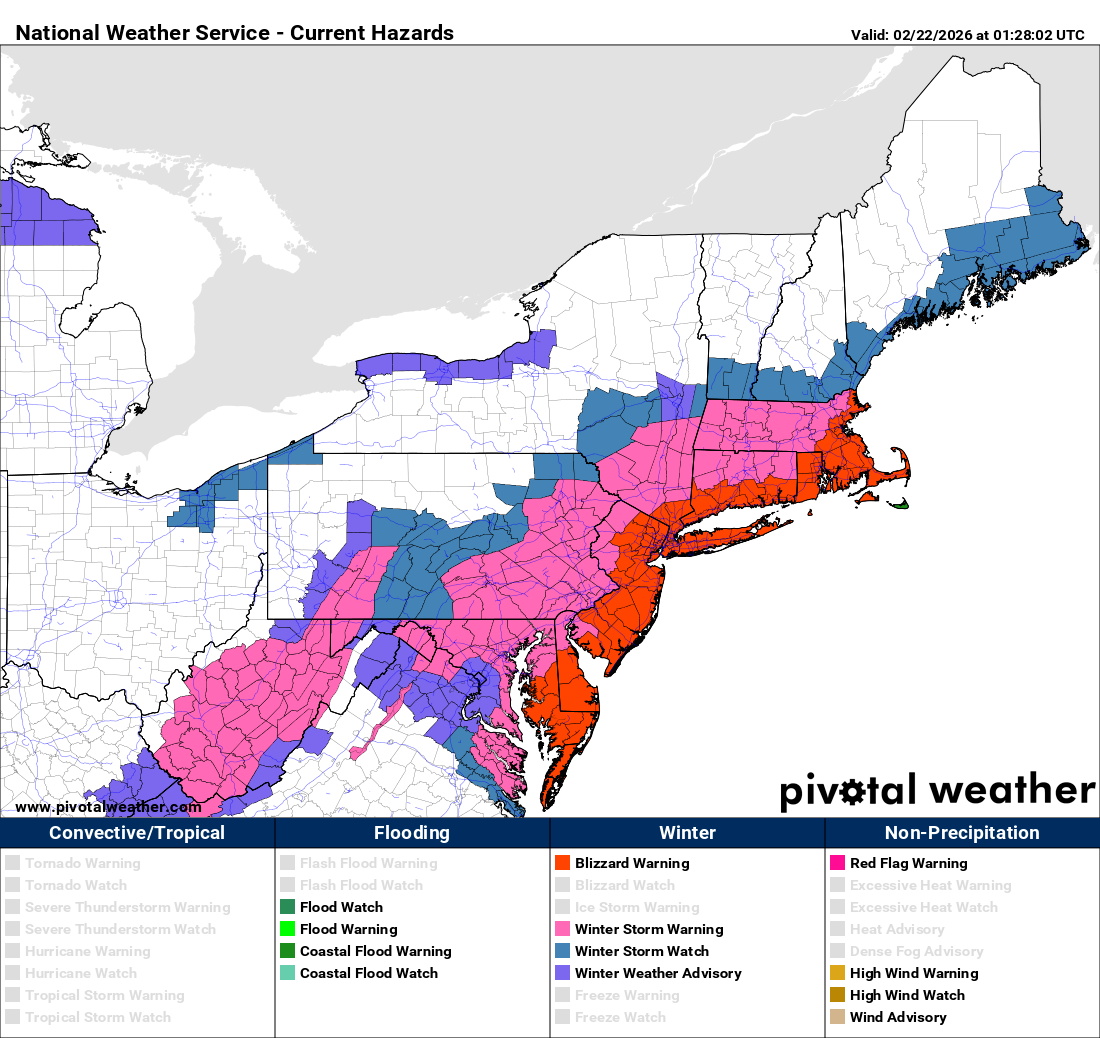
While the overall model solution for this system has not trended fully to some of the absolutely worst case GFS and ensemble scenarios, it has trended closer to the coast over the last 48 hours as can be seen in the most recent afternoon run of the European model. As a result, the main precipitation shield will now affect areas along and a bit inland from the coast, resulting in very heavy snowfall driven by strong winds — and blizzard warnings have been issued accordingly as can be seen in the NWS hazards map above.
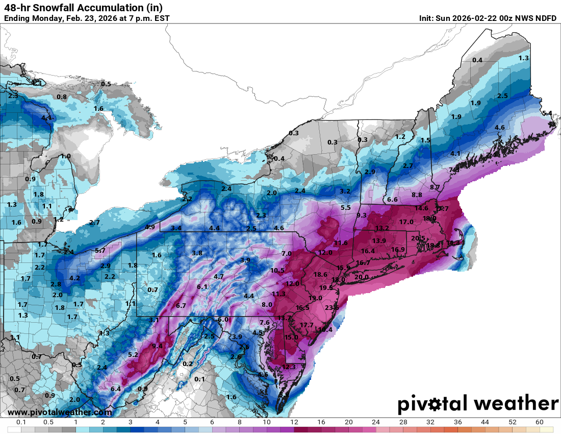
This map shows the official NWS forecast snowfall through the day Monday, which appears to be on the high end of the model snowfall forecasts and (to me, anyway) a bit overdone in the heaviest snowfall areas. Regardless of exact amounts, though, snowfall amounts of a foot or more should be widespread from the Delmarva northeast through New Jersey and the New York City metro area and into southern New England including Boston.
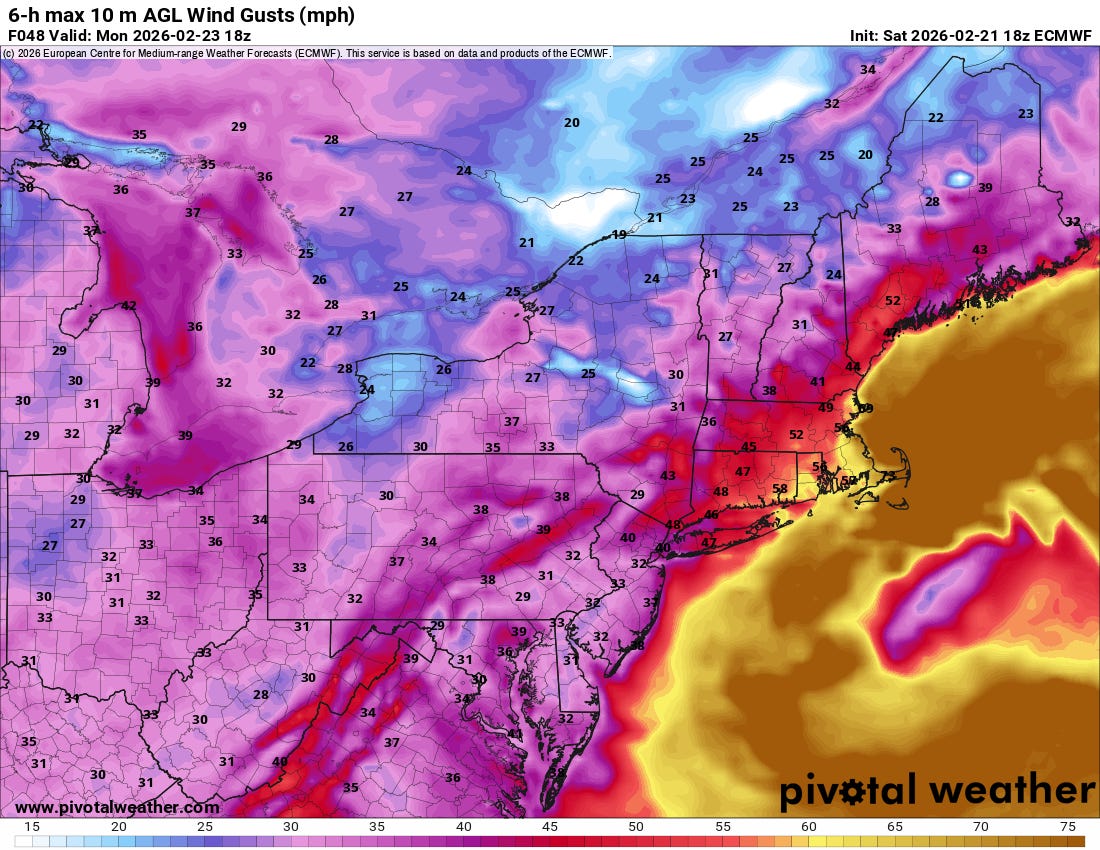
The combination of very heavy snowfall, widespread wind gusts greater than 40 mph late Sunday into Monday, and near zero visibilities due to falling and blowing/drifting snow, will mean nearly impossible travel across the region. These winds will also likely cause significant power outages.

The winds will also result in moderate to potentially localized major coastal flooding from the Virginia Capes to southern New England. The Sunday evening into early Monday morning high tide cycle looks to be the most impactful.

Arctic air will surge into the region behind the low pressure system, with Wednesday morning looking the coldes (forecast lows from the European ensemble model above).
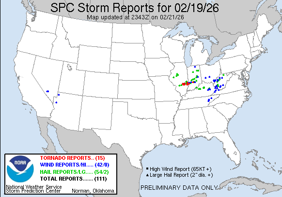
A couple of other weather stories to talk about this evening. First, I wanted to recap Thursday’s evening severe weather in the Ohio Valley that I discussed in my last post. A number of supercell severe thunderstorms developed across parts of central and southern Illinois late Thursday afternoon, and moved northeast across Indiana. A number of tornadoes occurred from southeast Illinois across southern Indiana, which was well forecast by the Storm Prediction Center. The strongest tornado as of now was an EF2 tornado in Monroe County, IN just southwest of Bloomington.
Something I have not really talked about this last week that I should certainly make mention of is the record warmth that has dominated much of the country east of the Rockies. This animation from coolwx.com shows where record high temperatures were approached or exceeded this week.
The record temperature web tool from NOAA’s National Center for Environmental Information shows that more than 1500 record warm temperatures were set in the last week. Some daily record warm minimum temperatures were broken by several degrees.

Outside of the shot of Arctic air in the wake of the upcoming blizzard, much of the country will see unseasonable warmth again this week (European ensemble forecast temperature anomalies for Thursday morning shown above).
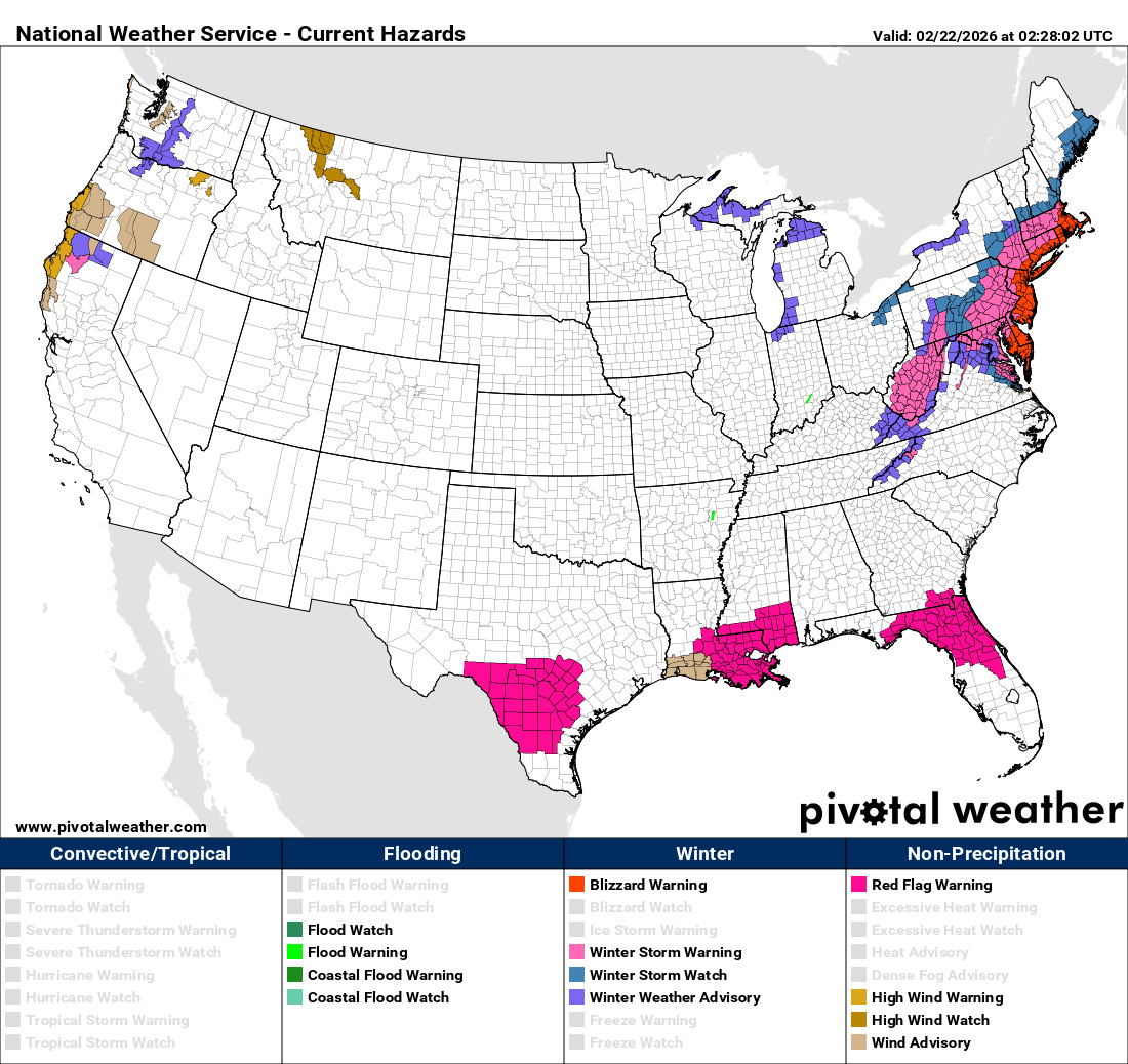
Given expected warm and dry conditions, fire weather will be a concern again across parts of the central and southern US during the next week. Red flag warnings are already in effect for parts of Texas, Florida and the central Gulf Coast.

Leave a comment