And a discussion of the difference between hurricanes and extratropical storms
Feb 22, 2026
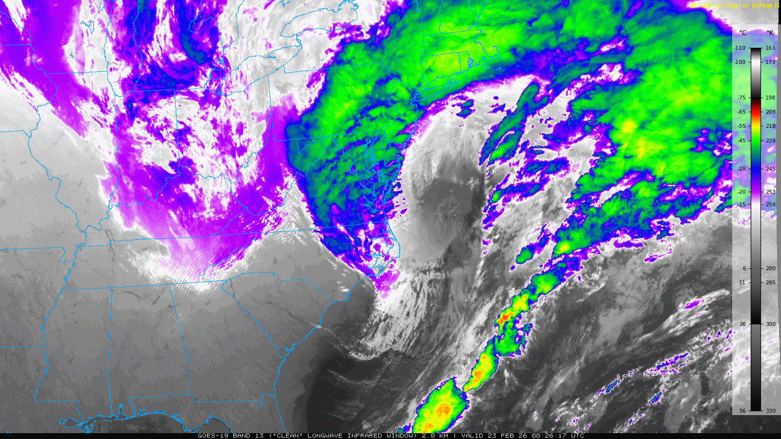
Infrared satellite imagery this evening shows the intense storm system evolving over the Northeast and western Atlantic. If you look closely, you can see the low level circulation just east of the Delmarva Peninsula at the center of the large, intensifying low pressure system. To the northwest of the center you can see the large, comma shaped precipitation shield as depicted by the green and blue cold cloud tops.

The latest NWS surface pressure analysis (RTMA) from 9 pm ET shows that the central pressure of the low is down to about 990 millibars — 29.23 inches of mercury.

The evening run of the High Resolution Rapid Refresh (HRRR) stormscale model shows the surface low intensifying another 22 mb down to 968 mb over about the next 18 hours — this storm is clearly in the “bomb” cyclone category.

This post from Matt Devitt Weather shows how this low will have similar intensity to a category 1-2 hurricane — but it is important to understand that this is an “extratropical cyclone” that forms from a very different process than tropical cyclones (see this link for more details and explanation). These systems are driven primarily by an intense middle and upper level atmospheric disturbance interacting with a strong contrast in temperatures at the surface. East coast “bomb” cyclones are helped by the strong thermal contrast provided by the cold polar air over land and the warmer oceanic temperatures over the western Atlantic — particularly in and near the Gulfstream. You can see the temperature contrast associated with this system very clearly in the RTMA graphic above — temperatures are around 30F along the Delmarva coast versus the 70s in the warm sector of the storm.
The difference in the genesis processes between extratropical and tropical cyclones is not just a matter of scientific curiosity for meteorologists. The processes involved result in systems with rapidly different structures: extratropical cyclones are much larger in size, with winds and precipitation extending well away from the center, while tropical cyclones are smaller, have their worst weather typically concentrated relatively close to the center, and can become more intense because of the atmospheric processes involved. Tropical cyclones are reliant upon warm oceanic temperatures to drive their genesis and intensification processes, which is why they develop over the ocean and weaken once they move over land. Extratropical cyclones can develop anywhere there is a favorable interaction of an upper level weather disturbance and a temperature gradient — but because the strongest thermal gradients are associated with oceans, the strongest extratropical cyclones tend to be over water.
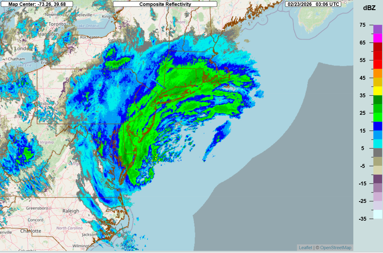
Looking at our blizzard tonight, the NSSL Multi-radar Multi-sensor System (MRMS) radar mosaic shows that precipitation is extending well to the north and northwest of the center of the low pressure center. Most of this precipitation is in the form of snow, with heavy snow now falling as far away as southern New England.

The plot of latest wind gusts shows that winds are only really beginning to crank up as the storm system intensifies. Actual blizzard conditions — defined as frequent wind gusts of 35 mph and falling or blowing snow reducing visibilities to 1/4 mile or less — are likely confined to portions of the Delmarva Peninsula.
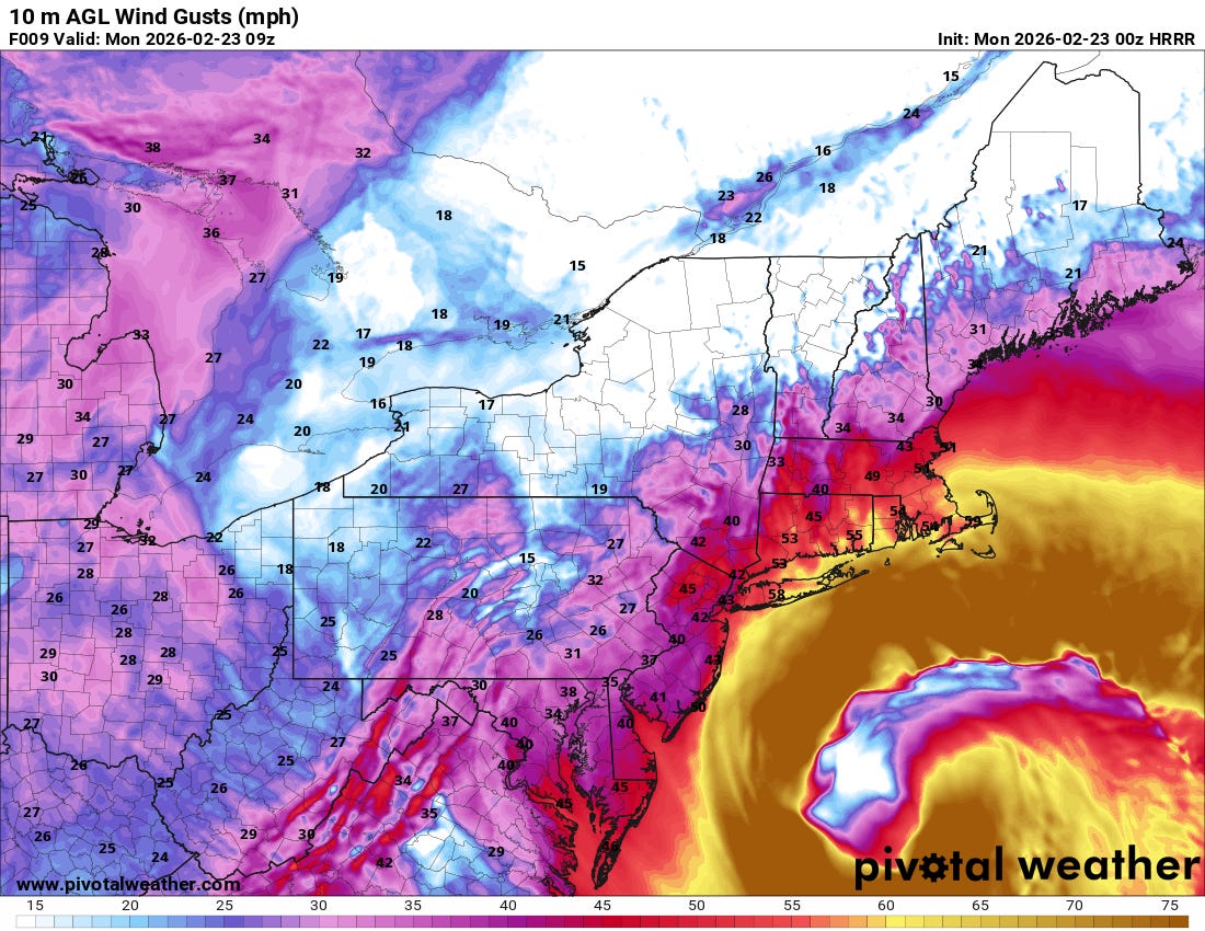
As the low intensifies overnight and into Monday morning, wind gusts greater than 35 mph will become widespread from the Delmarva into southern New England, and blizzard conditions will become more prevalent.
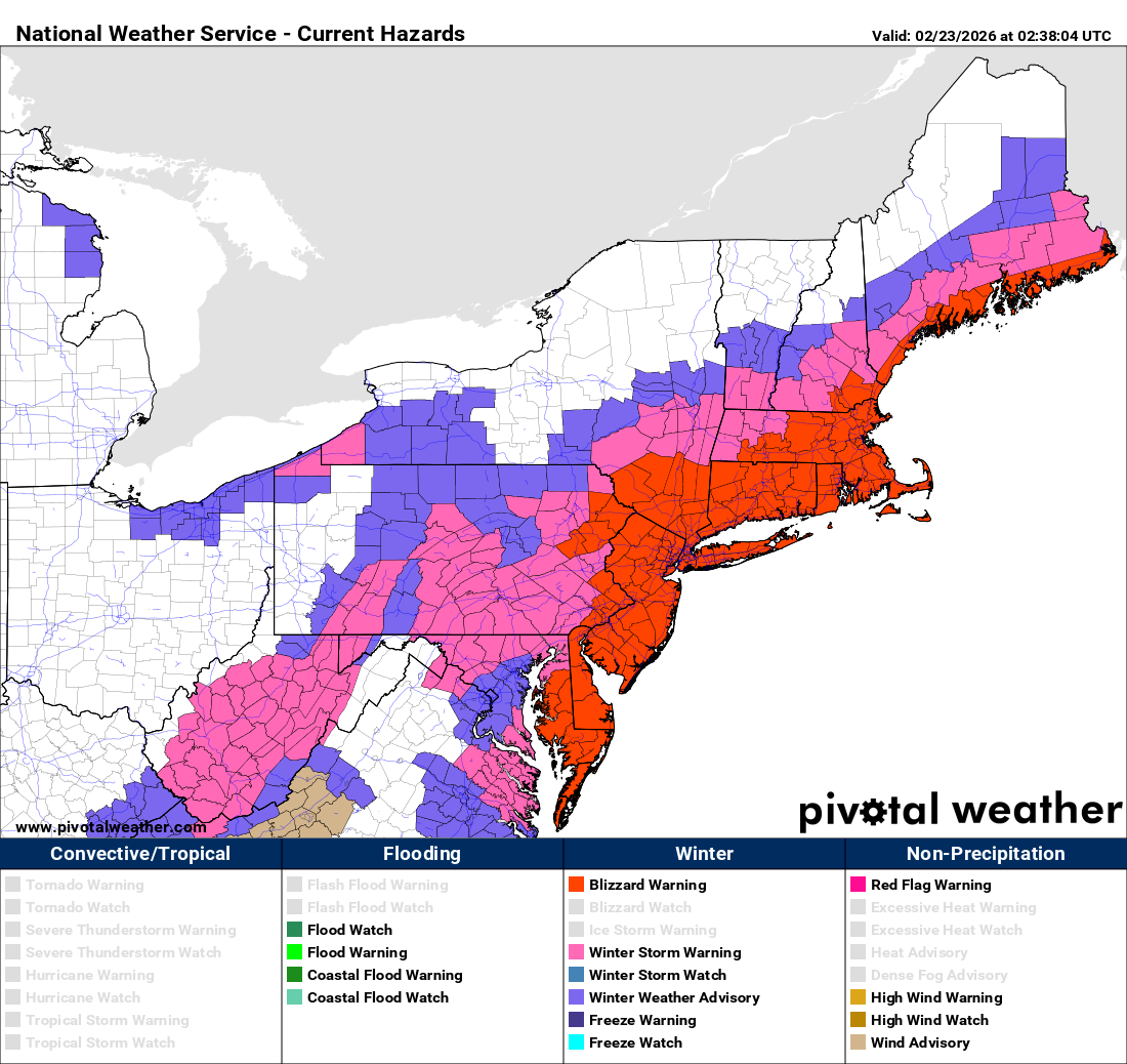
Blizzard warnings are in effect for these areas, and already difficult travel conditions will become nearly impossible as winds and snow continue to intensify.

Power outages will also become an increasingly widespread problem as the low intensifies and winds strengthen. Power outages are already on the upswing this evening, with nearly 100K customers without power in the Mid-Atlantic region per PowerOutage.us.

Snowfall so far looks to have been heaviest in the area from the Delmarva across Long Island, with amounts of 4-10” seeming to be common based on NWS reports. The evening HRRR model looks relatively reasonable in showing in additional snowfall amounts as shown above (through midnight tomorrow night). This will mean widespread 1-2’ amounts in the region from the Delmarva to southern New England, with isolated 24-30” maximum amounts.

This NWS Weather Prediction Center key messages graphic does a great job summarizing the hazards associated with this intense storm system. In addition to the blizzard conditions, very heavy snowfall and wind discussed above, moderate to locally major coastal flooding will occur overnight tonight into Monday morning coincident with high tide.

Leave a comment