One last shot of Arctic air for the Northeast before warmer conditions move in
Feb 28, 2026
Good Saturday morning — I have a busy day today (luckily another beautifully warm day here in central Oklahoma) but wanted to get a quick post out about what we are seeing as far as weather this weekend.
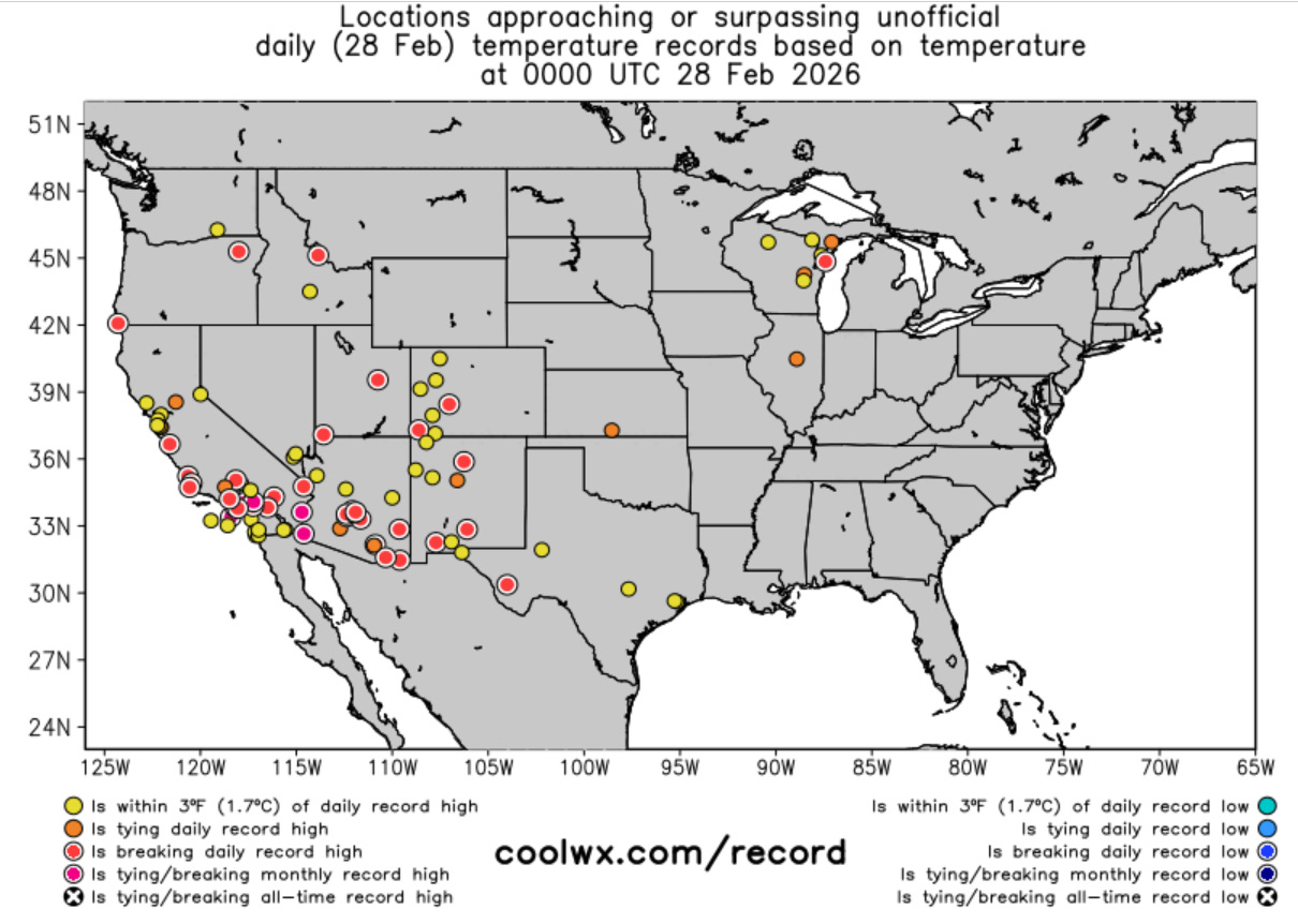
The record warmth was prevalent in the Southwest again on Friday, with this time California being the most unusual location as far as temperatures. Numerous locations broke (and in some cases shattered) daily records, and several monthly high temperatures were set. New monthly records included:
- Woodland Hills at 97F, breaking its monthly record by 3F and daily record by 5F (records back to 1949)
- Burbank at 94F, breaking its monthly record by 2F and daily record by 8F (records back to 1939)
- Escondido at 96F, breaking its monthly record by 2F and daily record (set last year) by 8F (records back to 1893)
- Indio at 100F (tied monthly and daily record, records back to 1894)
- Needles at 92F (tied monthly record and 1F above daily record, records back to 1888)
Record warmth will be widespread again on this last day of February (and “meteorological winter”), with additional monthly records likely to be reached.

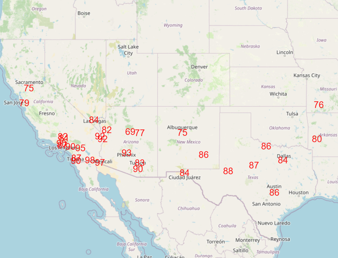
While not quite as many records are forecast for Sunday (graphics courtesy NWS Weather Prediction Center), March will still be getting off to a very warm start for much of the Southwest and Southern Plains.

Meanwhile, after a mild start to the weekend, the Northeast will be bracing for another shot of Arctic air to start the upcoming week. The cold air looks to peak on Monday with morning lows as much as 25 degrees below normal (European AI model forecast temperature anomaly for Monday morning above).
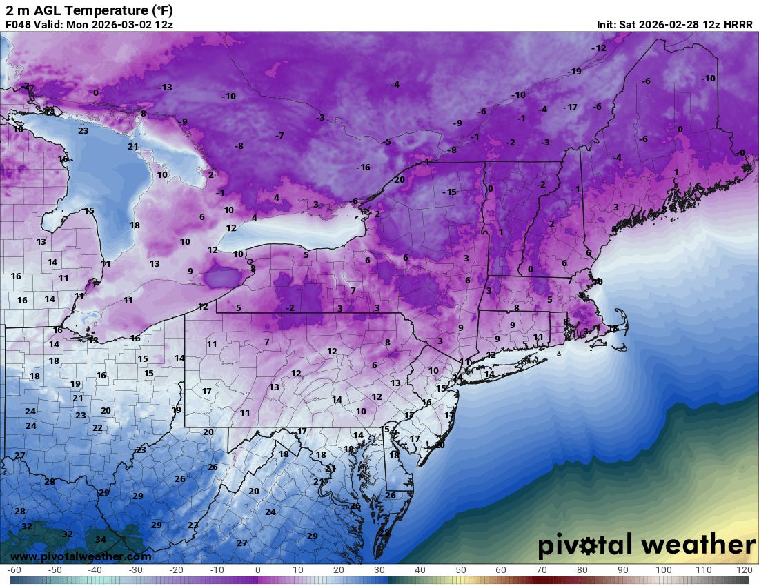
Subzero temperatures are likely for parts of New England and upstate New York, with single digits and teens down into the I-95 corridor.

Precipitation will be relatively sparse across much of the country this weekend, but some showers and thunderstorms will be scattered across the Florida Peninsula and parts of the Northwest today, and will become more prevalent across the Midwest on Sunday. This rainfall in the middle part of the country is heralding a significant weather pattern shift for next week that will bring much wetter conditions to the central part of the nation, along with a trend toward much warmer conditions for much of the East.

Leave a comment