Active pattern redevelops again next week
Mar 07, 2026
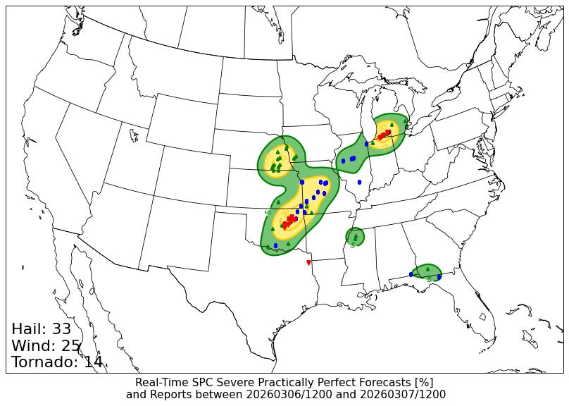
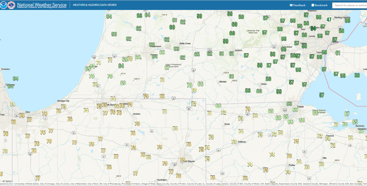
While yesterday was nowhere near what we would consider an “outbreak” of severe thunderstorms, about 75 reports of severe weather were scattered across the central United States (including a few in the Southeast). They were rather clustered and focused as can be seen in the reports map above, with one area in the mid-Missouri valley, another from northeastern Oklahoma across the Ozarks of Missouri, and then the area with significant tornadoes in southwest Lower Michigan I posted about last night.
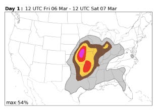
It is interesting to me that even though it obviously was a bit off with exact location and coverage, the NCAR FengWu AI probabilistic forecast that I included in my post yesterday actually did a decent job in identifying these maxima in severe weather coverage — even showing a small 15% max in the vicinity of southwest lower Michigan.
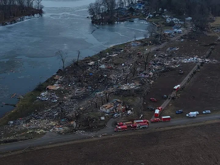
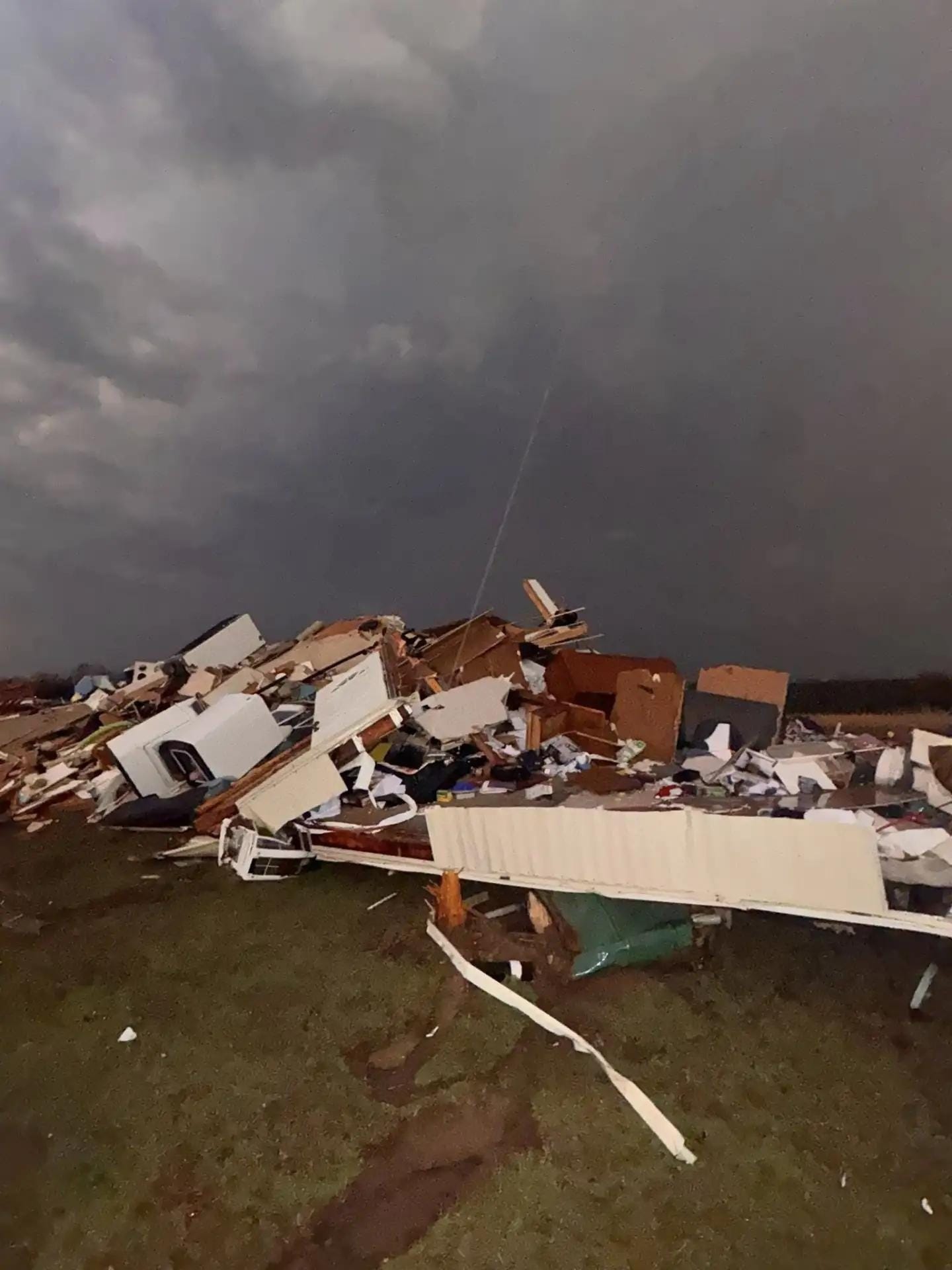
Sadly, at least 6 people perished due to the storms yesterday. Four of these were in southwest Lower Michigan, where what appear to be two separate significant tornadoes killed 1 person near Three Rivers and 3 people near Union City. Yesterday appears to have been the deadliest day for tornadoes in Michigan in 46 years. Amazingly, prior to yesterday there had only been 9 tornadoes in total in the state on or before March 6 — and there has never been a tornado stronger than EF2 this early in the season (note the still frozen lake in the damage picture above).
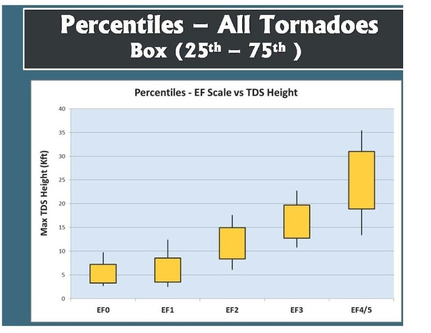
Given some of the damage pictures and the fact that tornadic debris was detected by radar up to about 15,000 ft AGL, it is quite possible that at least one of these tornadoes may be EF3 or greater. (1 pm CT Update: NWS Northern Indiana just released a statement that the damage near Union City is at least EF-3 with maximum winds of 150 mph.)
In my post last night, I discussed how these tornadoes developed within an area of low tornado probabilities — but along a warm front where wind shear was enhanced. This observed high temperature map from yesterday shows clearly where the warm front hung up across southern Lower Michigan, with temperatures in the mid and upper 70s to the south and upper 50s to the north.
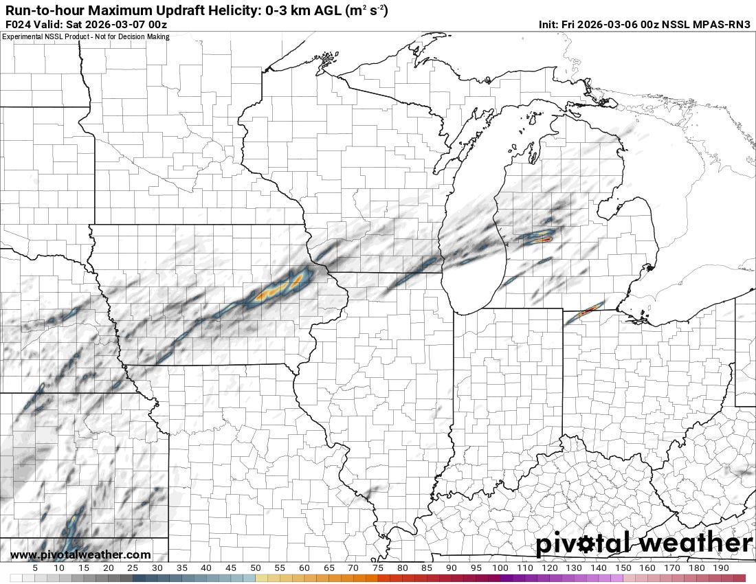
The main reason for the low tornado probabilities was not any question about the environment being favorable for severe weather and tornadoes, but rather whether surface-based storms — i.e., storms with inflow connected to the surface — would develop to be able to take advantage of the favorable environment. Most of the high resolution models showed limited development of such storms — though when a model did show development like this NSSL experimental model run, they showed strongly rotating supercell storms.
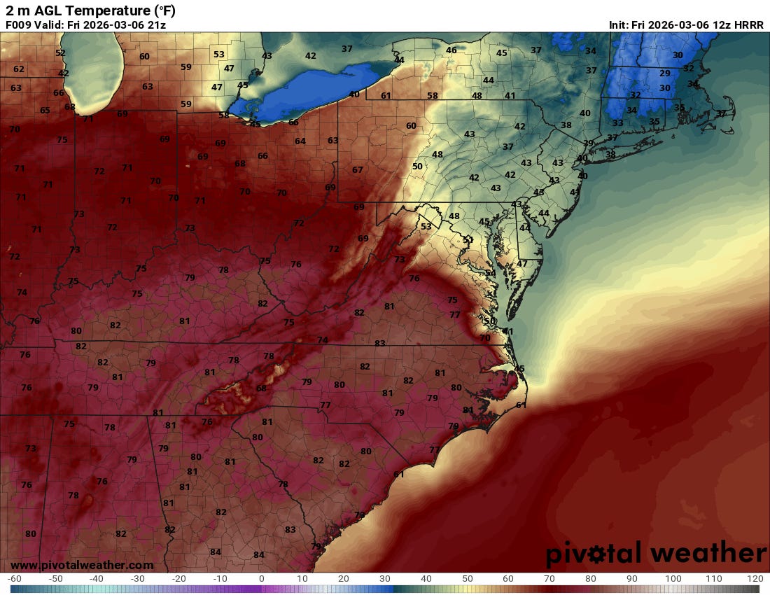
One factor in why the models did not show much thunderstorm development in the warm sector south of the front was likely that the models underestimated the warmth in this area. Above is the forecast temperature map from the morning High Resolution Rapid Refresh (HRRR) model, and it only showed temperatures rising into the lower 70s across most of Indiana and eastern Illinois. The actual atmosphere was several degrees warmer, and this probably played at least some role in allowing a surface based storm to develop in Northeast Illinois during the mid-afternoon hours. As this storm moved northeast into the very favorable environment along the warm front in southern Michigan, it quickly intensified and became tornadic.
Two more fatalities occurred south of Tulsa, OK near Beggs when a tornado struck this home. Additional tornadoes caused damage in the Tulsa area and to the east and northeast.
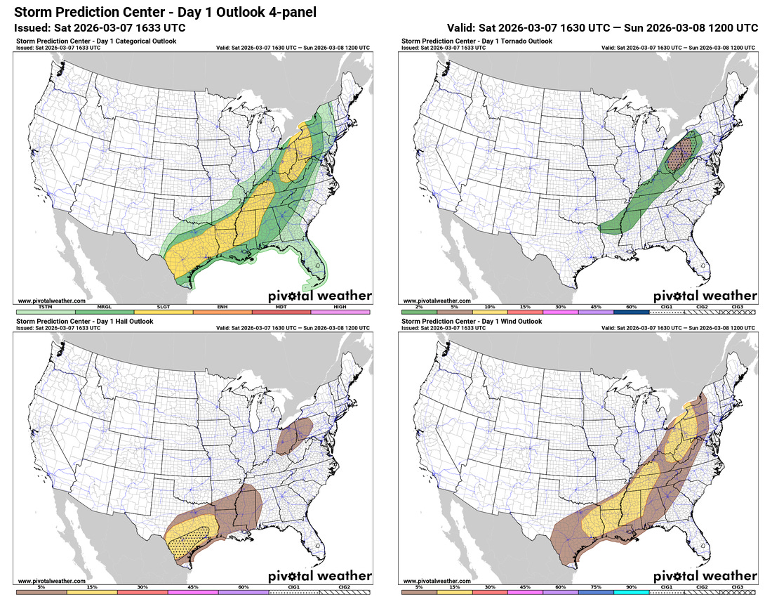
As the cold front associated with the storm system responsible for the severe weather of the last couple of days continues to sag southeast, additional severe thunderstorms are expected today from the eastern Great Lakes to the western Gulf Coast, with a slight (level 2 of 5) risk in place from the Storm Prediction Center.

Much of the AI guidance today suggests a more focused risk for damaging winds and a few tornadoes this afternoon and evening across parts of the central Appalachians (Nadocast shown above). SPC’s tornado forecast has a CIG1 conditional intensity area in this region, showing that even though the probability of a tornado within 25 miles of a point is only 2-5%, if a tornado were to occur it has the potential to be strong.

SPC recently issued a tornado watch for this general region, in effect until 8 pm EST.

After a bit of a risk of severe weather in the Mid-Atlantic on Sunday as the front shifts offshore, focus will then turn to another active period for potential severe thunderstorms the middle of next week as the next system moves east (NCAR FengWu AI severe weather probabilities shown).

Leave a comment