Risk starts today in the Mid-South
Mar 09, 2026
Good morning and welcome to a new week. I am currently working on a deep dive post about news from over the weekend about the tornadoes in southern Lower Michigan on Friday that I hope to have out later today — but in the meantime I wanted to get out a quick update about the severe weather risk the next few days.
Starting with today, a cluster of strong to occasionally severe thunderstorms is currently over central Arkansas, where a severe thunderstorm watch is in effect. As these storms slide east-southeast today, they are expected to intensify as they move along a warm front into an increasingly warm and unstable airmass across Mississippi.
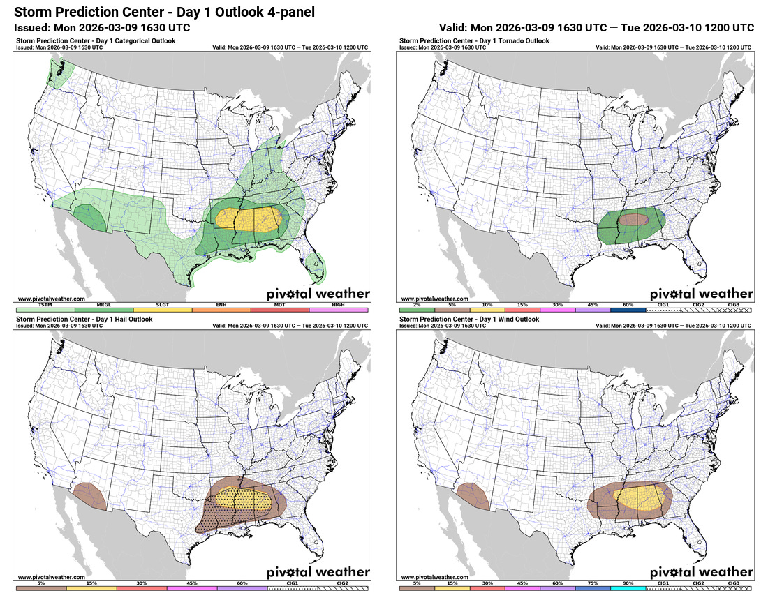
The NWS Storm Prediction Center (SPC) has a slight (level 2 of 5 risk) of severe storms associated with this evolution. The morning upper air balloon data from Jackson revealed rather steep lapse rates — change in temperature with height — which is indicative of the potential for large hail and accordingly a CIG1 for significant hail is in place.
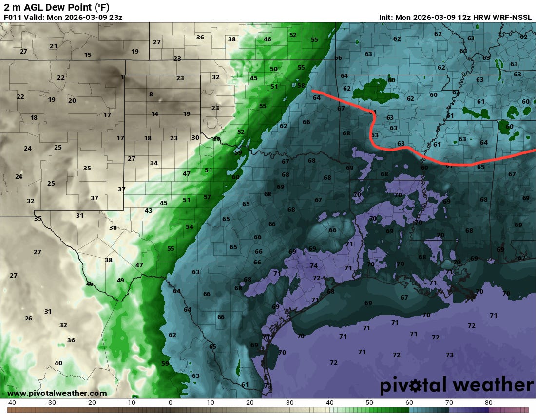
The update just issued by SPC increased the tornado potential across northern Mississippi and northeast Alabama. In this above surface dewpoint forecast from the morning National Severe Storms Lab high resolution model valid at 6 pm CT, you can see a very distinct warm frontal boundary across the region (red line I’ve drawn), with unusually moist (dewpoints near 70F) along and south of it. As low level winds and shear increase today, conditions will become more favorable for low level rotation with the severe storms and increase the potential for a few tornadoes. If any discrete storms can form and move east-southeast along this front, there could be a bit of a surprise as far as a stronger tornado kind of similar to Friday in Michigan (i.e., “never trust a warm front.”)
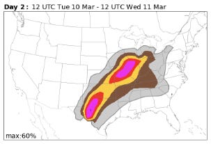
Heading into Tuesday, the setup still looks relatively similar to what I discussed yesterday, with the maximum risk areas in the Mid-Mississippi Valley along the warm front in that region, and farther south in Texas as the upper level low off of Baja California this morning starts to move east and impact that region.
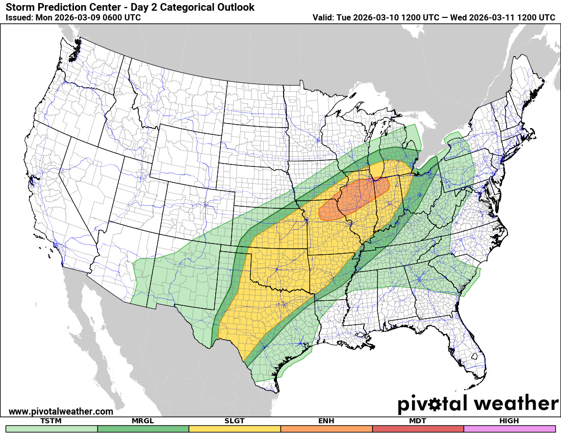
SPC continues to have an enhanced (level 3 of 5) risk of severe weather for Tuesday afternoon and evening along the warm front in the Mid-Mississippi Valley and Lower Great Lakes regions, with the potential for supercell severe storms capable of producing very large hail and a few strong tornadoes.
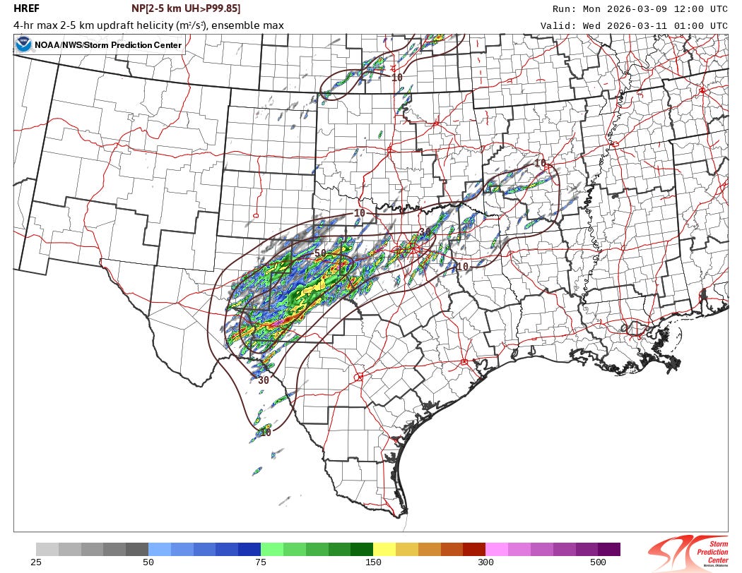
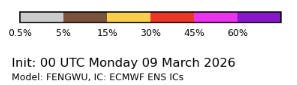
The morning data from the High Resolution Ensemble Forecast (HREF) system shows that a number of members are producing supercell storms with strong rotation across parts of western and northern Texas Tuesday afternoon and evening. Given this signal, signs from the AI forecasts, and the overall pattern, the threat for this region seems a bit higher as well and I would not be surprised to see later SPC forecasts increase the probabilistic risk here.
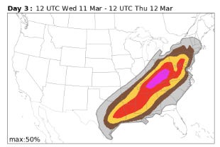
The threat of severe storms is expected to persist along the southeastward sagging cold front on Wednesday. There is increased uncertainty in the details obviously at that time range — and particularly given continued uncertainty in how the larger scale weather systems will evolve as I discussed yesterday.

Leave a comment